Livre Rare Book
162 résultats
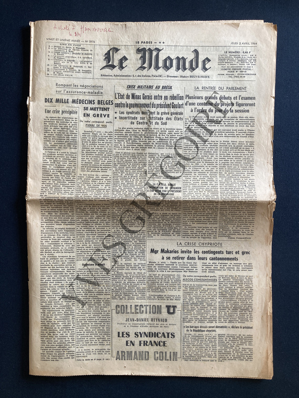
1964ABE-164353817482818 PAGES-35 CM X 50 CM-LA CRISE CHYPRIOTE MGR MAKARIOS INVITE LES CONTINGENTS TURC ET GREC A SE RETIRER DANS LEURS CANTONNEMENTS-LA CRISE MILITAIRE AU BRESIL-A PROPOS DU GRAND AUDITORIUM DE LA MAISON DE LA RADIO LES QUALITES ACOUSTIQUES DES SALLES DE CONCERT, DEMI PAGE-LA TOUR EIFFEL A SOIXANTE QUINZE ANS QUALITIEE DE "MONSTRUEISE" A SA NAISSANCE ELLE VA ETRE CLASSEE "MONUMENT HISTORIQUE", TIERS DE PAGE-COULEE EN 1788 LA FREGATE LA "BOUSSOLE" NAVIRE AMIRAL DE LA PEROUSE EST RETROUVEE PAR DES PLONGEURS FRANCAIS-1 PETIT MANQUE EN PLIURE DE UNE
19721770A NICE. LES EDITIONS LE CHANT DES SPHERES. 1971-1972. 3 VOLUMES IN-4 (21,5 X 27 X 17 CENTIMETRES ENVIRON), RELIURE DE L’EDITEUR PLEIN VEAU HAVANE, PLATS ENTIEREMENT ORNES D'UN DECOR MARITIME ESTAMPE A FROID ET DORE, DOS A CINQ NERFS DECORE DE MEME, TITRE ET TETE DORES, SOUS ETUI BORDE. AVEC 50 ILLUSTRATIONS EN COULEURS DANS LE GOUT DE L'ENLUMINURE: 1 TITRE ILLUSTRE (REPRIS DANS CHAQUE VOLUME), 15 PLANCHES HORS TEXTE DONT 1 PLANCHE DOUBLE, 17 BANDEAUX ET 17 CULS-DE-LAMPE. AVEC UNE CARTE REPLIEE EN COULEURS HORS TEXTE PAR DA ROS ET LA REPRODUCTION DE DOCUMENTS ANCIENS. TEXTE ENCADRE DUNE GUIRLANDE A DECOR MARITIME EN BLEU. PREMIER TIRAGE LIMITE A 2030 EXEMPLAIRES NUMEROTES, DONT 30 HORS COMMERCE ET 20 RESERVES, TOUS SUR VELIN DE LANA. UN DES 250 NUMEROTES DE 1 A 250 ET COMPORTANT: UNE ILLUSTRATION ORIGINALE EN COULEURS SIGNEE, UN DESSIN ORIGINAL EN NOIR SIGNE ET UNE SUITE EN BISTRE DE LA DOUBLE PLANCHE ET DES ILLUSTRATIONS HORS TEXTE, CELUI-CI PORTANT LE NUMERO 25, ACCOMPAGNE DE SON CERTIFICAT D'AUTHENTICITE ET ENRICHI D’UN ENVOI AUTOGRAPHE SIGNE DE L’ILLUSTRATEUR. UN DOS INSOLE PETITS DEFAUTS EXTERIEURS, SINON BON EXEMPLAIRE.
19713242A NICE. LES EDITIONS LE CHANT DES SPHERES. 1971-1972. 3 VOLUMES IN-4 (21,5 X 27 X 17 CENTIMETRES ENVIRON), RELIURE DE L’EDITEUR PLEIN VEAU BLEU, PLATS ENTIEREMENT ORNES D'UN DECOR MARITIME ESTAMPE A FROID ET DORE, DOS A CINQ NERFS DECORE DE MEME, TITRE ET TETE DORES, SOUS ETUI BORDE. AVEC 50 ILLUSTRATIONS EN COULEURS DANS LE GOUT DE L'ENLUMINURE: 1 TITRE ILLUSTRE (REPRIS DANS CHAQUE VOLUME), 15 PLANCHES HORS TEXTE DONT 1 PLANCHE DOUBLE, 17 BANDEAUX ET 17 CULS-DE-LAMPE. AVEC UNE CARTE REPLIEE EN COULEURS HORS TEXTE PAR DA ROS ET LA REPRODUCTION DE DOCUMENTS ANCIENS. TEXTE ENCADRE DUNE GUIRLANDE A DECOR MARITIME EN BLEU. PREMIER TIRAGE LIMITE A 2030 EXEMPLAIRES NUMEROTES, DONT 30 HORS COMMERCE ET 20 RESERVES, TOUS SUR VELIN DE LANA, CELUI-CI PORTANT LE NUMERO 1936, ACCOMPAGNE DE SON CERTIFICAT D'AUTHENTICITE. DOS ECLAIRCIS, PETITS DEFAUTS SANS AUCUNE GRAVIRE AU NIVEAU DES ETUIS, SINON BON EXEMPLAIRE.
19713851A NICE. LES EDITIONS LE CHANT DES SPHERES. 1971-1972. 3 VOLUMES IN-4 (21,5 X 27 X 17 CENTIMETRES ENVIRON), RELIURE DE L’EDITEUR PLEIN VEAU HAVANE, PLATS ENTIEREMENT ORNES D'UN DECOR MARITIME ESTAMPE A FROID ET DORE, DOS A CINQ NERFS DECORE DE MEME, TITRE ET TETE DORES, SOUS ETUI BORDE. AVEC 50 ILLUSTRATIONS EN COULEURS DANS LE GOUT DE L'ENLUMINURE: 1 TITRE ILLUSTRE (REPRIS DANS CHAQUE VOLUME), 15 PLANCHES HORS TEXTE DONT 1 PLANCHE DOUBLE, 17 BANDEAUX ET 17 CULS-DE-LAMPE. AVEC UNE CARTE REPLIEE EN COULEURS HORS TEXTE PAR DA ROS ET LA REPRODUCTION DE DOCUMENTS ANCIENS. TEXTE ENCADRE DUNE GUIRLANDE A DECOR MARITIME EN BLEU. PREMIER TIRAGE LIMITE A 2030 EXEMPLAIRES NUMEROTES, DONT 30 HORS COMMERCE ET 20 RESERVES, TOUS SUR VELIN DE LANA. UN DES 250 NUMEROTES DE 1 A 250 ET COMPORTANT: UNE ILLUSTRATION ORIGINALE EN COULEURS SIGNEE, UN DESSIN ORIGINAL EN NOIR SIGNE ET UNE SUITE EN BISTRE DE LA DOUBLE PLANCHE ET DES ILLUSTRATIONS HORS TEXTE, CELUI-CI PORTANT LE NUMERO 144, ACCOMPAGNE DE SON CERTIFICAT D'AUTHENTICITE. BON EXEMPLAIRE.
197165881Un des 250 exemplaires numérotés de 1 à 250 (n° 76) comportant une illustration originale en couleurs, un dessin original en noir, une suite en bistre de la double planche et des illustrations hors texte de l'édition, 3 vol. petit in-4 reliure éditeur pleine basane marron richement estampée à froid et dorée sous étuis bordés, dos à 5 nerfs dorés et orné, tête dorée, Les Editions Le Chant des Sphères, Editions d'Art Sefer, Nice, 1971-1972
1965ABE-945794230512 PAGES FORMAT 60X42-MARCEL ACHARD: BON ANNIVERSAIRE JULES ROMAINS!/PHOTO AVEC LOUIS JOUVET/SUITE P8 ET P9/PAR ANDRE MAUROIS, GABRIEL AUDISIO, JACQUES CHASTENET, EDITH MORA, ARMAND LANOUX, PAUL GUTH-JEAN (NOHAIN) QUI RIT./PAR PIERRE HUMBOURG-VENISE DES SAISONS PAR FRANCOIS NOURISSIER/PHOTO-EN PISTE PAR MICHEL TOURNIER/PRESENTATION DU LIVRE "LE CIRQUE D'IZIS" D'ANDRE SAURET/PREVERT-LA PEROUSE PERDU ET RETROUVE/PAR MARTIN ALLANIC-BEAU FRANCOIS UN CONTE "NOIR" DE MAURICE GENEVOIX (5) DESSIN DE CARLOTTI-PATRIE SANS FRONTIERES/PAR JACQUES DURON/PHOTO SENGHOR-ELOGE DE L'AVIRON/PAR JEAN SEPHERIADES-FESTIVALS: MUNICH UN CARRE D'AS/PAR HUGUES R.GALL/PHOTO PAUL HINDEMITH DANS "CARDILLAC"-DUBROVNIK: FERVEUR D'UN RITE-CINEMA PAR PIERRE AJAME: LA VAGUE ET SON REFLUX/"LES BAISERS" DE BERTRAND TAVERNIER/PHOTO BERNARD ROUSSELET ET LAETITIA ROMAN-"MARIE CHANTAL CONTRE LE DR KAH" DE CLAUDE CHABROL
1977LFA-126717915Un ouvrage de 269 pages, format 245 x 160 mm, illustré, relié cartonnage sous jaquette couleurs, publié en 1977, bon état
1933ABE-158860056502416 PAGES-25,5 CM X 32 CM-CHRISTOPHE COLOMB-VASCO DE GAMA-COOK-LA PEROUSE-DUMONT D'URVILLE-ILLUSTRATIONS PLEINE PAGE EN COULEURS-ILLUSTRATIONS NOIR ET BLANC-CHRISTOPHE COLOMB EN COUVERTURE-(100G)
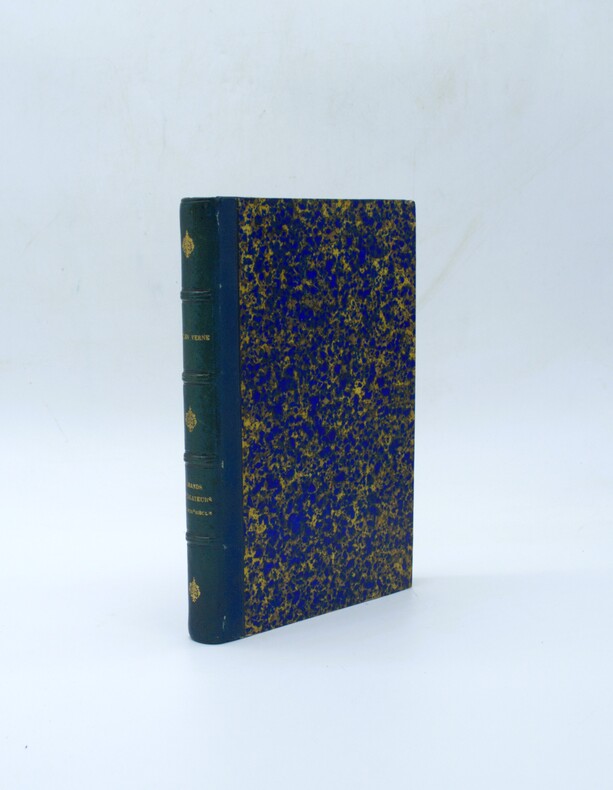
1879PHO-2277Paris, Hetzel et Cie, s.d. [1879]. In-4° de VI, [2], 464 pp. 51 dessins par P. Philippoteaux. 66 fac-similé‚ et cartes par Matthis et Morieu. Demi-chagrin bleu, dos à 4 faux-nerfs orné, titre doré, tranches mouchetées rouges. (Reliure de l'époque). Quelques rousseurs. Bel ex. Ouvrage historique et géographique, réalisé en collaboration
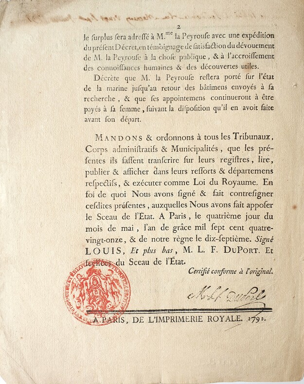
17914196Paris, Imprimerie Royale, 1791. 1791 2 ff. in-folio (244 x 196 mm.) dont 1 blanc. Bandeau gravé surmonté de linscription manuscrite à lencre brune « lu à laudiance du mercredy vingt-sept juillet 1791.» ; tampon officiel rouge et signature à lencre noire in fine. (traces de plis, salissures et défauts dusage). Non relié, conservé tel que paru dans une chemise de papier d'époque.
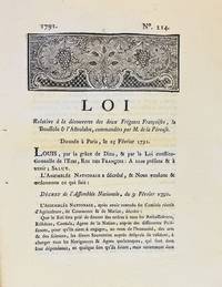
17913590A Dijon: De l'Imprimerie de Capel 1791. First edition. Woodcut headpiece. Contemporary manuscript certification at the end signed by two officials of the Département de la Côte-d'Or dated Dijon 23 avril 1791. Unbound as issued. In fine condition. First edition. Woodcut headpiece. Contemporary manuscript certification at the end signed by two officials of the Département de la Côte-d'Or dated Dijon 23 avril 1791. Unbound as issued. 3 1 blank p. <p><br /> The first formal document acknowledging fears of La Pérouse's disappearance in a rare provincial printing issued shortly after the royal decree.<br /> <p><p><br /> Very rare Dijon printing of the first formal decree acknowledging concern over the disappearance of La Pérouse's expedition. This decree issued by the Assemblée Nationale and promulgated in the name of Louis XVI on 25 February 1791 initiated the official search for La Boussole and L'Astrolabe last heard from in 1788 following their departure from Botany Bay. It instructed France's ambassadors consuls and agents abroad to solicit assistance from foreign powers and navigators-especially in the southern Pacific-"de faire toutes recherches des deux frégates Françoises La Boussole & L'Astrolabe. de même que toute perquisition qui pourroit constater leur existence ou naufrage."<br /> <p><p><br /> The decree also called for the arming of one or more vessels carrying scientists naturalists and artists tasked with both locating La Pérouse and conducting a broader exploratory mission "utile & avantageuse à la navigation à la géographie au commerce aux arts & aux sciences." This ultimately led to the voyage of Rear Admiral Bruni d'Entrecasteaux 1791-1794.<br /> <p><p><br /> La Pérouse's expedition 1785-88 commissioned by Louis XVI and modelled in part on the voyages of Cook was the most ambitious French maritime expedition of the Enlightenment. Departing from Brest in August 1785 the two frigates visited South America including Chile Easter Island Alaska California Macao the Philippines and Australia Botany Bay sending reports and scientific observations until their disappearance after March 1788. Their fate remained a mystery until the wreckage was found decades later on Vanikoro Island.<br /> <p><p><br /> The Dijon edition printed by Capel and officially certified by the departmental administration is part of a coordinated provincial dissemination of the decree alongside other issues printed in Pau Orléans Grenoble Valenciennes Auxerre and Évreux.<br /> <p><p><br /> References: cf. Ferguson 106a Auxerre ed.; Kroepelien 710; McLaren 132 Valenciennes ed.; Horner Looking for La Pérouse pp. 4-6.<br /> <p>. De l'Imprimerie de Capel unknown
17973921Paris c. 1797. Copper engraving by Simonet after Duche de Vancy and J.M. Moreau le Jeune approx 29 x 42 cms trimmed to platemark left-hand margin extended hand-coloured blank verso. Map unknown
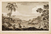
179755648Atlas Du Voyage De La Pérouse. 1797. Scene showing the locals attacking voyagers as they disembark from their boats. From the Voyages of La Pérouse who set sail from France in 1785 to continue the discoveries of Captain Cook. He was shipwrecked in 1788 but his narrative maps and views survived and were published in 1797. Copper engraving. Very good condition. slight browing around edges but not effecting image Uncoloured. Size: 40 x 25.5 cm. 15½ x 10 inches unknown
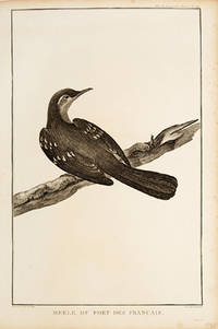
179755672Paris. 1797. Print of an Alaskan Merle Bird. From the Voyages of La Pérouse who set sail from France in 1785 to continue the discoveries of Captain Cook. He was shipwrecked in 1788 but his narrative maps and views survived and were published in 1797. Atlas Du Voyage De La Pérouse. Size: 255 x 400 mm. Copper engraving. Uncoloured. Very good condition. Slight browing around edges but not effecting image. unknown
1788M6851Paris 1788. Very Good; laid on acid-free canvas for long-term preservation. Notes: This handsome sea chart depicts magnetic needle readings along various routes in the North Pacific ocean.<br> Size : 590x1090 mm 23.23x42.91 Inches Coloring: Hand Colored in Outline Category: Maps Sea Chart; Maps Ocean Pacific; Maps United States West; unknown
Il saggio, da lettere inedite, su ISTANBUL, occupa 46 pagine. Il fascicolo in-8° (cm. 21,2x14,1), brossura editoriale (mancanze al dorso, ma ben cucito), contiene inoltre: 1) Tableau historique des DECOUVERTES géographiques des Scandinaves, et spécialement de celle de l'AMERIQUE AVANT Christophe COLOMB. Pp. 37, ma MANCA la carta geogr. fuori testo. 2) Mathieu FLINDERS (comandante della Marina inglese e prigioniero in Francia). Sur le banc du NAUFRAGE et sur le SORT de M. LA PEROUSE. Pp. 21. 3) Recensioni di opere storiche tedesche e dell'Accademia Celtica.
62768P., Lecointe, 1832, 4 volumes petit in 12, cartonnage de papiper crème de l'éditeur, 28-179, 212, 198 et 206 pages ; quelques rousseurs ; galeries de vers marginales au Tome II ; cartonnages légèrement fanés.
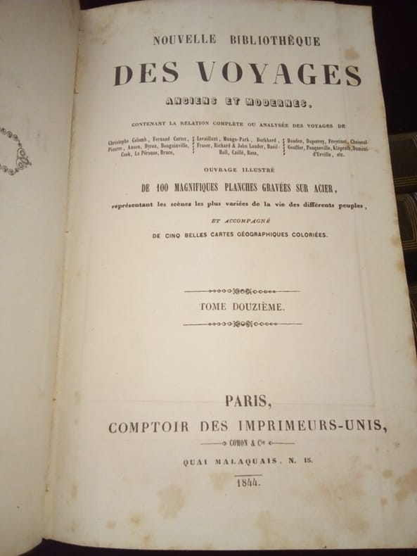
1844SEG350Paris Comptoir des Imprimeurs Unis 1844 Grands In8 - Demi-chagrins d'époque - dos à nerfs ornés - Frottements sur certains mors et coiffes sans gravité - Complet des 5 grandes cartes dépliantes rehaussées en couleurs et des 100 gravures hors texte sur acier - Rousseurs éparses particulièrement aux Tomes 1 & 2 .Belle condition Tome 1 : 1845 - 363 pages - 1 carte dépliante de l'Océanie - Voyages de George Anson , de Bougainville et du Cpt Byron Tome 2 : Sd , 393 pages - Voyages de Cook Tome 3 : 1844 - 403 pages - Voyages de Cook Tome 4 : 1844 - 396 pages - Voyages de Cook Tome 5 : 1844 - 396 pages - voyages de Cook Tome 6 : 1844 - 388 pages - Voyage de La Pérouse , du Cpt Baudin , de Freycinet et de Dumont d'Urville Tome 7 : 1845 - 412 pages - 1 carte dépliante de l'Afrique - Voyages de Bruce Tome 8 : 1845 - 441 pages - Voyage de Le Vaillant Tome 9 : 1845 - 438 pages - Voyage de Mungo-Park , de René Caillié , des frères Lander Tome 10 : 1845 - 439 pages - 1 carte dépliante de l'Asie - Voyage de Chardin , Voyages aux Indes Orientales Tome 11 : 1844 - 412 pages - Voyage de Macartney , de Klaproth , de Niebuhr , Voyage en Arabie , Voyage à Smyrne Tome 12 : 1844 - 400 pages - 2 cartes dépliantes des Amériques - Voyage de Colomb , Voyage de Cortez , Voyage aux Etats Unis , Voyage en Amérique , Voyage en Morée
1844SEG350Paris Comptoir des Imprimeurs Unis 1844 Grands In8 - Demi-chagrins d'époque - dos à nerfs ornés - Frottements sur certains mors et coiffes sans gravité - Complet des 5 grandes cartes dépliantes rehaussées en couleurs et des 100 gravures hors texte sur acier - Rousseurs éparses particulièrement aux Tomes 1 & 2 .Belle condition Tome 1 : 1845 - 363 pages - 1 carte dépliante de l'Océanie - Voyages de George Anson , de Bougainville et du Cpt Byron Tome 2 : Sd , 393 pages - Voyages de Cook Tome 3 : 1844 - 403 pages - Voyages de Cook Tome 4 : 1844 - 396 pages - Voyages de Cook Tome 5 : 1844 - 396 pages - voyages de Cook Tome 6 : 1844 - 388 pages - Voyage de La Pérouse , du Cpt Baudin , de Freycinet et de Dumont d'Urville Tome 7 : 1845 - 412 pages - 1 carte dépliante de l'Afrique - Voyages de Bruce Tome 8 : 1845 - 441 pages - Voyage de Le Vaillant Tome 9 : 1845 - 438 pages - Voyage de Mungo-Park , de René Caillié , des frères Lander Tome 10 : 1845 - 439 pages - 1 carte dépliante de l'Asie - Voyage de Chardin , Voyages aux Indes Orientales Tome 11 : 1844 - 412 pages - Voyage de Macartney , de Klaproth , de Niebuhr , Voyage en Arabie , Voyage à Smyrne Tome 12 : 1844 - 400 pages - 2 cartes dépliantes des Amériques - Voyage de Colomb , Voyage de Cortez , Voyage aux Etats Unis , Voyage en Amérique , Voyage en Morée
0259332135.Gpaperback. Good. Access codes and supplements are not guaranteed with used items. May be an ex-library book. paperback
1798496London: G & T Robinson 1798. The English edition of a map published to accompany La Perouse' Voyage. G&T Robinson Nov. 1st 1798. Covers from the Gulf of Carpentaria to the Solitaire Islands to the Navigator Islands in the east and to above New Guinea. Charts Maurelle's tracks. G & T Robinson unknown
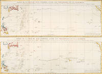
179756361Paris: 1797. An interesting large sheet with two maps covering the same area. The top chart shows the routes of the Spanish galleons from Acapulco to the Philippines. The bottom chart shows La Perouse's route from Monterey through Hawaii and the Marianas to Macao. From the Voyages of La Pérouse who set sail from France in 1785 to continue the discoveries of Captain Cook. He was shipwrecked in 1788 but his narrative maps and views survived and were published in 1797. Thirty-eight years later the scattered remains of La Boussole and L'Astrolabe was discovered wrecked on a vicious reef on an atoll in the New Hebrides. Full title: "Partie de la Mer du Sud comprise entre les Philippines et la Californie d'apres de Carte Espagnole trouvee sur le Galion pris par l'Amiral Anson en 1743 qui represente l'etat des connaissances a cette epoque et les routes que suivaient ordinairement les Galions dans leur traversee de Manille a Acapulco. Partie de la Mer du Sud comprise entre les Philippines et la California d'apres une autre Carte Espagnole communiquee a La Perouse dans sa relache a Monterey sur laquelle il avait trace sa route ainsi que les Iles qu'il avait reconnues avec des notes sur celles qu'il n'avait pas retrouvee." Copper engraving. Very good condition; some light stains along the lower horizontal fold; a tear and some foxing to the upper margin; wide margins. Hand coloured. Size: 79 x 55.5 cm. unknown
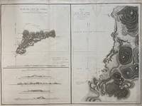
1797299774Paris: L'Imprimerie de la Republique 1797. Map. Engraving with hand coloring. Sheet measures 21 1/4" x 28"<br/> <br/> This chart depicts Easter Island with a close-up of Cook's Bay. Relief is depicted by hachure and elevation is shown from several vantage points. Points and peaks of the elevation views correspond to labels on the map. The Bay shows depths and various structures are labeled. The map appeared as Plate 10 in "Atlas du Voyage de La Perouse." It is in very good condition. Stain to upper margin minor foxing marks.<br> <br> Jean Francois de Galaup 1741-c.1788 was a French Navy officer and explorer known for his travels in Oceania. In 1787 he explored the northeast and mainland Asian coasts in the area of Korea. Other voyages included Alaska Japan Australia and the South Pacific. This map demonstrates some of the many observations and findings made on his journeys.<br/> <br/> L'Imprimerie de la Republique unknown
1797016788Paris: La Perouse 1797. Map. Very good condition. Unbound. First Edition. Folio. A large map beautifully decorated with original outline color. The map is included in the Atlas volume of La Perouse's Voyages but was drawn from Spanish manuscripts as it was thought that it might be a part of the Northwest Passage. The map has an extra vertical crease from mis-folding but is quite clean and has large margins which are lightly soiled here and there. La Perouse Paperback