3 315 résultats
1741173310.Gpaperback. Good. Access codes and supplements are not guaranteed with used items. May be an ex-library book. paperback
0980570344.Gspiral_bound. Good. Access codes and supplements are not guaranteed with used items. May be an ex-library book. unknown
1962138348Adelaide: Public Library of South Australia 1962. Hardcover. Very Good. Adelaide Public Library of South Australia 1962 facsimile edition/ 1839. Octavo ii 95 pages. Synthetic cloth slightly rubbed; endpapers and adjacent leaves a little tanned at the edges; text block beginning to separate from the binding but firm; a very good copy. Peade SA30: one of only 37 copies. This was one of the earliest facsimile editions published by the library 'reproduced . using the xerographic process' with the text bound from concertina-fold paper printed on one side only uncut and unopened along the leading edges. Public Library of South Australia hardcover
1996290505PN. New. 1996. Soft Cover. Date is original print. This is a reprint edition . PN paperback
1900000012Christchurch New Zealand: Whitcombe & Tombs 1900 A Souvenir of the Jubilee of Canterbury New Zealand. Original olive cloth with black titling. Just the slightest edge and corner wear. Free endpaper age toned and bearing presentation inscription from the jubilee committee president and editor Miss E Stevenson with compliments of the NZNA Wm Reece President Dec 16 1900 Age toning to page edges and free endpapers otherwise a VG copy showing little ageing. 215pp with photographs and illustrations in the text. Covers the Pilgrim Fathers of the Canterbury Settlement the Canterbury Maori and the Natural History of Canterbury. Contents include The Story of the 'Pilgrim Fathers' of New Zealand; 'Peninsula and Plain'; The Sumner Road; Canterbury Settlement; Reminiscences of Early Days; 'Escapades of Mackenzie' & 'Meeting of Bishops Selwyn and Harper'; 'Sheep-Driving in the Early Days'; South Canterbury; The Maori - Origin Life and Legends; Historic Outline of the Canterbury Maoris; Notes on Maori Art; Plants and Animals of Canterbury; A Glimpse into the Alps of Canterbury 500 gram rate . Signed by Author. First Edition. Original Cloth. Very Good/No Jacket. 12mo - over 6 - 7 tall. Whitcombe & Tombs hardcover
2010006142Brisbane QLD Australia: Self Published 2010. Illustrated laminated boards. Light foxing to endpapers. Pen notes to rear endpaper plus pen underlining to approximately 6 pages. 276 pages with colour and b/w illustrations. . THIRD EDITION. Hard Cover. Good/No Jacket. 8vo - over 7¾" - 9¾" tall. Self Published Hardcover
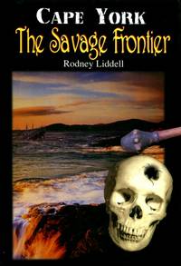
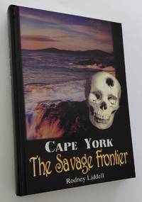
1996054495Brisbane: Rodney Liddell 1996. viii 276pp bibliography chronology maps bw ills.Or pictorial glossy boards. Minor foxing to page edges and prelims-otherwise excellent. Somewhat controversial look at Aboriginal history in particular on Cape York greatly enlarged from the 96 page edition of five years earlier. Looks at a supposed Aboriginal 'invasion' of Australia and extermination of the original Papuans less than 1000 years ago savagery among the native tribes of Cape York and the Torres Strait Islands last century and violent confrontations of native tribes and massacre of hundreds of Europeans including men women and children cast ashore from numerous shipwrecks. 'The history many authors were afraid to write for fear of being branded as racist by biased and prejudicial views'. First Edition Thus. Hard Cover. Very Good/None as Issued. 8vo. Rodney Liddell Hardcover
1996015183<p>Redbank Queensland Australia: Author Rodney Liddell 1996. viii 276pp. plus iii. Illustrated throughout: colour-plate sections numerous b/white halftone plates archival and private sources plus facsimiles and line-drawn maps. Book clean and square. Spine firm. Colour-illustrated gloss boards have several surface indentations. Leaves clean and unmarked. After a decade of original documentation research the author formed the opinion that anthropologists and sociologists were promoting what they personally believed the public would accept of the happenings at Cape York and The Torres Strait rather that the accurate historic record. In this confronting and informative book the author Rodney Liddell reveals the savagery and brutality of the early days of North Queensland's Cape York and Torres Strait region . . . Contents include: Prelims. Acks. Introduction. Islands of Western Torres Strait. The 6 Aboriginal Tribes North of the Jardine River. 28 chapters more. Book weight approx. 610g. . First Thus. Hardcover. Very Good-. 8vo - approx. 23cm x 16cm.</p> Author (Rodney Liddell) hardcover
183980070London: The Author 1839. 3rd Edition. Hardcover. Very Good. London The Author 1839 third edition considerably enlarged/ 1837. Octavo iv 243 16 advertisements pages plus 3 folding maps 'District of Adelaide' with an inset 'Sketch of Encounter Bay' 310 × 312 mm; 'Maritime Portion of South Australia' 240 × 425 mm and 'The City of Adelaide' 162 × 198 mm a folding leaf of shipping statistics and a folding advertising slip with an engraved illustration. Original blind-stamped purple cloth slightly rubbed and bumped at the extremities with minimal expert restoration to the head of both joints; spine sunned to brown; first map lightly foxed; an excellent copy internally fine. With the armorial bookplate of the Marquess of Downshire most probably Arthur Wills Blundell Sandys Trumbull Windsor Hill 4th Marquess of Downshire 1812-1868. The preferred edition being more than twice as large as its predecessors of 1837 and 1838. Ferguson 2725. The Author hardcover
1920009863London: Longmans Green & Co 1920. xix 290pp index folding map 16 bw plates. Or blue cloth. Spine sunned corners rubbed/bumped covers rubbed endpapers toned occasional moderate foxing. Folding map foxed. Frontis slightly loose. Scarce volume on Bligh's second South Sea voyage with the ships Providence and Assitant. First Edition. Hard Cover. Near Very Good. 8vo. Longmans, Green & Co Hardcover
1901052410London: Sampson Low Marston & Co. Ltd. 1901. 31pp. Gray wraps with black tape spine. Black tape spine only silverfished several very short tears and small chips to edges of wraps prev owner name to front. Explores several logs of Cook's voyage to find the origins of the name of Botany Bay. Very scarce. First Edition. Soft Cover. Very Good. 8vo. Sampson Low, Marston & Co. Ltd. Paperback
1968BIB322018Adelaide: Libraries Board of South Australia. 1968. Small Quarto Size approx 17.5cm x 24cm. Near Fine condition - an excellent copy. Cream cloth boards green title patch to spine. Australiana Facsimile Editions No 188. Black & white plates and facsimile documents 2 & fold-out maps and charts. Robust professional packaging and tracking provided for all parcels. 400 pages. The first voyage of James Cook was a combined Royal Navy and Royal Society expedition to the south Pacific Ocean aboard HMS Endeavour from 1768 to 1771. It was the first of three Pacific voyages of which Cook was the commander. The aims of this first expedition were to observe the 1769 transit of Venus across the Sun 3 - 4 June of that year and to seek evidence of the postulated Terra Australis Incognita or "unknown southern land". Robust professional packaging and tracking provided for all parcels. . Near Fine. Facsimile Edition. Hardback. Libraries Board of South Australia hardcover
19691709011Wellington: A.H. & A.W. Reed 1969. First Thus. Hard Cover. Very Good/Very Good. Very neat clean copies. First impression. Two companion volumes in publisher's green cloth with gilt titles to spine. 192 and 262 pages profusely illustrated with half-tone plates line drawings charts and a large foldout chart in each volume redrawn from Cook's original maps.Top edge on NZ volume spotty. The dustjackets have light rubbing and creasing to edges a few very small closed tears. These volumes bring together Cook's journals of his voyages to the east coast of New Holland Van Dieman's Land and New Zealand. These journals have been edited and annnoted to provide an interesting important reference. <br/><br/> A.H. & A.W. Reed hardcover
1897037490London: Thomas Nelson & Sons 1897. ix 512pp index bw ills some folding. Near contemporary full maroon leather prize binding Eagle Hose School Sandhurst decorated in gilt with prize label on front pastedown covered by later owner's art deco bookplate. Marbled endpapers and edges. Approx 4cm crack at top of spine at both edges some minor rubbing otherwise a very nice example. First Edition. Hard Cover. Very Good. 8vo. Thomas Nelson & Sons Hardcover
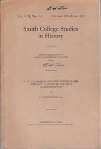
1928011459Northampton : Smith College 1928 gift copy with a signed presentation inscription to Professor F A Hunter from Beaglehole dated 1928 when issued "To Professor Hunter with gratitude and admiration J C Beaglehole August 1928" FA Hunter ownership stamp present on the wrapper cover which replicates the title page and once on the title page 112pp sewn sheets in paper wrapper which is detached easily reglued from the sheets EARLY PIECE by Beaglehole 4 years after graduating from Victoria University which was his M.A. thesis. This is part of the Smith College Studies in History; vol XIII No 1-3 October 1927-April 1928 Important piece in the history of New Zealand scholarship 500 grams . Signed by Author. First Edition. Original Wraps. Very Good/No Jacket. 8vo - over 7 - 9 tall. Smith College paperback
191280313Adelaide: R.E.E. Rogers Government Printer 1912. First Edition. Hardcover. Very Good. Adelaide R.E.E. Rogers Government Printer 1912 and 1913. Foolscap folio 66 pages plus a folding chart 3 large folding plans or charts describing a typical plan of a lock and weir and charting the effects of certain reservoirs on navigation and a large folding map of the Murray 555 × 910 mm the 'section between Swan Reach and Wentworth . showing locations of lock-sites' with a very large inset map of the entire length of the river and 32 pages plus a folding map 'Proposed improvements in the vicinity of the mouth of the River Murray' 537 × 518 mm. Contemporary full morocco lettered in gilt on the front cover 'Captain Johnston's River Murray Reports'; the original spine is missing and has been replaced with a fairly pedestrian piece of cloth giving it a quarter cloth look; extremities rubbed bumped and a little worn; title pages a little marked with the second one a little foxed along the top margin; neat repairs to a few trifling tears to the folding plans with a tape-stain to an old repair along one fold of the last map; slight nicks to the bottom edge of some leaves in the first paper; overall in very good condition. The ownership signature of Arthur Searcy 1913 is written in pencil on each title page. Arthur Searcy 1852-1935 was Controller of Harbors from July 1911 and Chairman of the Harbors Board Committee until his retirement at the age of 65 information from the Searcy scrapbooks in the State Library of South Australia. He was the older brother of the more well-known Alfred 1854-1925. <p>Loosely inserted are retained duplicate typescripts of two letters in all four pages foolscap from Searcy as Chairman of the Board to the Minister of Marine regarding proposed works at Victor Harbor one page and Goolwa three pages. The letters are signed and dated at the head by Searcy August and September 1922 respectively; the one on Goolwa raises numerous objections to Johnston's scheme. Three related contemporary newspaper cuttings one printing a lengthy letter from Simpson Newland are also present. The September 1928 ownership signature of E.H. Bakewell is written in pencil on the recto of the front free endpaper. Bakewell was managing director of the South Australian Reinforced Concrete Company which makes sense in this context. R.E.E. Rogers, Government Printer hardcover
1876944374.Gpaperback. Good. Access codes and supplements are not guaranteed with used items. May be an ex-library book. paperback
1999021158Austalia : Takarakka Nowan Kas Publications 1999. Light general wear to covers. 160 pages with colour illustrations. . Soft Cover. Good. 8vo - over 7¾" - 9¾" tall. Takarakka Nowan Kas Publications Paperback
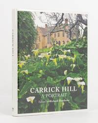
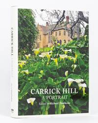
2011135317Kent Town: Wakefield Press 2011. First Edition. Hardcover. Near fine/Near fine. Kent Town Wakefield Press 2011. Quarto viii 152 pages with colour pictorial endpapers and numerous illustrations most in colour. Papered boards; foot of the spine a trifle bumped; a near-fine copy with the dustwrapper a trifle creased. Presentation copy dated October 2013 signed and warmly inscribed in ink on the verso of the front free endpaper by Christopher Legoe AO QC then Immediate Trust Chairperson of the Carrick Hill Foundation to prominent local home economics educator and sometime Carrick Hill guide Marietta Resek. Loosely inserted is a 32-page booklet 'Carrick Hill Guides 1984-2014. Thirty Years of Volunteer Guiding at Carrick Hill' Springfield Carrick Hill 2014. 2 items. Wakefield Press hardcover
2011135311Kent Town: Wakefield Press 2011. First Edition. Hardcover. Near fine/Dust Jacket Included. Kent Town Wakefield Press 2011. Quarto viii 152 pages with colour pictorial endpapers and numerous illustrations most in colour. Papered boards; extremities very slightly bumped; a near-fine copy with the very slightly rubbed and creased dustwrapper lightly scored on the rear panel. Presentation copy dated 5 March 2012 signed and warmly inscribed in ink on the verso of the front free endpaper by the author to prominent local home economics educator and sometime Carrick Hill guide Marietta Resek. Numerous ink signatures and inscriptions to Marietta appear on page vi; signatories include Jan Murray and Pam Debelle. Loosely inserted is a 32-page booklet 'Carrick Hill Guides 1984-2014. Thirty Years of Volunteer Guiding at Carrick Hill' Springfield Carrick Hill 2014 signed in ink by three of the writers Ilonka McInnes Pam Debelle and Jan Murray with a loosely-inserted ALS on Carrick Hill notepaper signed and warmly inscribed by Jan Murray to Marietta and a colour Carrick Hill postcard. 4 items. Wakefield Press hardcover
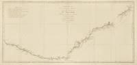
1774143635Paris: Chez Saillant et Nyon . chez Panckoucke 1774. Near fine. Paris Chez Saillant et Nyon . chez Panckoucke 1774 first thus. An original map printed surface 365 × 771 mm sheet size approximately 410 × 830 mm engraved under the direction of Robert Bénard. Trimmed outside the plate-mark leaving ample margins; vertical and horizontal folds; a couple of trifling spots of foxing; small production flaw to the edge of the right-hand margin; some very faint offsetting and other trifling signs of age; in near-fine condition. A map of the east coast of Australia from Point Hicks to Cape Cornwall by way of Botany Bay and Port Jackson as charted by Cook on his first voyage. It comes from the first French edition of the official account of the voyage 'Relation des voyages entrepris . pour faire des découvertes dans l'hémisphère méridional' 'Tome III. Pl. 16'. <p>Tooley 342; see Beddie 659. Chez Saillant et Nyon ... chez Panckoucke unknown
184625916Paris: French Admiralty chart 1846. Very rare early map of the south west coast of Western Australia just 17 years after the founding of the colony. The map covers much of the Western Australian coast from the Dampier Archipelago in the north Broome Exmouth Gulf Shark Bay Perth Geographe Bay Cape Leeuwin Albany all the way to Port Lincoln in South Australia. To our knowledge the only copy held in an Australian institution is at the State Library of Western Australia. It is not recorded in the collection of National Library of Australia collection nor other Australian institutions.<br /> <br /> It is very interesting for the early inland detail. The areas around Perth and Fremantle are shown extending inland to Beverley York Bejoording Toodjoy and Northam on the Swan River with the Swan Avon & Moore Rivers.<br /> <br /> There are 4 insets: Plan de la entree de la Riviere Cygnes Swan River et de l'Ile Rottnest J. L. Stokes; Plan de Port Grey nomme aussi Baie Champion Captain Wickham Plan du Havre Peel dans la Baie Warnbro Lieut. J. S. Roe Plan de la Baie Warnbro J.S. Roe. Coastal features include Baie de l'Esperence; Houtmann's Abrolhos; Albany north east of Albany a mountain described as "Montagne escarpee visible a 10 lieues"; Golfe Exmouth with a prominent Cape Nord Ouest. Depth soundings are taken all around the coast. <br /> <br /> Daussy maps are rare. The State Library of Western Australia holds two. Their copy of this map bears the "Prix deux francs" lower right; with an applied printed chart sellers label from P. Sauvat Bordeaux below the rule on the lower right. They also hold the following: "Carte des mers Australes partie comprise entre les méridiens du Cap de Bonne Espérance et du Port du Roi Georges" cartographic material / dressée par M. Daussy Ingénieur Hydrographe en Chef ; gravé par Jacobs ; écrit par J.M. Hacq. MAPR0000018. This map is recorded as Tooley 1470 and Libraries Australia ID 23501679 which calls it "Rare". <br /> <br /> Centered below the margin - Ecrit de J. M. Hacq Grave par Jacobs lower left Noo. 1111 in upper right margin. Printed area 34.5 x 23.25" with very large margins 40 1/4 x 27 1/2". Backed with tissue on the center fold and margin edges supporting some small closed tears. <br /> <br /> In magnificent condition overall. An extremely rare map especially in this condition. French Admiralty chart unknown
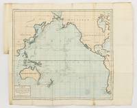
1790143934Paris: F. Dufart 1790. Very Good. Paris F. Dufart circa 1790. A hand-coloured engraved map printed surface 378× 415 mm sheet size approximately 420 × 540 mm. 'Gravée par Tardieu l'Ainé . Dessiné par Poirson . Ecrit par Beaublé'. Original folds as issued; some minor uneven tanning; in very good condition. An uncommon chart of the Pacific Ocean and Australia showing magnetic variation and dip drawing on observations made in the course of Pacific voyages after 1775 most notably Cook's third voyage. It is most likely from a duodecimo edition of Buffon's 'Histoire naturelle générale et particulière' around the end of the eighteenth century 'PL. III. Tome XVI' and 'Page 58' are printed in the top margin. It is based on a larger chart in four sheets attributed to Jean-Charles de Borda. The engraver Tardieu is one of half a dozen members of the family working as engravers at the period one of whom P.A.F. Tardieu would engrave the charts published in the official account of the Baudin voyage. F. Dufart unknown
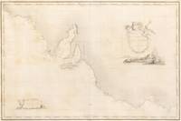
1812133915Paris: Imprimerie Royale 1812. Very Good. Paris Imprimerie Royale 1812 second issue/ 1811. An engraved map 'Gravé par P.A.F. Tardieu . Ecrit par Giraldon et Lale' matted framed and glazed visible image size surface 510 × 760 mm; external dimensions approximately 725 × 980 mm. Vertical centrefold crease as issued; paper a little tanned with some offsetting and a few spots of foxing; in excellent condition not examined out of the frame. One of the earliest published charts of the South Australian coastline compiled by Louis de Freycinet on the Baudin voyage 1800-1803. It includes the complete coastline of Kangaroo Island which was first circumnavigated and fully charted by the French on this voyage Matthew Flinders had charted its north coast a short time previously. The charming engraved vignettes of Australian wildlife are after drawings by Charles Alexandre Lesueur. <p>This example is from the scarce second issue published as Plate 10 of the imperial folio atlas to the 'Partie navigation et géographie' volumes of the official account of the expedition 'Voyage de découvertes aux terres australes' 1812. It had previously appeared as Plate 2 in the second part of the atlas to the 'Historique' volumes published in 1811 Tooley 611. Tooley does not appear to list this issue but does list a subsequent state twice as 414 and 633 which includes a price at the bottom right and the reference 'Hyd. Fr. N° 636' next to the plate number. Imprimerie Royale unknown
2005018130Sydney: John Furphy 2005. HEAVY. 736pp illustrated throughout in full colour index. Illustrated laminated boards. A new copy. The 21st annual edition of Australasia's premier antiques price guide. First Edition. Hard Cover. Fine. 4to. John Furphy Hardcover