Philip's MapsBiblio.com

1 660 résultats
0540085901.Gpaperback. Good. Access codes and supplements are not guaranteed with used items. May be an ex-library book. paperback
0540092940.Gspiral_bound. Good. Access codes and supplements are not guaranteed with used items. May be an ex-library book. unknown
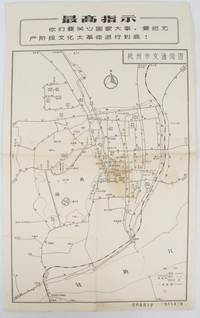
19671632381967. Vintage transportation black and white map of Hangzhou folded no scale a legend lower right corner shows bus/trolleybus routes and terminals. The map covers the old city of Hangzhou from the north side of the city 杭三中"Hangzhou No.3 High School" to the south side 钱江大桥 "Qiantang River Bridge". The West Lake is featured in the centre with its famous tourist spot 三潭映月 "Three Pools Mirroring the Moon" indicated. Bus/trolleybus routes connects schools hospitals municipal government departments cinemas department stores tourist spots around the West Lake etc are all shown on this map. <br> <br>Stained in the central section light wear along folds and edges otherwise good. Text in Chinese. Sheet measures 39.1 x 24.8cm The headline Chinese text in the box along the top of the map reproduces one of the highest directives from Mao's Quotations: "You must pay attention to state affairs and carry the great proletarian cultural revolution through to the end!" . unknown
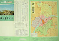
1977137003No place of publication.: 江苏人民出版社.Jiangsu ren min chu ban she. 1st Edition 2nd Printing. 1977. Colour Chinese transportation map featuring the city of Nanjing capital city of Jiangsu Province and its surrounding regions. Upper side: A transpiration map of Nanjing and neighbouring counties right section with a list of names of stations buses trains coaches ferries and their addresses lower right edge tourist guide including the addresses and phone numbers of major travel agents hospitals cinemas and more left section accompanied by two tables of bus routes. On reverse: a "Map of Nanjing Municipal Transpiration Map" scale not given a chart of terminus for bus and trolley bus lower right section. Some soiling on reverse stamp of a prior dealer in Guangzhou a handwritten date of "September 17th 1977" upper side light creases good copy. Text in Chinese. Sheet measures 37.8 x 52.3cm. . 江苏人民出版社.[Jiangsu ren min chu ban she]. unknown
2008169215北京.Beijing.: 星球地图出版社.Xing qiu di tu chu ban she. May2008. Two large coloured maps printed on double sided on a single sheet folded issued shortly after the devastating 2008 Wenchuan Earthquake which was occurred on 12 May 2008. Small tears along folds mended by both non-acidic tape and cello tape some creasing generally good. Text in Chinese. Sheet measures 84.9 x 119.7cm. <br> <br>Map of Sichuan Province: scale 1: 1100000 inset map lower right corner showing the provincial capital city Chengdu a statistical chart lower section listing counties within Sichuan Province their population and territory size. <br> <br>Map of Wenchuan County and Its Vicinity: 1: 300000 various colour representing altitude differences inset map showing the position Wenchuan County within Sichuan Province a mileage chart listing the distance between Wenchuan County to nearby cities. A brief introduction of Wenchuan on left section accompanying the images of the rescue forces. The Great Wenchuan Earthquake was the biggest earthquake in Chinese history with a casualty over 69000 people. . 星球地图出版社.[Xing qiu di tu chu ban she]. unknown
0881300748.Ghardcover. Good. Access codes and supplements are not guaranteed with used items. May be an ex-library book. hardcover
4123666Philips. Paperback. Used; Very Good. Simply Brit welcome to our online used book store where affordability meets great quality. Dive into a world of captivating reads without breaking the bank. We take pride in offering a wide selection of used books from classics to hidden gems ensuring theres something for every literary palate. All orders are shipped within 24 hours and our lightning fast-delivery within 48 hours coupled with our prompt customer service ensures a smooth journey from ordering to delivery. Discover the joy of reading with us your trusted source for affordable books that do not compromise on quality. 03/11/2005 Philips paperback
3266937Philips. Paperback. Used; Good. Simply Brit welcome to our online used book store where affordability meets great quality. Dive into a world of captivating reads without breaking the bank. We take pride in offering a wide selection of used books from classics to hidden gems ensuring theres something for every literary palate. All orders are shipped within 24 hours and our lightning fast-delivery within 48 hours coupled with our prompt customer service ensures a smooth journey from ordering to delivery. Discover the joy of reading with us your trusted source for affordable books that do not compromise on quality. 03/11/2005 Philips paperback
1887749373.Ghardcover. Good. Access codes and supplements are not guaranteed with used items. May be an ex-library book. hardcover
1886705801.Gmap. Good. Access codes and supplements are not guaranteed with used items. May be an ex-library book. unknown
193860338Marshfield OR: Oregon Coast Highway Association 1938. 4to. 16 pp unpaginated. numerous text illustrations double-page centerfold map by T.J. Greene small closed tear minor creasing self-printed photo-illustrated colour-softcovers center crease and printed in double-columns for folding slight soiling front cover still VG- copy w/ small rubber stamp of Breakers Motor Apts. Crescent City California on front cover. First edition thus of this automobile and bus travel tour guide to the newly completed US Highway 101 which finally had completed paved highway and bridges including the iconic Yaquina Bay bridge designed by Conde B. McCullough. Throughout the 1930’s with substantial support from the WPA and PWA projects as well as the U.S. Bureau of Public Works the highway became a scenic continuous drive. Oregon Coast Highway Association, paperback
194962765London & Paris: British European Airways 1949. 4to. 20 pp unpagianted. colour-illustrated maps and red & black text throughout. Self-printed colour-illustrated maps w/ ad for BP Aviation Service and Anglo-Iranian Oil Co. Ltd. on back cover Dunlop tire ad verso of front center crease fold as issued w/ original BEA sleeve from the library of Archibald Angus MacDonald 1892-1977 stepson of famed southern California oil man William F. Byrne as well as oil company and drilling equipment owner and manager of MacDonald & Burns Oil Producers. First edition of this surprisingly scarce BEA route map book issued following World War II and prior to the establishment of the Western US UK and French Zones into the Federal Republic of German and the Soviet Zone into the German Democratic Republic East Germany. In 1946 BEA was established to feed short commuter flights across Europe and until 1950 used a fleet of Douglas DC-3 aircraft based out of Croydon and Northold Airports moving to Heathrow in 1950. No copies in Worldcat. British European Airways, unknown
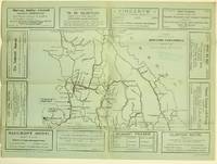
19255871Ashcroft British Columbia: Ashcroft Journal - Board of Trade Ashcroft B.C. 1925. Loose Sheet. Very Good. Map measuring 20 inches x 15 inches printed with black ink on light green paper. Map shows a section of British Columbia from Vancouver north to Quesnell east to Fernie. Map surrounded by ads for Ashcroft businesses. On verso a descriptive narrative offers Ashcroft's history known locally as "Spud City" its regional resources hunting and fishing opportunities and the physical aspects of the landscape. Two rubber stamps one per side for the City Publicity Bureau in Vancouver. Very slight edge-wear to the left margin; a slight stain on the non-map side; old folds now mellowed. A handsome copy of a scarce map suitable for framing. Regarding the publication date: The map refers to Ashcroft as an unincorporated city was formed in 1952 the Main Cariboo Road is described as "a first class dirt and gravel road" and Dr. William Henry Sutherland British Columbia Minister of Public Works is quoted as stating that the scenery in the Marble Canyon Lillooet Lakes and the region of the Fraser River between Lillooet and Lytton "could not be duplicated on the whole of North American Continent and I doubt if it could be surpassed in Europe." Sutherland served in that capacity from 1922-1928 As such we'll posit 1925 as the publication date. Now enclosed in a removable clear archival sleeve. Ashcroft Journal - Board of Trade, Ashcroft, B.C. unknown
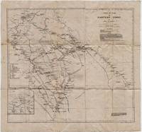
19225331Cambridge: Cambridge University Press 1922. Loose sheet mounted on linen. Good-. Eric Teichman. Map printed in color measuring 26.5 x 25 inches. With a Tibetan glossary. Provides Teichman's routes as well as other routes along with villages monasteries or groups of farms. Edgewear with light stains here and there. In. From Travels of a Consular Officer in Eastern Tibet Together With A History of the Relations between China Tibet and India and mounted on linen. The map was clearly used perhaps in the field as evidence of wear including a split in the paper not the linen on which it's mounted suggests. From the collection of Asian books and maps formed by Albert Ravenholt. On verso Ravenholt has written "Teichman's Kam 28 degrees 25' - 33 degrees 20'. [Cambridge University Press] unknown
19508975Nairobi Kenya: Printed in E. Africa by W. Boyd & Co 1950. First edition. 18x13cm 64pp. Illustrated ads photos fold out map attached at rear. Staple bound in illustrated wrappers. Old tape reinforcement to spine edges rubbed owner's name to front cover. Upper corners stained else clean internally and very good. <br /> <br /> Very scarce mid-century publication a guide for English and American sportsmen seeking angling opportunities in Kenya Colony. Brown and Rainbow Trout eggs were introduced into the rivers by colonists around 1905. The sport was a popular pastime for the colonists and tourist fishing in the region continues to thrive today. The three color map at rear shows the Kenya Highlands with principle trout rivers roads and railways.<br /> <br /> OCLC cites a single holding at the University of California. Printed in E. Africa by W. Boyd & Co unknown
19294297Meadville PA: Keystone View Company 1929. 3rd Edition. Hardcover. Very Good. <br /> <br /> Third edition 1929 12mo 321pp ix pamphlet with three location maps in rear pocket. 3/4 black morocco over blue cloth gilt stamped on spine. Very good with moderate to heavy spotting and soiling to boards. Some moisture staining to fore-edge of page block mainly at the rear index else clean internally. Keystone View Company hardcover
OI-GGCC-RXV5New. unknown
1938041686Ottawa: The Minister Of National Defence 1938. Book. Near Fine. Hardcover. 1st Edition. 4to - over 9¾ - 12" tall. 460 Pages Maps. The Minister Of National Defence Hardcover
194227092A.A. Knopf New York 1942 HARDBACK NODustjacket 1942 Stated 1st EDITION First Printing NF/NF NOJACKET Dates Match on title & Copyright pg bound in GREEN buckram cloth with Gilt design & title 304 pages of clean bright highly illustrated text with no dust jacket Title and a decoration device are embossed into the front cover in bright gilt. Title Author's name as well as two decorative devices are embossed into the spine in bright gilt. Interior nice tight clean Light Wear Fox Index. Signed by Authors. 1st Edition. Hardcover. Near Fine/No Jacket. A.A. Knopf, New York, hardcover
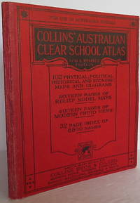
1930009775Sydney: Collins. Softcover. Published Sydney: Collins 1930. Small 4to. wrappers 7 3/8" x 8 3/4" vii 92pp32pp. illustrated with b/w photos maps some color. Stiff red boards and red cloth. Very good plus clean attractive. . Very Good Plus. Soft cover. 1930. Collins paperback
194633453Washington D.C.: Maps and Graphic Division 1946. 1st. revision March 1946. Edges browned 4 inch and 2 inch tears on folds one with small loss at double fold small chip and stain to margins top and bottom some minor edge wear and marginal tears; a good copy. 1 pp. 110 x 90 cm. Color map of China's transportation routes during the war. Scale ca. 1:2750000; E 1000--E 1260/N 420--N 180. Map no. 1379 June 15 1945. OCLC shows only one copy at the LOC of this revised copy. Maps and Graphic Division unknown
1999060925067Franklin Maps 1999. unknown_binding. Very Good. 0x0x0. Very good condition. Clean text without highlighting or underlining. Tight spine. Light wear to the exterior. Franklin Maps unknown
19577856Toronto: Macmillan 1957. First Edition. Hardcover. pp. xxviii 277. Octavo. Publisher's green cloth over boards with gilt rules and lettering to the spine monogram to the centre of the front board; map endpapers. Black-and-white portrait frontispice of the subject and additional full-page black-and-white maps. Trifle bumping to spine ends else bright clean and unmarked; near fine. An excellent copy. <br/><br/> Macmillan hardcover
19933611Madeira Park B.C.: Harbour Publishing 1993. First Edition First Printing. Hardcover. pp. 238. Royal 8vo. Cream boards gilt lettering to the spine; map endpapers. Richly illustrated with many black-and-white photographs portraits maps drawings et al. Single neat ink name to upper corner of the ffep else contents remain bright clean and unmarked with tight sound binding; near fine and housed in near fine dustjacket. <br/><br/> Harbour Publishing hardcover
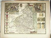
001174FINE map. Reproduction from Speed's "THEATRE OF THE EMPIRE .". Softcover. FINE map. Overall 17.5"x23.5" image 15.25"x20". This is not a photographic reproduction. Attractive & colorful. . FLAWLESS image. Not even the faintest aging foxing etc. VERSO FLAWS: light but extensive surface damage from some sort of adhesive with some loss of lettering. Verso only effected not into recto. . paperback