Swarte Joost:Livre Rare Book

11 983 résultats
20018569Centre National de la Bande Dessinée et de l'Image (CNBDI), 2001. Double carte au format fermé de 15 x 21 cm., illustrée par Swarte. Tout petit pli au coin supérieur.
19979042Genève, Ambassade Royale des Pay-Bas / Théâtre du Loup, 1997. Carton d'invitation (14,5 x 21 cm.)à l'exposition du projet d'architecture pour un théâtre à Haarlem.
19909043Petit Saconnex, Café du soleil, 1990. Carton d'invitation au vernissage de l'exposition "Escale à Paris", illustré d'une composition de Tardi.
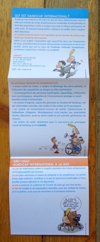
20025476Handicap International, 2002 Dépliant édité par Handicap international, illustré par Zep. Tout beau tout neuf.
Booklet is 'as new' condition. 48pp. The history of the prehistoric cave paintings at the Font-de-Gaume cave near Les Eyzies in Perigord, France.
No marks or inscriptions. No creasing to covers or to spine. An as new very clean very tight copy with bright unmarked boards and no bumping to corners. Map has small crease to lower front corner. 63pp. Guide to the Etruscan treasures in the area centred on Rome plus large fold-out map (32 x 27 inches) in the two pockets of transparent wallet. All text in Italian.
No marks or inscriptions. A very clean very tight copy with bright unmarked boards and no bumping to corners. Dust jacket not price clipped or marked, torn or creased with a little rubbing to bottom of spine. 307pp. The author follows a route from Boulogne by way of Reims, Colmar, Lucerne, the St Gotthard Pass, Milan, Lake Maggiore, Cremona, Ravenna, Florence and finally Rome where he continues his tour.
No marks or inscriptions. A lovely clean crisp very tight copy with bright unmarked cream cloth boards and no bumping to corners. Clipped dust jacket not marked or torn or creased. 338pp. With 215 pages of beautiful photographs of the Provence region of France in black & white and four colour plates. Two fold-outs in perfect condition. Ninety introductory pages on the region and 32 pages of notes on the photographs.
Slight discoloration to corner of ffep. No other marks or inscriptions. Dust jacket price clipped and with a number of small tears to the edges. A clean tight copy. 255pp.
No marks or inscriptions. No creasing to covers or to spine. A very clean very tight copy with bright unmarked boards and no bumping to corners. Dust jacket not price clipped with chips, creases and tears to edges and a little colour loss to front. 239pp. Well over 200 full-size photographic plates, mainly black & white plus a few colour. Seven introductory pages of text in French.
198952876(Hamburg, 1989). Mehrfach gefalt. farbiger Hafenplan (o. Maßstabangabe.). Blattgröße 49,5 x 69 cm, verso Anschluß Hafenplan (32 x 45 cm), Plan der Innenstadt, Übersichtskarte Hamburg u. Umgebung sowie Schnellbahnnetz. Mit 35 TextS., darin einige Abb. Deckelmaß 18 cm. OBrosch.
189926541Leipzig, F. A. Brockhaus, 1899. Ca. 21,5 x 13,5 cm.
Granollers, Edit. Alpina, s/f. Mapa topográfico excursionista. Escala 1: 50.000. Entelado. Firma antiguo propietario. Texto en español y francés. Muy buen ejemplar.
Madrid, Dirección General del Instituto Geográfico y Catastral, 1954. 2ª edición. Mapa publicado por sectores (sector 144). Escala 1:50.000. 56x76 cms. Mapa entelado y plegado. Buen ejemplar.
113671 couvercle en cuir avec carte postale en couleurs insérée: "Aubenas. Promenade du Champ de Foire et kiosque à musique". coffret en bois recouvert de papier peint, 20 x 15 x 3 cm ;
199050810(München), Hallwag, (1990). Mehrfach gefalt. farbige Straßenkarte. Maßstab 1:500.000. Mit 1 eingeschalt. Übersichtskarte. (Transitstraßen). Blattgröße 98 x 77 cm. Deckelmaß 21 cm. OKart.
200191760Ostfildern, Falk-Verlag, [2001]. Mehrfach gefalt. farbiger Straßenplan in Hyperboloid-Projektion mit Kilometernetz, Maßstab 1:19.000-1:32.500. Mit 119 S. Straßenverzeichnis. Blattmaß 72 x 101 cm. Deckel 21 cm. OKart.
200355628Ostfildern), Falk-Verlag, [2003]. Mehrfach gefalt. farbiger Straßenplan in Hyperboloid-Projektion mit Kilometernetz, Maßstab 1:19.000-1:32.500. Mit 158 S. Straßenverzeichnis. Blattmaß 72 x 101 cm. Deckel 20,8 cm. OKart.
200244841Ostfildern, Falk-Verlag, [2002]. Mehrfach gefalt. farbiger Straßenplan in Hyperboloid-Projektion mit Kilometernetz, Maßstab 1:19.000-1:32.500. Mit 129 S. Straßenverzeichnis. Blattmaß 72 x 101 cm. Deckel 21 cm. OKart.
198739492Hamburg, Falk-Verlag, 1987. Farbiger Straßenplan mit Patentfaltung in Hyperboloid-Projektion mit Kilometernetz. Maßstab 1:18.000-1:25.000. Verso Straßenverzeichnis. Blattmaß 41 x 67 cm. Gefaltet 23 x 12 cm. OKart.
196261241Frankfurt/Main, Fina-Touring-Service, 1962]. Mehrf. gefalt. farbiger Plan im Maßstab 1: 15.700, daneben Straßenverzeichnis. Plangr. 8,5 x 41 cm. Blattgr. 41 x 60,5 cm. Falzmaß 20,5 cm.
200588263Regensburg, Schmid, 2005]. Mehrfach gefalt. farbige Vogelschaukarte. Blattgröße 48 x 68 cm. Falzmaß 24 cm.
197739597(Seevetal, Iris-Stadtpläne), [1977]. Mehrf. gefalt. farb. Stadtplan. Blattgröße 57 x 68 cm, Bildgröße 32 x 37 cm. Verso Plan der Innenstadt (Bildgröße 19 x 26,5 cm). Mit 48 nn. S. Einführung (mit Textillustr.) u. Straßenverzeichnis. Deckelmaß 18 cm Wickelfalz. OKart.
198877623(Hamburg, Kompass-Stadtpläne-Verlag, 1988). Mehrfach gefalt. farbiger Stadtplan (Ohne Maßstabangabe). Blattmaß 49 x 69 cm. Mit eingeheftet 71 TextS.(Sraßenverzeichn.) mit 1 farb. Abb. Deckelmaß 18 x 11 cm. OKart.
193890194Hamburg, Friederichsen, de Gruyter & Co. [ca. 1938]. Dreifarb. lithograph. gefalt. Stadtplan (gelb-blau-grün), verso Straßenverzeichnis. Maßstab 1:10.000. Blattmaß 33 x 34 cm, Kartenmaß: 30,5 x 33 cm, Falzmaß:14,5 x 10 cm.