11 716 résultats
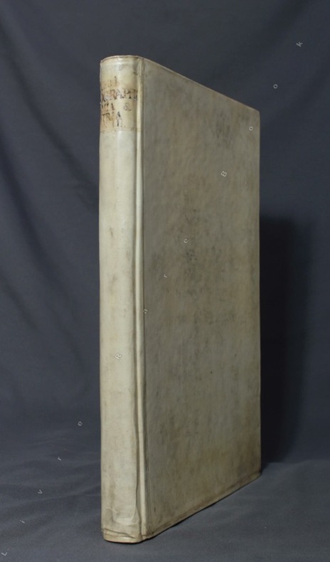
1550ABC_49514Italy 1550. 17th-century gold-tooled brown calf sewn on 6 supports with the corresponding raised bands on the spine a red morocco title label on the spine with the title "Novissima urbis Romae descriptio" lettered in gold gold-tooled board edges. Large oblong folio ca. 59 x 42.3 cm. With 76 full-page engravings and 12 full-page etchings. Remarkable album with 77 beautiful examples of 16th-century Italian cartography all in very fine dark impressions. The collection includes plans of important Italian towns such as Rome Venice Genoa Naples Milan Florence Palermo Siena Bologna and Pisa as well as detailed views of individual buildings and monuments in Rome. They are engraved by several cartographers from the school of Antonio Lafreri 1512-1577 primarily Claudio Duchetti d. 1585 Matteo Florimi d. 1613 and Lafreri himself. Florimi's works are among the rarest of the Lafreri school map makers especially his Siena imprints of which several have here been included.In the middle of the 16th century Italy was the centre of map production and distribution in Europe. This industry primarily took place in Venice and Rome. The most notable of the publishers in Rome was Lafreri. His most important and most popular work is the Speculum Romanae magnificentiae a collection of plans an views of Rome's monuments; no two copies of the Speculum are the same. The present collection contains more than thirty plates from the Speculum. When Lafreri died his nephew Claudio Duchetti inherited the company. He continued to produce the Speculum plates but often made small adjustments and signed his own name at the bottom. Most of the Speculum plates in the present album are by Duchetti. After his death the copperplates were sold to other publishers such as Giovanni Orlandi before 1590-after 1640 who reissued them. The majority of the plates in the present album were printed by Orlandi in 1602.The album further contains 32 engraved city plans mostly of Italian towns although a few foreign cities are also included; one of the rarest is the view of Moscow which is also included here. The collection ends with a incomplete series of 11 etchings of landscapes and biblical scenes.A list of contents is available upon request.With the bookplate of Louis Routy de Charodon seigneur de Grésigny and Charodon 1710-1794 on the front pastedown and remnants of another bookplate above. The boards are somewhat scratched and stained the spine shows traces of use the edges of the boards have been professionally restored and the boards have been lengthened to fit the maps. The maps are slightly browned some are slightly foxed the first few maps have been mounted onto 17th-century leaves the longer maps are somewhat soiled on the fore edge three maps are restored at the fore edge and one at the bottom edge some maps have been cut slightly short. Otherwise in good condition.l Cf. Parshall P. "Antonio Lafreri's "Speculum Romanae magnificentiae"" in: Print Quarterly vol. 23 1 2006 pp. 3-28. hardcover
150 x 130 cm. Scale: 1:3,000,000. Colour lithograph, dissected into 24 sections and mounted on original linen. Very rare, monumental wall map of the Ottoman Empire, featuring one of the largest and most detailed printed representations of the Arabian Peninsula produced in the Islamic World prior to World War I. Perhaps more than any other map, it reveals the immense logistic challenges faced by Hajj pilgrims just in advance of the construction of the Baghdad and Hejaz Railway systems. Printed for official use, the map appeared at a time when the Sublime Porte was going to great lengths to shore up its authority in the Red Sea region (Hejaz, Asir, and Yemen), while being pressured by Britain to retreat from the domains it claimed in the Arabian Gulf (Kuwait, Al-Qatif/Hofuf, and Qatar). - Indeed, the present map would have been of great value to Ottoman generals and cabinet officials for strategic planning, as Arabia was increasingly a focus of global attention and interference. It served as the ideal strategic aid to chart the future construction of the Hejaz Railway (built 1900-08) and the Baghdad Railway (extended from the Anatolian Railway, from 1903 onwards) and delineates some of the world's most strategically important railway lines before 1900. - The main map encompasses most of the Arabian Peninsula, from Qatar and the Hadramaut westwards (while far eastern Arabia, including Oman and what is today the United Arab Emirates is featured in an inset, lower left). The coastlines and rivers are crisply depicted; mountain ranges are expressed by delicate tan shading; all cities and towns of note are labelled; the names of regions and tribal areas are revealed, while all key roads and Hajj caravan routes are delineated. The map features stellar coverage of the western Gulf region, labelling Qatar (then an autonomous part of the Ottoman Empire), Bahrain (a British protectorate prized for its fine natural harbour), and Kuwait, an autonomous Sheikhdom within the Ottoman Empire that would shortly become a British protectorate. Inland, the map details the Saudi-Wahhabi domain Nejd, with its capital Riyadh, while to the northwest lies the territory of the rival Al-Rashid clan, with its capital Ha’il. - Minor soiling and waterstaining, occasional light edge wear. Tears in linen partly repaired. A rare survival. Osmanli cografya literatürü tarihi [History of geographical literature during the Ottoman period], pp. 756f. David Rumsey Map Collection 13186.000 (the single other copy known in the trade). Not in Al-Qasimi collection (1493-1931).
Diameter: 45.5 cms (18 inch), height in stand: 64.5 cm. An engraved terrestrial globe with 12 gores and 2 polar caps over a plaster-covered core, and the engraved horizon ring on the wooden stand, all coloured by a contemporary hand. In a contemporary wooden stand with 3 turned legs supporting the horizon ring, and 3 turned stretchers with a cylindrical centrepiece with a knob on the underside. Further with a contemporary brass hour circle and a slightly later iron meridian ring (and probably the axis pivots). Only recorded copy of the 1848 edition (preceded only by one recorded copy of the 1846 edition) of Malby’s 18 inch (45.5 cms) terrestrial globe, the largest he engraved and much rarer than his 12 inch globe. “Debai” (Dubai) is shown on the Gulf coast, only 15 years after the al-Maktoum dynasty took charge of it in 1833. The globe seems to be intended especially for navigational use, with not only a grid of parallels and meridians (with the prime meridian through Greenwich), but also the irregular curved lines indicating the variation of magnetic from geographic north (“isogones”), at 5 degree intervals. From these one can clearly see where the magnetic poles were. Malby seems to be the first and almost the only globe maker to show them. The engraver signed the present globe “Chas. Malby” and signed the 12 inch globe of 1845 described by Dekker “C. I. Malby”. He must therefore have been Charles Isaac Malby (1816-post 1868). Thomas Malby, Charles’s brother, first set up as a globe publisher around 1839 and was trading as Malby & Co by 1841. Charles may have engraved nearly all of his globes. The earliest Malby globe known to survive is dated 1842, but his earliest recorded 18 inch globes are a pair at the Mariners’ Museum in Virginia: the celestial globe dated 1843 and the terrestrial globe dated 1846. The Austrian National Library has an 18 inch Malby terrestrial globe dated 1850, but we find no further example until 1872. The present 1848 example appears to be unique. The horizon ring has an owner’s stamp on the printed surface, nearly due east, apparently a coat of arms in a wreath, but difficult to make out. The horizon ring and globe have a dozen small cracks repaired and a few small gaps in the surface image, some repaired, but are otherwise in good condition. Extremely rare and lovely large globe, with the fascinating and unusual graphic presentation of geomagnetism. Cf. British Library online cat. BLL01013005847; Dekker, GLB0081; Dunn & Wallis, British globes up to 1850 (1999) 209 & 443; World in your hands (Rudolph Schmidt coll.) 7.12 & 7.13; Yonge, Early globes (1968), p. 46.
Suite completa delle carte raffiguranti i 4 continenti. Xilografie, 1575, finemente colorate a mano in epoca, impresse su carta vergata coeva, complete della linea marginale, in eccellente stato di conservazione. Le carte sono tratte dalla prima edizione de La Cosmographie universelle d'Andre Thevet, cosmographe du roy : illustree de diverses figures des choses plus remarquables veues par l'auteur, & incogneues de noz anciens & modernes, curata da Pierre l’Huilier, che precede di uno o due anni la ristampa di Guillaume Chaudiere. Nato a Angoulême intorno al 1516, Thevet divenne frate francescano e intorno al 1550 compì la sua prima spedizione, quando accompagnò il cardinale Jean de Lorraine in Italia e nel bacino del Mediterraneo. Poco dopo, Thevet pubblicò la Cosmographie de Levant, un compendio circa fatti, persone, luoghi, flora e fauna della zona visitata. L’esperienza di Thevet come un viaggiatore attirò l'attenzione di Nicolas Durand, Cavaliere di Villegagnon, che si apprestava a fondare una colonia in quello che è oggi il Brasile. Durant chiese a Thevet di accompagnarlo nella spedizione come suo confessore. Durante il viaggio, Thevet si ammalò e fu costretto a tornare in Francia dopo aver trascorso sole dieci settimane in Brasile. Tuttavia, combinando le sue osservazioni con le informazioni acquisite da altri viaggiatori, Thevet realizzò il suo Singularitez de la France Antarctique, pubblicato a Parigi nel 1557, che gli valse il riconoscimento reale e la nomina a cosmografo della corte dei Valois. Si dedicò poi alla sua opera più ambiziosa, La Cosmographie universelle, una sorta di descrizione di ogni parte del mondo conosciuto. Il suo collaboratore François de Belleforest, probabilmente a seguito di un litigio, lo abbandonò pubblicando una propria cosmografia nel 1572. Al di là delle accuse di furto del materiale mosse da Thevet, senza dubbio la pubblicazione di Belleforest, tolse successo all’opera di Thevet che, con oltre 2.000 pagine, apparve a 3 anni di distanza, nel 1575. Thevet continuò a scrivere di viaggi reali e immaginari fino alla morte, nel 1592, lasciando due opere manoscritte: la Gran Insulaire, un almanacco di isole di tutto il mondo, e le Histoire de deux voyages, un resoconto, probabilmente amplificato, dei suoi viaggi nel Nuovo Mondo. EuropeEsemplare nell’unico stato conosciuto. La carta deriva dalla rappresentazione murale del mondo di Gerard Mercator del 1569. La mappa è riccamente ornata con mostri marini e numerosi vascelli, e riporta anche le mitiche isole di Frislandia, Ibira e Enoem. La Groenlandia e l’Islanda sono in forma molto allungata, mentre la Scandinavia non si discosta, nella forma, dalla carta di Olaus Magnus.AsieEsemplare nel primo stato di due, avanti la firma dell’editore Chaudiere e la data 1581. La carta dell’Asia è basata sul modello di Mercator del 1569. La Nuova Guinea stranamente non compare nella mappa, mentre il Giappone assume una curiosa forma a tartaruga. La più importante novità cartografica della mappa è rappresentata dalla corretta rappresentazione delle stretto di Anania, oggi Bering.Table d’AfriqueEsemplare nel primo stato di due, avanti la firma dell’editore Chaudiere e la data 1581. Betz sottolinea come questa mappa dell’Africa costituisca un importante tassello nella storia della cartografia del continente, trattandosi della prima mappa di formato in-folio a descrivere l’area basandosi sul modello mercatoriano del 1569, fondendolo con le informazioni desunte dalle carte di Gastaldi e Ortelius. Il risultato è una mappa che fornisce un enorme numero di informazioni cartografiche, talvolta difficili da leggere.Quarte Partie du Monde Esemplare nel primo stato di tre, con il marchio tipografico sotto la descrizione nel cartiglio in basso a sinistra, edito nella prima edizione de La Comosgraphie Universelle del 1575. Burden ebidenzia che il secondo stato della carta non presenta questo marchio tipografico, mentre i... Set of the 4 continents. Woodcuts, 1575, finely hand colored at the time, printed on contemporary laid paper, complete the marginal line, in excellent condition. The maps are from the first edition of The Cosmographie universelle d'Andre Thevet, Cosmographe du roy: ILLUSTREE de diverses figures des choses plus remarquables veues par l'auteur, & incogneues de noz anciens & modernes, curated by Pierre the Huilier, which of one or two years before the reissue of Guillaume Chaudiere. Born around 1516 in Angoulême, Thevet became a Franciscan friar about 1550 and made his first expedition, when he accompanied the Cardinal Jean de Lorraine in Italy and in the Mediterranean basin. Soon after, he published the Cosmographie de Levant, a compendium of facts about people, places, flora and fauna of the area visited. The experience of Thevet as a traveler came to the attention of Nicolas Durand, Knight Villegagnon, who was preparing to establish a colony in what is today Brazil. Durant asked Thevet to accompany the expedition as his confessor. During the trip, Thevet became ill and was forced to return to France after having spent only ten weeks in Brazil. However, by combining his observations with information obtained from other travelers, Thevet realized his Singularitez Antarctique de la France, published in Paris in 1557, which earned him recognition and real cosmographer the appointment of the Valois court. He then devoted himself to his most ambitious work, The Cosmographie universelle, a kind of description of each of the known world. His collaborator François de Belleforest, probably as a result of a quarrel, left him by publishing its own cosmography in 1572. Thevet’s work, of over 2,000 pages, appeared 3 years later, in 1575. Thevet continued to write real and imaginary travel until his death in 1592, leaving two manuscripts: Great Insulaire, an almanac of islands around the world, and the Histoire de deux voyages, a quick, probably amplified, of his travels in the New World. EuropeExample in the only known state. The map comes from the wall map of the world by Gerard Mercator of 1569. The map is richly ornamented with numerous sea monsters and ships, and also reports the mythical islands of Frislandia, Ibira and Enoem. Greenland and Iceland are very elongated, while Scandinavia does not differ in form from the map of Olaus Magnus.AsieExample in the first state of two, before the address of Chaudiere and the date 1581. The map of Asia is based on the model by Mercator wall map of the world. 1569. The New Guinea strangely does not appear in the map, while Japan takes a curious form a turtle. The most important novelty of the cartographic map is represented by the correct representation of the Strait of Ananias, Bering today.Table d'AfriqueExample in the first state of two, before the address of Chaudiere and the date 1581. Betz points out this map of Africa is an important step in the history of cartography of the continent, this is the first map of folio format to describe the area based on the Mercator’s model of 1569, by fusing the information obtained from the maps by Gastaldi and Ortelius. The result is a map that provides a huge number of cartographic information, sometimes difficult to read.Fourth Partie du MondeExample in the first state of three, with the typographical mark under the description in the title, published in the first edition of The Comosgraphie Universelle of 1575. Burden notes that the second state of the map does not present this mark, while the third state is with the address of Chaudiere and the date 1581. From the cartographic point of view, the map is derived from the map of the world of Gerard Mercator of 1569, while the nomenclature and morphology of the northern part seem to be the assembly of several cartographic sources. New Guinea, and a large mass southern called "Cercle Antartique" are richly decorated with scenes of native life. Excellent examples of these rare maps, among... Betz, The Mapping of Africa, pp. 133/34, 17 I/II; Norwich 12; Burden, The Mapping of North America, pp.59/60, 46 I/III; Sweet, Mapping the continent of Asia, 6, I/II.
38009901Korea late 18th-early 19th century 1780-1810. Eight color gouache pastel tinted maps ca. 57.5 x 90.1 cm.contemporary re-backing very solid clean examples complete set of all provinces hand-painted gouache manuscripts. RARE & OBSCURE . . . . A RARE & COMPLETE SET OF ANTIQUARIAN MANUSCRIPT KOREAN . . . YI PERIOD PROVINCIAL MAPS . . "P'ALTO CHIDO" OR "EIGHT PROVINCES MAPS" . . . DELUXE ELEPHANT FOLIO SIZE SHEETS . . . HAND-COLORED GOUACHE PASTELS . This is a very RARE & COMPLETE set of eight Korean provincial manuscript maps. Drawn circa 1780-1810 by an unsigned Korean cartographer. These maps are of historical importance giving place names isolating the time frame. . Painted on very thin finely hand-made mulberry-fiber tissue paper contemporary re-backed with a stiff hand-made paper. Beautifully hand-painted & colored in gouache pastels. . The record shows several reliable verities of manuscript maps showing the eight ancient Korean provinces. . Commonly these maps had no title cartographer's name date or other critical bibliographic colophon data. This is a common theme with Korean manuscript maps. . Political divisions of Korea are by and large mostly stable making name comparisons easier. . PROBABLE MAP TITLES INCLUDE: . a. The "SINJUNG-TONGGUK-YOJI-SUNGNAM:" "EIGHT SEPARATE MAPS EACH SHOWING ONE COMPLETE PROVINCE OF THE EIGHT KOREAN PROVINCES similar in intention to the "P'ALTO CHIDO." . The eight provinces were established during the Chosen dynasty 1392-1910 alternately and commonly called the Yi dynasty. . The eight provinces are from the north to south: . 1. Hamgyong 2. P'yong'an 3. P'yongyang 4. Kangwon 5. Hwanghae 6. Kanghwa 7. Kyongsang 8. Cholla'ungch'ong . During the Sejo reign 1455-68 Yang Songji made the first "P'Alt-do "P'ALTO CHIDO" type maps of the eight provinces this type and style became the "standard" for future examples. There after his style and format were copied by others for centuries. . b. A second version and style of the above eight provinces maps is called "TONGGUK CHIDO: MAP OF THE EASTERN COUNTRY i.e. KOREA" showing a compressed northern frontier along Manchuria the characteristic "CHONG CH'OK" style. . c. A third similar map: "P'ALDO-CHONGDO: A SINGLE MAP SHOWING THE EIGHT PROVINCES OF KOREA." . These maps are pictorially beautiful and artistically drawn in detail. Graphics expressing a primitive naive folk charm depicts prominent geological landscape features. Mountain ranges hills forests in green streams/rivers blues political district seats distinctively painted cartouches box-like in various differing colors for each province. Roads paddy coastal shore line & islands in blue tints with other features nicely colored. . There are a large number of name throughout each map all written in Hanzi traditional Chinese characters called "Hanja" in Korean as was the common practice at that time for Koreans. There are no Hangul characters at all. The Hanja identify navigational directions names of surrounding ocean harbors beaches geographical names city towns villages mountains rivers roads and the like. . Each of the eight maps illustrates a complete single province. Within each of the various political divisions and boundaries outlined and named. . RARITY OF KOREAN ANTIQUITIES: Antiquarian Korean examples are sparse when compared to items of the same period in China and Japan. Korean works are less than 10% of those created elsewhere. . Fewer Korean items were made survived and preserved. The attrition rate: bad weather unstable ancient mud building structures fires natural disasters earthquakes war and other factors diminished the remaining examples. . Those the numbers that come to marked are steadily reduced while the value continues to appreciate. Many never return to market when acquired by institutions or private collectors who eventually donate to museums. . DATING THESE MAPS: These were mostly undated. . There are three possible methods of dating. . a. BY PLACE NAME: there are details in the reference books about county seat names being colored or put in various kinds of 'boxes' on the map depending on that according to the resources approximate dates can be derived. . b. PAPER TECHNOLOGY & FIBERS: Koreans have been using hand-made mulberry bark and fiber paper from the Zhenguan period AD 627-649 printing Buddhist sutras by woodblocks on similar kinds of paper. . These two technologies papermaking and woodblock printing was transmitted to Japan around 700 AD. . Since that time both Koreans & Japanese have utilized mulberry paper Washi in Japanese to woodblock print and paint a large variety of items including maps books and single page works. . By comparing the paper of these maps with known dated printed Japanese books a very close approximate date can be derived. . These Korean map papers are nearly identical to dated woodblock-printed Japanese examples we have. It is therefore highly possible these maps were painted on hand-made mulberry paper from circa 1780-1810 period. . In ancient times sheet size was limited to a small size then joined to other sheets to create a large size single sheet. These maps are of that format. See McCune below where he states the kind of paper used which matches our examples. . CONDITION: Per McCune we summarize: as usual these maps were folded several times from their creation time so they could be safely stored and carried in small 'book' format in covers with a tied string. See McCune below. . Being painted on very fine & thin hand-made mulberry paper most all examples were eventually re-backed. Ours as typical have period re-backing using the same character hand-made mulberry fiber paper of a thicker quality. . They are well preserved however nevertheless as usual there remains some old original wear at the folds the expected light water stains dustiness with other typical very minor flaws for an item of this grand size being 200 years old. These do not detract from the overall excellent impression and stunning appeal. . RARITY: . The complete set is RARE! The work is nicely executed in a firm hand with artistic value illustrating artistically hills mountains and other features of the map pictorially. It is not only a map but a work of art. Tastefully colored in subtle pastels nice representation of water rives and sea. . Such early and beautifully artistic examples seldom come to market. . A RARE AND FRESH EXAMPLE NEVER BEEN ON THE MARKET IN THE LAST 120 YEARS ! . PROVENANCE: These items were acquired from a former missionary's estate who was stationed in Korea from circa 1900-1930's. They have been in this private collection since and have never been on the market. . Color scans are posted to our website. . REFERENCES: . TOOLEY Ronald V. et al.: Article: Shannon McCune: SOME KOREAN MAPS pp.70-102 with illustrations. McCUNE Shannon.: KOREAN MAPS OF THE YI DYNASTY KOREAN CULTURE Korean Consulate General L.A. Ca. Sept. 1983 pp.21-31 34 back cover color plate color & b.w. illustrated. . He discusses "P'ALTO CHIDO""EIGHT PROVINCES MAP" origins maps without scale and were copies of a Korean scholar named Won his title was: Haksaeng works based on Chong Ch'ok's 1390-1475 TONGGUK CHIDO MAP OF THE EASTERN COUNTRY then modified by Won to be the more typical "P'ALTO CHIDO" "EIGHT PROVINCES MAP" but in his new style. This new style clearly resembles our maps in layout format color of county seats and similar boxes around them and other critical details. KOREAN CONSUL GENERAL KOREAN CULTURE September 1983 pp.21-31 34 color map on back cover color and b.w. illustrated. . It was from these maps that the later versions similar to ours eventually emerged mostly by Imperial Order by the ".Yi Dynasty court specifically decreed that both magistrates and governors should prepare up-to-date maps of their territories udder their supervision." p.25. HARLEY J.B. ed. et al.: CARTOGRAPHY IN THE TRADITIONAL EAST AND SOUTHEAST ASIAN SOCIETIES. Ahead of Title: THE HISTORY OF CARTOGRAPHY Vol. 2 Book 2 an excellent article by Gari Ledyard: CARTOGRAPHY IN KOREA pp. 235-345239 figures 10.23 10.24 et al. NAKAMURA Hiroshi.: EAST ASIA IN OLD MAPS. . --. NIHON KO CHIZU TAISEI: GREAT COLLECTION OF OLD JAPANESE MAPS MONUMENTA CARTOGRAPHICA JAPONICA . --. OLD CHINESE WORLD MAPS PRESERVED BY THE KOREANS. Article in IMAGO MUNDI IV 1958. LEE Chan. CH'AN Yi.: OLD MAPS OF KOREA. Han'guk ko chido. By: Ch'an Yi Hong-gyu Che Han'guk Tosogwanhak Yon'guhoe. He discusses and illustrates a good number of similar examples. On pp.226-27 he outlines an early Yi Dynasty example of: THE MAP OF EIGHT provinces found in TONGGUK YOJI SUNGNAM Chong Sang-gi's Tongguk Chido. These manuscripts were on large paper one province per sheet. Many other fine related examples are illustrated & discussed. . --. OLD MAPS OF KOREA: HISTORICAL SKETCH. He traces the early origins of Early Yi dynasty1392-1910 Eight Provinces Map origins and progressions excellent lucid article with illustrations and references to Yi HOE's MAP OF EIGHT PROVINCES. Excellent essay on provincial maps. SHIN Michael D. ed.: KOREAN HISTORY IN MAPS: From Prehistory to the Twenty-First Century. British Museum similar examples cited: commons-wikimedia-org/wiki/Category:Room_67_British_Museum# /media/File:Map_of_the_Jeolla_Province_British_Library_c.27. f.14_fol.12_n02.jpg Library of Congress: Young Il Kim: dong-kookyu-do: A RECENTLY DISCOVERED MANUSCRIPT OF A MAP OF KOREA. Imago Mundi vol.21 1967 pp.31-49 illustrated. . . unknown
172051181Nürnberg, Homannischen Officin, n.date (maps ca 1720-39). Large folio. 54,5x32 cm. Contemporary, probably original, limp full calf with flap (""portmanteau""). (Only 4 maps with dating: 2 with 1732, 1728 and 1739).Cover with blind-tooled frames inside which a crowned monogram and the number 50 (= number of plates). Binding worn at edges, covers and back somewhat rubbed. Flap torn and partly with an old repair. Fine allegorical engraved hand-coloured title, printed title with Index (these 2 leaves strengthened in lower margin, no loss of image), and all 49 engraved maps, all in fine original hand-colouring and in double-folio. In excellent condition, with large cartouches (cartouches uncoloured). A few maps with insignificant small tears in folding. The title-page engraved by Michael Rössler, pointing to an early issue of the atlas, and before the publishing house had its name changed to Homann Erben (from 1730).
Nürnberg, Homannischen Officin, n.date (maps ca 1720-39). Large folio. 54,5x32 cm. Contemporary, probably original, limp full calf with flap (""portmanteau""). (Only 4 maps with dating: 2 with 1732, 1728 and 1739).Cover with blind-tooled frames inside which a crowned monogram and the number 50 (= number of plates). Binding worn at edges, covers and back somewhat rubbed. Flap torn and partly with an old repair. Fine allegorical engraved hand-coloured title, printed title with Index (these 2 leaves strengthened in lower margin, no loss of image), and all 49 engraved maps, all in fine original hand-colouring and in double-folio. In excellent condition, with large cartouches (cartouches uncoloured). A few maps with insignificant small tears in folding. The title-page engraved by Michael Rössler, pointing to an early issue of the atlas, and before the publishing house had its name changed to Homann Erben (from 1730).
Pianta archeologica a proiezione verticale con alzato incisa da Etienne Duperac per l’editore Lorenzo Vaccari. Ricostruzione ideale della Roma Antica eseguita dal Duperac dopo un serio esame della pianta Severiana e della pianta archeologica di Pirro Ligorio, il maggiore studioso dei monumenti antichi di Roma dell’epoca. All’interno della città, è delineato ciascun edificio, riportando i nomi di quelli principali; questi includono il Colosseo, il Pantheon, le Terme di Diocleziano e il Circo Massimo. Fuori città sono contrassegnati le tenute di campagna (per esempio, i Giardini di Domiziano), i monumenti funerari (come i Mausolei di Adriano e di Augusto, ed i circhi di Nerone e Adriano). La lastra è stata intagliata dall’incisore ed editore parigino Étienne Dupérac, che si fece chiamare Stephanus durante il suo periodo di lavoro a Roma (1569-1582). Nella dedica a Carlo IX, l’autore stesso spiega come questa carta sia il frutto di quindici anni di studio di tutte le rovine e dei monumenti della Roma Antica e dei testi letterari correlati. In particolare, viene riportato un dettagliato resoconto della scoperta della pianta Severiana, i cui resti furono scoperti nella chiesa dei SS. Cosma e Damiano nel 1562. Hülsen segnala come unico esemplare originale conosciuto quello conservato al British Museum, che reca il nome dello stampatore Francesco Villamena. Inoltre, aggiunge che, nel catalogo della stamperia dei Vaccari è annoverata la “Roma antica d’otto fogli reali, intagliata per mano di Stefano Duperach Parisino”, a lui sconosciuta. Frutaz obietta giustamente che la tiratura di Villamena sia solo una ristampa, databile ai primi del ‘600, quando l’editore era attivo a Roma. Nelle nostre ricerche, abbiamo finalmente rinvenuto un esemplare originale della pianta, finora sconosciuto, che è assolutamente da identificarsi con la “Roma antica d’otto fogli reali” del catalogo Vaccari, citata da Hülsen. Infatti l’esemplare, conservato nella collezione cartografica della Newberry Library di Chicago, reca proprio l’imprint di Lorenzo Vaccari, editore anche della raccolta I Vestigi dell’Antichità di Roma Raccolti et Ritratti in Perspettiva con ogni diligentia da Stefano Dv Perac Parisino (1575). Tra il 1649 ed il 1660, Gian Giacomo de Rossi ne pubblica una ristampa, utilizzando i medesimi rami (presumibilmente acquisiti dalla bottega del Villamena), ma aggiungendo scene dell’Antica Roma e una legenda tipografica con 159 richiami a monumenti. L’opera è descritta nell’ultimo catalogo della tipografia de Rossi, redatto da Lorenzo Filippo nel 1735 (p. 16, n. 1) come “Roma Antica di Stefano du Perac Parigino intagliata a bulino da Francesco Villamena co’ trionfi de Romani antichi, intagliati a bulino da Jacopo Lauro in dodici fogli reali grandi”. Dunque le tavole aggiuntive dei trionfi sono, secondo il catalogo, incise da Giacomo Lauro. Tale attribuzione viene respinta da Ashby e quindi da Hollstein, che attribuisce la lastre a Peter de Jode. La tipografia de Rossi fu venduta da Lorenzo Filippo, costituendo il fondo principale della neonata (1738) Calcografia Camerale (poi Regia, quindi Nazionale e oggi Istituto Centrale per la Grafica), luogo in cui sono ancora conservati i rami originali, erroneamente sotto il nome di Francesco Villamena. In alto, lungo il bordo superiore, è impresso il titolo: URBIS ROMAE SCIOGRAPHIA EX ANTIQUIS MONUMENTIS ACCURATISS. DELINEATA. A sinistra lo stemma con la sigla S.P.Q.R. (Senatus Populus Que Romanus). Nel cartiglio in basso a destra, con la raffigurazione dei gemelli Romolo e Remo, troviamo incisa la dedica: KAROLO IX GALLIARUM REGI CHRISTIANISSIMO STEPHANUS DU PERAC PARISIENSIS Quanta fuerit veteris illius popuki R. potentia atque amplitudo, karole regu[m] maxime, omnes sciunt:quae autem ipsius urbis, antiquis temporibus, maiestas ac pulchritudo, non alinde melius ac certius cognosci potest, quam ex admirabilibus veterum aedifitioru[m] vestigiis, q... Vertical projection archaeological map, engraved by Etienne Duperac for the publisher Lorenzo Vaccari. Ideal reconstruction of Ancient Rome carried out by Duperac after a serious examination of the Severian map and the archaeological work by Pirro Ligorio, the greatest scholar of ancient monuments in Rome at the time. Inside the city, each building is outlined with the names of the main ones; these include the Colosseum, the Pantheon, the Baths of Diocletian and the Circus Maximus. Outside the city are marked the country estates (for example, the Gardens of Domitian), the funerary monuments (such as the Mausoleums of Hadrian and Augustus, and the circuses of Nero and Hadrian). The plate was carved by the Parisian engraver and publisher Étienne Dupérac, who called himself Stephanus during his period of work in Rome (1569-1582). In the dedication to Charles IX, the author himself explains how this work is the result of fifteen years of study of all the ruins and monuments of Ancient Rome and related literary texts. In particular, a detailed account is given of the discovery of the Severian map, the remains of which were discovered in the church of Saints Cosma and Damiano in 1562. Hülsen reports as the only known original example the one preserved at the British Museum, which bears the name of the printer Francesco Villamena. Furthermore, he adds that the catalogue of the Vaccari print shop includes the "Roma antica d’otto fogli reali, intagliata per mano di Stefano Duperach Parisino”, unknown to him. Frutaz rightly objects that the Villamena's edition is only a reprint, datable to the early 17th century, when the publisher was active in Rome. In our research, we finally found an original example of the map, hitherto unknown, which is absolutely to be identified with the "Ancient Rome of eight royal sheets" of the Vaccari catalogue, quoted by Hülsen. In fact the exemplar, preserved in the cartographic collection of the Newberry Library of Chicago, bears the imprint of Lorenzo Vaccari, publisher also of the collection I Vestigi dell'Antichità di Roma Raccolti et Ritratti in Perspettiva con ogni diligentia by Stefano Dv Perac Parisino (1575). Between 1649 and 1660, Gian Giacomo de Rossi published a reprint, using the same plates(presumably acquired from the Villamena workshop), but adding scenes from Ancient Rome and a typographical legend with 159 references to monuments. The work is described in the last catalogue of de Rossi's printing house, edited by Lorenzo Filippo in 1735 (p. 16, n. 1) as "Roma Antica di Stefano du Perac Parigino intagliata a bulino da Francesco Villamena co’ trionfi de Romani antichi, intagliati a bulino da Jacopo Lauro in dodici fogli reali grandi”. So the additional plates of the triumphs are, according to the catalogue, engraved by Giacomo Lauro. This attribution is rejected by Ashby and then by Hollstein, who attributes the plate to Peter de Jode. The de Rossi printing house was sold by Lorenzo Filippo, constituting the main fund of the newborn (1738) Calcografia Camerale (later Regia, then Nazionale and now Istituto Centrale per la Grafica), where the original plates are still preserved, mistakenly under the name of Francesco Villamena. Example of the third state of four (cfr. Bifolco-Ronca, p. 2359) with the imprint Cura et Tipis Io. Iacobi de Rubeis in Romae ad Templ. Stae. Mae. De Pace cum Privil. Sum. Pont. Excudebat Romae Io. Iacob. De Rubeis. Etching with engraving, a very good example of the De Rossi edition, with decorations and the key-numbers on the lower part; minor repairs perfectly realized, otherwise in excellent condition. Literature Bifolco-Ronca, Cartografia e topografia italiana del XVI secolo, pp. 2358-59, tav. 1214, III/IV; Destombes (1970): n. 96; Caldana (2013): n. I.12; Frutaz (1962): n. XXII e tavv. 37-50; Grelle Iusco (1996): pp. 172, 379; Hollstein (1952): IX, p. 202, nn. 403-414; Hülsen (1915): XI, pp. 60-62, nn. 56-59; Mostra Bergamo (2016): n. 72; Sca...
1617LBW-982[Amsterdam, 1617]. En quatre feuilles jointes de 590 x 2240 mm ; encadré sous verre.
11790Imprimé à Amstelredam [sic], chez Cornille Claessz sur l'Eau au Livre à Ecrire, l'an 1602. In-folio de [2]-61 pages (A-H4), cartonnage noir à la Bradel, signé Honegger. Restauration mineure à quelques feuillets.
18295146264London, The Trustees of the British Museum 1820-1829. Mit 2 Schabkunst-Porträts und 2 Holzschnitt-Vignetten. Gr.-2° (46 x 33,5 cm). Professionell restaurierte Pappbände der Zeit mit gedruckten Orig.-Papierrückenschildern.
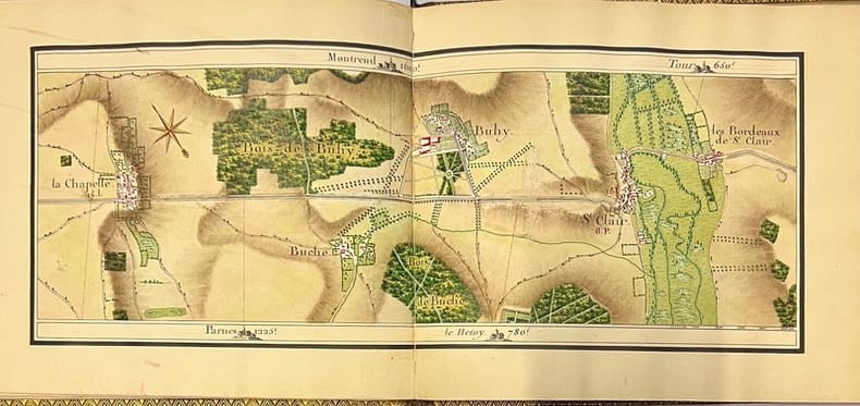
176943413, , 1769. Manuscrit in-8 oblong (23 x 20 cm), titre, table, remarques et 29 cartes à double page finement dessinées et aquarellées, maroquin vert, dos lisse orné, large dentelle dorée encadrant les plats, coupes filetées or, frise intérieure, gardes de soie rose, tranches dorées (reliure de l'époque).
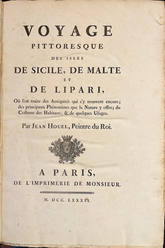
18751A Paris, de l'imprimerie de Monsieur, 1782 - 1787. 4 volumes grand in-folio de VIII-138; [4]-148; [4]-126; [4]-124 pages, demi-chagrin vert, dos lisses orné de filets et fleurons dorés. Non rogné. Reliures restaurées.
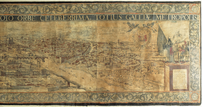
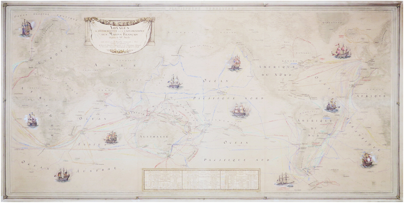
1751LBW-6655Paris, [1751]. En cinq feuilles jointes et entoilées de 0,86 x 2,85 m.
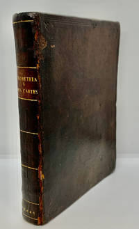
16491000378<p>Geometria à Renato Des Cartes Anno 1637 Gallicè edita; nunc autem Cum Notis Florimondi de Beaune In Curiâ Blaesensi Consiliarii Regii In linguam Latinam versa & commentariis illustrata Operá atque studio Francisci à Schooten Leydensis in Academiâ Lugduno-Batavâ Matheseos Professoris Belgicè docentis. Lugduni Batavorum Leiden: Ex Officinâ Ioannis Maire 1649. First separate and first Latin edition of "La Géometrie". 18th-century leather binding with spine lettering wear to corners and ends but binding is firm. Occasional foxing. The previous owner was John Fitzwilliam died 1699 who was elected fellow of Magdalen in 1661 and became the librarian there in 1662. He would become tutor to Lady Rachel Wriothesley later Lady Russell whose husband Lord Russel was executed under the Rhy House Plot to assassinate King Charles II. The work for a time was part of the private library of Makree Castle in Collooney Ireland but was later owned by the celebrated collector philanthropist Harrison Horblit. "The work was the first to propose the idea of uniting algebra and geometry into a single subject and invented an algebraic geometry called analytic geometry which involves reducing geometry to a form of arithmetic and algebra and translating geometric shapes into algebraic equations. For its time this was ground-breaking. It also contributed to the mathematical ideas of Leibniz and Newton and was thus important in the development of calculus." $12000.00</p> hardcover
168424285Edo Tokyo: Hyoshiya Ichirobe Hayashi-shi Yoshinaga First month 1684 But Third month 1680. A large woodcut map of Edo Tokyo with fine handcolouring on joined and folded paper. The map is breathtaking in its detail and features many paintings of important landmarks temples bridges and people who are often pictured working or fishing from boats on the waterways running through Tokyo. A stunning and very rare woodblock map beautifully and unusually handcoloured. Roads blocks buildings open areas canals and waterways are all vividly laid out on this huge and most impressive map. 123.5 by 149.5 cm. folded within paper covers folds to 28 by 18 cm now preserved in a fine clamshell box. A remarkably well preserved and very rare item with some light rubbing due to age and as to be expected. A bit of old worming or light soiling and occasional small repairs but in all quite astonishing in its quality and beautifully preserved with bright and vivid colour and detail. AN EXTRAORDINARY ITEM REMARKABLE FOR BOTH ITS CARTOGRAPHIC DETAIL AND ITS ARTISTIC BEAUTY. The wood block printing shows land tenures of Daimyo and Hatamoto. It also shows temples and shrines includes a distance chart and descriptive listing of Daimyo showing crests and halberds. There is also a inset of the eastern portion of Edo. Hyoshiya Ichirobe (Hayashi-shi Yoshinaga) unknown
159047728Venetia [Venice], apresso gli heredi di S. Gagliani, 1590. [Colophon: In Vintia, appresso Giorgio Angelieri, a instantia de gli heredi di Simon Gagliani de Karera, 1590]. Small folio. 18th century (ab. 1780-90) half vellum with gilt leather title label to spine. Corners a bit bumped and title label a bit worn, otherwise nice and tight. A very nice copy, on thick, crisp paper. A few quires browned and brownspotted, and some occasional lighter browning. Four leaves with a marginal worm-tract, far from affecting text. Beautiful engraved title-page, consisting of a wide architectural border illustrated with large figures, putti, globes, and various symbols. Beautiful large woodcut initials and head- and tail-pieces. 47 half-page engraved maps in the text (by Porro, of islands and continents), excellent, crisp impressions. Large woodcut device to colophon. (12) ff., 201, (1) pp.
Venetia [Venice], apresso gli heredi di S. Gagliani, 1590. [Colophon: In Vintia, appresso Giorgio Angelieri, a instantia de gli heredi di Simon Gagliani de Karera, 1590]. Small folio. 18th century (ab. 1780-90) half vellum with gilt leather title label to spine. Corners a bit bumped and title label a bit worn, otherwise nice and tight. A very nice copy, on thick, crisp paper. A few quires browned and brownspotted, and some occasional lighter browning. Four leaves with a marginal worm-tract, far from affecting text. Beautiful engraved title-page, consisting of a wide architectural border illustrated with large figures, putti, globes, and various symbols. Beautiful large woodcut initials and head- and tail-pieces. 47 half-page engraved maps in the text (by Porro, of islands and continents), excellent, crisp impressions. Large woodcut device to colophon. (12) ff., 201, (1) pp.
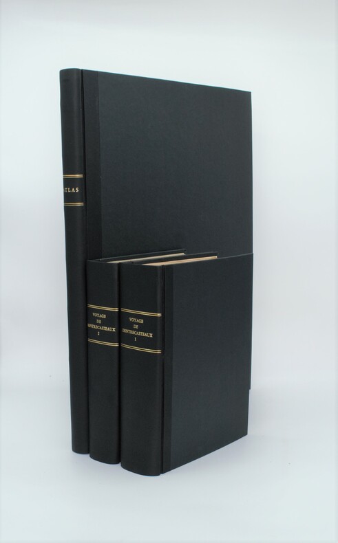
1807PHO-1A Paris, Dépôt général des Cartes et Plans de la Marine et des Colonies, 1807 et De L’Imprimerie Impériale, 1808 RARE ENSEMBLE COMPLET en 3 volumes TEXTE ; 2 forts vol. in-4° ; (2)-LVI-704 pp.-32 pl. h.-t. repliées in-fine (I-XXXII)/(2)-VIII-692 pp.-1 pl. h.-t. Repliée sur papier bleuté , relié demi cuir , dos lisse avec titre et tomaison , tranches mouchetées , mouillure angulaire sur 7 planches, petites rousseurs sur les planches . ATLAS ; 1 volume grand in-folio (560x445) ,page de titre-1 fnch. (Table )-39 cartes et vues h.-t. , dont 29 à double page ,dressées par l'ingénieur hydrographe C. F. Beautemps Beaupré et gravées sur cuivre par E. Collin , relié demi cuir , dos lisse ,cachets répétés , petites rousseurs .
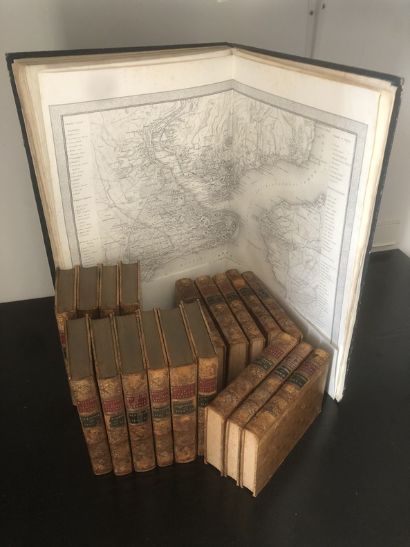
1835PHO-1099Paris, Bellizard, Barthes, Dufour et Lowell ; Londres, Bossange, Barthes et Lowell ; Saint-Petersbourg, Fd. Bellizard et Cie, 1835-1841. 18 volumes de texte in-8 et un atlas in-folio TEXTE : 18 volumes in-8, relié plein cuir tacheté époque, dos lisse orné avec pièce de titre rouge et auteur et tomaison vertes, filet sur les plats, adhésif, frottements, défauts d'usage .., rousseurs dans le texte. ATLAS : Paris. Bellizard, Dufour etc. 1844. Imprimé chez Thierry Frères. Reliure époque, dos lisse. Grand in-folio (555x375mm) il est composé d'un titre, d'une listes des cartes, d'une carte générale de l'Empire Ottoman avec les contours aquarellés (690x550mm), de 21 cartes particulières (dont une sur 2 feuilles et 2 à double page dépliantes représentant les états de l'empire ottoman et les états limitrophes (845x590mm et 845x545), de 13 plans de batailles ou de siège, et de 3 plans de villes dont un grand plan dépliant de Constantinople (690x670mm) par G. Heck et Lon. Plée et gravée par U. Muschani. Reliure avec défauts, réparation au dos, fente intérieure, petite mouillure angulaire, une carte et un feuillet détaché
176915641769 Nuremberg, 1769. 33x52,5 cm. Recueil de 20 grandes cartes de la Suisse sur double pages, en couleurs ! Augmenté d'une carte de Neuchâtel et Valangin dressée en 1778. Reliure de la fin du XVIIIème siècle ou du début du XIXème siècle en demi-basane à petits coins. Plats recouverts de papier beige moucheté. Dos lisse orné de bandes dorées. Titre sur pièce de couleur orangée. Petites traces d'usage sur la reliure et papier très légèrement bruni par endroit, sinon ouvrage en excellent état et complet, ce qui est exceptionnel !
8502Franckfurt am Mann, Merian, 1654. Grand in-4 de 90-[10] pages (A-L8; M6), plein vélin blanc, reliure du XVIIIe siècle de réemploi, exemplaire lavé, toutes les planches ont été proprement remontées sur onglet, sans un faux pli. Ex-libris gravé du XVIIIe siècle de Georg August Graf zu Erbach.
Six-leaf panoramic view. Toned lithograph in contemp. colour, c. 205 x 660 mm each. Matted individually. Splendid, coloured circular panorama of Vienna, measuring roughly four metres in length. - Plate 1: Spinnerin am Kreuz - Arsenal. Plate 2: Penzing - Leopoldsberg. Plate 3: Kalksburg - Schönbrunn. Plate 4: Rothneusiedl - Rodaun. Plate 5: Schwechat - Laxenburg - Oberlaa. Plate 6: Simmering - Schwechat. Gregosch taught at the Budapest School of Arts and Crafts and was one of the illustrators of "Die Österreichisch-Ungarische Monarchie in Wort und Bild" (cf. Th./B.). - Extremely rare, especially when complete and in colour: the copy in the Wienmuseum and that in the Eckl collection are both uncoloured. Nebehay/Wagner II, 208. Eckl collection, no. 869. Thieme/Becker XIV, 582.
1939LBW-80781939. 1,11 x 2,14m ; montée sur toile.
La rarissima veduta aerea di Roma di Balthasar Jenichen, pubblicata a Norimberga. La veduta di Jenichen deriva a sua volta da una xilografia della Cosmographia di Sebastian Münster (Basilea, 1550), che raffigura Roma così com'era intorno al 1490 (Per la veduta di Münster si veda A. Frutaz, Le piante di Roma, XCVIII)."Orientata con nord in basso. A proiezione obliqua; veduta prospettica. È una ripetizione del panorama comparso la prima volta col Bergomensis (1490) e, con lievi modificazioni, ripetuto poi nello Schedel, nel Munster e in altre edizioni tutte inspirate al panorama, detto di Mantova, e che rappresenta Roma sotto il Pontificato di Alessandro VI. Forse lo Jenicken ricalca un vecchio rame senza mai aver visto Roma, sicché non riesce ad interpretare la linea della cupola del Pantheon, colloca l'Aventino presso la Porta del Popolo e qua e là dissemina altri errori topografici. L'assenza del Colosseo ricollega la presente pianta più direttamente al Munster" (cfr. Scaccia Scarafoni, p. 74)."In alto a sinistra legenda con lettere di rimando in veduta (A-Z). È noto un solo altro esemplare con iscrizioni in caratteri gotici conservato al Paul Getty Museum ed un altro con iscrizioni in caratteri romani conservato presso la BVE. Si tratta pertanto di una pianta di estrema rarità e peraltro graficamente assai raffinata" (cfr. Marigliani p. 121, che erroneamente raffigura e attribuisce la copia con caratteri gotici allo Jenichen).Il lettering del nostro esemplare è in latino, mentre esiste una copia con caratteri gotici, di dimensioni ridotte. Un esempio (ex collezione Pecci-Blunt) si trova al Getty Museum, un altro è pubblicato su Marigliani, altro ancora è descritto da Scaccia Scarafoni alla Biblioteca Nazionale di Roma.La veduta dello Jenichen è sconosciuta a Frutaz, mentre Hollstein ne descrive solo 2 esemplari nelle collezioni dei gabinetti delle stampe di Berlino e Monaco. Scaccia Scarafoni descrive l'esemplare presso la Biblioteca Nazionale di Roma; Jenichen è stato il principale editore tedesco di carte topografiche. Insieme al connazionale Matthias Zündt si interessarono particolarmente alle cosiddette carte d'occasione - nate per documentare avvenimenti - e ne produssero diverse sulla scia e nella tradizione di quelle dei loro omologhi editori italiani. Data la loro natura effimera, sono tutte rare o introvabili.La veduta di Roma, priva di data, può essere ricondotta la periodo 1562-1590 in base alle informazioni sul periodo di attività dell'artista. Una datazione intorno al 1570 ci sembra più compatibile con alcuni dei lavori topografici - datati - dell'artista.Acquaforte e bulino, impressa su carta vergata coeva priva di filigrana, con margini, in perfetto stato di conservazione. Rarissima.BibliografiaScaccia Scarafoni, Le Piante di Roma, pp. 74-75, n. 129; Marigliani, Le piante di Roma nelle collezioni private, p. 121, n. 17; Hollstein XL B, p. 54, n. 150; G.K. Nagler, Lexicon, VI, p. 439, n. 2; Andresen II, Nr. 279; Passavant IV, p. 429, n. 27; Le Blanc, II, p. 429, n. 27. The very rare Balthasar Jenichen's etched bird's-eye view of Rome, published in Nuremberg. Jenichen's view in turn derived from a woodcut in Sebastian Münster's Cosmographia (Basel, 1550), which depicts Rome as it was about 1490 (For Münster's view, see A. Frutaz, Le piante di Roma, XCVIII).Münster's table with lettered names keyed to buildings and monuments on the view has been shifted from the foot to the upper left-hand corner in Jenichen and the present view. In its place at foot are eight quatrains of German verse on the rulers of Rome, the last line of which reads: Das spricht Balthasar Jenichen. Lettering in the present view is Latin, while there is a copy with Gothic lettering, reduced in size. One example (ex Pecci-Blunt collection's) is at the Getty Museum, another one is published in Marigliani - who erroneously attributes the copy with Gothic characters to Jenichen. Unknown by Frutaz; Hollstein describes only 2 example of this very rare work. Scaccia Scarafoni listed the further example at the Biblioteca Nazionale di Roma (that own also the copy with Gothic text).Jenichen was the leading German publisher of news-sheet maps. Jenichen and compatriot Matthias Zündt took particular interest in the conflict and produced views and maps of it that equaled and surpassed those of their Italian counterparts. Given their ephemeral nature, all are rare and desirable.The view of Rome, undated, can be traced back to the period 1562-1590 according to the artist's period of activity. A dating around 1570 seems to us to be more compatible with some of the artist's topographical and dated works.Etching and engraving, printed on contemporary laid paper, with margins, perfect condition.LiteratureScaccia Scarafoni, Le Piante di Roma, pp. 74-75, n. 129; Marigliani, Le piante di Roma nelle collezioni private, p. 121, n. 17; Hollstein XL B, p. 54, n. 150; G.K. Nagler, Lexicon, VI, p. 439, n. 2; Andresen II, Nr. 279; Passavant IV, p. 429, n. 27; Le Blanc, II, p. 429, n. 27.