1 660 résultats
2025SKU1731490Benchmark Maps 2025-03-01. paperback. New. 11x1x15. New Book Ships with Tracking Benchmark Maps paperback
2025SKU1733453Benchmark Maps 2025-03-01. paperback. New. 11x1x15. New Textbook Ships with Tracking Benchmark Maps paperback
0008597642.Gspiral_bound. Good. Access codes and supplements are not guaranteed with used items. May be an ex-library book. unknown
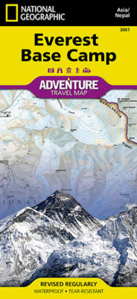
Q-156695519XNatl Geographic Society Maps 2019-01-01. Map. New. In shrink wrap. Looks like an interesting title! Natl Geographic Society Maps unknown
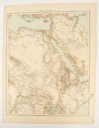
1895175108London.: Times Atlas of the World. 1895. Double-page folding map printed in colour 46.5 x 36.5 cm. edges gilt central fold with an inset map of Somaliland Somalia and the island of Sokotra key to European possessions outlined in colour small edge fold tears affecting the margin only and two other small edge tears slight toning at the edgaes but in very good condition. Attractive and detailed map prepared for the first edition of "The Times Atlas of the World". . (Times Atlas of the World). unknown
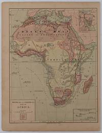
1877176015New York.: Harper & Brothers. circa1877. Chromolithographed map with outlne handcolour 27.1 x 21 cm major towns marked with a red cross relief by hachures ocean currents marked two inset maps of the Suez canal and Mascarene Island two very small marginal edge tears not affecting the map slight toning unrelated text on the verso prepared for "Harper's School Geography" in very good condition Interesting map of Africa before the escalation of the European race for colonial possessions from 1880. The map shows: the European possessions of the Cape Colony Transvaal Republic Orange River Republic and Natal; regions of the continent as fertile belts and desert belts; and indicates agricultural and other production such as palm oil ivory skins and cattle. Major cities are shown with important trade centers highlighted with a red cross. Prepared for US students in "Harper's School Geography" longitude is shown from the Greenwich prime meridian at the head of the map and from the Washington prime meridian at the foot. A small outline map of Ohio is included for relative scale. . Harper & Brothers. unknown
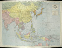
1940205763London.: Hutchinson & Co. Circa1940. Full colour folding map 70.7 x 93 cms; 76 x 101.2 cms sheet original folds short fold splits previous owner's neat title markings on the verso but the map in very good condition. A "Geographia" map of the war theatre in Asia and the Pacific including the northernmost coast of Australia. Showing railways and canals roads and steamer routes oilfields and pipe lines and a key to the unfederated states of Malaya. The Spratley Islands are marked as French and Thai territorial claims within French Indo China are marked. . Hutchinson & Co. unknown
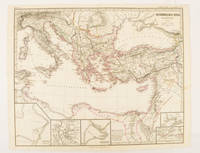
174950Gotha.: Justus Perthes. Map with original colour and outline hand-colour 32.2 x 40 cm text in German five inset maps central fold slight marginal toning and spotting on the verso but in very good condition. A most handsome and highly detailed map detailing the Eastern provinces of the Byzantine/Roman Empire in the time of the Roman Emperor Justinian 527-565. The inset maps depict Carthage Rome Constantinople Naples and a Western continuation of the main map originally issued for the "Hand-Atlas für die Geschichte des Mittelatters und die Neueren Zeit" . Justus Perthes. unknown
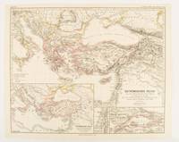
1874174914Gotha: Justus Perthes. 1874. Map with original colour and outline hand-colour 32.2 x 40 cm three inset maps text in German central fold slight marginal toning in very good condition. A most handsome map detailing the Eastern Roman Empire from the immigration of Hungarians in Ponnonia around 895 to the subjugation of the Bulgarian Empire by Emperor Basilius in 1019. The inset maps depict Divisions of the Empire Palestine and the Themata around Propontis present day Sea of Marmara issued for the "Hand-Atlas für die Geschichte des Mittelatters und die Neueren Zeit". . Justus Perthes unknown
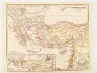
1876174911Gotha: Justus Perthes. 1876. Map with original colour and outline hand-colour 32.2 x 40 cm text in German four inset maps central fold slight marginal toning and spotting on the verso but in very good condition. A most handsome and highly detailed map detailing the Eastern provinces of the Byzantine/Roman Empire before the Fourth Crusade. The inset maps depict Constantinople Divisions of the Empire and Antioch issued for the "Hand-Atlas für die Geschichte des Mittelatters und die Neueren Zeit" . Justus Perthes unknown
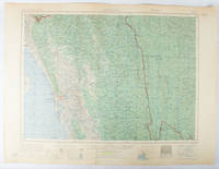
1955173072Washington D.C.: Army Map Service U.S. Army. 1955. Large colour map. 1:250000 scale. Transverse mercator projection. 23°00'N 91°30'E-22°00'N 93°00'E. Series U502 Sheet NF 46-6 Edition 1-AMS. Map measures 57.3 x 75.8cm. Slight wear creasing even light browning small closed tears on edges upper-right corner little foxed. Shows signs of use but map is clean and complete. Corps of Engineers Army Map Service map of Chittagong and surrounds compiled in 1955. Based on the British Indian one-inch and half-inch map series from 1938-43 and 1936-43 respectively. . Army Map Service, U.S. Army. unknown
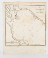
1839175248Paris.: Librairie de Gide. 1839. Engraved map 21.1 x 20.8 cm 27 x 22 cm sheet original folds trimmed to the inner margin with slight loss to the border only map spotted but otherwise in sound condition. Map of the Port of Kerch in Crimea prepared for the 1839 edition of the French Journal "Nouvelles Annales des Voyages." the editors for this edition amongst others the translator and geographer Jean-Baptiste Benoît Eyriès and Alexander von Humboldt founding members of the world's first geographical society the Société de Géographie. . (Librairie de Gide). unknown
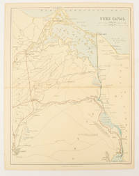
1880174937London Edinburgh & Glasgow.: William Mackenzie. 1880. Map printed in colour with original outline hand colour 29.8 x 22.7 cm central fold edge toning but in very good condition. Published for inclusion in "The National Encyclopaedia: A Dictionary of Useful Knowledge". . William Mackenzie. unknown
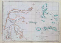
1860184035London.: Weekly Dispatch Atlas. circa1860. Map with outline handcolour 31.3 x 43.3; 33.3 x 48.7 cms sheet 12 x 17 inches small marginal bloom not affecting the map in very good condition. Detailed mapping of these two island groups by Edward Weller 1819–1884 from the ‘Weekly Dispatch Atlas’ an atlas published in monthly instalments from 1855 for subscribers to the long running newspaper. Weller was a pioneer in lithography and was sought after for his skill in producing detailed and accurate maps. . Weekly Dispatch Atlas. unknown
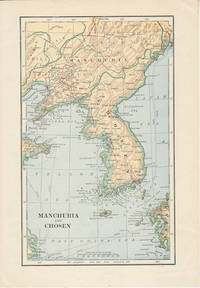
1900174813London. Circa1900. Map printed in colour showing submarine and overland telegraphs Manchuria Chosen Liao-Ting Kirin and Chili 21.5 x 13.3 cm 25.7 x 17.1 cm sheet size margins a little scuffed in very good condition. . unknown
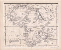
1830176607London.: Robert Jennings. 1830. Engraved map 11.5 x 14.3 cm showing route of European explorers faint added outline colour in an early hand and manuscript note to the verso in the same ink edges age-toned but in very good condition. Detailed pre-colonial map of Africa "Regions Unexplored" marked and "no fresh water to be found" on the west coast. An early manuscript inscription on the verso refers to Lander's ."wanderings of Clapperton" the Scottish naval officer and explorer. Richard Lander had returned with Hugh Clapperton's journal following his death and the account was published in the same year as Fenner's "Pocket Atlas of Modern & Ancient Geography" for which this map was prepared. . (Robert Jennings) unknown
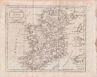
1796176602circa1796. Engraved map 18.3 x 22 cm 21.7 x 27 cm sheet original folds age toning and some offsetting inner edge darkened and discoloured but the map in good condition. Finely engraved map showing Ireland divided into counties lower coast of Scotland and Wales and the Isles of Man and Anglesea; also noting Nymph Bank 'discovered in 1735 by Capt. Doyle.' . unknown
1893174920New York.: Hunt & Eaton. Circa1893. Printed map in colour elevation shown with hachures 29 x 23.5 cm text on the verso relating to entries for Afghanistan Beluchistan and Turkey prepared for Hunt & Eaton's "New York Recorder's Atlas" small tears to the top edge but in very good condition. . Hunt & Eaton. unknown
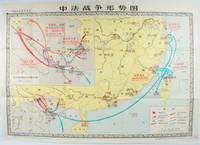
1978171343北京. Beijing.: 地图出版社.Di tu chu ban she. 1978. Large Chinese map in colour showing southern part of China and northern Vietnam folded in original envelope scale 1: 150000 inset map upper left corner scale 1:800000. Both maps show the battles between Qing court and French army between 23 Aug 1884 and 25 Mar 1885. Original paper envelope repaired with acidic free tape map in very good condition. Text in Chinese. Sheet measures 76.8 x 107.1cm. . 地图出版社.[Di tu chu ban she]. unknown
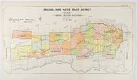
1912177249Sydney.: W.A. Gullick Govt. Printer. 1912. Large lithographed folding county map 78.8 x 45.4 cm the parishes highlighted in colour two small fold splits slight toning in very good bright condition. Attractive map from the Report on the first Interstate Conference on Artesian Water Sydney 1912 showing boundaries of water trust districts proposed boundaries with position and length of drains for the counties of Denham and Jamison in northern New South Wales boundaried by the Namoi River to the South. . [W.A. Gullick, Govt. Printer] unknown
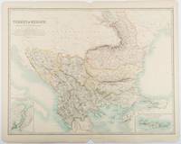
1893177055Edinburgh & London.: W. & A. K. Johnston. 1893. Engraved map with original outline hand-colour 44 x 57.4 cm map two inset maps of the Bosphorus and Crete; central fold corners chipped with loss lower edge with several small marginal tears neatly repaired head and foot clipped at the fold with loss to the margin but the map in very good condition. Detailed and finely engraved map also showing submarine telegraph lines and relief by hachures. Re-issue of the map first published in 1863 for "Keith Johnston's Royal Atlas of Modern Geography". . W. & A. K. Johnston unknown
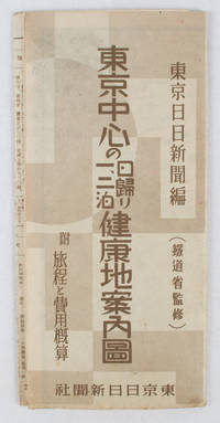
1419163423東京日日新聞社. Showa 14 19391939. Title on map :東京中心の健康地案内鳥瞰圖. Tōkyō chūshin no kenkōchi annai chōkanzu. <br>Colour map of region around Tokyo with inset map in lower right corner. Few closed tears along central fold larger tear repaired small holes at folds a little light browning. Measures 19.5 cm x 9.5 cm when folded and 38.7 cm x 54 cm when open. Bird's eye view map of the region around Tokyo showing places where the residents of the city can go for healthy one two or three day trips. The map published by the Tokyo Nichi Nichi Newspaper in 1939 highlights hot springs golf courses beaches parks fishing areas mountains shrines and ski areas. The mark ハ indicates hiking courses. On the reverse side the distance to each resort area the way to get there and the costs are detailed. Users of the map area are warned that the areas circled in red around the mouth of Tokyo Bay is a military area where photos cannot be taken without permission. Even with the rising tides of war in 1939 city people were clearly still looking for ways to escape the noise and dust of the city for health-giving recreation. . 東京日日新聞社. unknown
1880187528Edinburgh.: J. Bartholomew. circa1880s. Map 40.2 x 30.4 cms with printed colour and outline hand colour in very good condition. Handsome map with colonial interests attractively coloured. . J. Bartholomew unknown
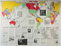
1942202620Army Orientation Course. / News Map of the Week Inc. Volume 4 No. 32. 13 April1942. Folding colour pictorial map on sheet 88 x 119 cms blank on verso inset maps two photographic diagrams and black and white photographic illustrations descriptive text top edge chipped a few short edge tears and lower corner torn no loss pinholes at the corners inoffensive tidemark at a lower corner in good condition. Colour world map showing political boundaries and military events of World War II from April 3 to 9 1942. with descriptive text beneath including: the loss of two British Cruisers off Ceylon; the occupation of Bataan by the Japanese and their landing on Manus; Japanese war tactics revealed by Malay prisoners and the increasing importance of Central Africa to the Allied war effort. The. Map is indexed according to these notes. Two inset maps of Europe chart Hitler's gains in 1941 and activity on the Russian Front. Additional diagrams on the main world map show war spending and the civilian and war output of US industries. . Army Orientation Course. / News Map of the Week, Inc. unknown
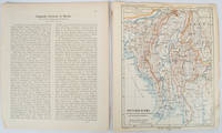
1903173709Gotha: Justus Perthes. 1903. Map printed in colour 24.7 x19.4cm and leaf of descriptive text in German 26.5 x 22.5cm slight toning and edges of the map worn with two small tears no loss. Geopolitical map of Burma with railways and railways under construction highlighted. The accompanying text is by the German Tibetologist linguist and orientalist Dr Emil Schlagintweit. . Justus Perthes unknown