[KIKUCHI, KIYOSHI, EDITED BY]. 菊池清編輯.Biblio.com
1 660 résultats
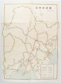
1519172590奉天. Mukuden.: 満鉄鉄道総局. Mantetsu Tetsudo Sokyoku. 昭和 15 1940. Colour folded map seven small very holes not affecting the printed image otherwise good. 53 x 38.5cm Map showing the comprehensive railway network in Manchuria with names of all the stations. It includes the lines run by the South Manchurian Railway Company their temporary industrial lines light rail as well as the lines run by other Russian and Chinese companies. By 1940 the network had expanded so much that it included almost the whole of Manchuria. . 満鉄鉄道総局. [Mantetsu Tetsudo Sokyoku]. unknown
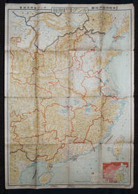
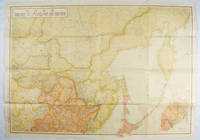
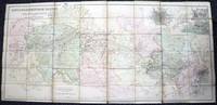
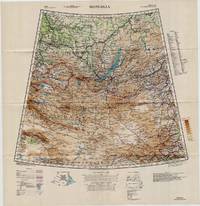
1938159295Tokyo: 大日本雄辯會講談社 Dainihon Yūbenkai Kōdansha. Shōwa 13. 1938. Two large detailed maps of China and on the reverse of the Soviet Union in Asia Manchuria and Mongolia printed double sided on a single large sheet. Issued as a supplement to Volume 14 Number 1 of the magazine Kingu on New Year's Day in 1938. <br> <br>Holes at a number of holes causing a small amount of loss some occasional browning some chipping on margins. The map has clearly been used but is still largely complete. The colourful map of China on a scale of 1:2600000 includes part of Manchukuo and Inner and Outer Mongolia on the north and part of French Indochina to the south-west. It shows East Hebei Autonomous Anti- Communist Council Jidong Fanggong Zizhi Zhengfu 冀東防共自治政府 south of Manchukuo which existed from late 1935 until February the 1st1938. The legend includes national and provincial borders cities roads railways sea and air routes and undersea cables. There is an inset map of East Asia titled "Present Situation of Far East" on the lower right corner which shows the areas under influence of Communism and those under influence of/controlled or colonised by the United Kingdom France Japan and China. <br> <br>The map on the reverse printed in blue and black shows the Asian section of the Soviet Union Manchuria and Mongolia on a scale of 1:3000000. There is an inset map of Asia titled "Asian Continent" at the upper left corner the area enclosed by a rectangle which indicates the area covered in this map. The legend includes cities railways roads national borders district borders province borders and air routes. . 大日本雄辯會講談社 [Dainihon Yūbenkai Kōdansha]. unknown
1419171112東京. Tokyo.: 伊林書店. Ibayashi Shoten. 昭和14 1939. Colour printed folding map 78 X 109cm minor damage original envelope 27.5 x 20cm. Very good copy. This map offers comprehensive information on northern China Manchuria the Soviet Union and Hokkaido including Kuril Islands under the Japanese control. It also includes the Jewish Autonomous State which existed in the late 1930s. The inset map provides detailed information on the border area of Japan Manchuria and the Soviet Union. Legends include national borders railways major cities iron mines and oil wells. <br> <br>Published in 1939 this map is an expression of the tension Japan felt in its relationship with the Soviet Union. At the time the Soviet Union was seen as the mighty threat to the lying just north of Manchuria and Japan . . 伊林書店. [Ibayashi Shoten]. unknown
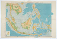
1572160538東京.Tokyo.: 日本名所圖繪社.Nihon Meisho Zuesha. 昭和16 1941. Folding colour Japanese map of the Malay Archipelago and Thailand scale 1: 8500000 with attractive original pictorial paper envelope. This map also shows the Dutch French and American colonies. Hainan Province and the South China Sea are shown in the north. Agricultural and mineral resources indicated across the map. Few small holes at holes and other light signs of wear. Slipcase lttle torn. Text in Japanese and English. 53.3 × 78.2cm. . 日本名所圖繪社.[Nihon Meisho Zuesha]. unknown
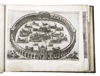
1550ABC_49514Italy 1550. 17th-century gold-tooled brown calf sewn on 6 supports with the corresponding raised bands on the spine a red morocco title label on the spine with the title "Novissima urbis Romae descriptio" lettered in gold gold-tooled board edges. Large oblong folio ca. 59 x 42.3 cm. With 76 full-page engravings and 12 full-page etchings. Remarkable album with 77 beautiful examples of 16th-century Italian cartography all in very fine dark impressions. The collection includes plans of important Italian towns such as Rome Venice Genoa Naples Milan Florence Palermo Siena Bologna and Pisa as well as detailed views of individual buildings and monuments in Rome. They are engraved by several cartographers from the school of Antonio Lafreri 1512-1577 primarily Claudio Duchetti d. 1585 Matteo Florimi d. 1613 and Lafreri himself. Florimi's works are among the rarest of the Lafreri school map makers especially his Siena imprints of which several have here been included.In the middle of the 16th century Italy was the centre of map production and distribution in Europe. This industry primarily took place in Venice and Rome. The most notable of the publishers in Rome was Lafreri. His most important and most popular work is the Speculum Romanae magnificentiae a collection of plans an views of Rome's monuments; no two copies of the Speculum are the same. The present collection contains more than thirty plates from the Speculum. When Lafreri died his nephew Claudio Duchetti inherited the company. He continued to produce the Speculum plates but often made small adjustments and signed his own name at the bottom. Most of the Speculum plates in the present album are by Duchetti. After his death the copperplates were sold to other publishers such as Giovanni Orlandi before 1590-after 1640 who reissued them. The majority of the plates in the present album were printed by Orlandi in 1602.The album further contains 32 engraved city plans mostly of Italian towns although a few foreign cities are also included; one of the rarest is the view of Moscow which is also included here. The collection ends with a incomplete series of 11 etchings of landscapes and biblical scenes.A list of contents is available upon request.With the bookplate of Louis Routy de Charodon seigneur de Grésigny and Charodon 1710-1794 on the front pastedown and remnants of another bookplate above. The boards are somewhat scratched and stained the spine shows traces of use the edges of the boards have been professionally restored and the boards have been lengthened to fit the maps. The maps are slightly browned some are slightly foxed the first few maps have been mounted onto 17th-century leaves the longer maps are somewhat soiled on the fore edge three maps are restored at the fore edge and one at the bottom edge some maps have been cut slightly short. Otherwise in good condition.l Cf. Parshall P. "Antonio Lafreri's "Speculum Romanae magnificentiae"" in: Print Quarterly vol. 23 1 2006 pp. 3-28. hardcover
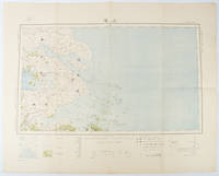
1519173266Tokyo.: 大日本帝國陸地測量部. Dainihon Teikoku Rikuchi Sokuryōbu. Taisho 15. 1926. Folding colour Japanese map of Shanghai and coastal areas of Jiangsu and Zhejiang Provinces. Scale 1:100000 embossed stamp lower right corner. Legend lower edge showing different landforms on the left section forests deserts wildlands plateaus rivers and lakes middle section showing various facilities such as post offices telecommunication offices temples ancestral halls ancient battle ground mines military fortifications submarine communications cables city walls and gates etc. right section showing different sizes of cities towns and villages and administrative boundaries. <br> <br>Occasional foxing along edges and folds ink annotation in Kanji on reverse good copy. Text in Japanese. Sheet measures 45.2 x 57.7cm. This very detailed map was originally surveyed by the Land Survey Department Empire of Japan in Taisho 7 1918. This revised edition features the railway line connecting Hangzhou - Jiashan - Shanghai - Suzhou - Wuxi. . 大日本帝國陸地測量部. [Dainihon Teikoku Rikuchi Sokuryōbu]. unknown
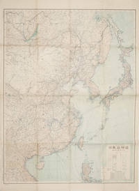
1419160524Tokyo.: 大日本帝國陸地測量部. 昭和14 1939. Large colour folding Japanese WWII map. Scale 1:5000000 featuring Japan Korea Taiwan Karafuto Eastern China parts of French Indochina and the Northern Philippines US colony in detail. Legend includes territorial boundaries national and regional and shows some borders as unclear i.e. Taiwan and bordering region along Northeast China the Soviet Union and Mongolia air routes submarine communication cables linking major costal cities i.e. Hong Kong Xiamen Shanghai Nagasaki etc. airports radio stations mining fields and more. A small chart shows the names of mountains rivers and lakes also included adjacent to legend. Some small holes at folds creases and some minor loss edges generally very good. Text in Japanese. 109 x 77.8cm. . 大日本帝國陸地測量部. unknown
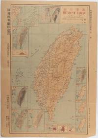
1945215871Taiwan.: 禹甸圖書局. Yudian tushuju. 1945. 1945 Ministry of Interior map of Taiwan published in the 34th year of the Republic of China with inset title and key top right. Romanised Japanese names for some areas and cities written in capital letters on main map which is surrounded by 15 small inset maps at edges each with its own scale. Paper browned wear at folds and edges repaired with archival washi on reverse some light stains and a few marks. 1 x 3cm chip bottom right corner. 77.4 x 54 cm. Text in traditional Chinese characters. Inset maps show clockwise from right edge; 1. Distribution of inhabitants according to ethnic background or minority group 2. Qing Dynasty prefectures and counties 3. Japanese administrative regions during the occupation 4. Strategic industrial and military places three city maps - 5.Chilung or Keelung port 6. Taipei city and 7. Tainan city 8. Geological formations 9. agricultural metallurgical and mineral products 10. Soil types 11. Topography of the island including sea currents and altitude diagram 12. Taiwan's position in relation to the mainland coast provinces of Fujian and Zhejiang as well as the Liuqiu Ryukyu Islands including Okinawa 13. Okinawa detail 14. Climate and rainfall in January 15. Climate and rainfall in July. . 禹甸圖書局. [Yudian tushuju]. unknown
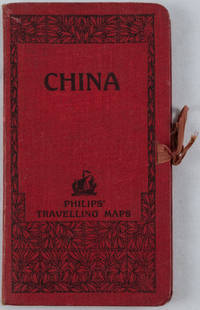
1920161936no date. circa1920. Linen backed colour folding map of China insets of Peking and Environs and Hongkong and Canton in lower left corner. 54 x 63.8cm. Table of place names at upper left gives the cities that "By a recent ordinance of the Republic all 'Fu' 'Chow'' and 'Ting' cities have been nominally reduced to the rank of 'Hsien'. The following parallel list gives the 'Fu' cities the names of which have been officially changed together with the new form adapted." Map folds into a red cloth covered case with ribbon ties 19 x 10.3cm. Title and decoration printed in black on upper cover. Trifle foxed on linen backing a little insect damage case in a few small places otherwise a very good clean map. . hardcover
14486Without date or place. London Fire Force circa 1943. On one side of piece of 41 x 20.5 cm paper with lines and indications in light and dark blue red and green. In fair condition on aged paper with creasing and one closed tear towards the head. The map has Trafalgar Square at its head with the note that the two 'Basins' carry '40000 Galls. each' and Parliament Square at its foot. Whitehall and Parliament Street connect the two on the right of the map and to the left of the map is the lake in St James's Park: '200000 Galls Underground Tank Pumping Station 1400 Galls Pump 15 foot Gravity Main from Serpentine'. Also marked on the map are 'Inlet connections for L.F.F. Pumps and Pits' '6 Signle Outlet Suction Hydrants Round Thread' and 'Two 6 foot Steel Pipes in Subway Also under Embankment in Subway'. Down the centre of the map are the government buildings: the Admiralty Treasury Downing Street Foreign and Colonial Offices India Office and Home Office Office of Works Board of Education Board of Trade and Ministry of Health. No other copy found listed.Image on application. Without date or place. (London Fire Force, circa 1943.) unknown
1835000014144London: Cha. F. Cheffins 1835. Map. Ex-Library. 29 3/8" x 61.5". Linen-backed map done on two sheets. Map printed in black pink yellow and green hand-colored. Housed in a 8" x 5.5" green case with gilt lettering and a gilt device on the front board the front of the case states "London & Birmingham Railway. Map of the Line. above the device Incorporated 6th May 1833". A portion of the map backed with green goat in order to have it enter and exit the case more smoothly. A large and beautiful representation of the London to Birmingham railway line with the stops outlined at the bottom edge of the map. With two engraved vignettes showing the depots in Birmingham and in London. An early example of this captivating map. A bookplate and one stamp on the verso of the map otherwise no markings. The bookplate states that the map was a gift donated by James J. Hill a wealthy bibliophile from St. Paul to the University of Wisconsin Library. The map has three small spots of loss to its folds. The case has wear and light discoloration. Cha. F. Cheffins unknown
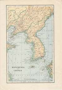
1900174813London. Circa1900. Map printed in colour showing submarine and overland telegraphs Manchuria Chosen Liao-Ting Kirin and Chili 21.5 x 13.3 cm 25.7 x 17.1 cm sheet size margins a little scuffed in very good condition. . unknown
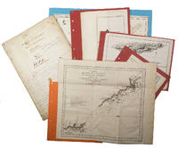
1755ABC_474521755. Manuscript of 24 pages 6 printed maps on cardboard. This wonderful logbook details the journey of a French captain from Manila to the Maluku Islands in todays Indonesia. The journey took place during the months of March to May of 1755. The captain of the ship recounted with great detail the events of every day of the journey with detailed daily accounts of the weather winds manoeuvres of the ship its departures anchorages and precise coordinates at every point of the journey. The captain furthermore had a keen eye for the geographical and nautical details along the journey. He recounted the exact locations of for example sandbanks and bays where ships and their crews can take provisions and fresh water. The accounts are detailed and captivating: "After our boats were back on board we set sail . in the afternoon to moor under the old Portuguese fort on the Solor island Indonesia the winds for the tide were fresh at 1:34 a.m. . sand and gravel and then I went back to mooring. The pavilion of the fort . the village is under the said fort at 3 cables from us .". The captain goes on to describe the geographical features of the islands as well as other places en route with great detail. Curiously we find inscriptions in Spanish and the names of one don Phelipe Qui who describes himself as el piloto and one Padre Don Estevan de Melo. The latter might be identical with Don Estevan Roxas y Melo a native of Lima Peru and secretary to the Archbishop of Manila Rodriguez since 1736. Roxas y Melo was part of the 1751 reconstruction of the Cathedral of Manila working under the auspice of the Italian architect Juan de Uguccioni.The logbook comes with six printed maps partly illustrating the journey of the captain pasted on contemporary cardboard. They depict the Bay of Sulavesi with the city of Bantang Pitcairn the coast of New Guinea the coast of Queensland the Santa Cruz Islands in the present-day Solomon Islands and Alejandro Selkirk Island. The plates stem from the French translation of James Hawkesworths An Account of the Voyages Hawkesworth Relation des voyages entrepris par ordre de sa Majesté Britannique actuellement regnante; pour faire des découvertes dans l'hemisphère meridional Paris 1774.Some holes on the first sheet not affecting the text. Small water damage some slighlty affecting the text. Remnants of seals on last page. Otherwise in good condition. unknown
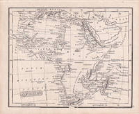
1830176607London.: Robert Jennings. 1830. Engraved map 11.5 x 14.3 cm showing route of European explorers faint added outline colour in an early hand and manuscript note to the verso in the same ink edges age-toned but in very good condition. Detailed pre-colonial map of Africa "Regions Unexplored" marked and "no fresh water to be found" on the west coast. An early manuscript inscription on the verso refers to Lander's ."wanderings of Clapperton" the Scottish naval officer and explorer. Richard Lander had returned with Hugh Clapperton's journal following his death and the account was published in the same year as Fenner's "Pocket Atlas of Modern & Ancient Geography" for which this map was prepared. . (Robert Jennings) unknown
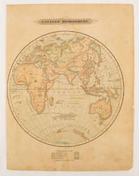
1875175128Harper & Brothers. 1875. Spherical map printed in colour 21.3 x 21.2 cm with shaded key to elevation and ocean currents unrelated text on the verso paper toned and margins soiled bottom edge ragged small sealed to to the inner margin but in sound condition. Map showing the five continents of Asia Africa Antarctica Europe and Australia. Published by Harper & Brothers for inclusion in their "School Geography". Plateau of Tibet very prominently marked. Gobi Desert and Plateau of Mongolia also marked India described as Hindostan Indo-China includes Thailand. . Harper & Brothers. unknown
1962174808Kuala Lumpur.: Survey Department Federation of Malaya. 1962. Very attractive large coloured folding map 108 x 83cm showing all the major hotels and rest houses throughout the country. Coloured references show rubber rice coconut and oil palm areas pineapple and miscellaneous cultivation areas mining land jungle built-up areas and shopping centres along with major features such as rivers principal roads minor roads and cart tracks railways lighthouses district state and international boundaries and triganometrical stations with heights. Scale 18 miles to an inch mile. Two inset maps of Northern Malaya and South Western Malaya are 9 miles to an inch. There are smaller inset maps of Ipoh; Malacca Singapore & Johor Bahru Penang Sungei Patani Kuala Lipis Kuantan Alor Star Kota Bharu Petaling Jaya Seremban Klang Batu Pahat Muar Segamat Johore Bahru and a small inset map of Malaya and adjacent territories. There is a large black & white table of approximate mileages. When folded the map is encased in the original printed manila covers measuring 21 x 14cm with a printed price of $2.50. A crisp bright map in very good condition. Survey Department Federation of Malaya No. 23. . Survey Department Federation of Malaya. unknown
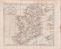
1796176602circa1796. Engraved map 18.3 x 22 cm 21.7 x 27 cm sheet original folds age toning and some offsetting inner edge darkened and discoloured but the map in good condition. Finely engraved map showing Ireland divided into counties lower coast of Scotland and Wales and the Isles of Man and Anglesea; also noting Nymph Bank 'discovered in 1735 by Capt. Doyle.' . unknown
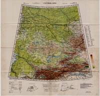
19425332Washington D.C.: Army Map Service U.S. Army 1942. Second Edition. Loose sheet. Very Good. Full color map measures 29 x 29 inches. With a list of authorities i.e. other maps consulted in the creation of this map. Glossary. Index to boundaries. Folds as issued and with light soiling. A bright copy. First published 1931 by the War Office this edition is labeled "For Use by War and Navy Department Agencies Only. Not for Sale or Distribution." A vital map published the year 1942 the Japanese invaded Burma and closed off the Allies main supply route the Burma Road. Having already controlled littoral China supplying inland Chinese forces and the Chinese population became increasingly fraught. The region covered extends westward to USSR southward to Northern India and eastward to Mongolia. From the collection of Asian books and maps formed by Albert Ravenholt. On verso Ravenholt has written "Central Asia as far as E. of Tihwa. Army Map Service U.S. Army unknown
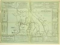
19255871Ashcroft British Columbia: Ashcroft Journal - Board of Trade Ashcroft B.C. 1925. Loose Sheet. Very Good. Map measuring 20 inches x 15 inches printed with black ink on light green paper. Map shows a section of British Columbia from Vancouver north to Quesnell east to Fernie. Map surrounded by ads for Ashcroft businesses. On verso a descriptive narrative offers Ashcroft's history known locally as "Spud City" its regional resources hunting and fishing opportunities and the physical aspects of the landscape. Two rubber stamps one per side for the City Publicity Bureau in Vancouver. Very slight edge-wear to the left margin; a slight stain on the non-map side; old folds now mellowed. A handsome copy of a scarce map suitable for framing. Regarding the publication date: The map refers to Ashcroft as an unincorporated city was formed in 1952 the Main Cariboo Road is described as "a first class dirt and gravel road" and Dr. William Henry Sutherland British Columbia Minister of Public Works is quoted as stating that the scenery in the Marble Canyon Lillooet Lakes and the region of the Fraser River between Lillooet and Lytton "could not be duplicated on the whole of North American Continent and I doubt if it could be surpassed in Europe." Sutherland served in that capacity from 1922-1928 As such we'll posit 1925 as the publication date. Now enclosed in a removable clear archival sleeve. Ashcroft Journal - Board of Trade, Ashcroft, B.C. unknown
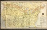
19205872Canadian Pacific Railway 1920. First Thus. Loose Sheet. Very Good-. Poole Brothers. Map measuring 31.75 inches x 17.75 inches printed four-color. Map shows the breadth of lower Canada from just north of Vancouver Island across to Newfoundland as well as all of the United States excluding southernmost Texas and Florida. CPR lines are represented in red ink whereas connecting American railroads are in black. Black stars along the CPR indicate locations of Canadian Pacific Hotels. Two slight chips to left margin and with a couple short closed tears along folds. Please see photo. A handsome map from the tail-end of the golden age of rail travel. Now preserved in a removable clear archival sleeve. Canadian Pacific Railway unknown
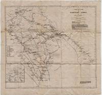
19225331Cambridge: Cambridge University Press 1922. Loose sheet mounted on linen. Good-. Eric Teichman. Map printed in color measuring 26.5 x 25 inches. With a Tibetan glossary. Provides Teichman's routes as well as other routes along with villages monasteries or groups of farms. Edgewear with light stains here and there. In. From Travels of a Consular Officer in Eastern Tibet Together With A History of the Relations between China Tibet and India and mounted on linen. The map was clearly used perhaps in the field as evidence of wear including a split in the paper not the linen on which it's mounted suggests. From the collection of Asian books and maps formed by Albert Ravenholt. On verso Ravenholt has written "Teichman's Kam 28 degrees 25' - 33 degrees 20'. [Cambridge University Press] unknown
1942L7VCIV4N38L2UK Government: Survey Directorate HQ Tenth Army / Indian Field Survey Co. 1942. 42 chromolithographed topographic maps of parts of Iraq made from aerial photographs during World War II on a scale of 1:100000 and 1:253440 a quarter-inch to a mile. 68 x 50.5 cm & 60 x 47 cm. An impressive collection of Iraq maps compiled from the most current aerial photography and produced by the British Army for use in the Persian theatre of war during World War II. The cities and regions covered include Ain Sifni Aqra Tel Afar Salman Pak BaQuba Sumaika Penjwin Halabja Baghdad Kirkuk Dulaim Erbil and Mosul divisions.Previously folded. Generally well-preserved. Survey Directorate HQ Tenth Army / Indian Field Survey Co., unknown
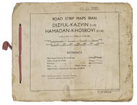
1944ABC_4794483 Rep Group. I.E." 1944. Original beige printed paper wrappers side stichted by hand through 3 holes with a reddish pink cloth ribbon. Oblong 21 x 255 cm. With 1 index map and 16 numbered folding strip maps. Exceptionally rare collection of folded strip maps of roads in Western Iran which was very likely meant for military use during the Second World War. The abbreviated inscription on the front wrapper possibly stands for "24th brigade branch transportation office" though it is unknown which 24th brigade this would have been. The maps were originally printed on quarter inch sheets in 1942 and have been significantly enlarged for this edition to a scale of 1 inch to 2 miles. We have not been able to trace any other copies of either the first or second edition of this work anywhere.With an owner's inscription on the front wrapper. The maps and back wrapper have been reinforced with bookbinder's gauze. The wrappers are somewhat soiled creased and the edges are somewhat frayed. The maps have slightly browned and the index map has a small brown stain in the lower outer corner without affecting the image. Otherwise in good condition. 83 Rep Group. I.E.", hardcover
19425330Washington D.C.: U.S. Army Army Map Service 1942. Loose sheet. Near Fine. Sheet 22 1/M North K-O 46-50. Full color map measures 28 x 29 inches. With a list of authorities i.e. other maps consulted in the creation of this map. Glossary. Index to boundaries. Folds as issued. An especially bright copy. First published 1931 by the War Office this edition is labeled "For Use by War and Navy Department Agencies Only. Not for Sale or Distribution." Revised to aid the US WWII effort in the Far East special emphasis is applied to railways international boundaries and "nomadic encampments." From the collection of Asian books and maps formed by Albert Ravenholt. U.S. Army, Army Map Service unknown
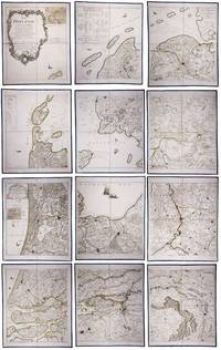
179023331Paris: Jean A. Dezauche successor of Delisle & Buache 1790. Each map in contemporary box with green morocco spines with titles 'Hollande' and 'Zelande' lettered in gold and green paper sides with ornamental gilt borders along the edges. Together ca. 230 x 155 cm. Engraved and etched map hand-coloured in outlines the cities coloured red. Printed on 12 sheets each divided into 4 segments numbered 1-48. The 48 segments are mounted on contemporary linen and folded the edges reinforced with blue ribbon. With: 2 LE ROUGE George Louis. Topographie de la Zelande en 9 feuilles traduitte de l'Hollandois. Second title: Partie orientale de la Flandre Hollandoise Paris Jean A. Dezauche 1790. Large engraved and etched wall map hand-coloured in outlines the cities coloured in red printed on 9 numbered sheets each divided in 4 segments numbered 1-36 size each sheet 48 x 56.5 cm; the 36 segments are mounted on contemporary linen the edges reinforced with blue ribbon. Two large complementary wall maps of the seven Dutch provinces covering 1 the provinces Holland Utrecht Friesland Groningen Overijssel and Gelderland and a part of Brabant bound to the line Steenbergen - Roermond and 2 Zeeland. Both are rare especially the map of Zeeland. They were the first maps of the Netherlands on such a large scale mostly about 1:105000 but with some eastern regions squeezed in at about 1:140000. Fully assembled the map of Hollande would measure about 230 x 155 cm and the map of Zeeland about 143 x 175 cm.Originally published in 1748 Le Rouge's 21 plates for the two maps were revised for publication in a second state by Jean Crepy ca. 1770. The map in its present third state was revised and published by Jean A. Dezauche in 1790. On the back of each sheet is an engraved label with the sheet number and the name of the region covered added in manuscript.From the library of Marco-Antonio III 1730-1800 Prince Borghese: on each box is the engraved armorial bookplate of the library of this Borghese Prince. Marc-Antonio's son Camillo Filippo Ludovico 1775-1832 married Napoleon's sister in 1803.Boxes are slightly scuffed. A remarkable copy with a princely provenance.l De Vries 'Een Franse wandkaart van Nederland uit 1748' in: Caert-Thresoor 1 1982 pp. 24-29; cf. BMC Printed maps VIII cols. 967 & 969 1748 edition; not in Donkersloot-de Vrij; Oehme A French world atlas in: Imago mundi 25 1971 pp. 55-64 on Le Rouge. Jean A. Dezauche, successor of Delisle & Buache, unknown