[CHINA - MAP - WORLD WAR II].Biblio.com
1 660 résultats
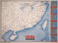
1945194660New York.: Army Information Branch. Volume III No. 51F. 9 April1945. Folding colour map and six inset maps in a vertical panel 88 x 119 cms sheet and on the recto circular map of Europe smaller inset map of Asia and of the Ryukyu Islands descriptive text original folds in very good bright condition. Scarce Newsmap of "China Southeast Coast" from Shanghai to French Indochina with the islands of Formosa and Hainan. At the right edge are inset maps of the vicinities of Shanghai Wenchow Foochow Swatow Canton and Hong Kong. On the verso is a large map of the European theatre of operations centred on Berlin a map of the Pacific area noting the American occupation of Okinawa with a detailed map of this island. In unusually fine bright condition. . Army Information Branch. unknown
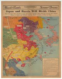
1940209821Los Angeles.: Los Angeles Examiner. 1940. Printed colour pictorial map on a single newspaper leaf 42.3 x 39.9 cms; 54.3 x 42.5 cms sheet archivally laid down on linen slight discoloration to lower centrefold and sheet slightly age-toned but in very good condition. A striking geopolitical map by Los Angeles Examiner artist Howard Burke covering China Japan Southern Russia and the northern part of French Indochina and Siam showing how the "Aggressors Divide China." Areas under Japanese occupation are shown in red and their naval blockade shown by an arc of naval vessels with vivid arrows indicating lines of supply. Text labels including sources of agricultural and raw materials provide a dynamic overview of the geopolitical situation and show the influence of American scientific illustrator and cartographer Richard Edes Harrison who argued for examining geographic issues from multiple perspectives and Los Angeles Times artist Charles Owens. . Los Angeles Examiner. unknown
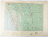
1955173072Washington D.C.: Army Map Service U.S. Army. 1955. Large colour map. 1:250000 scale. Transverse mercator projection. 23°00'N 91°30'E-22°00'N 93°00'E. Series U502 Sheet NF 46-6 Edition 1-AMS. Map measures 57.3 x 75.8cm. Slight wear creasing even light browning small closed tears on edges upper-right corner little foxed. Shows signs of use but map is clean and complete. Corps of Engineers Army Map Service map of Chittagong and surrounds compiled in 1955. Based on the British Indian one-inch and half-inch map series from 1938-43 and 1936-43 respectively. . Army Map Service, U.S. Army. unknown
186161812New York: W. Schaus; printed by Sarony Major & Knapp 1861. Second Edition. 59 x 76cm open. 19.5x19cm closed. Tinted lithographic map backed in brown silk in black slipcase with printed paper label. Bookseller's ticket of Rev. A. O. Brickman Baltimore. Two ownership inscriptions of "J. M. Deems Maj. 1st MD Cav" and inscribed "Deems" on the slipcase. Trimmed; splits along half of one horizontal fold; minor stains and discoloration to verso not affecting image which is bright and generally Very Good. Hand-made slipcase worn with portion cut out but with manuscript ownership label intact. <br /> <br /> Uncommon Civil War map used by a distinguished Union Army officer. James Monroe Deems 1818-1901 was a composer and music educator from Baltimore who secured a commission as a major in 1861. He was promoted to Lieutenant Colonel in spring 1863; led the First Maryland Cavalry during the Battle of Gettysburg; retired due to rheumatism in November 1863; and was brevetted Brigadier General in 1867. He likely acquired this map in Baltimore near the beginning of his military career and certainly before his promotion in 1863 given the use of "Maj." in his ownership inscriptions. <br /> <br /> The map itself is the second edition of this design by J. Schedler despite the title it is not a bird's-eye view. The more common first edition has two insets showing the Lower Mississippi Valley and the city of Richmond see Stephenson 17.3. This version has only one inset showing the eastern United States. Stephenson describes this edition as having a Washington DC bookseller's ticket; the present copy has a Baltimore bookseller's ticket instead. <br /> <br /> This copy was mounted for use in the field: it was trimmed down to the neatline the captions removed the image cut up into segments and mounted on linen. The printed label on the slipcase appears to be a portion of the original title. This may have been done by the bookseller Brickman possibly at Deems' request. <br /> <br /> Uncommon. OCLC records about 10 similarly titled maps but few listings distinguish between the first and second editions. STEPHENSON LC Civil War Maps 2nd ed 17.35. 61812. [W. Schaus; printed by Sarony, Major & Knapp] unknown
194288863Boston: Little Brown and Company / An Atlantic Monthly Press Book 1942. Octavo 24cm; burgundy cloth-covered boards with titling in gilt on spine and illustration stamped in gilt and black to front cover; black topstain; map endpapers; 680pp; portrait frontispiece with illustrations throughout. Lacking dustwrapper. Modest shelf-wear and -soil light rubbing to board edges faint foxing to edges of textblock and 3" tear to fold of map at p.458; Very Good. Winner of the Pulitzer Prize for Biography. 88863. Little, Brown and Company / An Atlantic Monthly Press Book unknown
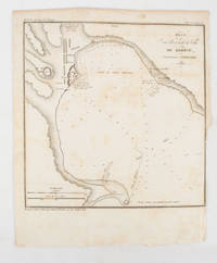
1839175248Paris.: Librairie de Gide. 1839. Engraved map 21.1 x 20.8 cm 27 x 22 cm sheet original folds trimmed to the inner margin with slight loss to the border only map spotted but otherwise in sound condition. Map of the Port of Kerch in Crimea prepared for the 1839 edition of the French Journal "Nouvelles Annales des Voyages." the editors for this edition amongst others the translator and geographer Jean-Baptiste Benoît Eyriès and Alexander von Humboldt founding members of the world's first geographical society the Société de Géographie. . (Librairie de Gide). unknown
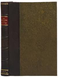
16642341508London: Excudebat J.F. James Flesher pro Jona Hart 1664. First Thus. Hard Cover. Near Fine/No Jacket. Rebound with new end sheets: brown leather spine marbled paper over boards red morocco spine label gilt titles and rules. Binding tight pages clean and unmarked. 1664 Hard Cover. viii 230 pp. Last text page misnumbered 216. Descartes's fundamental and originating work of the modern era in Western philosophy bound together with a work by one of the Utrecht Cartesians Lambert van Velthuysen. This is the first British printing of the Meditations though it does not include Descartes's 'Objections and Replies' as many editions do. Velthuysen was connected by marriage to Descartes's friend Henry Regnier and corresponded with scientists and philosophers such as von Leeuenhoek Spinoza and Leibniz. The work included here shows the influence of Thomas Hobbes - unsurprising given that Velthuysen is credited with translating Leviathan into Dutch. John Locke may have met Velthuysen while in Utrecht in 1684/85 and had eight titles by Velthuysen in his personal library including the Rheims edition of the present title. Bound into this volume are two plates not called for in either work which may be taken from the Hart printing of Principia Philosophia which was published the same year. Wolf 736 Wing D1133a. Excudebat J.F. [James Flesher] pro Jona Hart hardcover
1888J4KDIGIVEPWUFrance 1888. Brown and black ink watercolour chalk and gold paint on paper mounted on several laminated sheets of paper 69.5 x 52.5 cm. Charming trompe-l'oeil of maps of European countries on a decorated background somewhat reminiscent of a church ceiling. It contains a French inscription "to my beloved parents" which together with some inconsistencies in the use of perspective suggest a young French artist. The maps show some interesting departures from reality: in the Netherlands parts of the province of Gelderland are shifted 50 kilometres to the north replacing Zwolle with Arnhem and Sweden lacks Stockholm but includes Copenhagen in place of Malmö. However the most humorous is in the map of Germany which lacks its western neighbours - the Netherlands Belgium Luxemburg and France - giving it an extensive North Sea coast. The gothic lettering is inconsistent in style with the artist apparently improvising an alphabet for each inscription in the process forgetting Denmark.Somewhat soiled and browned at the edges with several white spots due to overpainting; the sheets are coming loose from one another. unknown
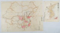
1902220266Japan. No date. Circa1902. Two very attractive colour folded manuscript maps one showing China and the other Korea. <br> <br>Map of China: Watercolour map 48 x 63.5cm. Closed tear now professionally repaired. <br> <br>Map of Korea: Finely detailed watercolour map a few tiny holes very neatly repaired on the verso with archival washi. 33 x 24.5cm Two delicate hand-painted maps one of China and one of Korea produced by a Japanese student cartographer named Koike Tokushige 小池徳重. <br> <br>The undated map of China appears to have been produced in the first five years of the twentieth century: a time when Japan had recently colonized Taiwan and when Japanese economic and political interest in the region was rapidly expanding. The inscription on the map suggests that it was a third year college project. But the high level of detail suggests that the artist had considerable experience of map making. The map of China shows the main provinces rivers major transport routes the Great Wall and the location of key cities although the names of the cities are not included. It also shows outlines of the Korean Peninsula Taiwan and the Japanese island of Kyushu but not the rest of Japan. <br> <br>The map of Korea is more detailed. It provides an accurate outline of the Korean Peninsula with careful hatching indicating changes in elevation. Rivers and major road routes are shown on the map and the locations of major towns are marked though only Busan and Incheon are named. Dotted lines show coastal sea routes and routes between Kyushu and Busan and between Incheon and China. The map shows the Gyeongin railway line between Seoul and Incheon which was completed in 1899 and route of the Gyeongbu railway line between Busan and Seoul whose construction started from both ends in 1901. But the map depicts only small sections of this line close to Seoul and Busan as being completed with the rest more lightly outlined to show the projected route implying that the map was drawn around 1901-1902 and certainly before the Gyongbu line was opened in 1904. <br> <br>Inserted text gives the land area and population of Korea. Rather strangely though the figure given for the Korean population is vastly underestimated. Ikeda gives this as 5.7 million when in fact at that time is was around 18 million. . unknown
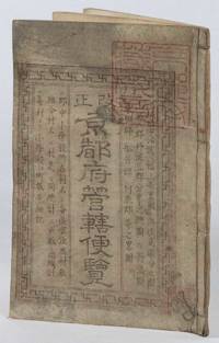
1873216097京都. Kyoto.: 村上勘兵衛. Murakami Kanbei. Meiji 5 1873. Black and white woodblock maps and city plan 22 x 15.3cm 17 double-folded leaves 4 hole string binding. Covers worn and soiled chop on upper cover. This guide to Kyoto and its surroundings includes two double-page and twelve single-page pictorial maps published around Meiji 5 1873. Each map highlights geographical features place names and major buildings such as Buddhist temples within Kyoto and its surrounding areas. The latter section covers three counties of the Tanba region offering a detailed look at the area beyond Kyoto itself. . 村上勘兵衛. [Murakami Kanbei]. unknown
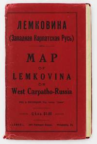
19295372Philadelphia: Lemko Press 1929. Very good. Lithographed folding map approximately 32 x 40 inches printed in pink and black. Housed in original red wrappers printed in black. Modest wear along folds a couple of small separations at crossfolds light marginal toning. Wrappers with minor spine and edge wear. An extremely rare map of "Lemkovina" the homeland of the Lemko an Eastern Slavic people from the Central Carpathian Mountains where Poland Slovakia and Ukraine meet in the present day. From the late-19th century to the 1920s tens of thousands of Lemkos immigrated to the Unites States and Canada -- fleeing war oppression and seeking better economic opportunities. Once in the United States Lemko intellectuals founded institutions to preserve and promote Lemko culture in the New World and to lobby for sovereignty of the Lemko homeland. The present large-format map is an intriguing artifact of the Lemko-American immigrant experience. The map was drafted by the Lemko-American activist Dmitriy Vislocky and published by the Lemko Press in Philadelphia in 1929; it showcases the areas where the Lemko population prevailed as well as areas of mixed Lemko-Slovakian and Lemko-Polish demographics; while it does not explicitly define Lemkovina as a sovereign state its rhetorical direction is nevertheless clear.<br /> <br /> The Lemko are an Eastern Slavic people who originate from a large area along both slopes of the Central Carpathian Mountains in a region traditionally often referred to as "West Carpatho-Russia" located along the eastern stretch of today's border of Poland and Slovakia and extending slightly east into Ukraine. The Lemko language is akin to Ukrainian and is written in Cyrillic. Traditionally many consider the Lemkos to be a subgroup of Russians or Ukrainians although many Lemkos have tended to self-identify as a distinct ethnicity. The Lemkos have vibrant and sophisticated cultural traditions with distinct music folklore clothing and customs. Most Lemkos are Eastern rite or Byzantine-rite Catholics although some have converted to the Eastern Orthodox faith. The period leading up to during and after World War I was traumatic for the Lemkos. The group splintered their loyalties with some supporting the Russians both Red and White factions while others were sympathetic to Ukrainian nationalism and some either voluntarily or under coercion were allied with Austria-Hungary. Lemkos caught on the wrong side of events often met with cruel fates. In the aftermath of the war Lemkos who supported the Red Russians formed the "Lemko-Rusyn People's Republic" which existed from December 1918 to March 1920 a state that took in part of the northern slope of the Central Carpathians of Lemkovina. Meanwhile further to the east was the pro-Ukrainian "Eastern Lemko Republic" November 1918 to January 24 1919. However these republics were soon extinguished with all Lemkovina being divided between Czechoslovakia and Poland. The Lemkos in Poland would have a very difficult time as the Polish state considered them disloyal. Eventually they were forcibly displaced from their homeland. <br /> <br /> Lemkos began to immigrate to the United States and Canada in the late 19th century in good part due to economic opportunities. The greatest center of activity for Lemko peoples in North America was in Pennsylvania although large communities could be found across the American Northeast and Midwest as well as in places such as Toronto Canada. Many Lemkos found decent jobs initially in the burgeoning manufacturing industry. Smaller but still significant Lemko communities developed as far away as Colorado and Alberta where they were engaged in the ranching and mining industries. Today hundreds of thousands of North Americans count Lemko ancestry. Lemkos adjusted very well to life across the Atlantic and generally met with success. The most famous of all Lemko-Americans was the artist Andy Warhol 1928-1987 who was born in Pittsburgh the son of Lemko immigrant parents. In the 1920s Lemko intellectuals in America largely based in Pennsylvania formed a movement to preserve Lemko culture while lobbying for the eventual resurrection of an autonomous if not sovereign Lemko homeland – Lemkovina. However there was a great deal of internecine dispute over the nature of this proposed state as some favored a pro-Ukraine sovereign entity while others wanted it to be Soviet satellite yet the dream of a future sovereign Lemko nation of any sort was never to be realized as powers ranging from the Czechoslovak and Polish governments to Hitler and Stalin would never allow it. Lemko culture flourished in the U.S. and Canada centered around Lemko halls and churches and beginning in the 1920s a handful of small printing presses were established to serve and educate the community issuing Lemko-language almanacs primers newspapers and pamphlets. One of the most important of these houses was the Lemko Press of Philadelphia which under the leadership of Dmitriy Vislocky published the Lemko Gazette. The circle of the Lemko Press had a pronounced Ukrainophone allegiance and was at odds with some other Lemko-North American groups.<br /> <br /> As a major part of their campaign to define "Lemkovina" and call for its eventual nationhood presumably as a pro-Ukrainian sovereign state in opposition to both the Soviets and Poland Dmitriy Vislocky and the Lemko Press produced the present map. As best as we are aware it is the only large format map of the period to specifically show Lemkovina as a distinct entity and being published in Philadelphia it stands as a remarkable feat of Lemko-American immigrant cartography. The large format map executed to the ample scale of 1:200000 with text in Cyrillic and lithographed from a hand-drawn template shows the Polish-Slovakian frontier region which today extends east into Ukraine along the Central Carpathian Mountains an area traditionally sometimes known as "West Carpatho-Russia." A very rugged and rural area it is roughly framed by the the Dunajec River in the west and the San and Uzh Rivers in the east and with the cities of Nowy S cz Poland to the northwest and Košice Slovakia to the southeast. The map delineates all major rivers roads and railways and locates cities towns and villages. The legend below the title explains the color-coding employed to define demographic areas. Territory shaded in bold pink are of majority ‘Russian’ meaning Lemko and Rusyn population i.e. core Lemkovina while the areas covered by southwest-northeast hashed lines are of mixed Lemko/Rusyn-Slovakian population and the areas with northwest-southeast hashed lines are of mixed Lemko/Rusyn-Polish population. Beyond are labeled the lands of Poland to the north Slovakia to the south Eastern Galicia to the northeast and Sub-Karpatsky Russia Ukraine to the southwest while the map defines the Polish-Czechoslovak border as it was then internationally recognized. While the map does not explicitly state that Lemkovina is a country Dmitriy Vislocky’s sovereignist direction of travel is nevertheless clear.<br /> <br /> The present map is extremely rare. It was likely issued in only a small print run and the survival rate of such fragile ephemeral American immigrant publications is very low. We can trace only a single institutional example of the map held by the David Rumsey Map Collection at Stanford University. Beyond that we are aware of only a single other example as having appeared on the market in the last twenty-five years.<br /> David Rumsey Map Collection Stanford University: 11153.000. Lemko Press unknown
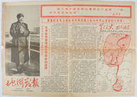
1967169746Beijing.: 地图戰報.Di tu zhan bao. September1967. Maps printed in red and black single sheet printed on both sides folded scale not given photographic image of Mao Zedong. Some light browning at edges with tears and losses on left edge still good. Text in Chinese. Sheet measures 26.5 x 38.4cm. Includes a map of Autumn Harvest Uprising and also shows the routes of the military advancing towards Jinggangshan between September and October 1927. On reverse left section a map shows the route along which Chairman Mao led the Fourth Army of the Chinese Red Army marching towards south of Anhui and Jiangxi Provinces in 1929. On reverse right section a map titled "The Long March of The Chinese Workers' and Peasants' Red Army October 1934-October 1935". Quotations of Chairman Mao about the Long March insert on corners of the map. <br> <br>Issue no. 6 of a series of maps with text issued by the Red Guards organisations in the form of Cultural Revolution tabloid-sized newspaper. This issue is designed to celebrate the 40th anniversary of the Autumn Harvest Uprising which was one of the earliest armed uprisings organised by the Chinese Communist Party. . 地图戰報.[Di tu zhan bao]. unknown
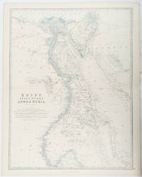
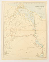
1861177021Edinburgh & London.: William Blackwood & Sons. 1861. Engraved map with original outline hand-colour 57 x 43.8 cm 61.1 x 49 cm sheet central fold very slight edge toning but the map in very good bright condition. First edition. Fine large folding map: the Nile delta and river with attractive original outline colour railways and canals marked and name references to biblical and classical geography. Published for inclusion as map 39 in "Keith Johnston's royal atlas of modern geography" . William Blackwood & Sons. unknown
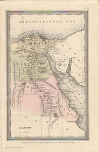
1833174939London.: Published for the Proprietors by Mr. Bull. 1833. Engraved map 14.1 x 8.8 cm original hand colour in very good condition. Fine miniature map with appealing hand colour denoting Lower Central and Upper Egypt. . Published for the Proprietors by Mr. Bull. unknown
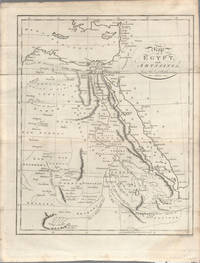
1803174955London. circa1803. Engraved map 23 x 18.5 cm original folds small split to one fold affecting the margin only paper age- toned lower corner darkened and on the verso inked circles to the lower half in an early hand but in good condition. Finely engraved early 19th Century map also showing to the north Syria Palestine and Cyprus and Darfur and Mountains of the Moon Sources of the Nile to the South. . unknown
1880174937London Edinburgh & Glasgow.: William Mackenzie. 1880. Map printed in colour with original outline hand colour 29.8 x 22.7 cm central fold edge toning but in very good condition. Published for inclusion in "The National Encyclopaedia: A Dictionary of Useful Knowledge". . William Mackenzie. unknown
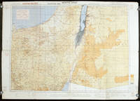
1942207841London.: Royal Engineers. July1942. Printed colour topographical map mounted on linen 56.7 x 79.2 cms; 64.6 x 89. 5 cms sheet original folds edgewear small marginal chips a little dusty but in good condition. Detailed World War II operational map of Egypt and the Middle East issued by 512 Army Field Survey Company of the Royal Engineers. The map is marked "Not to be Published" in the upper right margin. Railways roads camel tracks telegraph lines boundaries altitudes towns and villages are marked. . Royal Engineers. unknown
38009901Korea late 18th-early 19th century 1780-1810. Eight color gouache pastel tinted maps ca. 57.5 x 90.1 cm.contemporary re-backing very solid clean examples complete set of all provinces hand-painted gouache manuscripts. RARE & OBSCURE . . . . A RARE & COMPLETE SET OF ANTIQUARIAN MANUSCRIPT KOREAN . . . YI PERIOD PROVINCIAL MAPS . . "P'ALTO CHIDO" OR "EIGHT PROVINCES MAPS" . . . DELUXE ELEPHANT FOLIO SIZE SHEETS . . . HAND-COLORED GOUACHE PASTELS . This is a very RARE & COMPLETE set of eight Korean provincial manuscript maps. Drawn circa 1780-1810 by an unsigned Korean cartographer. These maps are of historical importance giving place names isolating the time frame. . Painted on very thin finely hand-made mulberry-fiber tissue paper contemporary re-backed with a stiff hand-made paper. Beautifully hand-painted & colored in gouache pastels. . The record shows several reliable verities of manuscript maps showing the eight ancient Korean provinces. . Commonly these maps had no title cartographer's name date or other critical bibliographic colophon data. This is a common theme with Korean manuscript maps. . Political divisions of Korea are by and large mostly stable making name comparisons easier. . PROBABLE MAP TITLES INCLUDE: . a. The "SINJUNG-TONGGUK-YOJI-SUNGNAM:" "EIGHT SEPARATE MAPS EACH SHOWING ONE COMPLETE PROVINCE OF THE EIGHT KOREAN PROVINCES similar in intention to the "P'ALTO CHIDO." . The eight provinces were established during the Chosen dynasty 1392-1910 alternately and commonly called the Yi dynasty. . The eight provinces are from the north to south: . 1. Hamgyong 2. P'yong'an 3. P'yongyang 4. Kangwon 5. Hwanghae 6. Kanghwa 7. Kyongsang 8. Cholla'ungch'ong . During the Sejo reign 1455-68 Yang Songji made the first "P'Alt-do "P'ALTO CHIDO" type maps of the eight provinces this type and style became the "standard" for future examples. There after his style and format were copied by others for centuries. . b. A second version and style of the above eight provinces maps is called "TONGGUK CHIDO: MAP OF THE EASTERN COUNTRY i.e. KOREA" showing a compressed northern frontier along Manchuria the characteristic "CHONG CH'OK" style. . c. A third similar map: "P'ALDO-CHONGDO: A SINGLE MAP SHOWING THE EIGHT PROVINCES OF KOREA." . These maps are pictorially beautiful and artistically drawn in detail. Graphics expressing a primitive naive folk charm depicts prominent geological landscape features. Mountain ranges hills forests in green streams/rivers blues political district seats distinctively painted cartouches box-like in various differing colors for each province. Roads paddy coastal shore line & islands in blue tints with other features nicely colored. . There are a large number of name throughout each map all written in Hanzi traditional Chinese characters called "Hanja" in Korean as was the common practice at that time for Koreans. There are no Hangul characters at all. The Hanja identify navigational directions names of surrounding ocean harbors beaches geographical names city towns villages mountains rivers roads and the like. . Each of the eight maps illustrates a complete single province. Within each of the various political divisions and boundaries outlined and named. . RARITY OF KOREAN ANTIQUITIES: Antiquarian Korean examples are sparse when compared to items of the same period in China and Japan. Korean works are less than 10% of those created elsewhere. . Fewer Korean items were made survived and preserved. The attrition rate: bad weather unstable ancient mud building structures fires natural disasters earthquakes war and other factors diminished the remaining examples. . Those the numbers that come to marked are steadily reduced while the value continues to appreciate. Many never return to market when acquired by institutions or private collectors who eventually donate to museums. . DATING THESE MAPS: These were mostly undated. . There are three possible methods of dating. . a. BY PLACE NAME: there are details in the reference books about county seat names being colored or put in various kinds of 'boxes' on the map depending on that according to the resources approximate dates can be derived. . b. PAPER TECHNOLOGY & FIBERS: Koreans have been using hand-made mulberry bark and fiber paper from the Zhenguan period AD 627-649 printing Buddhist sutras by woodblocks on similar kinds of paper. . These two technologies papermaking and woodblock printing was transmitted to Japan around 700 AD. . Since that time both Koreans & Japanese have utilized mulberry paper Washi in Japanese to woodblock print and paint a large variety of items including maps books and single page works. . By comparing the paper of these maps with known dated printed Japanese books a very close approximate date can be derived. . These Korean map papers are nearly identical to dated woodblock-printed Japanese examples we have. It is therefore highly possible these maps were painted on hand-made mulberry paper from circa 1780-1810 period. . In ancient times sheet size was limited to a small size then joined to other sheets to create a large size single sheet. These maps are of that format. See McCune below where he states the kind of paper used which matches our examples. . CONDITION: Per McCune we summarize: as usual these maps were folded several times from their creation time so they could be safely stored and carried in small 'book' format in covers with a tied string. See McCune below. . Being painted on very fine & thin hand-made mulberry paper most all examples were eventually re-backed. Ours as typical have period re-backing using the same character hand-made mulberry fiber paper of a thicker quality. . They are well preserved however nevertheless as usual there remains some old original wear at the folds the expected light water stains dustiness with other typical very minor flaws for an item of this grand size being 200 years old. These do not detract from the overall excellent impression and stunning appeal. . RARITY: . The complete set is RARE! The work is nicely executed in a firm hand with artistic value illustrating artistically hills mountains and other features of the map pictorially. It is not only a map but a work of art. Tastefully colored in subtle pastels nice representation of water rives and sea. . Such early and beautifully artistic examples seldom come to market. . A RARE AND FRESH EXAMPLE NEVER BEEN ON THE MARKET IN THE LAST 120 YEARS ! . PROVENANCE: These items were acquired from a former missionary's estate who was stationed in Korea from circa 1900-1930's. They have been in this private collection since and have never been on the market. . Color scans are posted to our website. . REFERENCES: . TOOLEY Ronald V. et al.: Article: Shannon McCune: SOME KOREAN MAPS pp.70-102 with illustrations. McCUNE Shannon.: KOREAN MAPS OF THE YI DYNASTY KOREAN CULTURE Korean Consulate General L.A. Ca. Sept. 1983 pp.21-31 34 back cover color plate color & b.w. illustrated. . He discusses "P'ALTO CHIDO""EIGHT PROVINCES MAP" origins maps without scale and were copies of a Korean scholar named Won his title was: Haksaeng works based on Chong Ch'ok's 1390-1475 TONGGUK CHIDO MAP OF THE EASTERN COUNTRY then modified by Won to be the more typical "P'ALTO CHIDO" "EIGHT PROVINCES MAP" but in his new style. This new style clearly resembles our maps in layout format color of county seats and similar boxes around them and other critical details. KOREAN CONSUL GENERAL KOREAN CULTURE September 1983 pp.21-31 34 color map on back cover color and b.w. illustrated. . It was from these maps that the later versions similar to ours eventually emerged mostly by Imperial Order by the ".Yi Dynasty court specifically decreed that both magistrates and governors should prepare up-to-date maps of their territories udder their supervision." p.25. HARLEY J.B. ed. et al.: CARTOGRAPHY IN THE TRADITIONAL EAST AND SOUTHEAST ASIAN SOCIETIES. Ahead of Title: THE HISTORY OF CARTOGRAPHY Vol. 2 Book 2 an excellent article by Gari Ledyard: CARTOGRAPHY IN KOREA pp. 235-345239 figures 10.23 10.24 et al. NAKAMURA Hiroshi.: EAST ASIA IN OLD MAPS. . --. NIHON KO CHIZU TAISEI: GREAT COLLECTION OF OLD JAPANESE MAPS MONUMENTA CARTOGRAPHICA JAPONICA . --. OLD CHINESE WORLD MAPS PRESERVED BY THE KOREANS. Article in IMAGO MUNDI IV 1958. LEE Chan. CH'AN Yi.: OLD MAPS OF KOREA. Han'guk ko chido. By: Ch'an Yi Hong-gyu Che Han'guk Tosogwanhak Yon'guhoe. He discusses and illustrates a good number of similar examples. On pp.226-27 he outlines an early Yi Dynasty example of: THE MAP OF EIGHT provinces found in TONGGUK YOJI SUNGNAM Chong Sang-gi's Tongguk Chido. These manuscripts were on large paper one province per sheet. Many other fine related examples are illustrated & discussed. . --. OLD MAPS OF KOREA: HISTORICAL SKETCH. He traces the early origins of Early Yi dynasty1392-1910 Eight Provinces Map origins and progressions excellent lucid article with illustrations and references to Yi HOE's MAP OF EIGHT PROVINCES. Excellent essay on provincial maps. SHIN Michael D. ed.: KOREAN HISTORY IN MAPS: From Prehistory to the Twenty-First Century. British Museum similar examples cited: commons-wikimedia-org/wiki/Category:Room_67_British_Museum# /media/File:Map_of_the_Jeolla_Province_British_Library_c.27. f.14_fol.12_n02.jpg Library of Congress: Young Il Kim: dong-kookyu-do: A RECENTLY DISCOVERED MANUSCRIPT OF A MAP OF KOREA. Imago Mundi vol.21 1967 pp.31-49 illustrated. . . unknown
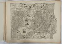
1932176499London.: Royal Geographical Society. 1932. Twenty one loose maps with tissue guards printed on sheets 49.5 x 63.5 cm in the original folio title-wrappers the maps with some edge wear and toning but on the whole in very good condition the wrappers browned and stained torn with minor loss at the foot of the title wrapper small closed edge tears now re-enforced with archival material and sound. Lacking the introductory notes by Edward Heawood. The complete suite of maps: an impressive production. The first map is a general map of England and Ireland by an unknown author 1594; nineteen county maps; and a final sheet of miniature county maps printed as a deck of playing-cards. The county maps proper vary in date from Saxton's “Southamtonia” of 1575 to John Speed's version of Norden's map of Sussex dated 1610. A contemporary reviewer dubbed it " a rich cartographical feast" allowing easy access to rare and valuable maps and comparison of maps by different cartographers for the same county. <br>The county maps reproduced include five by Christopher Saxton three by John Norden Philip Symonson's map of Eastern Kent published in 1596 a series of seven maps dating from the early years of the seventeenth century two maps prepared for Camden and two published by John Speed. . Royal Geographical Society unknown
193691525Milano: Touring Club Italiano 1936. Very Good. 12 of 37 unbound sheets. 4p.center 2 pages are 34 cm. x 25 cm. map. Partly colored. Scale: 1:1000000. Italian text. Touring Club Italiano unknown
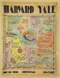
66643Yale University Athletic Association. Good. 160pp. Thin quarto 31 cm The front wrap is detached but present. The rear wrap is absent. Two small closed tears to the fore-edge of the front wrap. Scarce. Cover art by Utah artist John Held Jr.<br /> <br /> Utah Artist John Held Jr. 1889-1958 was a prominent illustrator of the 1920s and 1930s. He began by drawing sports and political drawings for The Salt Lake Tribune when he was just 16 years old. Held moved to New York City in 1910 where he went on to gain notoriety for his drawings in the popular magazines "Life" "The New Yorker" "Vanity Fair" "Judge" and "College Humor." His work epitomized the Jazz Age. He is most recognized for creating the short-haired "flapper."<br /> <br /> The cover of this publication features one of Held's maps. Held's maps illustrate the diversity of his art while at the same time serving to demonstrate Held's interpretation of various notable places and things. Kori Alexander writes in his article entitled Relevant Magic in the Art of John Held Jr. "While it was Held's caricatures of the young college chaps and flapper girls that earned him public notoriety it was his linoleum cuts and pen and ink maps that fortified his legitimacy as a social commentator." Virginia Commonwealth University website. Yale University Athletic Association unknown
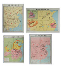
217061Shanghai.: 地图出版社 Cartographic Publishing House. Four coloured folding maps in the High School Chinese History Teaching Maps series. <br>Map 1 辽北宋西夏形势图 Liao Bei Song Xi Xia Situation Map 106 x 75.6cm <br>Map 2 金南宋西夏形势图 Jin Nan Song Xi Xia Situation Map 106 x 75.6cm <br>Map 3 宋代主要农民起义图 Major Peasant Rebellions During the Song Dynasty Map 76.5 x 106cm <br>Map 4 元末农民战争形势图 Peasant Battles in the Late Yuan Dynasty Situation Map 106 x 76.5. <br>Text in simplified Chinese characters. Some very slight browning at folds on reverse not affecting image or text minor soiling at edges else all in very good bright condition. Descriptive listing in Chinese also included. Map 1 辽北宋西夏形势图 shows the Liao regime established by the Khitan in the north the western Xia established by the Danxiang in the northwest which co-existed with the Northern Song. Important military and economic activity locations also shown. <br>Map 2 金南宋西夏形势图 shows the situation during the Southern Song Dynasty when three regimes co-existed; the Jin established by the Jurchens in the northeast the Western Xia established by the Dangxiang in the northwest and the Southern song. Important military activity locations also shown. <br>Map 3 宋代主要农民起义图 shows locations of peasant uprisings in the Northern and Southern Song Dynasties <br>Map 4 元末农民战争形势图 shows the situation of the three northern expeditions of the Red Turban Rebellion at the end of the Yuan Dynasty and the activities of the rebel armies. . 地图出版社 [Cartographic Publishing House]. unknown
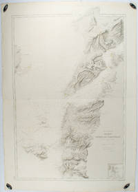
1883178272Paris.: Service hydrographique et océanographique de la marine. 1883 but1894. Engraved hydrographical chart on watermarked double sheet 99 x 63 cm soundings in metres lighthouses picked out in yellow and red inset map of the port and town of Tenedos central fold a few very slight edge tears to the generous margins light spotting and surface soiling but in very good condition. Fine and impressive large naval chart of this strategically important strait then still under the control of the Ottoman Empire. <br> <br>From a private collection; "Lord John Fitzroy Royal Yacht Squadron" in manuscript on the verso. . Service hydrographique et océanographique de la marine unknown
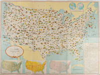
1955172003Washington D.C.: 国務省. Kokumishō. No date. circa1955. Large folding Japanese coloured map of the United States with 3 inset maps at foot of map showing main railways air and highway routes and hemispheres at the top right. Some browning mainly visible on reverse still a good copy. 66 x 81cm. An intricate and detailed pictorial map of the United States published in Japanese by the US State Department. The same type of map had been published since 1945 in English and subsequently in other languages. The Japanese language map is hard to find. The map is undated but was probably produced in the 1950's. The images include depictions of women board riders in two piece swimsuits of the sort popular in the 1950s but the inset text lists Alaska and Hawaii as external territories of the US indicating that the map was produced before they attained statehood in 1959. <br> <br>An inset panel provides information on the area and population of the US the population of major American cities mineral and other resources climate and topography. A note at the bottom right hand corner of the map states that copies of the map can be obtained free of charge from your nearest US Information Office. <br> <br>Every region of the country is decorated with an illustration of the natural resources industries or cultural or historical resources associated with that particular place. These include images of early colonial settlers the birthplaces of Mark Twain and Woodrow Wilson Booker T. Washington's house and Abraham Lincoln's grave; images of major dams oil fields coal mines cotton plantations etc. various animals and crops and images of ships cars and public buildings including the Statue of Liberty located rather oddly far out at sea. . 国務省. [Kokumishō]. unknown
193960959San Francisco CA: San Francisco Bay Exposition 1939. 8vo. 116 pp. With oblong folio. 19.25 x 16 in. colour pictorial map frontisp. detailed sections of island and exhibits in blue on verso fold creases numerous photo illustrations text maps diagrams stepped thumb tabs at outer fore-edge. Blue-cloth backed softcovers featuring the striking Art Deco cover art by Simon “Si†Vanderlaan 1904-1986 famed pin-up artist and illustrator who worked for Walt Disney studios during World War II minor scuffing very minor age toning shelfwear still VG bright copy from the library of Prof. Marvin Nathan. Revised 1939 edition of this excellent guide to the first year in 1939 of the Golden Gate International Exposition including “Cartograph†revealing all of the Art Deco architectural wonders and surrounding areas of Treasure Island. The pictorial maps were issued separately as well as with the “Official Guide Books.†Ruth Taylor White’s 1902-1985 delightful pictographic maps or cartographs included depictions of the Territory of Hawaii in which she had driven or traveled to every corner of the Islands and the Grand Canyon for her for her brother’s book “Grand Canyon Country.†Later Little Brown requested an entire atlas which was published as the very scarce Our U.S.A. “A gay geography.†Her cartographs influenced the style of American cartographic illustration for decades afterwards. See: Griffin Mapping Wonderlands: Illustrated Cartography pp. 192-193; Field MapCarte 29/364: Our U.S.A. A Gay Geography 2014. San Francisco Bay Exposition, paperback