1 660 résultats
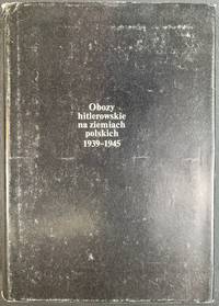
197941930Warszawa Warsaw: Pan´stw. Wydawn. Naukowe 1979. Pamphlet. 1st Edition. Original Cloth in dustjacket 8vo 678 2 pages 36 unnumbered leaves of plates with 164 illustrations. 25 cm. In Polish. Title translates to “Nazi camps in Poland 1939 - 1945. An Encyclopaedic Reference Book.†ISBN: 8301000651. <br> A massive encyclopedic record of Nazi camps prisons and ghettos in Poland based on extensive source material in Polish and foreign archives and research carried out by the General Commission for the Investigation of Nazi Crimes in Poland. The 5877 entries pages 87-601 are arranged in alphabetical order of location providing data on the period of existence character of and fundamental information about each site. Pages 11-86 comprise an introduction by Czeslaw Pilichowski "Hitlerowskie obozy i os´rodki przymusowego odosobnienia oraz ich rola w realizacji programu ludobo´jstwa i zaglady narodu polskiego" "Nazi Camps and Forced Detention Centers and Their Role in Implementing the Program of Genocide and Extermination of the Polish Nation". Includes a bibliography and indexes and summaries in Russian English French and German p. 657-676. The last 73 pages contain photographs. <br> SUBJECTS: World War 1939-1945 -- Prisoners and prisons German. -- Concentration camps -- Poland. Guerre mondiale 1939-1945 -- Prisonniers et prisons des Allemands. -- Camps d'internement -- Pologne. Obozy koncentracyjne -- Polska -- 1900-1945. OCLC: 5709074. <br> Top corners bumped some tears to dust jacket otherwise Very Good Condition in Very Good Dustjacket. Important Work. BK5 holo2-147-20. Warszawa (Warsaw): Pan´stw. Wydawn. Naukowe unknown
19522092902141000174Bijutsu shubbansha 1952. Soft Cover. Fine. Size: A3 Bijutsu shubbansha paperback
0365854689.Gpaperback. Good. Access codes and supplements are not guaranteed with used items. May be an ex-library book. paperback
19392092902141000906Tokyo Mikuraku 1939. Soft Cover. Fine. The book is in fine condition. Tokyo Mikuraku paperback
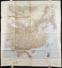
1945206545Calcutta: Compiled and drawn by the Survey of India. Second Edition. 1945. Large folding colour map 77.5 x 80cm; 95.5 x 86.2cm sheet including legend and small inset showing adjoining maps light toning and wear to upper margins and at corners and folds; but in very good condition. Very large clear map of China printed in 1945. The projection is noted as the "Lambert Conical Orthomorphic" a polyconic projection employed by the exhaustive Survey of India and the map includes surrounding countries: Taiwan Korea French Indo-China with a small inset key to Korean place-name abbreviations. As is typical of maps of this period Arunachal Pradesh is shown as Tibetan territory.The legend lists borders and provinces railways roads and canals with topography indicated with colouration. . Compiled and drawn by the Survey of India. unknown
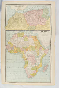
1894177068Chicago.: Geo. F. Cram. 1894. Chromolithographed maps 54.3 x 34.1 cm sheet central fold a few small edge tears and marginal age toning but in very good condition. Detailed maps prepared for George F. Cram's 1894 "Standard American Atlas": one of the first American firms to publish a world atlas. Maps of Oceania and South Africa printed on the verso. . Geo. F. Cram. unknown
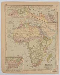
1877177229New York.: Ivison Blakeman Taylor & Co. circa1877. Printed colour map 27.5 x 21.7 cm large inset of Northern Africa and a smaller of Southern Africa two small edge tears lower corner neatly strengthened the sheet toned but the map in good condition unrelated text printed on the verso. Map of Africa as a whole before the Imperial race for colonies in the 1880s with interesting insets of Northern and Southern Africa. . Ivison, Blakeman, Taylor & Co. unknown
1895175108London.: Times Atlas of the World. 1895. Double-page folding map printed in colour 46.5 x 36.5 cm. edges gilt central fold with an inset map of Somaliland Somalia and the island of Sokotra key to European possessions outlined in colour small edge fold tears affecting the margin only and two other small edge tears slight toning at the edgaes but in very good condition. Attractive and detailed map prepared for the first edition of "The Times Atlas of the World". . (Times Atlas of the World). unknown
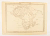
1880174956London.: The London Printing and Publishing Company. Circa1880s. Printed map 24 x 32.1 cm decorative border two original vertical folds paper toned mainly at the edges inner margin of the sheet ragged but in good order. A late edition of the map used for the well-known Tallis map this without the characteristic vignettes and on thinner paper. . The London Printing and Publishing Company. unknown
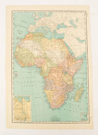
1899174902New York.: Rand McNally & Co. 1899. Printed colour map 36.3 x 24.3 cm inset map of the Suez Canal and two smaller insets of the Cardagos Crayos Islands Mascarene Islands and Cape Verde Islands central fold and on the verso a printed panel listing the countries in Africa with their territorial governance area and population lower corner creased at the outer margin but in very good condition. An interesting late nineteenth-century map noting colonial governance. . Rand, McNally & Co. unknown
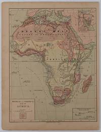
1877176015New York.: Harper & Brothers. circa1877. Chromolithographed map with outlne handcolour 27.1 x 21 cm major towns marked with a red cross relief by hachures ocean currents marked two inset maps of the Suez canal and Mascarene Island two very small marginal edge tears not affecting the map slight toning unrelated text on the verso prepared for "Harper's School Geography" in very good condition Interesting map of Africa before the escalation of the European race for colonial possessions from 1880. The map shows: the European possessions of the Cape Colony Transvaal Republic Orange River Republic and Natal; regions of the continent as fertile belts and desert belts; and indicates agricultural and other production such as palm oil ivory skins and cattle. Major cities are shown with important trade centers highlighted with a red cross. Prepared for US students in "Harper's School Geography" longitude is shown from the Greenwich prime meridian at the head of the map and from the Washington prime meridian at the foot. A small outline map of Ohio is included for relative scale. . Harper & Brothers. unknown
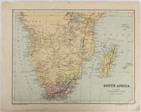
1877177228Edinburgh & London.: W. & A. K. Johnston. circa1877. Printed colour map 25 x 32.5 cm edge tears one affecting the lower border only two small chips from the upper margin corner repaired the map in very good condition. Map of North America with a small inset of the British Isles on the verso. Map of Southern Africa before the Scramble for Africa in the late 19th Century. . W. & A. K. Johnston. unknown
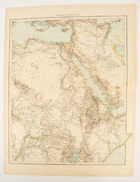
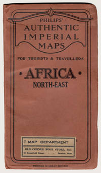
190029227London: George Philip & Son Ltd. ca.1900. Early printing of this map by the cartographic publishing company. Finely rendered in colours. Large multi-folding map approximately 22" x 27" publisher's original protective wrappers printed in black. A very fine copy pristine and very near to mint. George Philip was born in Huntly Aberdeenshire to a staunchly Calvinist family but in 1819 George traveled to Liverpool where his brother Robert who was a nonconformist minister lived. In 1819 he became assistant to the Liverpool bookseller William Grapel and in 1834 set up his own business as a bookseller and stationer in Paradise Street Liverpool. He rapidly expanded the business by producing books particularly educational works and maps. Within his first year of trading to keep up with demand he had to move his business into larger premises at the Atlas Buildings in South Castle Street. <br> Philip used cartographers such as John Bartholomew the elder August Petermann and William Hughes to produce maps on copper plates. Philip then had these printed and hand-coloured by his women tinters. By the time he produced his county maps of 1862 he was using machine coloured maps produced on power-driven lithographic presses. 'His maps ranged from the expensive Imperial Library Atlas 1864 to an atlas costing as little as 3d. and although the bulk of his production was for the commercial and particularly the educational market he also produced important scientific maps notably of North America especially the Arctic and Pacific Northwest Africa and of the West Indies.<br> This is a very fine copy of a scarce map showing the extent of European possessions in North-East Africa before the end of the colonial period. George Philip & Son, Ltd. unknown
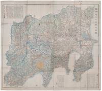
1418159850Shūseidō 衆星堂. Reprint. Tenpō 14 1843. Large folding handcoloured map of the thirteen provinces from which Mt. Fuji can be viewed. 159 x 178cm. Folds into paper covered card covers measuring 40 x 24cm. Title label upper cover. A little browning along folds occasional spotting and soiling. A little worming causing approximately 1cm of loss in places. Two chops in lower section. A very striking and attractive map. This very large handsome map is a detailed map of the thirteen provinces from which one can see Mt. Fuji. Provinces shown are the eight provinces of the Kantō region Sagami 相模 Musashi 武蔵 Kazusa 上総 Shimofusa 下総 Awa 安房 Kōzuke 上野 Shimotsuke 下野 and Hitachi 常陸 and five other provinces Izu 伊豆 Suruga 駿河 Tōtōmi 遠江 Kai 甲斐 and Shinano 信濃. The map offers a large amount of detailed information such as province and county borders rivers high ways post towns checkpoints villages and scenic spots. <br> <br>The cartographer Akiyama Einen or Nagatoshi 秋山永年 came from Edo and the editor Funakoshi Seizō 船越清蔵 studio name: Shugu 守愚 1805-62 a Confucian scholar from Nagato Province now the western half of present-day Yamaguchi Prefecture. A dedication by Funahashi Akira 舟橋徴 is dated 1843. . Shūseidō 衆星堂 unknown
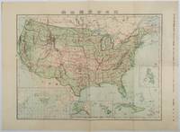
1911179415Tokyo.: 楠山正雄. Kusuyama Masao. Meiji 44 1911. Colour folding map 40 x 55cm inset maps showing the Philippines Alaska and Hawaii very good copy. This map was a supplement of October 1911 issue of a monthly magazine Shin Nippon 新日本 which was published between 1911 and 1918. The main map covers the contiguous United States with inset maps of the world showing the American territories of Alaska Hawaii and the Philippines. Curiously Cuba has been marked as an American territory having been directly occupied from 1906 to 1909 though at the time still beholden to the 1903 Cuban-American Treaty of Relations. . 楠山正雄. [Kusuyama Masao]. unknown
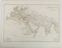
1820177230Paris. circa1820. Engraved map with original outline hand-colour 21.1 x 31.5cm original folds a few spots and a little creased but in very good condition. Latin map of the Ancient world encompassing Europe India Arabia the Middle East and North Africa by the French cartographer Jean Baptiste Poirson 1761-1831 finely engraved. . unknown
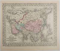
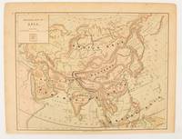
1879221209Pennsylvania. 1879. Lithographed maps on two sides of a single leaf with original hand-colouring 27 x 34 cms map size 31.1 x 37.1 cms sheet with a finely-engraved foliated border margins age-toned one margin tide-marked at the edge not affecting the maps a handsome pair of maps in very good condition. A most attractive pair of late 19th Century maps on two sides of a single leaf: Asia as a whole polar projection with Europe and parts of Africa and New Guinea. Scale 1:1000 miles. It includes steamship routes and mileages from London to destinations in Asia: Zhoushan Chusan Island Hong Kong Manilla Sarawak Bombay etc. along with political and geographical details; and on the verso the map covers the regions of Persia Iran Arabia including parts of the Arabian Peninsula Turkey in Asia Anatolia Afghanistan and Beloochistan parts of Iran Afghanistan and Pakistan and marks key settlements rivers and geographic features. . unknown
158464215Antwerp.: Abraham Ortelius. circa1584. Two engraved maps on laid paper each 30.3 x 19.5 cm printed on the one sheet 48 x 60 cm original fold attractive hand colour with related French text on verso slight toning and spotting to the margins but the maps in very good condition preserved in a modern window mount. Attractive maps of the German coast published in Ortelius' great atlas "Theatrum Orbis.". The left-hand map showing the mouths of the Elbe complete with sea monster and Eider Rivers and the coast of Schleswig-Holstein; the right-hand map of the Baltic coast with the Pomeranian islands of Rugen and Usedom. . (Abraham Ortelius). unknown
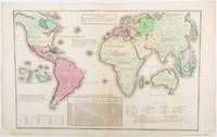
1835203763Philadelphia.: W. Marshall. Circa1835. Handcoloured engraved map 26.5 x 41.3 cms; 29.6 x 48.3 cms sheet central fold insets of "Oceanica" and "New Holland" central table some light staining in the image and margins in good condition. Eurocentrism laid bare. This 19th Century map includes a "State of Society" for each part of the world declared with a symbol to represent "Barbarous Half Civilized Civilized and Enlightened Societies" as well as noting religion and ethnicity. It includes a table of distances between chief towns or capitals and between these towns and Washington DC. Australia "New Holland" is styled principally as pagan barbarous unexplored and African a thin sliver of what is now New South Wales and Victoria is labelled civilized European and Protestant. Scarce. . (W. Marshall). unknown
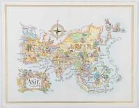
1964195995Pan American World Airways. 1964. Colour pictographic/pictorial map of Asia 23.2 x 30.1 cms gilt double-rule border printed on a folding decorative menu card 32 x 50 cms open highlighted in gilt text in English French and Japanese central fold and later central vertical crease in very good condition. Pan Am menu card for First Class passengers dubbed "The President Special" the deluxe cuisine by fabled Maxim's of Paris "Good food is the basis for true happiness". Passengers were feted with gourmet meals on bone china with silver cutlery. The witty pictorial cover-map of Asia was by French artist and commercial illustrator Jacques Liozu 1910-1974 also known for his larger scale maps. . Pan American World Airways. unknown
1875174830New York.: Harper & Brothers. 1875. Map printed in colour polar projection 21 x 27.1 cm marginal spotting and toning small edge tears to the inner margin but in god condition. Prepared for "Harper's School Geography" first published by Harper & Brothers in 1875. The map shows physical features mountains steppes plains rivers and deserts etc. together with sources of primary production: whale fisheries furs coffe tea minerals etc.The verso of the map with references and attractive line engravings part of the entry for Netherlands and Belgium. . Harper & Brothers. unknown
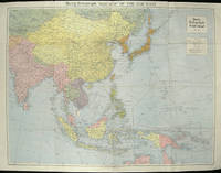
1940205763London.: Hutchinson & Co. Circa1940. Full colour folding map 70.7 x 93 cms; 76 x 101.2 cms sheet original folds short fold splits previous owner's neat title markings on the verso but the map in very good condition. A "Geographia" map of the war theatre in Asia and the Pacific including the northernmost coast of Australia. Showing railways and canals roads and steamer routes oilfields and pipe lines and a key to the unfederated states of Malaya. The Spratley Islands are marked as French and Thai territorial claims within French Indo China are marked. . Hutchinson & Co. unknown
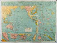
1945180206Sydney.: H.E.C. Robinson. Circa1945. Full colour inset maps principal cities and towns marked shipping routes international boundaries and railways. 99 x 73cm. Some small insect damage has been repaired on the verso visible on map as a few small lighter areas in the western Pacific. Pinpoint holes at folds paper repair along cover but a very good clean copy. From the Sydney publisher H.E.C. Robinson the firm founded in 1895 by Herbert Robinson 1857-1933 a founder of the Royal Geographical Society of Australasia. <br> <br>Although the map is undated North and South Korea are shown as divided which occurred in late 1945 and Manchuria is marked as still under Soviet occupation which only lasted until 1946 at which point it was handed over to Communist China. <br> <br>As well as what now would be considered Southeast Asia the main map shows the eastern half of India Tibet and parts of Mongolia the USSR and East Asia. Inset maps include: Caroline Islands Marshall Islands Federation of Malaya Singapore Hong Kong Taiwan Japan Hawaiian Islands Philippine Islands Midway Gaum and Wake Islands Fiji Islands Eastern & Western Samoa Santa Cruz and Solomon Islands New Caledonia Rabaul Tahiti Lord Howe etc. . H.E.C. Robinson. unknown
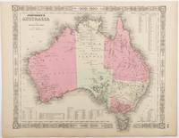
1865214355Johnson and Ward. Circa1865. Hand coloured map 32.3 x 39.7 x cms including the decorative border; 35.6 x 45.8 cms sheet key to major centres unrelated text on verso sheet age toned in very good condition. Detailed map from the leading mid 19th Century American firm of Johnson and Ward. Although Tasmania was known as such from 1856 the map refers to "Van Diemen Land". . Johnson and Ward. unknown
191363117New York: C.S. Hammond & Co. Schum Bros. Stationers and Printers 1913. 12mo. 3.5 x 7.5 double-sided colour lithograph map which folds out to 25.25 x 16.5 in. on 28 x 17.75 in. sheet very light dustsoiling slight shelfwear very slight age toning along the folds. Original printed gray-blue pocket portfolio folder blue lettering on recto & verso added affixed label of Schum Bros. over imprint minor age toning still a VG bright clean map. First edition thus of this very scarce Brass Era automobile travel map depicting Manhattan and portions of Long Island from Brooklyn across to Smithtown and Great River. Verso Map includes Long Island fro Great River up to Darlington across to Truman Beach and Bridgehampton with two inset maps: “Contination of North Shore†and “Continuation of South Shore†with “Good Roads†and “Fair Roads†differentiated as well as depiction of the Long Island Railway line and red dots tracing the electric interurban lines. As early as 1906 Hammond & Co. had produced a map for Good Roads enthusiasts and motorists but this updated issue documenting the improved roads was issued in 1913 and then regularly from 1914-1925. No copies in Worldcat. C.S. Hammond & Co., Schum Bros., Stationers and Printers, unknown