1 660 résultats
0881308587.Gspiral_bound. Good. Access codes and supplements are not guaranteed with used items. May be an ex-library book. unknown
19702433190324008Colonial Dames of America 1970-01-01. Hardcover. Very Good. Signed by Author. Nice looking book has minor edge wear. Colonial Dames of America hardcover
0929591720.Gpaperback. Good. Access codes and supplements are not guaranteed with used items. May be an ex-library book. paperback
18872210070050NY: John B. Alden Publisher 1887 1887-01-01. Hardcover. Very Good. Bound in publisher's cloth. Hardcover. No dust jacket. Good binding and cover. Clean unmarked pages. 191 pages : color illustrations color maps ; 16 cm. "including one hundred and thirty-eight colored maps diagrams tables etc NY: John B. Alden, Publisher, 1887 hardcover
1943144341943. Archive of nine large original World War II maps used by a United States Army soldier in the European Theater of Operations during the Allied liberation of Western Europe. Lithographed military maps variously issued by U.S. Army and War Office agencies 1943-1944. Large formats ranging from approximately 19" x 24" to 42" x 34". These maps document the cartographic infrastructure of Allied ground and air operations in the climactic campaigns of 1944-1945. The German sheets-many designated for "Army/Air" or restricted War and Navy Department use-reflect the intensive aerial reconnaissance bombing coordination and mechanized advance into the industrial and administrative heartland of the Third Reich. Cities such as Berlin Magdeburg Kassel and Düsseldorf were central to armaments production rail networks and military command making accurate and rapidly updated mapping indispensable. The Paris map corresponds to the Allied advance culminating in the Liberation of Paris in August 1944 marking the symbolic reclamation of a major European capital from Nazi control. Several sheets note reliance on prewar German cartography 1938 editions supplemented by wartime intelligence underscoring how Allied forces repurposed and revised enemy geographic data for invasion and occupation planning.<br /> <br /> Crucially these maps also capture a political geography that was almost immediately transformed by postwar settlement and Soviet expansion into Central and Eastern Europe. Within two years of their issue Germany was divided into occupation zones and by 1949 into separate states aligned with Western and Soviet blocs. Cities such as Berlin Halle Saale Magdeburg and Wernigerode fell within the Soviet zone and subsequently the German Democratic Republic fundamentally altering administrative boundaries transportation networks and the ideological framing of space. Cartographic production in these regions shifted accordingly with new editions reflecting socialist state structures and restricted internal mapping policies characteristic of the emerging Eastern Bloc. Thus these 1943-1944 sheets preserve a transitional moment: Nazi Germany still territorially intact on paper yet already subjected to Allied military penetration and poised on the brink of partition. As artifacts carried by an American soldier they embody both the tactical prosecution of total war and the immediate redrawing of Europe into Cold War spheres of influence. The archive includes operational maps of Magdeburg Sheet M.53 1:250000 "First Edition" 1943 with manuscript annotation Kassel Sheet L52 "Emergency Road Map" First Edition color based on 1938 mapping with wartime intelligence updates Düsseldorf Sheet K52 similar issue with fading highlighting and manuscript marks Hanover Sheet L53 1943 Berlin Sheet N53 "Army/Air" 1943 Halle Saale Sheet M52 marked "War and Navy Department Agencies only. Not for sale or distribution" 1943 Wernigerode Sheet 4130 First Edition War Office 1944 Jülich G.S.G.S. No. 4507 War Office 1944 35" x 30" and a large U.S.-issued map of Paris 42" x 34" 1944. All were retained by the soldier following his service.<br /> <br /> Very good overall with expected wartime folds and handling; several sheets with manuscript annotations highlighting fading or moderate water exposure notably Wernigerode stiffened from dampness; no major losses observed. A substantial and research-rich archive of original Allied operational maps materially linking frontline navigation aerial bombardment liberation campaigns and the swift geopolitical reconfiguration of Germany and Europe under the expanding Soviet Eastern Bloc. unknown
193664218Chicago IL: The Pullman Company Poole Bros. Inc. Railroads of the United States Canada & Mexico 1936. 4to. 24 pp unpaginated. which folds out into giant oblong atlas folio pictorial colour map 32 x 27 in. on verso illustration borders and self-printed over on recto in orange & black w/ photo illustrations slight age toning slight shelfwear couple very slight closed tears still VG bright copy. First edition of this delightful promotional map issued by Pullman & the Poole Bros. for advocating rail travel from British Columbia to Central Mexico Atlantic to Pacific along the Gulf of Mexico and Baja California. The cartographer and cartoonist has filled each area of the map with charming little pictorial vignettes highlighting historic sites National Parks recreational sports and other leisure activities. The Pullman Sleeping Car diagram depicts sections with drawing-room two compartments and double bedrooms with promotional photos. Worldcat locates 4 copies Boston Pub Osher Map Lib. U of MO St. Louis SMU. The Pullman Company, Poole Bros., Inc.], Railroads of the United States, Canada & Mexico, unknown
1593530137.Gmap. Good. Access codes and supplements are not guaranteed with used items. May be an ex-library book. unknown
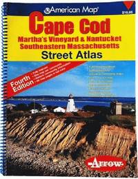
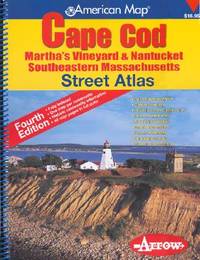
200681813aaspArrow Map 2006. 4th. spiral_bound. Good. 10x0x13. Fourth Edition 2006 with a yellow red and blue cover. Wire coil binding. Pages unmarked; mild usage wear. Arrow Map unknown
1557513015.Gspiral_bound. Good. Access codes and supplements are not guaranteed with used items. May be an ex-library book. unknown
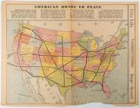
1938215547Los Angeles.: Los Angeles Examiner. Sunday 1 May1938. Printed colour pictorial map 33 x 48 cms; 41.8 x 54.5 cms sheet central fold sheet toned corners chipped with some loss to the bottom border and at the central fold in good condition; and on the verso "Movie-Go-Round" by Louella O. Parsons black and white photos and advertisements. Pictorial map printed for the weekend supplement of the Randolph Hearst owned newspaper the Los Angeles Examiner. The map-maker and artist Howard Burke had also worked for the San Francisco Examiner and was known for pictorial maps many with a persuasive or rhetorical edge and as here were designed to shore up American patriotism and defences against a wider world in the increasingly turbulent pre-war 1930s. The caption to this map outlines a multi-billion dollar 25 year proposal by Congressman J. Buell Snyder for a network of coast to coast transcontinental highways "in case of an attack by a foreign power at any point along the border". Buell Snyder earned the soubriquet "the father of superhighways" and during the War he was assigned to a Congressional Committee in charge of appropriations for the War Department. Scarce. . Los Angeles Examiner. unknown
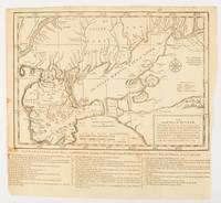
1739174921London.: The Gentleman's Magazine. circa1739. Engraved map 22.2 x 31.4 31.1 x 33 cm sheet size elaborate explanatory key in three columns at the foot original folds sealed 2 cm tear to the lower part of the inner margin one other small fold tear no loss inner margin of the key trimmed with some loss an original fault paper browned and spotted on the verso but an historic map in good condition. . [The Gentleman's Magazine]. unknown
1528000404.Gpaperback. Good. Access codes and supplements are not guaranteed with used items. May be an ex-library book. paperback
1527883051.Gpaperback. Good. Access codes and supplements are not guaranteed with used items. May be an ex-library book. paperback
1992050926Seattle WA: Seal Press 1992. Advance Uncorrected Galley Proofs . Paper Back. Very Good/No Jacket. 4to - over 9¾" - 12" tall. 103pp.; SC blk.plastic comb-binding w/clear plastic cover; slight rub w/cleantight pgs. "Poems by Barbara Kingsolver. Spanish translations by Rebeca Cartes. <br/> <br/> Seal Press unknown
1992Q-1878067141Seal Pr 1992-03-01. Hardcover. New. In shrink wrap. Looks like an interesting title! Seal Pr hardcover
1994Q-1878067575Seal Press 1994-08-01. Paperback. New. In shrink wrap. Looks like an interesting title! Seal Press paperback
18739509Paris 1873. French naval chart sheet 3273 sheet size 105.5 x 72 cm engraved by Nyon black and white centrefold one or two marginal nicks and tears blank verso. This detailed chart of Grenada was derived from British Admiralty surveys. Map unknown
18739508Paris 1873. French naval chart sheet 3256 sheet size 72.5 x 105 cm engraved by Delamare black and white with coastal profiles in the lower part of the chart centrefold one or two marginal nicks and tears blank verso. This detailed chart of Isla Culebra now an island-municipality of Puerto Rico was derived from British Admiralty surveys. With no permmanent population for centuries the island was settled by the Spanish in the 1880s and ceded to the United States after the Spanish-American War. Map unknown
18738667Paris 1873. French naval chart sheet 3119 50 x33 cm black and white blank verso. Chart of the island of Montserrat in the British West Indies featuring coastal profiles dominated by the Soufrière Hills volcano and an inset of Plymouth the former capital of the island which was destroyed in the volcanic eruptions of the mid 1990s. Map unknown
0540089311.Gspiral_bound. Good. Access codes and supplements are not guaranteed with used items. May be an ex-library book. unknown
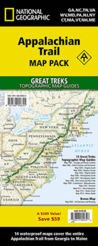
20191-1566958326Natl Geographic Society Maps 2019. Paperback. New. fol map edition. 568 pages. 9.50x4.75x1.00 inches. Natl Geographic Society Maps paperback
1566958385.Gmap. Good. Access codes and supplements are not guaranteed with used items. May be an ex-library book. unknown
2010DADAX1566958326National Geographic 2022-01-01. 2022. map. New. 4.25x3.00x9.25. Buy with confidence. Excellent Customer Service & Return policy. National Geographic unknown
2010SONG1566958326National Geographic 2022-01-01. 2022. map. Used: Good. 4.25x3.00x9.25. Buy with confidence. Excellent Customer Service & Return policy. National Geographic unknown
18622109160014D Appleton and Company 1862. Hardcover. Good. 1962 printing. Bound in publisher's cloth. Hardcover. Shelf wear. Spine ends chipped with loss. Some folded maps torn. D Appleton and Company hardcover