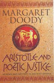
Aristotle and the Secrets of Life
2003Q-0712616152Century 2003-01-01. Hardcover. New. In shrink wrap. Looks like an interesting title! Century hardcover

GridFreed LLC · États-Unis90,48 $US≈ 76,56 €
1 660 résultats
1986Q-0333428897MacMillan 1986-01-01. Hardcover. New. New. In shrink wrap. Looks like an interesting title! MacMillan hardcover
2013G0930657578I3N00APC Enterprises 2013. Perfect Paperback. Good. Pages can have notes/highlighting. Spine may show signs of wear. ~ ThriftBooks: Read More Spend Less.Dust jacket quality is not guaranteed. APC Enterprises paperback
1939144331939. Archive of six large original World War II-era maps used by a United States Army soldier in the European Theater of Operations during the Allied liberation of Europe. Lithographed maps various issuers 1938-1939 wartime use 1944-1945.<br /> <br /> Beyond their immediate tactical utility these maps occupy a pivotal geopolitical moment. The Czech sheets document territories liberated by American forces in May 1945 particularly around Plzeň which marked the effective western limit of U.S. advance before demarcation lines were fixed with Soviet forces. Within months these same regions fell firmly within the Soviet sphere of influence formalized through postwar agreements and culminating in the 1948 Communist coup in Czechoslovakia. Cartographically borders administrative divisions and place names shifted to reflect the new socialist state while subsequent Eastern Bloc map production emphasized different political geographies aligned with Moscow. Thus these pre-Communist and German-printed sheets capture a fleeting interstice: cities momentarily under American military administration before incorporation into the Soviet Eastern Bloc. The 1938 promotional map of Czechoslovakia preserves the nation's pre-Munich territorial identity prior to its partition under Nazi pressure while the 1939 Hamburg map reflects the industrial heartland of the Third Reich before Allied devastation and Germany's eventual division into East and West. In this sense the archive charts not only wartime movement but the rapid redrawing of Europe's political landscape-where American operational cartography was almost immediately superseded by Cold War boundary-making. Sizes range from 19" x 24" to 34" x 22". The archive comprises detailed city and regional maps of western Czechoslovakia-Město Teplá 19" x 24" Plzeň Sheet 4151 24" x 19" black and white with green overlay Horšovský Týn Sheet 4150 24" x 19" and Kralovice Sheet 4051-together with a large 1938 promotional map of Czechoslovakia 34" x 22" and a 1939 German-printed map of Hamburg 28" x 24". All are original period printings retained by the soldier following his service. Good overall with expected wartime folds creasing and moderate wrinkling from field use and storage; no significant losses observed. A rare and materially resonant survival of Allied operational maps that document both the liberation of Central Europe and the swift geopolitical transformation that consigned much of that terrain to the Soviet Eastern Bloc rendering these sheets artifacts of a brief and transitional military presence. unknown
G8N-H27-VU6Hardcover. Good. Jacket in Fair condition worn torn faded and foxed with significant tape repairs verso. Book has moderate wear some edge foxing; pages yellowed with an occasional minor blemish; binding firm; gift inscription to half-title. hardcover
19732083002116201937Meiji Maps Hisao Hayashi 1973. Soft Cover. Fine. The book is in fine condition. Meiji Maps Hisao Hayashi paperback
2003Q-0712616152Century 2003-01-01. Hardcover. New. In shrink wrap. Looks like an interesting title! Century hardcover
Q-0712615601Century. Hardcover. New. New. In shrink wrap. Looks like an interesting title! Century hardcover
19842090502113710154Not Available 1984. Soft Cover. Fine. The book is in fine condition. Not Available paperback
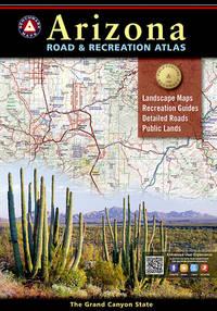
20189780929591186-2025Natl Geographic Society Maps 2018. Paperback. New. <p><strong>Author:</strong> Benchmark Maps</p><p><strong>Publisher:</strong> Natl Geographic Society Maps</p><p><strong>Binding:</strong> Paperback</p><p><strong>ISBN:</strong> 9780929591186</p><p><strong>Release Date:</strong> 2018</p><p><strong>Number Of Pages:</strong> 105</p><p><strong>Details:</strong> The Grand Canyon State abounds in natural beauty and outdoor possibilities. Completely reworked with larger scale Landscape Maps and a comprehensive Recreation Guide Benchmark's Arizona Road and Recreation Atlas is an invaluable resource for adventure planning and exploration.</p> Natl Geographic Society Maps paperback
20189780929591186-2025Natl Geographic Society Maps 2018. Paperback. New. <p><strong>Author:</strong> Benchmark Maps</p><p><strong>Publisher:</strong> Natl Geographic Society Maps</p><p><strong>Binding:</strong> Paperback</p><p><strong>ISBN:</strong> 9780929591186</p><p><strong>Release Date:</strong> 2018</p><p><strong>Number Of Pages:</strong> 105</p><p><strong>Details:</strong> The Grand Canyon State abounds in natural beauty and outdoor possibilities. Completely reworked with larger scale Landscape Maps and a comprehensive Recreation Guide Benchmark's Arizona Road and Recreation Atlas is an invaluable resource for adventure planning and exploration.</p> Natl Geographic Society Maps paperback
2024SONGB0CBQHWBQ8Benchmark Maps 2024-01-01. 13th Edition 2024. paperback. Used: Good. 11.00x0.50x15.00. Buy with confidence. Excellent Customer Service & Return policy. Benchmark Maps paperback
1734315040.Gpaperback. Good. Access codes and supplements are not guaranteed with used items. May be an ex-library book. paperback
A9781597752312Sheet map rolled. New. unknown
0540089281.Gpaperback. Good. Access codes and supplements are not guaranteed with used items. May be an ex-library book. paperback
2004mon0000832965Streetwise Maps 2004-03-01. Map. Good. 0.1300 in x 8.3000 in x 4.0400 in. Streetwise Maps unknown
D10P-00951Streetwise Maps. Used - Very Good. Very Good condition. Laminated map. A copy that may have a few cosmetic defects. May also contain light spine creasing or a few markings such as an owner’s name short gifter’s inscription or light stamp. Streetwise Maps unknown
0935039236.Gmap. Good. Access codes and supplements are not guaranteed with used items. May be an ex-library book. unknown
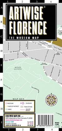
2007DADAX0935039392StreetWise 2007-12-27. map. New. 4.00x0.25x8.75. Buy with confidence. Excellent Customer Service & Return policy. StreetWise unknown
D10P-00950Streetwise Maps. Used - Very Good. Very Good condition. Laminated map. A copy that may have a few cosmetic defects. May also contain light spine creasing or a few markings such as an owner’s name short gifter’s inscription or light stamp. Streetwise Maps unknown
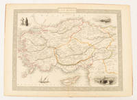
1851174952London & New York.: Tallis J & F. 1851. Lithographed map 24.5 x 32.3 cm borders picked out in original hand colour four inset vignette illustrations decorative Greek key border edge worn and discoloured paper toned but the attractive map in good condition. Attractive decorative map prepared for "Tallis's illustrated atlas and modern history of the world." one of the last great illustrated series of world maps. The fine vignettes are of Mt. Olympus Rhodes a ketch in the Mediterranean Sea and two costumed Ottomans. . Tallis, J & F. unknown
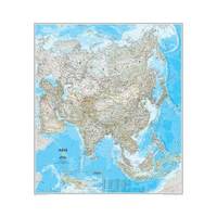
20131-0792250141National Geographic Society Maps 2013. Map. New. lam map edition. 1 pages. 32.90x1.70x1.40 inches. National Geographic Society Maps unknown
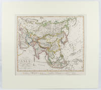
1855173439Gotha.: Perthes Justus. Circa1855. Engraved map 44.1 x 36.3 cm sheet size 35.8 x 29.7cm map size plate mark map with original hand colouring and hand coloured key noting Islamic "Mohammedanische" Buddhist "Buddhaistische" and European territories by country. Unusual map in an early issue. It was included as map 39 in Stieler's "Hand-Atlas uber alle Theile der Erde und uber das Weltgebaude by Frederic von Stulpnagel" revised by Hermann Berghaus in 1855. The issue is noted to the top right: Ausg. in 63BI. no XIV. Fine outline hand colouring denotes territories by religion and Chinese ports open to European trade and Japanese ports open to American trade. . Perthes, Justus. unknown
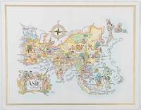
1964195995Pan American World Airways. 1964. Colour pictographic/pictorial map of Asia 23.2 x 30.1 cms gilt double-rule border printed on a folding decorative menu card 32 x 50 cms open highlighted in gilt text in English French and Japanese central fold and later central vertical crease in very good condition. Pan Am menu card for First Class passengers dubbed "The President Special" the deluxe cuisine by fabled Maxim's of Paris "Good food is the basis for true happiness". Passengers were feted with gourmet meals on bone china with silver cutlery. The witty pictorial cover-map of Asia was by French artist and commercial illustrator Jacques Liozu 1910-1974 also known for his larger scale maps. . Pan American World Airways. unknown
0792249542.Gmap. Good. Access codes and supplements are not guaranteed with used items. May be an ex-library book. unknown
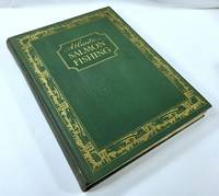
1937049296New York: The Derrydale Press 1937. One of 950 copies of the regular edition 1937. Well illustrated throughout in both color and in black and white. Hefty volume in green cloth lettered and decorated in gilt top edge gilt illustrated endpapers 193 pages plus plates folding map book 12.5 inches tall. Very good with very modest edge rubbing a little more rubbing to the spine ends a slightly dulled but readily legible spine good hinges sound text block clean pages with some very light foxing to the upper margins of a few pages personal bookplate on preliminary blank no other names or markings. Map appears to have never been unfolded. . First Limited Edition. Hard Cover. Very Good. Folio - 12" - 15" Tall. The Derrydale Press Hardcover