National Geographic Maps - AdventureBiblio.com
1 660 résultats
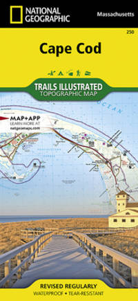
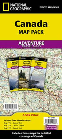
2010SONG1597756032National Geographic 2022-01-01. 2022. map. Used: Good. 4.40x0.70x9.10. Buy with confidence. Excellent Customer Service & Return policy. National Geographic unknown
1597756032New. Brand new and still unused unknown
1597756032.Gmap. Good. Access codes and supplements are not guaranteed with used items. May be an ex-library book. unknown
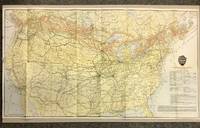
19205872Canadian Pacific Railway 1920. First Thus. Loose Sheet. Very Good-. Poole Brothers. Map measuring 31.75 inches x 17.75 inches printed four-color. Map shows the breadth of lower Canada from just north of Vancouver Island across to Newfoundland as well as all of the United States excluding southernmost Texas and Florida. CPR lines are represented in red ink whereas connecting American railroads are in black. Black stars along the CPR indicate locations of Canadian Pacific Hotels. Two slight chips to left margin and with a couple short closed tears along folds. Please see photo. A handsome map from the tail-end of the golden age of rail travel. Now preserved in a removable clear archival sleeve. Canadian Pacific Railway unknown
1851374132.Gpaperback. Good. Access codes and supplements are not guaranteed with used items. May be an ex-library book. paperback
1566957370New. Brand new and still unused unknown
1583559647.Gbundle. Good. Access codes and supplements are not guaranteed with used items. May be an ex-library book. unknown
1566957370.Gmap. Good. Access codes and supplements are not guaranteed with used items. May be an ex-library book. unknown
1583559248.Gpamphlet. Good. Access codes and supplements are not guaranteed with used items. May be an ex-library book. unknown
Q-1566953553Natl Geographic Society Maps 2019-01-01. Map. New. In shrink wrap. Looks like an interesting title! Natl Geographic Society Maps unknown
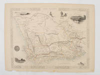
1851174666London.: Tallis John. 1851. Lithographed map 24.2 x 32 cm districts picked out in original hand colour inset vignette illustrations decorative border lower margin ragged but the attractive map in very good condition. Attractive decorative map from "Tallis's illustrated atlas and modern history of the world." one of the last great illustrated series of world maps. The fine vignettes are of Cape Town Graham Town and entrance to the Knysha Heads. . (Tallis, John). unknown
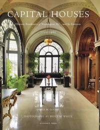
2015114822Acanthus Press. New. 2015. Hardcover. 0926494910 . FREE UPGRADE to Courier/Priority Shipping Upon Request - IN STOCK AND IMMEDIATELY AVAILABLE FOR SHIPMENT - IN STOCK AND IMMEDIATELY AVAILABLE FOR SHIPMENT - Flawless copy brand new pristine never opened - -- with a bonus offer-- . Acanthus Press hardcover
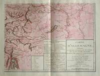
1805570721805. Copper engraving with handcolouring map shows the border of the Austrian Empire and Hungary Vienne sic and the Danube can be seen at the top of the map Two keys and scale inset. Few closed tears and some browning edges otherwise a clean and bright image. Map measures approximately 34 x 44cm. Map of Germany <br>indicating the present division of this empire as well as the new possessions of the princes who make up the Germanic body and including Batavia and Helvetia Switzerland with their divisions. by E. Mentelle a member of the institute and P. G. Chanlaire one of the authors of the National Atlas. An xiii 1805. Paris. There is a key to the explanation of the signs and an explanation of the colours used for the district of the various states contained in this map. . unknown
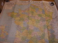
68-8512Paris France: Cartes Taride 1959. Rolled Color Map. 92.71 x 88.26 cm. 36.5" x 34.75". Good with tears. En Francais. Paris, France: Cartes Taride, 1959. unknown
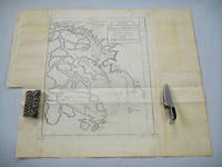
1749136827Paris. Circa1749. Engraved map on watermarked laid paper 20 x 27.3 cm of Fuzhou and coastline of Fujian Province original folds designed by the great French cartographer Jacques-Nicolas Bellin. This map is from the impressive 15-volume "Histoire Génèrale des Voyages" compiled by Antoine François Prévost map no. 2 Vol. 6. This map shows the estuary of Yangtze River Rivière de Chang. Very light browning on sheet edges but in very good condition. . unknown
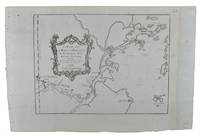
1749136826Paris. circa1749. Black and white engraved map on watermarked laid paper 20.9 x 32.7cm showing coastal area of Zhejiang Province Province de Che-kiang including Zhoushan Archipelago Isle de Chusan Zhoushan Bay Bay de Chusan and Xiangshan County Siang-chan-luen a walled city outside of upper border Ningbo Ning-po prefecture under Qing administration title cartouche lower left original folds. This map is No. 3 Vol. 6 from the impressive 15-volume "Histoire Generale des Voyages" compiled by Antoine François Prévost. Even browning mainly to the sheet edges in very good condition. . unknown
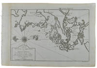
1749136795Paris. circa1749. Black and white engraved map of Quanzhou and Zhangzhou 21.1 x 30 cm here spelled Chin-chew and Chang-chew and both final words with added superscript "ou" on watermarked laid paper 25.6 x 38 cm original folds a few marginal spots simplified compass rose and a decorative fleur de lis bottom right in very good condition. Attractive map including the estuary of Quanzhou River Xiamen Emowi and Kinmen or Quemoy Quemowi island. The map was designed by the eminent French cartographer Jacques-Nicolas Bellin and here published as plate No. 22 in the impressive 15 volume compilation of voyages "Histoire Generale des Voyages" by Antoine François Prévost. . unknown
1749136781Paris. circa1749. Black and white engraved map on laid paper showing entrance to Pearl/Canton river Macao and the area which would become Hong Kong Sinn-gan-hien folded designed by the prominent French cartographer Jacques-Nicolas Bellin. This map is No. 16 Vol. 5 from the impressive 15-volume "Histoire Generale des Voyages" compiled by French novelist Antoine François Prévost. The walled city of Canton upper section is divided into areas of Tartar and Chinese. <br> <br>Some light even browning on paper added at margins good copy. Map measures 25.7 x 20.5. . unknown
1830009582Paris - 21 Quai Voltaire: Rosselin 1830. Map. Fine. Map. A fine map hand-coloured in outline folding into original marbled paper boards with title label to the front board. Boards rubbed conrners worn. The map measures 74 x 55cm and is in very good condition with the paper bright. A very good to fine copy of this rare map. Rosselin hardcover
2003I-265-661IGN - Institut Géographique National 2003. Very Good. Former library book. Different cover. Edition 2003. Ammareal gives back up to 15% of this item's net price to charity organizations. IGN - Institut Géographique National unknown
BN103037IGN - Institut Géographique National. Carte de randonnée : Pau <br/><br/>Carte de randonnée : Pau IGN - Institut Géographique National unknown
2003F-445-047IGN - Institut Géographique National 2003. Good. Ammareal gives back up to 15% of this item's net price to charity organizations. IGN - Institut Géographique National unknown
2003F-445-057IGN - Institut Géographique National 2003. Good. Ammareal gives back up to 15% of this item's net price to charity organizations. IGN - Institut Géographique National unknown
2003F-445-058IGN - Institut Géographique National 2003. Very Good. Ammareal gives back up to 15% of this item's net price to charity organizations. IGN - Institut Géographique National unknown
2003F-445-059IGN - Institut Géographique National 2003. Good. Ammareal gives back up to 15% of this item's net price to charity organizations. IGN - Institut Géographique National unknown