[TOKYO - TOURIST MAP] KING ASSOCIATESBiblio.com
1 660 résultats
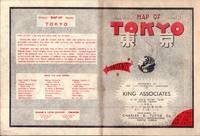
1954194113Tokyo.: Charles E. Tuttle Company. 1954. Printed four colour map 92 x 71cm; 102.5 x 74.5cm sheet folding into pictorial wrappers 25.6 x 19 cms inset map of the Marounouchi District and on the verso an extensive grid reference in English and Japanese and over four panels a map of the streetcar railway and subway system scant spotting to cover two small fold splits without loss and toning most evident at the folds in very good condition. Comprehensive 1950s map of Tokyo by US publisher Charles E. Tuttle "Here at last is the map that makes order out of chaos.extending as far as Haneda Airport Grant Hights Harbor Area and Nakano Ward" blurb. . Charles E. Tuttle Company. unknown
0008496374.Gpaperback. Good. Access codes and supplements are not guaranteed with used items. May be an ex-library book. paperback
1847361862.Gmap. Good. Access codes and supplements are not guaranteed with used items. May be an ex-library book. unknown
000825799X.Gspiral_bound. Good. Access codes and supplements are not guaranteed with used items. May be an ex-library book. unknown
189659118Chicago: J. Blegen 1896. 12mo. 69 1 pp. With 1 large folding double-sided map “The World†on recto “United States†on verso with illustrated ads for steamship lines and Milwaukie road on recto above World map edgewear rubbing at crease folds some creasing at fore-edges couple very minor closed tears at folds. Quarter-brown cloth over beige boards decorative blue border blue lettering minor soiling edgewear still VG copy. First edition of this very scarce travel guide and pocket map issued by Blegen 1842-1927 a Norwegian-American steamship travel agent from the 1890’s into the 20th Century. His concise guidebook offered railway fares from Chicago Ocean steamship rates from New York Montreal New Orleans and San Francisco along with postage rates death mortality statistics for major American cities Brownsville TX sported 45 per 1000 while Salt Lake was 8 per 1000 coin equivalents and even a guide to sanatoriums and health spas in Europe. No physical printed copies located in Worldcat only digital or print-on-demand copies. J. Blegen, hardcover
Q-0826037402Ronald Press Co. Hardcover. New. New. In shrink wrap. Looks like an interesting title! Ronald Press Co hardcover
1841395501.Gmap. Good. Access codes and supplements are not guaranteed with used items. May be an ex-library book. unknown
1845876067.Gpaperback. Good. Access codes and supplements are not guaranteed with used items. May be an ex-library book. paperback
1910218006.Gmap. Good. Access codes and supplements are not guaranteed with used items. May be an ex-library book. unknown
19792090502113710012Not Available 1979. Soft Cover. Fine. The book is in fine condition. Not Available paperback
0540089923.Gpaperback. Good. Access codes and supplements are not guaranteed with used items. May be an ex-library book. paperback
158355923X.Gpamphlet. Good. Access codes and supplements are not guaranteed with used items. May be an ex-library book. unknown
1597752533.Gmap. Good. Access codes and supplements are not guaranteed with used items. May be an ex-library book. unknown
Q-1566953227National Geographic Maps 2019-03-26. Map. New. In shrink wrap. Looks like an interesting title! National Geographic Maps unknown
0008445230.Gpaperback. Good. Access codes and supplements are not guaranteed with used items. May be an ex-library book. paperback
1845876997.Gpaperback. Good. Access codes and supplements are not guaranteed with used items. May be an ex-library book. paperback
GOR013582795Paperback. Very Good. paperback
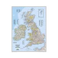
20131-0792250230Natl Geographic Society Maps 2013. Map. New. lam map edition. 1 pages. 24.00x2.00x2.00 inches. Natl Geographic Society Maps unknown
190375062London: McCorquodale 1903. First edition of this atlas map folio 16 1/4 x 27 1/2 inches. 5 sheets of British Commission maps and index map; 13 sheets of United States Commission maps Alaska boundary atlas and index map. Total of 20 maps 19 folding and 5 in color Maps are 53 x 32 inches. All but the British index map folded and backed in linen. Quarter red morocco over red cloth. Gilt Royal Seal to front board and spine. Maps mounted on linen and sectioned as issued. Portfolio case with moderate rubbing chipping to leather. Does not include the 10 cards to accompany the U.S. Commission maps seems to be common that these smaller ones are missing. Old staining to cloth. Toning and edge wear to British Index map. Slight toning and offsetting to maps. Overall a very good copy; quite scarce. [McCorquodale] hardcover
17088917London: John Nicholson 1708. Full Leather. Very Good binding. Octavo. xxxviii 2 412; 2 382 2 ads 32 index pp. maps. First edition. Contemporary paneled-calf boards with modern reback. Title page to Volume 1 and four of the eight maps are lacking but are supplied in tasteful facsimile. The maps in facsimile are the North America New England Virginia and Maryland and Carolina. Bindings are solid and presently nicely; contents are clean and bright; but for the maps and title page this is an exceptional set. <br /> <br /> Of this work William Reese writes: "This basic 18th-century reference work on British America . . . offers an excellent comprehensive survey of Great Britain's American colonies at the point when those on the mainland of North America had grown past their initial phase and were expanding rapidly in population and productivity. . . . This important contemporary work would probably have been the first point of reference for any Englishman at the time" Reese Struggle for North America 1. Usually attributed to Oldmixon who penned the dedication but occasionally gets attributed to Moll according to Sabin. A significant work by the British historian. Howes O-61 "aa"; European Americana 1708/95; ESTC T45485; Sabin 57156. John Nicholson unknown
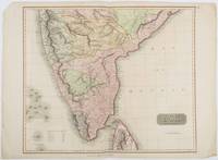
1816185242London.: Thomson. 1816. Engraved map with full handcolour 50.5 x 59.7 cms ; 53.9 x 73.8 cms sheet central fold a few minor edge tears one intruding into the top border the map unscathed marginal edgewear two corners with some loss but the map in very good crisp condition. An elegant map with great detail prepared for John Thomson's influential "New General Atlas" 1814-1821. Showing India from 20 degrees to 7 degrees north of the equator and includes the northern half of Ceylon with territorial interests attractively coloured. . Thomson. unknown
2021DADAX193149441XFranko Maps 2021-05-29. map. New. 8.00x6.00x1.00. Buy with confidence. Excellent Customer Service & Return policy. Franko Maps unknown
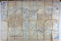
19803562N.p. probably Brownsville Tx 1980. Very good. Blue-line map 42 x 62 inches. Uneven toning minor overall wear. A large-format plat map of the Texas border town of Brownsville likely created in the early 1980s. The date is based on the appearance of the Sunrise Mall which opened its doors in 1979 and the name of the airport which was changed in 1983; as such the present map was printed sometime between those two dates. The present map shows the original city parcel as well as many other notable modern developments including the Airport Industrial Park the Fourteenth Street Commercial Plaza and the Amigoland Theme Park the latter of which was never built. The Rio Grande can be seen winding its way through the bottom portion of the map. We locate no other copies of this map anywhere. It was likely produced for local developers and as such is quite rare. An ideal decorative Texas map. unknown
1845878639.Gpaperback. Good. Access codes and supplements are not guaranteed with used items. May be an ex-library book. paperback
GOR006768433Paperback. Very Good. paperback