1 660 résultats
63-6396New York: Harcourt Brace 1938. Dust Jacket Only. 12mo. DJ Good with marginal tears at tail of spine minor staining inside DJ corners clipped. Original First Edition. New York: Harcourt Brace, 1938. unknown
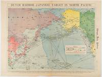
1942180751Chicago.: Chicago Daily Tribune. Friday June 51942. Printed colour map on a single newspaper leaf 37.5 x 53.2 cm; 44.7 x 59.8 cm sheet inset legend marginal browning and at the folds some undulation of paper and tide mark along lower section but in remarkably bright very good condition. Strategic map published in the Chicago Daily Tribune "The World's Greatest Newspaper" on June 5th 1942 two days after the Japanese attack on Dutch Harbor the site of the US army and navy bases in the Aleutians and as it transpired at the outset of the Battle of MIdway. The owner and proprietor of the Tribune Robert McCormick was staunchly against the United States entering the war and had firm views once it had occurred that American resources should not be used defending the British Empire. Famously the Tribune published the "Victory Program" Roosevelt’s military plan to prepare the United States for possible entry into World War II and was subject to prosecution for an alleged violation of the Espionage Act relating to the newspaper’s front-page account of the Battle of Midway 4-7 June 1942. It became an important test case for the limits of free speech and censorship during war-time. <br> <br>The Legend shows territorial Control of Ocean Areas marking Japanese Naval and Air bases as of 1941 and "according to latest reports" those established in the first six months of 1942. Also shown are pre-war sovereignties as at the bombing of Pearl Harbour on December 7th 1941. The Anson Archipelago is shown but a question mark "indicates islands etc. whose existence or give position is doubtful…". . Chicago Daily Tribune. unknown
6131516138.Gpaperback. Good. Access codes and supplements are not guaranteed with used items. May be an ex-library book. paperback
1987Q-0918678277The National Historical Society 1987-01-01. Hardcover. New. In shrink wrap. Looks like an interesting title! The National Historical Society hardcover
191628350<p>Press of Byron S. Adams Washingtn D.C. 1916. HARDBACK NOdUSTJAKET 1916 1st edition EX-LIBRARY Usual wear STAMPS ETC VG AS-S NO JACKETMAROON CLOTH SPINE titled in Gold gilt LITE WEAR CVR RUB 8vo INTERIOR LITE WEAR FOX Bound in red cloth on boards with gilt lettering to spine.96 pgs Old Blockhouse of Frontier Days lasted 1837 - 1857 Fort Croghan ETC. April 1847 Brigham Young at head exploring party of 143 men set out from winter quarters in search of promised Land. 1st Edition. Hard Cover. Very Good/No Jacket. Illus. by George Simon Etc. Ex-Library.</p> Press of Byron S. Adams, Washingtn, D.C. hardcover
19802083002116202287Modern Maps Masami Fukuoka 1980. Soft Cover. Fine. The book is in fine condition. Modern Maps Masami Fukuoka paperback
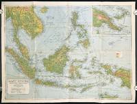
1940211106Sydney.: H.E.C. Robinson Pty. Ltd. circa1940. Full colour folding map 71 x 97 cms; 76.2 x 10² cms sheet blank on verso save for a neat inked stamp "East Indies" inset map of New Guinea and Papua heights shown by colour very good clean condition. Large scale World War II era map by Sydney publisher H. E. C. Robinson. Extremely detailed map it is coloured according to height above sea level and showing naval bases railways shipping routes air routes. Includes smaller inset map of "New Guinea & Papua" showing the eastern part of the island. . H.E.C. Robinson Pty. Ltd. unknown
1932105514.Gmap. Good. Access codes and supplements are not guaranteed with used items. May be an ex-library book. unknown
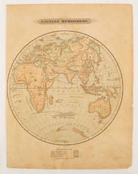
1875175128Harper & Brothers. 1875. Spherical map printed in colour 21.3 x 21.2 cm with shaded key to elevation and ocean currents unrelated text on the verso paper toned and margins soiled bottom edge ragged small sealed to to the inner margin but in sound condition. Map showing the five continents of Asia Africa Antarctica Europe and Australia. Published by Harper & Brothers for inclusion in their "School Geography". Plateau of Tibet very prominently marked. Gobi Desert and Plateau of Mongolia also marked India described as Hindostan Indo-China includes Thailand. . Harper & Brothers. unknown
0008445214.Gpaperback. Good. Access codes and supplements are not guaranteed with used items. May be an ex-library book. paperback
1845879791.Gmap. Good. Access codes and supplements are not guaranteed with used items. May be an ex-library book. unknown
GOR001664826Paperback. Very Good. paperback
19622080502106908338Not Available 1962. Soft Cover. Fine. The book is in fine condition. Not Available paperback
19742083002116204191Meiji Maps Gunma Education and Research Center for Disabled Children 1974. Soft Cover. Fine. The book is in fine condition. Meiji Maps Gunma Education and Research Center for Disabled Children paperback
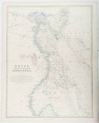
1861177021Edinburgh & London.: William Blackwood & Sons. 1861. Engraved map with original outline hand-colour 57 x 43.8 cm 61.1 x 49 cm sheet central fold very slight edge toning but the map in very good bright condition. First edition. Fine large folding map: the Nile delta and river with attractive original outline colour railways and canals marked and name references to biblical and classical geography. Published for inclusion as map 39 in "Keith Johnston's royal atlas of modern geography" . William Blackwood & Sons. unknown
1893174920New York.: Hunt & Eaton. Circa1893. Printed map in colour elevation shown with hachures 29 x 23.5 cm text on the verso relating to entries for Afghanistan Beluchistan and Turkey prepared for Hunt & Eaton's "New York Recorder's Atlas" small tears to the top edge but in very good condition. . Hunt & Eaton. unknown
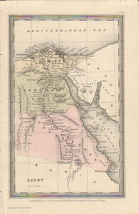
1833174939London.: Published for the Proprietors by Mr. Bull. 1833. Engraved map 14.1 x 8.8 cm original hand colour in very good condition. Fine miniature map with appealing hand colour denoting Lower Central and Upper Egypt. . Published for the Proprietors by Mr. Bull. unknown
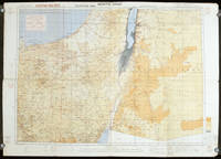
1942207841London.: Royal Engineers. July1942. Printed colour topographical map mounted on linen 56.7 x 79.2 cms; 64.6 x 89. 5 cms sheet original folds edgewear small marginal chips a little dusty but in good condition. Detailed World War II operational map of Egypt and the Middle East issued by 512 Army Field Survey Company of the Royal Engineers. The map is marked "Not to be Published" in the upper right margin. Railways roads camel tracks telegraph lines boundaries altitudes towns and villages are marked. . Royal Engineers. unknown
19782080502106916389Not Available 1978. Soft Cover. Fine. The book is in fine condition. Not Available paperback
20161-3659701874Editorial Académica Española 2016. Paperback. New. 236 pages. Spanish language. 8.66x5.91x0.54 inches. Editorial Académica Española paperback
1969Q-1566950341Natl Geographic Society Maps 1969-12-31. map. New. In shrink wrap. Looks like an interesting title! Natl Geographic Society Maps unknown
1566958717.Gmap. Good. Access codes and supplements are not guaranteed with used items. May be an ex-library book. unknown
74256E-115. Good. Hardcover. 4to. Published by Engineer Truck Company 2 Unknown Location France. No Date c1919 . 3 pages of maps 5 pages of text narrative & 44 full page black & white photo illustrations. Issued without a title page. Bound in red cloth boards with titles present to the front board. Boards have shelf-wear present to the extremities spine is chipped and worn. No ownership marks present. Text is clean and free of marks. Binding tight and solid. Documentation of the World War I tour of Truck #2 of the 23rd Engineers in France. The 23rd Engineer Regiment is a distinguished U. S. Army unit with a rich history most notably serving as "The Road Builders of the AEF" during World War I. Constituted in August 1917 they deployed to France in November 1917 building crucial roads bridges and fortifications for the American Expeditionary Forces AEF.; 8vo 8" - 9" tall . hardcover
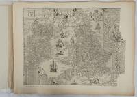
1932176499London.: Royal Geographical Society. 1932. Twenty one loose maps with tissue guards printed on sheets 49.5 x 63.5 cm in the original folio title-wrappers the maps with some edge wear and toning but on the whole in very good condition the wrappers browned and stained torn with minor loss at the foot of the title wrapper small closed edge tears now re-enforced with archival material and sound. Lacking the introductory notes by Edward Heawood. The complete suite of maps: an impressive production. The first map is a general map of England and Ireland by an unknown author 1594; nineteen county maps; and a final sheet of miniature county maps printed as a deck of playing-cards. The county maps proper vary in date from Saxton's “Southamtonia” of 1575 to John Speed's version of Norden's map of Sussex dated 1610. A contemporary reviewer dubbed it " a rich cartographical feast" allowing easy access to rare and valuable maps and comparison of maps by different cartographers for the same county. <br>The county maps reproduced include five by Christopher Saxton three by John Norden Philip Symonson's map of Eastern Kent published in 1596 a series of seven maps dating from the early years of the seventeenth century two maps prepared for Camden and two published by John Speed. . Royal Geographical Society unknown
LD7400c. early 19th century. Hardcover. Very Good. Half cloth and marbled paper over boards handwritten label on upper board; oblong folio 460 x 360 mm; entirely handwritten and drawn in black ink on the rectos only with "tableau des batiments militaires" and 7 maps. Boards heavily scuffed; binding shaken; some dusty finger-smudges here and there. Sold as is. <br/><br/> hardcover