National Geographic MapsBiblio.com
1 660 résultats
20111-0792292952Natl Geographic Society Maps 2011. Map. New. lam map en edition. 1 pages. 36.50x2.00x2.00 inches. Natl Geographic Society Maps unknown
20131-0792289862NATIONAL GEOGRAPHIC MAPS DIVISION 2013. Map. New. rol map en edition. 1 pages. 37.56x4.45x4.06 inches. NATIONAL GEOGRAPHIC MAPS DIVISION unknown
20111-0792289846Natl Geographic Society Maps 2011. Map. New. lam map edition. 1 pages. 25.08x2.20x2.20 inches. Natl Geographic Society Maps unknown
1528311515.Gpaperback. Good. Access codes and supplements are not guaranteed with used items. May be an ex-library book. paperback
Q-156695519XNatl Geographic Society Maps 2019-01-01. Map. New. In shrink wrap. Looks like an interesting title! Natl Geographic Society Maps unknown
1566951828.Gmap. Good. Access codes and supplements are not guaranteed with used items. May be an ex-library book. unknown
20131-0792230345National Geographic 2013. Map. New. map edition. 1 pages. 40.50x5.00x5.00 inches. National Geographic unknown
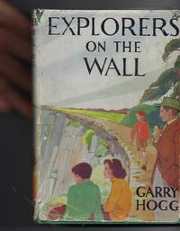
1948100515London: Nelson. Very Good in Good dust jacket. 1948. Second Printing. Hardcover. A scarce title in the Explorers Awheel Series with an extremely scarce dustwrapper. The book is in green cloth boards with white lettering to spine. Maps to endpapers. A prize presentation inscription on blank endpaper ; The Explorers; 8vo 8" - 9" tall . Nelson, hardcover
0282562745.Gpaperback. Good. Access codes and supplements are not guaranteed with used items. May be an ex-library book. paperback
1333901216.Gpaperback. Good. Access codes and supplements are not guaranteed with used items. May be an ex-library book. paperback
19872083002116201223Meiji Maps Georges Sand translated by Yoshitsura Kubomura 1987. Soft Cover. Fine. The book is in fine condition. Meiji Maps Georges Sand, translated by Yoshitsura Kubomura paperback
194New York: G. P. Putnam's Sons1884. First edition. Hardcover book bound in the publisher's original full decorative cloth-gilt. 20.5 cm. 329 pp. Contains four folding maps by Leonard Forbes Beckwith. In near fine condition. No ownership marks/writing present within. Hinges tight pages bright. Light edge wear to the cloth covers. hardcover
192729334HBDJ VG/VG- 1927 on Title pg 1ST edition Hardcover. Condition: Fine-. Dust Jacket Condition: Very Good. SMALL Dark burgundy cloth with Gold gilt Spine Cvr. Hinges & Binding strong. . 12mo 188 pg INDEX o/w VG Copy in dusty but o/w VG DJ with Spine DJ endchips. Hard Cover. FINE-/Very Good. 12mo Ghostly Castles Seat of its 1st Kings St. cloud St. Germaine MalmaisonVersailles Fountainebleau ETC<br /><br /> Robert McBride NY hardcover
1919061262New York: Frederick A. Stokes Co. 1919. Book. Near Fine. Hardcover. 1st Edition. 12mo - over 6¾" - 7¾" tall. Blue cloth spine panel lettered in orange color front and back cover pastedown illus. Text block edges typically somewhat tanned with minor loss along top edge/corner of cover pastedown otherwise only slight wear. Color illus. dust jacket shows area of loss along top front edge minor loss to corners several closed tears and rubbed joints/folds now in mylar. xii371 pp. illus. Frederick A. Stokes Co. Hardcover
19201203080035Government Printing Office 1920. Paperback. Very Good. 8vo. Softcover. Good binding and cover. Chipping and loss to tail of spine. Minor wear to extremities. 95 p. 1l. : 16 pl. fold. maps diagrs. part fold. ; 24 cm. Contents: pt. 1. Period of organization; pt. 2. Operations; pt. 3. Supply coordination munitions and administration; pt. 4. Mscellaneous subjects. Clean unmarked pages with minimal toning. Foldout maps in crisp clean condition with no tears or excessive wear. Please feel free to view our photographs. Government Printing Office paperback
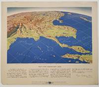
1944200808Remington Rand. 1944. Five printed colour maps each: 31.4 x 47 cms; 46.3 x 53.3 cms sheet central fold marginal edge wear chips and a few small edge tears tidemark affecting the ocean at the outer edge of Map VII but all the maps in very good condition. From a series of World War II battlefront maps "for the delight of arm-chair strategists" published by the Library Bureau of Remington Rand seven were published. Taken from a bird's eye view of the globe and with relief artistically rendered by artist Kenneth Thompson 1907-1996 and descriptive text by George Fielding Eliot 1894-1971. Eliot spent his youth in Australia attending Melbourne University serving with distinction in the Australian Infantry in WWI. Moving to the United States after a short stint in Canada serving with the RCMP her served as a reserve officer in the U.S. Army reserve in military intelligence from 1922 to 1933 and during WWII Eliot famously broadcast the first extended television coverage following the attack on Pearl Harbor. He continued to write books and articles about military strategy and world politics into the 1960s. <br> <br>In keeping with the "aviation-age" cartography of Richard Edes Harrison the unusual perspective of the maps--from above and often with a direction other than north at the top of the map--challenges the viewer to reconsider the geopolitical situation with the text of Eliot as a further prompt his captions below: <br> <br>Map III Italy & South France "Hannibal Caesar and Napoleon made their reputations here" <br>Map IV The Western Front "Will the cockpit of 1918 see the decisive battles of 1944" <br>Map V Southeastern Asia "The road to Mandalay -- and to China --along which bombs for Tokyo must travel" <br>Map VI The Southwest Pacific "Island-hopping toward Japan -- in short and long hops" <br>Map V11 The North Pacific "Here the enemy trusts in the protection of vast ocean distances" . Remington Rand. unknown
Q-1566955157National Geographic Maps 2019-01-01. Map. New. In shrink wrap. Looks like an interesting title! National Geographic Maps unknown
GOR006137461Paperback. Very Good. paperback
GOR007260323Paperback. Good. paperback
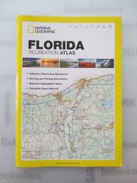
20122412P-48999A-1308CNational Geographic Maps 2012-10-01. paperback. Very Good. 9x0x15. This Book is in Very Good condition. See our picture for exact item you will receive. All items ship within 24 hours. Packaging is 100% Recyclable. Most items purchased from Charitable organizations. A portion of each sale is also donated to a monthly charity check your package for this month's charity. Reuse-Recycle-Rebook! National Geographic Maps paperback
2012TA250505077Y03National Geographic Maps 2012-10-01. paperback. Very Good. 9x0x15. Paperback--cover shows slight wear otherwise excellent condition National Geographic Maps paperback
ANAIS-1597755222National Geographic Maps. paperback. Good. 9.5X6.5X1.5. Buy with confidence. Excellent Customer Service & Return policy. National Geographic Maps paperback
2012CL260202005Z7National Geographic Maps 2012-10-01. paperback. Very Good. 8x1x11. Paperback--excellent condition National Geographic Maps paperback
2012SONG1597755222Universal Map 2012-10-01. 2012. paperback. Used: Good. 9.88x0.39x15.20. Buy with confidence. Excellent Customer Service & Return policy. Universal Map paperback
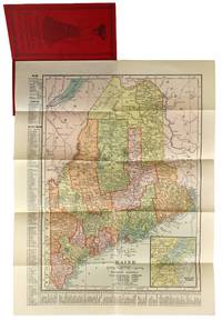
190447779New York: C.S. Hammond & Co 1904. Very Good . New York: C.S. Hammond & Co. 1904. Fold-out map of Maine in red pictorial wrappers 33x26 cm. Wrappers gently creased and dust soiled with mild water damage and previous paperclip ghosting. Interior has calendars for 1905 and 1906 and another ad for R. M. Lewsen & Co which matches the exterior proclaiming they are the largest cloak store and leading millinery store in Maine. Map folded with only light toning. A Very Good or better example. C.S. Hammond & Co unknown