1 660 résultats
1990045014Essex Ca: Tales Of The Mojave Road Publishing Company 1990. 1st Edition 1st Printing. Hardcover. Near Fine. 303 Pp. First Printing. Gold Cloth Stamped In Brown. First Printing. Very Near Fine. <br/> <br/> Tales Of The Mojave Road Publishing Company hardcover
1333403909.Gpaperback. Good. Access codes and supplements are not guaranteed with used items. May be an ex-library book. paperback
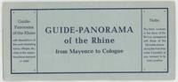
1960000015404Mainz: W. Suder 1960. Later edition. Wraps. Near Fine. 24.5 cm x 11.5 cm folded in the wrappers. Map bound in the leporello style. Blue paper wraps printed in dark blue. A colorful map with captions printed in black in 16 folds. A map similar to this one was first published earlier in the twentieth century by a different press. The captions are in English. Castles and other landmarks from Bonn Cologne Linz Krahnenburg Koblenz and from several other suburbs and towns on the Rhine river are pictured and discussed in the map's margins. Light wear to the wraps else a sharp example. W. Suder unknown
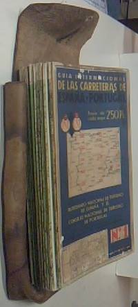
$A34816.- Barcelona . 1970. Publicitas. 48x104 desplegados. 1 tomo. 14 mapas color. Estuche de cuero con marcas. Muy buen estado general. . . Geografía / Mapas Cartografía unknown
196426130Gypsy Jaunts. Reseda CA Andrew M. Griffin 1964 SOFTCOVER 1964 1st Edition NF/GOOD AS-IS SOFTCOVER Pages are bound into three ring binder. White Binder with Gold Gilt has Slight creases is lightly soiled & has edge wear. Interior is clean and all the pages are free of tears.Special Advance Issue - Set No. 1. 5 1/2 in X 8 3/4 . .The fun and adventure experiences featured in "Gypsy Jaunts" are with a few exceptions absolutely free of any costs except the cost of gasoline for your car Includes Beales Cut The Dump Steckel Park Gaviota Beach Lytle Creek Canyon Kern County Pioneer Village UCLA Northwest of Idyllwild Port of Long Beach Santa Barbara Proctor & Gamble Factory Tour 3 Rings Horse Ranch Ramona Land Tucker Bird. Signed by Author. First Edition. Soft Cover. Gypsy Jaunts., Reseda, CA Andrew M. Griffin paperback
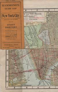
191341637New York: Wehman Brothers Publishers 1913. Very good. An impressive color map of the island of Manhattan and the Bronx. Scale is 1" equals 1/2 mile and includes railroads subways elevated railroads surface railroads and proposed railroads. An uncommon early 20th Century New York City street map. Folding color map. Measuring approximately 18" x 36" when unfolded. In original printed card wrapper. Verso a thorough printed street index. Mild handling wear toning. A few tiny holes near fold corners. Overall well preserved; very good. Wehman Brothers Publishers unknown
191363117New York: C.S. Hammond & Co. Schum Bros. Stationers and Printers 1913. 12mo. 3.5 x 7.5 double-sided colour lithograph map which folds out to 25.25 x 16.5 in. on 28 x 17.75 in. sheet very light dustsoiling slight shelfwear very slight age toning along the folds. Original printed gray-blue pocket portfolio folder blue lettering on recto & verso added affixed label of Schum Bros. over imprint minor age toning still a VG bright clean map. First edition thus of this very scarce Brass Era automobile travel map depicting Manhattan and portions of Long Island from Brooklyn across to Smithtown and Great River. Verso Map includes Long Island fro Great River up to Darlington across to Truman Beach and Bridgehampton with two inset maps: “Contination of North Shore†and “Continuation of South Shore†with “Good Roads†and “Fair Roads†differentiated as well as depiction of the Long Island Railway line and red dots tracing the electric interurban lines. As early as 1906 Hammond & Co. had produced a map for Good Roads enthusiasts and motorists but this updated issue documenting the improved roads was issued in 1913 and then regularly from 1914-1925. No copies in Worldcat. C.S. Hammond & Co., Schum Bros., Stationers and Printers, unknown
GOR007357030Paperback. Good. paperback
18705388<p>Gall & Inglis' 1870's-1880's. Paperback. Very good. VGC.Gall & Inglis'.No date given but probably 1870's to 1880's prior to London Tower Bridge build which is not included on the map.Green hardbacksmall dentsnicks and light shelf wear on the cover with folded map in VGC.The map is in VGC but with small stain marks and foxing marks on the edgessmall tear on the edge of the map.The map is hand coloured and includes:RailwaysRailway StationsSteamer RoutesOmnibus and Tramway RoutesParks.The size of the map is: 30x20 inch.The scale of the map is: 3 3/4 to 1 mile.The map covers: From Hyde Parkincluding parts of Kensington Palace to Blackwall and from Mildmay Park to South Lambeth.The map is in VGC for its age. A collectable and scarce map.</p> Gall & Inglis' paperback
1330157737.Gpaperback. Good. Access codes and supplements are not guaranteed with used items. May be an ex-library book. paperback
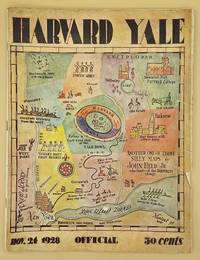
66643Yale University Athletic Association. Good. 160pp. Thin quarto 31 cm The front wrap is detached but present. The rear wrap is absent. Two small closed tears to the fore-edge of the front wrap. Scarce. Cover art by Utah artist John Held Jr.<br /> <br /> Utah Artist John Held Jr. 1889-1958 was a prominent illustrator of the 1920s and 1930s. He began by drawing sports and political drawings for The Salt Lake Tribune when he was just 16 years old. Held moved to New York City in 1910 where he went on to gain notoriety for his drawings in the popular magazines "Life" "The New Yorker" "Vanity Fair" "Judge" and "College Humor." His work epitomized the Jazz Age. He is most recognized for creating the short-haired "flapper."<br /> <br /> The cover of this publication features one of Held's maps. Held's maps illustrate the diversity of his art while at the same time serving to demonstrate Held's interpretation of various notable places and things. Kori Alexander writes in his article entitled Relevant Magic in the Art of John Held Jr. "While it was Held's caricatures of the young college chaps and flapper girls that earned him public notoriety it was his linoleum cuts and pen and ink maps that fortified his legitimacy as a social commentator." Virginia Commonwealth University website. Yale University Athletic Association unknown
19602817Doubleday Garden City 1960. HBDJ minor rub & chip on edges dj 1960 1st edition 2 IN. piece missing from back dj VG/VG-. Signed by Author. Hard Cover. Doubleday, Garden City hardcover
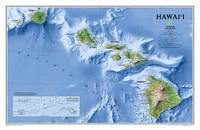
20121-0792250036Natl Geographic Society Maps 2012. Map. New. lam map edition. 1 pages. 24.00x2.00x2.00 inches. Natl Geographic Society Maps unknown
3865740278.Gmap. Good. Access codes and supplements are not guaranteed with used items. May be an ex-library book. unknown
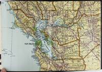
19282443San Francisco and Los Angeles: The Heald-Menerey Company 1928. Very good. Large color map measuring 44 x 64 inches cut into eight sections and folded into book form. Original black limp textured cloth yapp edges titled in pale yellow on front cover. Moderate edge wear titles on front cover almost completely worn away. Internally clean. A rare portable version of the large and impressive Heald-Menerey's Geographical Commercial and Recreational Map of California produced in the late-1920s. According to the sheet of instructions bound before the map: "The first of its kind ever devised for desk home or automobile use. It consists of the California Survey 44 x 64 inches in size cut into eight strips and folded to make a book of 64 pages. Page No. 1 is the extreme northwest corner of our Survey and page No. 64 is the extreme southwest corner." The instructions proceed to inform the user on how to locate points on the map given its form as a book. The verso of the instructions page is a county index keyed to the pages of the map. The cover title begins "California Survey" but the remainder is rubbed beyond readability.<br /> <br /> The map was produced by the Schmidt Lithograph Company of San Francisco. The legend of the map contains symbols representing roads trails railroads streams springs swamps aqueducts lighthouses county and state boundary lines national forests mountain peaks township and range lines base and meridian lines and more. There are also two inset maps - one showing San Francisco and vicinity and the other Los Angeles and its immediate surroundings. OCLC records just a handful of copies of this book-form map published between 1928 and 1933. The Heald-Menerey Company unknown
1743071833.Gpaperback. Good. Access codes and supplements are not guaranteed with used items. May be an ex-library book. paperback
1977FF0775T & A. D. Poyser 1977-01-01. 1st Edition. Hardcover. Very Good/Good. 9x6x1. THE Author has made a study of the Hen Harrier over many years and his field notes and sketch book of this exceptional bird of prey go back to the 1940's. The book opens with the world distribution of the harrier family then there is a fuller treatment of the Hen Harrier in Europe and North America the Marsh Hawk its history and present status. Further chapters detail hunting methods and prey selection the breeding cycle migration and distribution. The Jacket has a clear protective cover on it. T & A. D. Poyser hardcover
1977SKU1037248T & A. D. Poyser 1977. hardcover. Very Good. 9x6x1. T. and A. D. Poyser Pitman Press; Berkhamsted 1977. Hardcover. A Very Good blue cloth binding with gilt lettering on spine binding sturdy and intact some discoloration/sunning along board and spine edges dent bottom front board edge trace scattered foxing top text block edge some age toning to pages previous owner handwritten ink name top front free endpaper in a Very Good some handling/scuff marks to panels mild edge/corner wear spine fade couple of faint creases bottom front flap Mylar protected Dust wrapper. A nice and clean copy. 8vooctavo or approx. 6 x 9 inches 307pp. appendix bibliography tables indexed b&w illustrations. We pack securely and ship daily with delivery confirmation on every book. The picture on the listing page is of the actual book for sale the glare in the photograph is from the Mylar. Additional Scans are available for any item please inquire. T & A. D. Poyser hardcover
1945HVD-23715-A-0Creative Age Press. Good in Good dust jacket. 1945. First Edition. Hardcover. Dust cover has noticeable tears. Yellowing to pages. Spill stain to edge of pages. - Good overall condition. General wear. No major blemishes. No writing. ; - We're committed to your satisfaction. We offer free returns and respond promptly to all inquiries. Your item will be carefully wrapped in bubble wrap and securely boxed. All orders ship on the same or next business day. Buy with confidence. . Creative Age Press hardcover
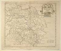
64216London.: Gibson. Early 18th Century. Black and white map from Camden's Britannia showing towns roads rivers and landforms 38 x 46.5 cm. . [Gibson.] unknown
323822The Folio Society 1992. Imp 8vo illus cl bds gilt lettering & ornament to leather spine upper pg edge stained red illus map eps frontispiece xxi 632 pp. plates counted all present VG light soiling/rubbing to spine light rubbing to bords & extrems minor foxing to pg edges in slipcase with gilt ornament to front and back cover VG light chaffing to covers & spine light brusing to exrems & front cover The Folio Society 1992 hardcover
1865005401.Gspiral_bound. Good. Access codes and supplements are not guaranteed with used items. May be an ex-library book. unknown
19432083002116200857Oriental Maps Nomura Yukichi 1943. Soft Cover. Fine. The book is in fine condition. Oriental Maps Nomura Yukichi paperback
F3-KKRA-KN67Hardcover. Very Good. Jacket is Good with moderate wear and tear book is Very Good with light wear clean yellowed pages firm binding. hardcover
8170530660.Gpaperback. Good. Access codes and supplements are not guaranteed with used items. May be an ex-library book. paperback