National Geographic MapsBiblio.com
1 660 résultats
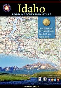
20159780929591063-2025National Geographic Maps 2015. Paperback. New. <p><strong>Author:</strong> National Geographic Maps</p><p><strong>Publisher:</strong> National Geographic Maps</p><p><strong>Binding:</strong> Paperback</p><p><strong>ISBN:</strong> 9780929591063</p><p><strong>Release Date:</strong> 2015</p><p><strong>Number Of Pages:</strong> 96</p><p><strong>Details:</strong> Idaho's boundless recreational opportunities and varied scenery is skillfully captured in Benchmark's Idaho Road and Recreation Atlas. Landscape Maps™ show the full range of topography: from the forest stands of the panhandle the mountainous backlands of central Idaho to the plains and prairies in the south. The Recreation Guide features complete fishing information hunting units and listings of campgrounds and RV parks.Map Scale = 1:250000</p> National Geographic Maps paperback
20159780929591063-2025National Geographic Maps 2015. Paperback. New. <p><strong>Author:</strong> National Geographic Maps</p><p><strong>Publisher:</strong> National Geographic Maps</p><p><strong>Binding:</strong> Paperback</p><p><strong>ISBN:</strong> 9780929591063</p><p><strong>Release Date:</strong> 2015</p><p><strong>Number Of Pages:</strong> 96</p><p><strong>Details:</strong> Idaho's boundless recreational opportunities and varied scenery is skillfully captured in Benchmark's Idaho Road and Recreation Atlas. Landscape Maps™ show the full range of topography: from the forest stands of the panhandle the mountainous backlands of central Idaho to the plains and prairies in the south. The Recreation Guide features complete fishing information hunting units and listings of campgrounds and RV parks.Map Scale = 1:250000</p> National Geographic Maps paperback
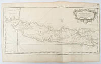
1750136782circa1750. Black and white copperplate engraving map of Java a little light even browning neat colour pencil highlighting of rivers and two settlements. Folded as issued. Good copy. 26 x 44cm. Issued in Prevost's Histoire Générale des Voyages ou nouvelle collection de toutes les relations de voyages par mer et par terre. . unknown
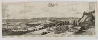
1720180201A Leide. Leiden.: Chez Pierre van der Aa. circa1720. Engraved panorama on watermarked laid paper 28.5 x 77.5 including captions; 31 x 79.5 cm sheet title cartouche engraved key in French and Dutch the upper margin trimmed to the platemark original folds edgewear and toning neat sealed tear to the outer edge barely visible 5mm intrusion to the image a very good dark impression. Finely composed and engraved panorama of Tokyo prepared for the monumental work "Galerie Agreable du Monde" by the master Dutch publisher Pieter Van de Aa 1659-1733. The detailed key in Dutch and French notes myriad buildings and temples on the horizon and in the foreground two processions converge: of nobles and their attendants dancers a trio of dogs and a priest or religious attending a suppliant. <br> <br>Pieter van der Aa 1659-1733 was born in Leiden Holland and started his own book publishing business when he was only twenty-three. His prolific output of highly decorated maps and atlases culminated in his magnum opus “Galerie Agreable du Monde” which illustrated the world known to Europeans in the early eighteenth century. Comprising 66 volumes it was the of plates published at that time it has been estimated that only 100 copies were published. . Chez Pierre van der Aa unknown
1330169999.Gpaperback. Good. Access codes and supplements are not guaranteed with used items. May be an ex-library book. paperback
19772091202132900025Not Available 1977. Soft Cover. Fine. The book is in fine condition. Not Available paperback
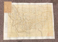
192020799Chicago & New York: Rand McNally & Co 1920. 12mo. 32 pp text; large color folding map 20 1/2" x 27 1/2"; printed on both sides. The front side shows railroads electric lines counties cities towns villages post offices lakes rivers etc. The verso shows the Montana automobile road map. Montana is home to two of the country's most beautiful and iconic National Parks - Yellowstone and Glacier. Printed stiff brown wrappers in fine condition; 3 short closed tears along lower edge of map. Rand McNally & Co unknown
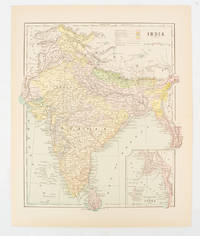
1910174839New York. circa1910. Printed colour map 29 x 25 cm with inset map of the Eastern Part of India colour key reference key to the ruling divisions current and projected railways and telegraphs also shown central fold slight toning; in very good condition. Interesting map shaded by Divisions: the Presidencies of Bengal Madras Bombay Ceylon "Native States under British Protection" and "Independent States" Nepal and Bhutan. . unknown
20121-1597750670Carto Direct 2012. Map. New. lam map edition. 1 pages. 24.00x2.00x2.00 inches. Carto Direct unknown
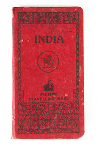
121332London Geoge Philip & Son Ltd. N.d. c. 1920 . Folding colour printed map laid on linen and housed within a red cloth case worn. Some small splits at the folds size when open: 67.5 cm x 54 cm.<br /> <br /> London, Geoge Philip & Son Ltd. N.d. c. 1920 hardcover
1904766048.Gpaperback. Good. Access codes and supplements are not guaranteed with used items. May be an ex-library book. paperback
1904766161.Gmap. Good. Access codes and supplements are not guaranteed with used items. May be an ex-library book. unknown
1841398535.Gpaperback. Good. Access codes and supplements are not guaranteed with used items. May be an ex-library book. paperback
2002Q-1841398608Compass Maps Ltd 2002-05-01. Paperback. New. New. In shrink wrap. Looks like an interesting title! Compass Maps Ltd paperback
19412083002116203428Oriental Maps Tokuno Bunji Takashina Junji 1941. Soft Cover. Fine. The book is in fine condition. Oriental Maps Tokuno Bunji Takashina Junji paperback
SKU0594671Elsevier 2019-11-25. paperback. Good. 7x0x9. Textbook May Have Highlights Notes and/or Underlining BOOK ONLY-NO ACCESS CODE NO CD Ships with Tracking Elsevier paperback
SKU0642178Elsevier 2019-11-25. paperback. New. 7x0x9. New Textbook Ships with Tracking Elsevier paperback
SKU1748060Elsevier 2019-11-25. paperback. New. 7x0x9. New Book Ships with Tracking Elsevier paperback
2000Q-044306265xChurchill Livingstone 2000-08-10. Paperback. New. In shrink wrap. Looks like an interesting title! Churchill Livingstone paperback
2007Q-0443074291Churchill Livingstone 2007-11-21. Paperback. New. In shrink wrap. Looks like an interesting title! Churchill Livingstone paperback
ria9780702074936_inpPaperback / softback. New. New Book; Fast Shipping from UK; Not signed; Not First Edition; N/A paperback
195528769HOLIDAY HOUSE BOOK 1955. VG 1955 DUSTJACKET ONLY NO BOOK DJ ONLY LITE DJ RUB & Wear A Most Remarkable Nation surviving from Ancient Times Persia is now Iran Emerging from Poverty without having Lost any of Her Love of Art Poetry & Fragrant Gardens. Unbound. Illus. by Rafaello Busoni . HOLIDAY HOUSE BOOK paperback
26975'Published by Survey Directorate G.H.Q. Paiforce 1944. All one page 20 x 33cms some stained but texts clear and complate. 1. Index map of Iraq and Iran for a 1:100000 scale survey series produced by the British military command PAIFORCE during World War II. All 20 x 32.5cm a couple sl. stained mainly good condition.1.Four Index maps of Iraq and Iran ¼ series I.D.R./X.D.R./G.S.G.S. 9002 3919 nos. 1-42.Index map of Iraq and Iran for a 1:100000 scale survey series produced by the British military command PAIFORCE during World War II. Index Map of 'Irq rn 1:100000 Series I.D.R. 9003'.3.Four Index Maps of places/areas of IRAN:a. Ahwaz 1:10000 series 1D MISC/563 to 573 stamped 11 June 1944b. Askaran and Sanandaj N.W. 1:25000 series …9005 stamped 25 June 1944c. Gach-I-Sar 1:50000 series stamped 11 June 1944d. Khurramshahr Abandan 1:12500 series4.Six Index Maps of places/areas of IRAQ all 1:25000 series ID 9005:a. Ba'qubab. Faidahc. Haffad. Hindiyae. Falluja f. MoselNo reference to other copies yet found. 'Published by Survey Directorate, G.H.Q. Paiforce [1944] unknown
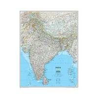
20101-1597752568Natl Geographic Society Maps 2010. Map. New. lam map edition. 1 pages. 30.30x1.30x0.10 inches. Natl Geographic Society Maps unknown
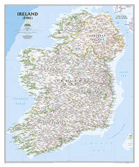
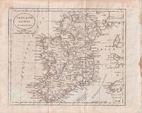
1796176602circa1796. Engraved map 18.3 x 22 cm 21.7 x 27 cm sheet original folds age toning and some offsetting inner edge darkened and discoloured but the map in good condition. Finely engraved map showing Ireland divided into counties lower coast of Scotland and Wales and the Isles of Man and Anglesea; also noting Nymph Bank 'discovered in 1735 by Capt. Doyle.' . unknown