National Geographic MapsBiblio.com
1 660 résultats
Q-1566955351Natl Geographic Society Maps 2019-01-01. Map. New. In shrink wrap. Looks like an interesting title! Natl Geographic Society Maps unknown
GOR008884725Paperback. Very Good. paperback
0540086371.Gspiral_bound. Good. Access codes and supplements are not guaranteed with used items. May be an ex-library book. unknown
GOR003375157Paperback. Acceptable. paperback
GOR001576744Paperback. Very Good. paperback
20121-0792250273NATIONAL GEOGRAPHIC MAPS DIVISION 2012. Map. New. lam map edition. 1 pages. 23.82x1.81x1.18 inches. NATIONAL GEOGRAPHIC MAPS DIVISION unknown
1875992960.Gmap. Good. Access codes and supplements are not guaranteed with used items. May be an ex-library book. unknown
1553415590.Gmap. Good. Access codes and supplements are not guaranteed with used items. May be an ex-library book. unknown
1954058667New York Ny: Jack And Charlie's "Twenty-One" / "21 1954. 1st Edition . Hardcover. Near Fine. 71 Pp. Red Cloth Gilt And Stamped In Blind. #343 Of A Limited Edition Of 1000 Copies. Lightly Used No Fraying Or Stains Gilt Brilliant. Ownership Stamp Of Fred Herrington 1898-1971 A California Lawyer Whose Collection Of Menus Is Held At Uc Davis. <br/> <br/> Jack And Charlie's "Twenty-One" / "21 hardcover
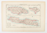
1900174875London and New York.: Encyclopedia Britannica. circa1900. Map in three insets after W & AK Johnston engravers with printed outline colour 18.9 x 28.9 cm central fold paper age-toned but in very good condition. Interesting map which first appeared in the ninth edition of Encyclopedia Britannica. . [Encyclopedia Britannica] unknown
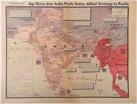
1944214362Los Angeles.: Los Angeles Examiner. April 31944. Colour pictorial map on a single newspaper leaf 37 x 50 cms; 41.5 x 54.6 cms sheet unrelated text on the verso although with an interesting account from a soldier's letter about an air raid in China toning more marked at the central fold two small splits no loss to the map edge wear with several small marginal edge tears neatly repaired on the verso with archival washi map unaffected in good condition. A dynamic map prepared and illustrated by the Examiner's art critic and editor Howard Burke covering the area surrounding India and Central Asia showing Japanese conquered territory in Malaya Thailand Indo-China and Burma; and in India British-controlled states and native feudal and protected states. <br> <br>Text boxes and pictographs give an overview of the geopolitical situation from the Allied perspective. One box notes "Chanda Bose has many adherents and fanatical followers in Bengal. They may prove to be a powerful fifth column in India". Text at lower edge opines "The situation in India is critical and has grown more so as the all-out offensive against Japan has been delayed. If the Allies do not act at once and with great force all our gains may be wiped out and the war in the Pacific prolonged indefinitely." <br> <br>The decisive and devastating bombings that were to signal such an end were four months away. <br> <br>Rare on the market. . Los Angeles Examiner. unknown
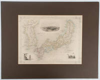
1850177528London.: The London Printing and Publishing Company. circa1850s. Lithographed map with original outline hand colour 25.8 x 33.5 cm three vignette illustrations decorative border central fold in very good condition presented in a window mount. Attractive decorative map with three vignettes by Rapkin: Yedo; a State barge in sail with penants flying--the paired oarsmen depicted through 10 small windows below deck; and Koreans in traditional costume; the map after the great mapmaker and publisher John Tallis. <br> <br>From the estate of the late collector and scholar Arthur Hacker with his pencilled catalogue mark on the verso. . The London Printing and Publishing Company. unknown
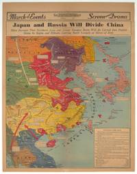
1940209821Los Angeles.: Los Angeles Examiner. 1940. Printed colour pictorial map on a single newspaper leaf 42.3 x 39.9 cms; 54.3 x 42.5 cms sheet archivally laid down on linen slight discoloration to lower centrefold and sheet slightly age-toned but in very good condition. A striking geopolitical map by Los Angeles Examiner artist Howard Burke covering China Japan Southern Russia and the northern part of French Indochina and Siam showing how the "Aggressors Divide China." Areas under Japanese occupation are shown in red and their naval blockade shown by an arc of naval vessels with vivid arrows indicating lines of supply. Text labels including sources of agricultural and raw materials provide a dynamic overview of the geopolitical situation and show the influence of American scientific illustrator and cartographer Richard Edes Harrison who argued for examining geographic issues from multiple perspectives and Los Angeles Times artist Charles Owens. . Los Angeles Examiner. unknown
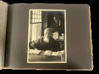
1930223021930. Japan travel photograph album. 1930s. This album documents Western travel through Japan during a period of expanding imperial influence and managed international tourism recording temple architecture theatrical performance and curated cultural sites alongside limited family portraiture. The photographs provide primary visual evidence of how foreign visitors encountered Japan through established travel circuits that emphasized religious monuments scenic landscapes and staged cultural forms while also including a labeled image from Korea that situates the journey within the geography of Japanese colonial rule.<br /> <br /> Album containing 22 silver gelatin photographs each mounted one per page with white ink captions identifying locations including "Nikko" "Kyoto" "Shochiku-za" "Koya San" "Akashi" "Takao" and "Korea." Three photographs depict members of a Western family posed in studio and outdoor settings including portraits in front of temple gates and residential entrances. The remaining images focus on architectural and cultural sites including temple facades with detailed ornamentation mountain and waterfall landscapes and a staged theatrical performance at the Shochiku-za theatre in Osaka showing performers in elaborate costume and makeup. One photograph labeled "Korea" depicts seated women wearing hanbok indicating travel beyond the Japanese home islands. The photographs are consistently sized at approximately 5 x 7 inches and mounted in an album measuring approximately 8.5 x 12 inches bound in cloth boards with decorative striping and cord binding.<br /> <br /> The album was produced during a decade when Japan promoted domestic and imperial sites as destinations for foreign travelers integrating religious landmarks urban infrastructure and colonial territories into a coherent tourist experience. Sites such as Nikko and Koya San were presented as emblematic of national heritage while theatrical venues and scenic locations formed part of structured itineraries. The inclusion of Korea reflects the extension of these travel routes into occupied regions where colonial subjects and landscapes were incorporated into representations of the empire. Photographs remain clear with strong contrast; minor wear to album consistent with handling; overall very good. A focused visual record of Western travel in 1930s Japan documenting how cultural sites and imperial geography were presented to foreign visitors. unknown
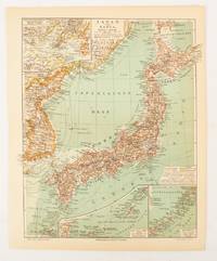
1902174898Leipzig.: Bibliographisches Institut. 1902-1908. Map printed in colour 27.2 x 21.4 cm inset colour key to territorial administration by country inset "western continuation of the main chart" including the Gulf of Tschili and Tsientsin and two insets at the foot of the map to the Kuril and the Ryuku Islands text in Geman central fold slight edge toning but in very good condition. Attractive map text in German prepared for Meyers Großes Konversations-Lexikon. . Bibliographisches Institut unknown
19882083002117402793new person oraisha 1988. Soft Cover. Fine. Volume: 1 new person oraisha paperback
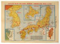
1945208877Chicago.: Chicago Daily Tribune. August1945. Printed colour pictorial map on a single newspaper leaf 37 x 52 cms; 43 x 59.5 cms sheet three inset maps archivally laid down on linen very good condition. Full page map published in the "Chicago Daily Tribune" after the bombing of Hiroshima and Nagasaki prior to occupation by US and Allied forces in September 1945. "This is a new map of the main islands of Japan where American occupational troops will land and establish their military rule." map text The legend notes "Places bombed by U.S. Air Forces with a red circle" and "Cities bombed by Atomic Bomb" with a red star. The main map shows the Japanese islands of Honshu Shikoku and Kyushu with the Korean peninsula. Inset maps show Hokkaido Formosa and a general map of the area. . Chicago Daily Tribune. unknown
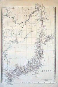
1852185246London.: Cassell Petter & Galpin. circa1852. Map with outline handcolour 42.5 x 30.1 cms; 49.2 x 34.3 cms sheet margins a little toned small corner crase but in very good condition. Very detailed map of the Japanese islands with Sakhalin above and the coast of Manchuria and Korea. . Cassell, Petter & Galpin. unknown
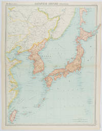
1922215880Edinburgh.: John Bartholomew & Son Ltd. 1922. Large double page map 54.2 x 43 cms map original fold some edge toning and to the fold but in very good condition. Large map prepared as plate 65 for “The Times Survey Atlas of the World” in 1922 and was prepared at the Edinburgh Geographical Institute under the direction of J G Bartholomew. The map shows Japan's territory inclusive of Korea southern Sakhalin and Taiwan. . John Bartholomew & Son Ltd. unknown
19872083002116202660Meiji Zuko Tokushima Japanese Language Education Practice Research Society 1987. Soft Cover. Fine. The book is in fine condition. Meiji Zuko Tokushima Japanese Language Education Practice Research Society paperback
19862091202132900086Not Available 1986. Soft Cover. Fine. The book is in fine condition. Not Available paperback
19612080502106910491Not Available 1961. Soft Cover. Fine. The book is in fine condition. Not Available paperback
18738669Paris 1873. French naval chart sheet 3245 sheet size 51 x 36 cm engraved by Régnier after a British Admiralty chart of 1871 black and white blank verso. Akkeshi Bay located in Kushiro Subprefecture on the east coast of Hokkaido the most northerly of the main islands of Japan. Map unknown
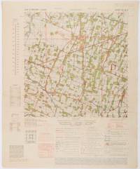
1945200411Washington D.C.: Army Map Service. First edition - revised AMS4. 1945. Army survey map printed in colour 36.7 x 36.7 cm; 58 x 48 cm sheet conversion graph glossary and administrative index to the inner margin; scale three column legend index to adjoining sheets and notes re grid references and mean declination to the foot; sheet toned a very few edge tears the map in very good condition. Wartime map produced by the US Army Map Service AMS who formed in 1942 and were at the forefront of military mapping campaigns during WWII and the post-war years. The very detailed map shows residency and administrative boundaries transportation ground and water features vegetation cultivation ruins religious sites "Graves; Chinese native" and "Cemetery; heathen Christian" walls hedges populated places built-up areas and buildings with those of iron stone wood and bamboo differentiated by colour; fishponds plantations and much more. . Army Map Service. unknown
156695861X.Gmap. Good. Access codes and supplements are not guaranteed with used items. May be an ex-library book. unknown