1 660 résultats
21683857-nnew. unknown
19692080502106916718Not Available 1969. Soft Cover. Fine. The book is in fine condition. Not Available paperback
DG-26-91939499696Hardcover. Good. First Edition First Printing. No dust jackets. Clean and tight. hardcover
1970B-Shelf-08152022-cjb018Charles Scribner's Sons 1970-01-01. Hardcover. Very Good. 8x6x1. Ships quickly. 3 Vol set as shown. Pages in Cover in VG condition. DJs have fluttered edges and a few small tears consistent with normal use. Mild shelf/reading wear. Orphans Treasure Box sells books to raise money for orphans and vulnerable kids. Charles Scribner's Sons hardcover
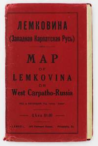
19295372Philadelphia: Lemko Press 1929. Very good. Lithographed folding map approximately 32 x 40 inches printed in pink and black. Housed in original red wrappers printed in black. Modest wear along folds a couple of small separations at crossfolds light marginal toning. Wrappers with minor spine and edge wear. An extremely rare map of "Lemkovina" the homeland of the Lemko an Eastern Slavic people from the Central Carpathian Mountains where Poland Slovakia and Ukraine meet in the present day. From the late-19th century to the 1920s tens of thousands of Lemkos immigrated to the Unites States and Canada -- fleeing war oppression and seeking better economic opportunities. Once in the United States Lemko intellectuals founded institutions to preserve and promote Lemko culture in the New World and to lobby for sovereignty of the Lemko homeland. The present large-format map is an intriguing artifact of the Lemko-American immigrant experience. The map was drafted by the Lemko-American activist Dmitriy Vislocky and published by the Lemko Press in Philadelphia in 1929; it showcases the areas where the Lemko population prevailed as well as areas of mixed Lemko-Slovakian and Lemko-Polish demographics; while it does not explicitly define Lemkovina as a sovereign state its rhetorical direction is nevertheless clear.<br /> <br /> The Lemko are an Eastern Slavic people who originate from a large area along both slopes of the Central Carpathian Mountains in a region traditionally often referred to as "West Carpatho-Russia" located along the eastern stretch of today's border of Poland and Slovakia and extending slightly east into Ukraine. The Lemko language is akin to Ukrainian and is written in Cyrillic. Traditionally many consider the Lemkos to be a subgroup of Russians or Ukrainians although many Lemkos have tended to self-identify as a distinct ethnicity. The Lemkos have vibrant and sophisticated cultural traditions with distinct music folklore clothing and customs. Most Lemkos are Eastern rite or Byzantine-rite Catholics although some have converted to the Eastern Orthodox faith. The period leading up to during and after World War I was traumatic for the Lemkos. The group splintered their loyalties with some supporting the Russians both Red and White factions while others were sympathetic to Ukrainian nationalism and some either voluntarily or under coercion were allied with Austria-Hungary. Lemkos caught on the wrong side of events often met with cruel fates. In the aftermath of the war Lemkos who supported the Red Russians formed the "Lemko-Rusyn People's Republic" which existed from December 1918 to March 1920 a state that took in part of the northern slope of the Central Carpathians of Lemkovina. Meanwhile further to the east was the pro-Ukrainian "Eastern Lemko Republic" November 1918 to January 24 1919. However these republics were soon extinguished with all Lemkovina being divided between Czechoslovakia and Poland. The Lemkos in Poland would have a very difficult time as the Polish state considered them disloyal. Eventually they were forcibly displaced from their homeland. <br /> <br /> Lemkos began to immigrate to the United States and Canada in the late 19th century in good part due to economic opportunities. The greatest center of activity for Lemko peoples in North America was in Pennsylvania although large communities could be found across the American Northeast and Midwest as well as in places such as Toronto Canada. Many Lemkos found decent jobs initially in the burgeoning manufacturing industry. Smaller but still significant Lemko communities developed as far away as Colorado and Alberta where they were engaged in the ranching and mining industries. Today hundreds of thousands of North Americans count Lemko ancestry. Lemkos adjusted very well to life across the Atlantic and generally met with success. The most famous of all Lemko-Americans was the artist Andy Warhol 1928-1987 who was born in Pittsburgh the son of Lemko immigrant parents. In the 1920s Lemko intellectuals in America largely based in Pennsylvania formed a movement to preserve Lemko culture while lobbying for the eventual resurrection of an autonomous if not sovereign Lemko homeland – Lemkovina. However there was a great deal of internecine dispute over the nature of this proposed state as some favored a pro-Ukraine sovereign entity while others wanted it to be Soviet satellite yet the dream of a future sovereign Lemko nation of any sort was never to be realized as powers ranging from the Czechoslovak and Polish governments to Hitler and Stalin would never allow it. Lemko culture flourished in the U.S. and Canada centered around Lemko halls and churches and beginning in the 1920s a handful of small printing presses were established to serve and educate the community issuing Lemko-language almanacs primers newspapers and pamphlets. One of the most important of these houses was the Lemko Press of Philadelphia which under the leadership of Dmitriy Vislocky published the Lemko Gazette. The circle of the Lemko Press had a pronounced Ukrainophone allegiance and was at odds with some other Lemko-North American groups.<br /> <br /> As a major part of their campaign to define "Lemkovina" and call for its eventual nationhood presumably as a pro-Ukrainian sovereign state in opposition to both the Soviets and Poland Dmitriy Vislocky and the Lemko Press produced the present map. As best as we are aware it is the only large format map of the period to specifically show Lemkovina as a distinct entity and being published in Philadelphia it stands as a remarkable feat of Lemko-American immigrant cartography. The large format map executed to the ample scale of 1:200000 with text in Cyrillic and lithographed from a hand-drawn template shows the Polish-Slovakian frontier region which today extends east into Ukraine along the Central Carpathian Mountains an area traditionally sometimes known as "West Carpatho-Russia." A very rugged and rural area it is roughly framed by the the Dunajec River in the west and the San and Uzh Rivers in the east and with the cities of Nowy S cz Poland to the northwest and Košice Slovakia to the southeast. The map delineates all major rivers roads and railways and locates cities towns and villages. The legend below the title explains the color-coding employed to define demographic areas. Territory shaded in bold pink are of majority ‘Russian’ meaning Lemko and Rusyn population i.e. core Lemkovina while the areas covered by southwest-northeast hashed lines are of mixed Lemko/Rusyn-Slovakian population and the areas with northwest-southeast hashed lines are of mixed Lemko/Rusyn-Polish population. Beyond are labeled the lands of Poland to the north Slovakia to the south Eastern Galicia to the northeast and Sub-Karpatsky Russia Ukraine to the southwest while the map defines the Polish-Czechoslovak border as it was then internationally recognized. While the map does not explicitly state that Lemkovina is a country Dmitriy Vislocky’s sovereignist direction of travel is nevertheless clear.<br /> <br /> The present map is extremely rare. It was likely issued in only a small print run and the survival rate of such fragile ephemeral American immigrant publications is very low. We can trace only a single institutional example of the map held by the David Rumsey Map Collection at Stanford University. Beyond that we are aware of only a single other example as having appeared on the market in the last twenty-five years.<br /> David Rumsey Map Collection Stanford University: 11153.000. Lemko Press unknown
0259016500.Gpaperback. Good. Access codes and supplements are not guaranteed with used items. May be an ex-library book. paperback
2020BIBSD0066437462020. Full Leather Bound. NEW. Size: 14.60 x 22.86 cms A Unique Premium Leather-Bound book for elite readers/collectors of old rare books. An Original Leather is being used for binding this book with Golden Leaf Printing and designing on Spine front and Back of the book with edge gilding. WE HAVE MULTIPLE OPTIONS IN COLOR OF LEATHER RED GREEN BLUE MAGENTA TAN PURPLE DEEP BROWN BLACK AND WITH DIFFERENT COLOR LABELS. YOU MAY CHOOSE ANY COLOR OF YOUR CHOICE AND MAIL US. This service is chargeable. Original edition was published in 1679 and this unique edition is Reprinted in 2020 with the help of original edition. Black & white printing on high quality natural shade paper with sewing binding for longer life professionally processed without changing its contents. As these are old books we processed each page manually on computer and make them readable. We give our best to give you the best book but in some cases we have to adjust few pages which are blur or missing or black spots. If it is multi volume set then it is only single volume. We hope that you understand these issues in these old treasure. This is an important book for the readers who want to know more about our old treasure. Our dedicated team is trying to bring these rare books back to the shelves. We are also giving service of printing the hard-to-find books which are not listed in our store. Hope you will like it and give your comments and suggestions. Lang: - French Pages 336. Product Disclaimer: Please be aware that because leather is a natural material slight discoloration or change in texture may be visible. FOLIO EDITION Size 12x19 Inches IS ALSO AVAILABLE ON REQUEST. hardcover
2741601704.Gpaperback. Good. Access codes and supplements are not guaranteed with used items. May be an ex-library book. paperback
19752083002116201760Meiji Maps Tsuneo Takano and others 1975. Soft Cover. Fine. The book is in fine condition. Meiji Maps Tsuneo Takano and others paperback
19992090502113716190Not Available 1999. Soft Cover. Fine. The book is in fine condition. Not Available paperback
1838021038London: T. McLean D.& P. Colnaghi and John F. Lewis 1838. 1838. Book. Illus. by John F. Lewis. Near Fine. Hardcover. First Edition. Folio approx. 55 x 36.5cm. Complete with all Lithographic plates as called for; tinted frontispiece tinted title-vignette further 27 tinted views on 25 leaves all by Lewis after Coke Smyth. A very clean bright copy. Finely bound in modern brown morocco to style with gilt lettering to the spine and gilt bands to the top and bottom of the spine. Contents clean and tight new light brown endpapers in keeping with the new binding two blank leaves to the front and rear all pages have been professionally cleaned and restored by a paper conservator minimal and unobtrusive water staining remains to some pages and plates mostly confined to the margins and blank areas most plates unaffected new archival paper guards to all plates no inscriptions. A fine complete copy beautifully rebound. References -. Abbey Travel II 394; Atabey 722; Blackmer 1015; Contominas 413; RIBA 1886. T. McLean, D.& P. Colnaghi and John F. Lewis [1838]. Hardcover
193269128London: William Heinemann 1932. Hardcover. Very good. Hardcover. Sixth printing. xxix 577pp index; 14 maps. Name on front free endpaper scattered pencil underlining to text notes on half of rear endpaper some spotting to rear board else very good in publisher's red cloth. William Heinemann hardcover
Q-0316706078Little Brown & Company 1929-01-01. Hardcover. New. In shrink wrap. Looks like an interesting title! Little Brown & Company hardcover
SKU1748713Academic Press 2017-04-20. paperback. New. 6x1x9. New Book Ships with Tracking Academic Press paperback
SKU0470112Academic Press 2017-04-20. Paperback. Good. Textbook May Have Highlights Notes and/or Underlining BOOK ONLYNO ACCESS CODE NO CD Ships with Emailed Tracking Academic Press paperback
19631125558442Chicago: Denoyer-Geppert Social Science Maps 1963. Book. Very Good. No Binding. 1 map : color ; 69 x 105 cm folded to 42 x 28 cm. showing transport routes America wide.main lines and secondary routes divided in sections and laid on canvas eyelets for hanging very good conditionScale ca. 1:4500000 Denoyer-Geppert social science maps A19. Denoyer-Geppert Social Science Maps unknown
19752090502113715761Not Available 1975. Soft Cover. Fine. The book is in fine condition. Not Available paperback
19782090502113712102Not Available 1978. Soft Cover. Fine. The book is in fine condition. Not Available paperback
19782090502113712103Not Available 1978. Soft Cover. Fine. The book is in fine condition. Not Available paperback
14486Without date or place. London Fire Force circa 1943. On one side of piece of 41 x 20.5 cm paper with lines and indications in light and dark blue red and green. In fair condition on aged paper with creasing and one closed tear towards the head. The map has Trafalgar Square at its head with the note that the two 'Basins' carry '40000 Galls. each' and Parliament Square at its foot. Whitehall and Parliament Street connect the two on the right of the map and to the left of the map is the lake in St James's Park: '200000 Galls Underground Tank Pumping Station 1400 Galls Pump 15 foot Gravity Main from Serpentine'. Also marked on the map are 'Inlet connections for L.F.F. Pumps and Pits' '6 Signle Outlet Suction Hydrants Round Thread' and 'Two 6 foot Steel Pipes in Subway Also under Embankment in Subway'. Down the centre of the map are the government buildings: the Admiralty Treasury Downing Street Foreign and Colonial Offices India Office and Home Office Office of Works Board of Education Board of Trade and Ministry of Health. No other copy found listed.Image on application. Without date or place. (London Fire Force, circa 1943.) unknown
0008496390.Gpaperback. Good. Access codes and supplements are not guaranteed with used items. May be an ex-library book. paperback
072343509X.Gpaperback. Good. Access codes and supplements are not guaranteed with used items. May be an ex-library book. paperback
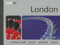
200237596London: Compass Maps 2002 Book. Fine. Hardcover. First Thus. Unique guidebook to London with pop-out maps. At the head of the spine is a compass to help get your bearings and inside is a small ballpoint pen for notetaking are both present and correct .Small size - only 17x10x1cm -easy to fit in a pocket. 84p. illus.col. NO copies found n Worldcat. Compass Maps hardcover
1835000014144London: Cha. F. Cheffins 1835. Map. Ex-Library. 29 3/8" x 61.5". Linen-backed map done on two sheets. Map printed in black pink yellow and green hand-colored. Housed in a 8" x 5.5" green case with gilt lettering and a gilt device on the front board the front of the case states "London & Birmingham Railway. Map of the Line. above the device Incorporated 6th May 1833". A portion of the map backed with green goat in order to have it enter and exit the case more smoothly. A large and beautiful representation of the London to Birmingham railway line with the stops outlined at the bottom edge of the map. With two engraved vignettes showing the depots in Birmingham and in London. An early example of this captivating map. A bookplate and one stamp on the verso of the map otherwise no markings. The bookplate states that the map was a gift donated by James J. Hill a wealthy bibliophile from St. Paul to the University of Wisconsin Library. The map has three small spots of loss to its folds. The case has wear and light discoloration. Cha. F. Cheffins unknown
1845879678.Ghardcover. Good. Access codes and supplements are not guaranteed with used items. May be an ex-library book. hardcover