[PHILIPPINES - 1960S TOURIST MAP]Biblio.com
1 660 résultats
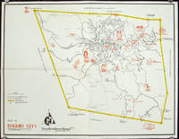
1960206510circa1960. Printed pictorial map 44.8 x 58 cms 46.7 x 60.3 cms sheet original folds a little wear but in very good condition. Attractive 1960s tourist map of Baguio city when it was the "Summer Capital" of the Philippines. Tourist attractions are shown pictorially in red blue triangles denote wood carving shops the city boundaries outlined in yellow sealed and unsealed roads are also shown. . unknown
1989472372Dublin : Phoenix Maps 1989. Facsimile Edition. Softcover. Near fine folding map; slightly dust-dulled and edge-bumped. Remains well-preserved overall. Physical description; 1 map ; 79 x 58 cm. on sheet 101 x 62 cm. folded to 21 x 15 cm. Notes; Reproduced from an original made available by the Neptune Gallery Dublin; believed to be a section from a map by Willliam Larkin circa 1819. Facsimile reprint. Subjects; Republic of Ireland ; Maps. Dublin : Phoenix Maps paperback
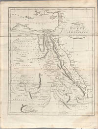
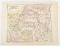
1803174955London. circa1803. Engraved map 23 x 18.5 cm original folds small split to one fold affecting the margin only paper age- toned lower corner darkened and on the verso inked circles to the lower half in an early hand but in good condition. Finely engraved early 19th Century map also showing to the north Syria Palestine and Cyprus and Darfur and Mountains of the Moon Sources of the Nile to the South. . unknown
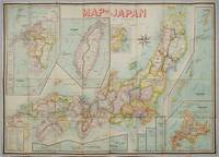
1906197908Kobe Japan.: Fuku-In-Kwan. 1906. Printed colour folding map on two conjoined sheets laid down 73.8 x 10⁵ cms foxing on verso not affecting map single pinhole in each corner scant spotting small fold splits no loss a few soft fold creases but in good condition. Very rare striking map of Japan published for the Western market. <br> <br>Created under the direction of Takachika Okishio featuring 10 inset maps: Chishima Kurile Islands Hokushu Hokkaido Ogasawara-Jima Bonin Islands Hachijo-Shima Ioshima Okinawa Saki-Shima Kyushu Saikaido Taiwan Formosa and Eastern Asia. The insets of Taiwan and Kyushu are the largest and centrally positioned. A Glossary and Explanation of Signs is printed at the foot of the map which list Towns Railway Stations Boundaries of Prefectures Notable Places Hot Springs Water-falls rapids Volcanoes Light-Houses Gold Silver and Coal-Oil fields. The Japanese Government Railway series of Travellers' Maps of Japan appear to have been modelled after this design. . Fuku-In-Kwan. unknown
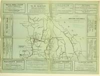
19255871Ashcroft British Columbia: Ashcroft Journal - Board of Trade Ashcroft B.C. 1925. Loose Sheet. Very Good. Map measuring 20 inches x 15 inches printed with black ink on light green paper. Map shows a section of British Columbia from Vancouver north to Quesnell east to Fernie. Map surrounded by ads for Ashcroft businesses. On verso a descriptive narrative offers Ashcroft's history known locally as "Spud City" its regional resources hunting and fishing opportunities and the physical aspects of the landscape. Two rubber stamps one per side for the City Publicity Bureau in Vancouver. Very slight edge-wear to the left margin; a slight stain on the non-map side; old folds now mellowed. A handsome copy of a scarce map suitable for framing. Regarding the publication date: The map refers to Ashcroft as an unincorporated city was formed in 1952 the Main Cariboo Road is described as "a first class dirt and gravel road" and Dr. William Henry Sutherland British Columbia Minister of Public Works is quoted as stating that the scenery in the Marble Canyon Lillooet Lakes and the region of the Fraser River between Lillooet and Lytton "could not be duplicated on the whole of North American Continent and I doubt if it could be surpassed in Europe." Sutherland served in that capacity from 1922-1928 As such we'll posit 1925 as the publication date. Now enclosed in a removable clear archival sleeve. Ashcroft Journal - Board of Trade, Ashcroft, B.C. unknown
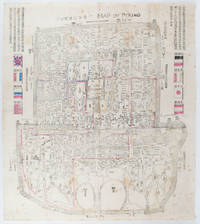
1900169765Circa1900. Large illustrated map of Beijing showing the city in the period following the invasion of the military forces of the Eight National Alliance old folds scale not given. Some scattered light foxing particularly at edges short closed tear at fold lower edge neat non acidic tape repair short section upper edge wear along folds and a couple of small unobtrusive holes with minor image loss. Blocks of text in traditional Chinese right and left upper sections stating each nation's occupied zone Japanese text title accompanies the English title along the upper section of the map. 63.7 x 56.9cm. Very good overall. A rare and significant large Japanese woodblock map of Peking Beijing issued just after the suppression of the Boxer Rebellion. Centred on the Forbidden City the map depicts Peking following the multinational suppression of the Boxer Rebellion or Yihetuan Movement of 1900. The map was issued to illustrate the areas of occupation associated with each of the powers in the Eight Nation Alliance. <br> <br>The map gives measurements of the city walls detailed names of streets and buildings and the boundaries of the inner and outer city including the forbidden city are shown with demarcation lines in pink yellow and blue. The hand coloured eight national flags of the occupation powers are featured at the right and left. <br> <br>This map is essentially a later edition of 京城内外首善全圖 a map of Beijing issued by the Qing for administrative purposes in the mid-19th century. The Japanese seized the wood blocks during the suppression of the Rebellion and subsequently pulled new impressions overprinting them additional details including flags and demarcations of areas of the city held by members of the Alliance. Versions are known in French German Japanese and as with the present example English. An attractive map of great historical interest. . unknown
19502080502106911444Not Available 1950. Soft Cover. Fine. The book is in fine condition. Not Available paperback
19012221875<p>Map of San Francisco: Showing points of special interest to attendants the Fifth International Convention of the Epworth League July 18-21 1901 folding map of 21" x 28" printed in black & red.With numbered locations of places of Methodist interest and historical. Verso of map with 23 panels detailing trips excursions to Yosemite Valley Southern California including Pasadena Redlands Riverside Palo Alto Santa Cruz Lick Observatory. Very good minor wear; short tears at folds.</p><p>San Francisco before the 1906 devastating earthquake.</p> unknown
187226020New York 1872. Hardcover. Very good condition. Maps of Manhattan's west side prior to the completion of Central Park which was finished in 1876. The maps were compiled by longtime New York City Department of Public Works map clerk and city surveyor Otto Sackersdorff noted for his 'Maps of Farms Commonly called The Blue Book 1815". The Blue Book was not published until 1868 as a demonstration of northern economic might at the end of the Civil War. <br /> <br /> The real estate maps show property lines existing roads parks shorelines wetlands and the Manhattan grid extending from west of 8th Avenue at 59th Street and Columbus Circle up to 222nd Street and Spuyten Duyvil & Kingsbridge. Parks and major thoroughfares include: Central Park St. Nicholas Avenue Fort Washington Park Kingsbridge Road and High Bridge Park.<br /> <br /> Folio 15 x 20 1/2" 14 maps in total: 1 full page and 13 double page 28 x 20" hand colored lithographed map sheets. Each map contiguous with one another. Period quarter green gilt leather and dark green buckram boards. Spine gently rubbed; the maps exceptionally bright and clean. <br /> <br /> Previous owner inscription in pencil E. B. Van Winkle from Chas. H. Myers July 1875. Van Winkle was a civil engineer with an interest in road construction and drainage having written a report on the drainage of the 23rd & 24th wards of New York City. Myers was an Assistant Engineer in Charge of Sewers for New York City.<br /> <br /> OCLC: 41175506 at Princeton and OCLC: 40671892 at Columbia and the New York Public Library. hardcover
1805175148London & Glasgow.: W. and D. Brownlie. 1805. Engraved map 18.7 x 23.9 cm original folds age toned and spotted inner margin a trifle ragged paper thinning in a few spots in good condition. Attractive map engraved for "A System of Geography; or A Descriptive Historical and Philosophical View of the Several Quarters of the World" published in 1805. . (W. and D. Brownlie) unknown
1910175858Calcutta.: E. I. R. Press. circa1910. Folding engraved map 33.5 x 73.5 cm river systems in blue attractively bursting the borders of the map inset map of the network into Calcutta legend noting stations lines under construction and foreign railways; original folds two small fold splits with no loss slight overall toning more noticeable at the folds in very good condition. Attractive map capturing one of the busiest areas of a staggeringly vast railway network. The Barharwa-Azimganj-Katwa loop is marked under construction. Scarce. . E. I. R. Press unknown
1893175715New York.: Hunt & Eaton. Circa1893. Printed colour map 24 x 28 cm four thumbnail inset maps: Banana; Boma; Matadi & Environs; Stanley Pool named for the explorer; and below a lozenge inset of the road from Matadi to Leopoldville marginal toning and small edge tears one corner creased but in very good condition and on the verso explanatory text and line engravings in two columns for this map and partial description for the previous entry for the Suez Canal from Hunt & Eaton's school atlas published in 1893. . (Hunt & Eaton). unknown
195961207New York: Platt & Munk Co. Inc. 1959. Oblong folio. 15 x 11 in. Approx. 75 pieces puzzle pictorial map illustration of 48 state products. Colour-illustrated box w/ label affixed on front cover announcing “Now includes Alaska the 49th State! but puzzle w/o additional image of Alaska red white & blue ribbing fore-edges minor scuffing 1 corner w/ tear & old scotch tape repair w/ former ownership marking of “Kathy†on lid still a VG copy and publisher’s ad for “Let’s Fly Away with Mother Goose†laid-in. Later printing of this surprisingly scarce pictorial map puzzle originally issued by Platt & Munk in 1932 featuring the artwork depicting Sequoia trees & fruits in California mining & sheep in Utah cattle & sheep in Montana hogs corn & wheat in Nebraska and citrus cotton oil & cattle in Texas. White 1884-1948 was an artist who trained & lived in Brooklyn NY and spent much of his later career through World War II as an instructor in fashion design and art renderings at the 5th Avenue Fashion Art Design School which preceded FIT and also featured other instructors such as Louis A. Eisele. Platt & Munk Co., Inc., unknown
0881303887.GGood. Access codes and supplements are not guaranteed with used items. May be an ex-library book. unknown
0881301531.Gpaperback. Good. Access codes and supplements are not guaranteed with used items. May be an ex-library book. paperback
0881301639.Gpaperback. Good. Access codes and supplements are not guaranteed with used items. May be an ex-library book. paperback
0881304433.Ghardcover. Good. Access codes and supplements are not guaranteed with used items. May be an ex-library book. hardcover
2022mon0002965477Difusion 2022. Paperback. Very Good. . Sealed in publisher's shrink wrap. Splitting in shrink wrap so minor shelf wear may be present otherwise VG/NF. Unread clean. 12 month access code present. Difusion paperback
2022mon0002965475Difusion 2022. Paperback. Very Good. . Sealed in publisher's shrink wrap never opened. 12 month access code included. Minor shelf wear minor splits in plastic may be present due to storage. Otherwise NF unopened/unread. Difusion paperback
2022mon0002965479Klett World Languages 2022. Paperback. Very Good. . Sealed in publisher's shrink wrap never opened. Minor shelf wear may be present due to storage otherwise VG/NF. 12 month access code present. Klett World Languages paperback
2022mon0002965531Klett World Languages 2022. Paperback. Very Good. . A nice clean copy unread. Minor shelf wear may be present due to storage. Otherwise VG/NF. Klett World Languages paperback
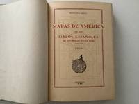
195520488AB1955. Madrid 1955 36 : 26 cm. X pages 1 leaf 378 pages 1 leaf 241 facsimiles of maps some folded and titles. Original half calftwo back lables. One of 500 numbered copies on special paper. the illustrations are made in Photogravure a high-quality engraving technique that uses light to transfer a photographic image onto a plate traditionally copper but now often photopolymer to create deep reliefs that reproduce soft tones and fine details when printed on paper. It is ideal for artistic reproductions and precision applications on various materials combining craftsmanship with digital technology. unknown
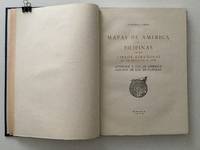
195920489AB1959. Madrid 1959 36 : 26 cm. 129 pages 1 leaf with facsimiles of maps some folded and titles. Original half calftwo back lables. One of 500 numbered copies on special paper. The illustrations are made in Photogravure a high-quality engraving technique that uses light to transfer a photographic image onto a plate traditionally copper but now often photopolymer to create deep reliefs that reproduce soft tones and fine details when printed on paper. It is ideal for artistic reproductions and precision applications on various materials combining craftsmanship with digital technology. unknown
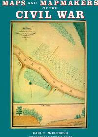
1999007290Boston Massachusetts U.S.A.: Harry N Abrams Inc 1999. 272pp/180 illustrations including 150 plates in full color. The largest most comprehensive & most beautifully illustrated collection of Civil War maps ever published. Still shrink wrapped. First Edition. Hard Cover. New/New. 4to - over 9¾" - 12" tall. Harry N Abrams Inc hardcover
1985040277Athens: Olkos Publishers 1985 Book. As New. Hardcover. 1st Greek Edition. Translated by G. Cox J. Solman. The charting of the Aegean Sea or the Greek Archipelago from the 15th up to the 19th century. 236p. Map Index; General Index. 166 color and black & white maps. Olkos Publishers hardcover