National Geographic Maps - AdventureBiblio.com
1 660 résultats
2023SONG1597756059National Geographic 2023-01-01. 2023. map. Used: Good. 4.72x1.02x9.06. Buy with confidence. Excellent Customer Service & Return policy. National Geographic unknown
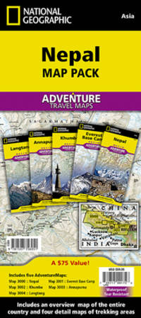
A9781597756051Sheet map folded. New. Waterproof tear-resistant travel map. The National Geographic Adventure Nepal Map Pack is the perfect companion for anyone who wants to travel to the 'Roof of the World'. Includes five Adventure maps that cover all of Nepal with various levels of detail: an overview map of all of Nepal; the trekking areas of Annapurna Langtang and Khumbu; and a detailed map of the highest mountain on earth Mount Everest. Each of the five maps covers these areas in detail with points of interest intricate road networks and an index to help find the smallest of towns. unknown
1597756059.Gmap. Good. Access codes and supplements are not guaranteed with used items. May be an ex-library book. unknown
2023DADAX1597756059National Geographic 2023-01-01. 2023. map. New. 4.72x1.02x9.06. Buy with confidence. Excellent Customer Service & Return policy. National Geographic unknown
181711715AB1817. Vienna Geistinger 1817. 71 : 148 cm. Manyfolded contemporary coloured engraving. Contemporary mounted on linen. Interesting historical map giving an broad overview of the development of the history from ancient times until the 18th century. Friedrich Strass 1766-1846 was a teacher at the monastery of Berge near Magdeburg. His "Strom der Zeiten" got a great populariety and was admired also from the foreign countries. - As mostly browned. unknown
0783499000.Gmap. Good. Access codes and supplements are not guaranteed with used items. May be an ex-library book. unknown
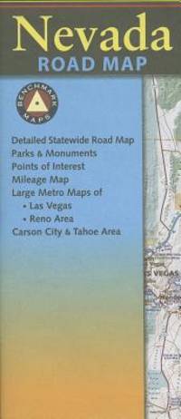
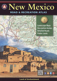
DADAX0929591518Benchmark 2018-03-15. 6th. paperback. New. 10.75x0.50x15.25. Buy with confidence. Excellent Customer Service & Return policy. Benchmark paperback
0875300901New. New. Satisfaction Guaranteed or your money back. unknown
2090502113702155Not Available N.A. Soft Cover. Fine. The book is in fine condition. Not Available paperback
19352083002116200065Oriental Maps Megumi Ito 1935. Soft Cover. Fine. The book is in fine condition. Oriental Maps Megumi Ito paperback
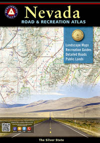
2025SKU1731490Benchmark Maps 2025-03-01. paperback. New. 11x1x15. New Book Ships with Tracking Benchmark Maps paperback
B0DLLNCSPSNew. Brand new and still unused unknown
2025SKU1733453Benchmark Maps 2025-03-01. paperback. New. 11x1x15. New Textbook Ships with Tracking Benchmark Maps paperback
186763963New York NY: Taintor Brothers Merrill & Co. 758 Broadway c. 1867 ca. 1870. One large folio colour lithograph map sized 19.5 x 25 in. expertly mounted on linen decorative border neatline very faint dustsoiling marks from when originally folded very slight age toning at the former creases still a VG bright copy. Early printing of this splendid map depicting the five boroughs before their consolidation 30 years later in 1898 and offering a superb snapshot of the streets ferry lines waterways and Harbor. New York rapidly changed during the end of the 19th Century with tremendous influx of immigrants into the City and this map captures a pivotal time. Joseph Taintor 1835-1881 established this mapmaking firm with his brother Charles Taintor in 1866 and after 1868 when they changed the name of the firm they added their Uncle and entered the field of school book pubishing including the Analytical Readers series. See: David Rumsey Historical Map Collection City of New York No. 0973.003. Taintor Brothers, Merrill & Co., 758 Broadway, unknown
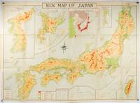
1935214827Tokyo.: Nihon-Kenkyusha. 1935. Large folding colour map of Japan 74.3 x 10⁵ cms; folding into printed card covers 27 x 19.5 cms: 9 insets: Chosen Korea; Hokkaido; Chisima Islands; General Map of Japan and Manchuokuo; Karafuto Saghalien; Okinawa Loochoo; Taiwan Formosa; Micronesia; Ogasawara; Hajijoshima; the covers a litle worn and marked and the sheet slightly toned but the map is in very bright clean condition. Scarce World War II era map of Japan including Korea published in English by Kenkyusha. Founded in 1907 it had a history of publishing for students of English and the English market. An attractively composed map in remarkbable condition; with the insets circled around the islands of Japan heights marked in graduations from green to red and showing provinces railways roads steamer routes Buddhist and Shinto Temples. . Nihon-Kenkyusha. unknown
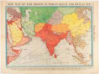
1942180782Chicago.: Chicago Daily Tribune. April 211942. Printed colour map on a single newspaper leaf 37.5 x 53.2 cm; 60 x 45 x 59.6 cm sheet marginal browning and at the folds but remarkably bright in very good condition. World War II map of Asia save for Japan showing British allies colonies and lines of supply and marking Japanese territorial occupation published in the Chicago Daily Tribune "The World's Greatest Newspaper" in April 1942. <br>"The Indian Ocean and the Bay of Bengal are the strategic waters in this campaign in which the occupied parts of Burma and the Andaman Islands serve as bases" caption <br>". the historic Chicago Tribune was an innovator in color inks and printing but also a pioneer in bringing colorful art in the form of illustrations photographs cartoons and advertisements to the average person in an everyday medium." see The Janet A. Ginsburg Chicago Tribune Collection Michigan State University Libraries. . Chicago Daily Tribune. unknown
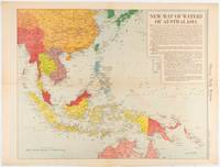
1619180757Chicago.: Chicago Daily Tribune. December 161942. Printed colour map on a single newspaper leaf 41.6 x 52.8 cm; 45 x 60 cm sheet inset legends marginal browning and at the folds but remarkably bright in very good condition. Map of Southeast Asia published in the Chicago Daily Tribune "The World's Greatest Newspaper" delineating the Pacific theatre of war with a detailed text legend. "This is a new war map of the far east showing an important part of southeastern Asia and Australasian waters from a station in which according to Prime Minister Curtin of Australia a United States fleet will operate." Interestingly New Guinea is marked as British rather than as an Australian administrative region which it became following the Treaty of Versailles. <br> <br>"… the historic Chicago Tribune was an innovator in color inks and printing but also a pioneer in bringing colorful art in the form of illustrations photographs cartoons and advertisements to the average person in an everyday medium." see The Janet A. Ginsburg Chicago Tribune Collection Michigan State University Libraries. . Chicago Daily Tribune. unknown
0929591615.Gpaperback. Good. Access codes and supplements are not guaranteed with used items. May be an ex-library book. paperback
20211-0929591615National Geographic Maps 2021. Paperback. New. map edition. 96 pages. 15.00x10.25x0.30 inches. National Geographic Maps paperback
19742083002116200974Meiji Maps Tatsumi Ueno and others 1974. Soft Cover. Fine. The book is in fine condition. Meiji Maps Tatsumi Ueno and others paperback
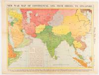
1942180760Chicago.: Chicago Daily Tribune. January 91942. Printed colour map on a single newspaper leaf 37.2 x 53.4 cm; 45 x 59.9 cm sheet inset legend marginal browning and at the folds lower margin with small edges tears not affecting the caption but remarkably bright in very good condition. Rare map of Asia "Between Suez on the west and Shanghai on the east" showing territorial interests and theatres of war published in the Chicago Daily Tribune in January 1942 barely two months after the Uniited States had joined the war effort after the bombing of Pearl Harbour. Thailand and Vietnam "French Indo-China" are marked "Occupied by the Japanese" and north-eastern China similarly marked Iran "Anglo-Russian Occupation" and the Gulf states "British Ally". The caption notes that "The map inludes waters thru which runs the British life line from the Suez canal to remote Australia and New Zealand. Nearly half the people in the world live in the lands shown on this map--more than 450 million for example in China and more than 375 million in India". <br> <br>". the historic Chicago Tribune was an innovator in color inks and printing but also a pioneer in bringing colorful art in the form of illustrations photographs cartoons and advertisements to the average person in an everyday medium." see The Janet A. Ginsburg Chicago Tribune Collection Michigan State University Libraries. . Chicago Daily Tribune. unknown
196380578Wesleyan University Press. As New. 1963. Hardcover. FREE UPGRADE to Courier/Priority Shipping Upon Request - IN STOCK AND IMMEDIATELY AVAILABLE FOR SHIPMENT - AS NEW THE TEXT BLOCK IS PRISTINE CLEAN UNMARKED AND IN EXCELLENT CONDITION - - xiv 430 pp. 154 photos. bibliog. index 4to. -- with a bonus offer-- . Wesleyan University Press hardcover
2005Q-1841393908Compass Maps 2005-03-04. Paperback. New. New. In shrink wrap. Looks like an interesting title! Compass Maps paperback
20121-1597752371Natl Geographic Society Maps 2012. Paperback. New. rol map edition. 1 pages. 31.80x2.00x1.90 inches. Natl Geographic Society Maps paperback
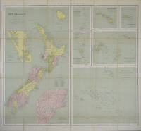
1865154409London.: George Philip & Son. 1865. 9 coloured maps by William Hughes segmented and mounted on linen 55.3 x 65.2cm. Folds into cloth covered case 17.2 x 12cm. Spine of case little faded and ribbon tie missing. Relief shown by hachures and spot heights. Philips' series of travelling maps series. Very good copy. Features a dominant map of New Zealand with 3 maps as insets to this map and 6 other maps separately shown within their own borders. The 3 inset maps are: Norfolk Island and Philip Island; Enlarged map of Auckland and the adjacent country; Enlarged plan of the country around Dunedin and the eastern portion of the Otago Gold Fields from Thomson's map. <br> <br>The 6 maps in addition to the New Zealand map are The Ladrones or Mariana Islands; The Sandwhich Islands; The Galapagos Islands; The New Hebrides and Santa Cruz Islands; The Feejee Friendly and Samoan Islands; The Marquesas Society and Low Archipelago. <br> <br>The New Zealand maps includes a list of native tribes and their locations. . George Philip & Son. hardcover