MORDEN, ROBERTBiblio.com
1 660 résultats
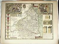
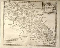
64139London.: Gibson. Early 18th Century. Engraved map on watermarked paper central fold 38 x 46.5 cm decorative title cartouche towns roads rivers and landforms shown; from Gibson's edition of Camden's Britannia upper edge trimmed by the original binder causing minor loss to the border at the inner edge but in very good condition. . [Gibson.] unknown
001174FINE map. Reproduction from Speed's "THEATRE OF THE EMPIRE .". Softcover. FINE map. Overall 17.5"x23.5" image 15.25"x20". This is not a photographic reproduction. Attractive & colorful. . FLAWLESS image. Not even the faintest aging foxing etc. VERSO FLAWS: light but extensive surface damage from some sort of adhesive with some loss of lettering. Verso only effected not into recto. . paperback
0008202036.Gspiral_bound. Good. Access codes and supplements are not guaranteed with used items. May be an ex-library book. unknown
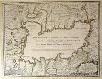
172354819Rainer Ottens. 1723. A most attractive map with early outline hand colour vertical fold barely visible diagonal crease upper half of map few very pale small brown spots otherwise a clean and bright image. Numbering in red pencil few annotations in pencil and light number stamp on reverse however not at all visible from front of map or affecting image. Sheet measures 46.6 x 60.2cm. . Rainer Ottens. unknown
18191405618Paris: Menard et Desenne 1819. Dernière édition. Hardcover. Octavo 684 pages. In Fair minus condition. Spine is tan with gold print on red banner. Boards half bound with green leather to spine and corners and green cloth to boards; corner leather not present spine leather is toned with some rubbing and wear to hinges board cloth has worn edges rubbing shelf wear. Text block has deckle edges; cracked front hinge foxing and toning throughout. Illustrated: “Enrichie de sept Cartes géographiques conformes aux nouvelles divisions et ornée des Pavillons des vingt principales Puissances maritimesâ€â€” title page; however illustrations may not be present. Text in French. <br /> <br /> NOTE: Shelved in Netdesk Column W. 1405618. FP New Rockville Stock. Menard et Desenne hardcover
0483222895.Gpaperback. Good. Access codes and supplements are not guaranteed with used items. May be an ex-library book. paperback
192355333Paris: Cartes Taride 1923. Paperback. Very good. Paperback. 139 x 108 cm 55 x 42.5 inches unfolded. Toning to folds with some minor spots of loss else a nice example. Folder worn and lightly chipped but very good. <br/><br/> Cartes Taride paperback
0282689079.Gpaperback. Good. Access codes and supplements are not guaranteed with used items. May be an ex-library book. paperback
0282579060.Gpaperback. Good. Access codes and supplements are not guaranteed with used items. May be an ex-library book. paperback
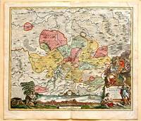
171761880Nuremberg.: Johann Baptist Homann. 1717. A beautifully engraved hand coloured map of North East Germany showing the area around Erfurt in detail. In the centre of the map is a small plan of Erfurt which is also shown as a panoramic view at the foot of the map and titled 'St. Petersburg'. An elaborate decorative title cartouche in the lower right corner depicts allegorical figures surrounded by the produce of the land including sheaves of wheat; a beehive; and a cornucopia of fruits. Cherubs holding a coat of arms float up from the scene on the right while on the lower left a centaur sits meditatively beneath a pine tree amongst slaughtered cattle. Physical features of the area are illustrated and farming areas shown by fields which criss-cross across the map. A clear dark impression the work of an outstanding German cartographer who in 1715 was appointed as imperial geographer by Emperor Charles VI. This map also includes "Schwan See" Swan Lake under a town of the same name which has since disappeared. Hand coloured two very minor splits at upper and lower edges on centre fold and not affecting engraved area a handsome map 54 x 61.5 cm. . [Johann Baptist Homann.] unknown
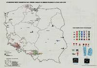
197941929Warszawa Warsaw: Pan´stw. Wydawn. Naukowe 1979. 1st Edition. Original black printed portfolio 8vo. Portfolio of seven large folding maps on on 4 sheets of heavy paper 3 are double sided 1 is singled sided. Primarily black and white with some color. Text in Polish. <br> Title translates to “Nazi camps in Poland 1939 - 1945. An Encyclopaedic Reference Book: Maps." Collection of 7 maps each 84 cm x 60 cm 33 x 24 inches produced by Jan Laskowski at the Main Commission for the Investigation of Nazi Crimes in Poland. The maps comprise Volume II of the work; Volume I is a heavily illustrated 676-page book of the same title which we offer separately. <br> The Seven maps all present are: <br> - Map 1 Single Sided: Hitlerowskie obozy na ziemiach polskich w latach 1939 - 1945. “Nazi camps in Poland in the years 1939 - 1945â€. Showing: concentration and extermination camps sub-camps of concentration camps extermination centers POW camps more important sub-camps working divisions commandos and temporary POW camps penal labor camps major labor camps prisons transit camps & ghettos. <br> - Map 2A: Getta na ziemiach polskich w okresie okupacji hitlerowskiej w latach 1939 - 1945 “Ghettos in Poland during the Nazi occupation in 1939 - 1945â€. <br> - Map 2B: Hitlerowskie obozy przejsciowe na ziemiach polskich w latach 1939 - 1945 “Nazi transit camps in Poland in 1939-1945â€. <br> - Map 3A: Hitlerowskie wiezienia i areszty na ziemiach polskich w latach 1939 - 1945 “Nazi prisons and arrests in Poland in 1939 - 1945â€. <br> - Map 3B: Hitlerowskie obozy pracy na ziemiach polskich w latach 1939 - 1945 “Nazi labor camps in Poland in the years 1939 - 1945â€. <br> - Map 4A: Hitlerowskie obozy jenieckie na ziemiach polskich w latach 1939 - 1945 “Nazi POW camps in Poland in 1939 - 1945â€. <br> - Map 4B: Hitlerowskie obozy koncentracyjne i osrodki zaglady na ziemiach polskich w latach 1939 - 1945 “Nazi concentration camps and extermination centers in Poland in 1939 - 1945â€. <br> Maps 2A & 2B have been described as a “Terrifying pair of maps showing the locations of German POW and internment camps in Poland during World War II highlighting the widespread locations of these establishments. In some parts of the map the information becomes so dense that three inset maps are shown. This map was designed by Jan Laskowski and printed in 1979 as part of a work on the Nazi extermination machine produced by PWN Warsaw a state-owned research-focused publishing house in Poland.<br> The map on the front is particularly interesting for its depiction of symbols used to classify internees in German camps. The uppermost of these depictions shows the combinations that can be made for different types of prisoners of different levels of importance. The armbands that would have been worn by these prisoners is shown as well as the prison uniforms. Other details are also shown. <br> The map lists hundreds of sites run by Nazi operators throughout the country. These include concentration camps death camps transitional camps and ghettos. The map is divided according to Poland's voivodeships with a key in the lower left. Names of cities too long to spell are also provided in the lower left. <br> This map was produced during a point in Poland's history during which it was actively revisiting the period during the Second World War. Leading social scientists devoted their time to trying to gather all the living as well as the recorded history of the events of the Holocaust and related atrocities before this information vanished. Leading these efforts particularly during the 1960s and 1970s was the Glówna Komisja Scigania Zbrodni przeciwko Narodowi Polskiemu known as the Chief Commission for the Prosecution of Crimes against the Polish Nation. They were active in publishing maps both for domestic educational purposes and for international remembrance and diplomatic efforts regarding the Holocaust. Jan Laskowski was a leading cartographer who produced a number of maps in this field. <br> These maps were produced as part of a series of maps that purported to combine to form an atlas of all of Hitler's crimes in Poland. Many of the large wall maps produced during this period could only show a fraction of the crimes or only the atrocities committed in one region. Thus a series of maps was needed to show all the points necessary which this present work contributes to. <br> Polish Reinterpretations of the Holocaust: Studying the effects of German occupation in Poland is a delicate subject. While it is certain that Poland suffered at least as badly as any other European nation during the Second World War reinterpretations of the Holocaust in the country have also been used to satisfy nationalistic tendencies. It has become evident to Western observers in the last several years that there is a strong nationalist movement in Poland that seeks to place blame for the Holocaust solely on the shoulders of non-Polish actors a movement originally fostered under Soviet rule. This movement has gone so far as to limit freedom of speech criminalizing with a three-year sentence the suggestion that Poland or its citizens in any form participated in the murders committed by Nazis. As such the term ‘Polish concentration camps’ has been deemed unacceptable with the government-approved term being ‘concentration camps on Polish territory.’ <br> All lines of evidence show that this map 2A & 2B was produced using the most accurate and impartial historical sources. The language on the map is simple naming only ‘Hitler's Atrocities’ and there is no evidence of a clear anti-German bias. However it is impossible to separate this map one of the most important productions of the remembrance movement during this period from the social situation in which it was produced. Maps like these can easily be converted into propaganda instruments and today's Polish leaders most of whom grew up during Soviet occupation will have formed their understanding of the Holocaust through maps like these. <br> Soviet Censorship: While the content of the map appears to have been produced free from bias the map still had to go through Soviet censorship. Mentioning prisoner of war camps in which primarily Soviet troops were interned would have been a prerequisite condition upon which the publication of the map rested. Further the lack of mention of any Soviet killings or camps requires no explanation….The map unlike many later maps makes no differentiation between the populations who suffered at the various camps. This represents the Soviet agenda that all nations suffered fought and won equally which sought to limit divisions in this post-identity state†Ruderman 2022. <br> SUBJECTS: World War 1939-1945 -- Prisoners and prisons German. -- Concentration camps -- Poland. Guerre mondiale 1939-1945 -- Prisonniers et prisons des Allemands. -- Camps d'internement -- Pologne. Obozy koncentracyjne -- Polska -- 1900-1945. OCLC: 830885973. <br> Light shelf wear to portfolio as expected. All maps in pristine condition with normal folds as issued. Very Good Condition. Complete and dramatic BR5 holo2-147-19-'cc. Warszawa (Warsaw): Pan´stw. Wydawn. Naukowe unknown
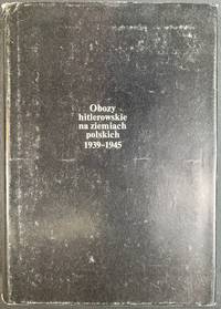
197941930Warszawa Warsaw: Pan´stw. Wydawn. Naukowe 1979. Pamphlet. 1st Edition. Original Cloth in dustjacket 8vo 678 2 pages 36 unnumbered leaves of plates with 164 illustrations. 25 cm. In Polish. Title translates to “Nazi camps in Poland 1939 - 1945. An Encyclopaedic Reference Book.†ISBN: 8301000651. <br> A massive encyclopedic record of Nazi camps prisons and ghettos in Poland based on extensive source material in Polish and foreign archives and research carried out by the General Commission for the Investigation of Nazi Crimes in Poland. The 5877 entries pages 87-601 are arranged in alphabetical order of location providing data on the period of existence character of and fundamental information about each site. Pages 11-86 comprise an introduction by Czeslaw Pilichowski "Hitlerowskie obozy i os´rodki przymusowego odosobnienia oraz ich rola w realizacji programu ludobo´jstwa i zaglady narodu polskiego" "Nazi Camps and Forced Detention Centers and Their Role in Implementing the Program of Genocide and Extermination of the Polish Nation". Includes a bibliography and indexes and summaries in Russian English French and German p. 657-676. The last 73 pages contain photographs. <br> SUBJECTS: World War 1939-1945 -- Prisoners and prisons German. -- Concentration camps -- Poland. Guerre mondiale 1939-1945 -- Prisonniers et prisons des Allemands. -- Camps d'internement -- Pologne. Obozy koncentracyjne -- Polska -- 1900-1945. OCLC: 5709074. <br> Top corners bumped some tears to dust jacket otherwise Very Good Condition in Very Good Dustjacket. Important Work. BK5 holo2-147-20. Warszawa (Warsaw): Pan´stw. Wydawn. Naukowe unknown
18728668Paris 1872. French naval chart sheet 3068 sheet size 36 x 53 cm engraved by Régnier black and white blank verso. The anchorage at San Juan Bautista located on Cumberland Bay Robinson Crusoe Island; the main settlement in the Juan Fernández Islands off the coast of Chile. Map unknown
8170530857.Gpaperback. Good. Access codes and supplements are not guaranteed with used items. May be an ex-library book. paperback
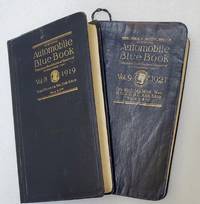
191974907Chicago: Automobile Blue Book Publishing 1919 & 1921. Vol. 8; Tall octavo. 776 pp. including numerous inserts maps photographic illustrations. Complete. Publisher's flexible blue cloth with gilt cover lettering. Expertly rebacked retaining the original spine. Ver good.Vol. 9; Tall octavo. 848 pp. including numerous inserts maps photographic illustrations. Complete but for the folding map at the rear often missing as they were used. The map is reproduced in smaller segments on pp. 2-21. Publisher's flexible blue cloth with gilt spine and cover lettering. Some creases and general rubbing but a good complete copy.Between these two books the entire West Coast is covered. Between them they detail 1783 driving routes across the arid west. These are exhaustive and comprehensive guides to early car touring in California and the West. With such instructions as 'turn left after the wooden bridge" we can infer that car travel in 1920 was a difficult proposition at best. There is an illustrated chapter on Yosemite with a full page map and five pages of texts with illustrations. While "Official Automobile Blue Books" are not rare one usually finds the guides for New York or the Midwest with Vol. 8 California and Vol. 9 Oregon and Washington rarely appearing on the market. Chances are that these particular volumes were just generally used to oblivion as California has always been the most car-friendly state in the Union and the Pacific Northwest was by and large empty of people. Automobile Blue Book Publishing hardcover
193960959San Francisco CA: San Francisco Bay Exposition 1939. 8vo. 116 pp. With oblong folio. 19.25 x 16 in. colour pictorial map frontisp. detailed sections of island and exhibits in blue on verso fold creases numerous photo illustrations text maps diagrams stepped thumb tabs at outer fore-edge. Blue-cloth backed softcovers featuring the striking Art Deco cover art by Simon “Si†Vanderlaan 1904-1986 famed pin-up artist and illustrator who worked for Walt Disney studios during World War II minor scuffing very minor age toning shelfwear still VG bright copy from the library of Prof. Marvin Nathan. Revised 1939 edition of this excellent guide to the first year in 1939 of the Golden Gate International Exposition including “Cartograph†revealing all of the Art Deco architectural wonders and surrounding areas of Treasure Island. The pictorial maps were issued separately as well as with the “Official Guide Books.†Ruth Taylor White’s 1902-1985 delightful pictographic maps or cartographs included depictions of the Territory of Hawaii in which she had driven or traveled to every corner of the Islands and the Grand Canyon for her for her brother’s book “Grand Canyon Country.†Later Little Brown requested an entire atlas which was published as the very scarce Our U.S.A. “A gay geography.†Her cartographs influenced the style of American cartographic illustration for decades afterwards. See: Griffin Mapping Wonderlands: Illustrated Cartography pp. 192-193; Field MapCarte 29/364: Our U.S.A. A Gay Geography 2014. San Francisco Bay Exposition, paperback
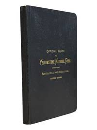
18899062St. Paul Minn: W.C. Riley 1889. 8vo 140 15pp ads and blank journal at rear. Illustrations maps large folding map in pocket at rear as issued. Original leather over card covers stamped in gilt on front with red page edges. Gift inscription on ffep in pencil dated 1907 else clean internally. A beautiful fine copy. <br /> <br /> Beautiful copy of this illustrated tourist's guide to Yellowstone giving descriptions of the attractions and features of the park with maps a brief history and rules and regulations. Riley issued a just few of these according to OCLC between 1886 and 1890. Scarce and more so in this condition - the nicest we've seen.<br /> <br /> <br /> . W.C. Riley unknown
195615240Ottawa: Edmond Cloutier Queens' Printer and Controller of Stationery. Very Good in Very Good- dust jacket. 1956. First Edition. Hardcover. Volume I has no dust jacket the red coth covered boards dated 1956 some shelf soil to page edges top back corner bumped. Volume II dated 1953 has chipped DJ 1 inch tear bottom front panel and 2 inch tear top back panel.; Fold-out maps in Vol. I and map endpapers appear undamaged B&W and color illustrations in Vol II; Color Illustrations . Edmond Cloutier, Queens' Printer and Controller of Stationery hardcover
1938041686Ottawa: The Minister Of National Defence 1938. Book. Near Fine. Hardcover. 1st Edition. 4to - over 9¾ - 12" tall. 460 Pages Maps. The Minister Of National Defence Hardcover
19567943Ottawa Ontario Canada: Pubished by the Authority of the Minister of National Defence Roger Duhamel Queen's Printer and Controller of Stationery 1956-1960. Hardcover. pp. xiii 629; xv 807; xiii 770. Thick Royal 8vo's. Uniformly bound in bright red cloth over boards gilt lettering to the spines and armorial device embossed to the centre of the front boards; map endpapers. Replete with many black-and-white and colour maps including many fold-out photographs illustrations portraits et al. Excepting some light bumping to the spine ends the extremities remain remarkably well-preserved with no additional detectable flaws contents remain equally and uniformly without blemish with bright clean and unmarked pages and tight sound bindings; about fine with each housed in light shelfworn dustjackets now in protective mylar covers. Overall very good to near fine. <br/><br/> Pubished by the Authority of the Minister of National Defence | Roger Duhamel, Queen's Printer and Controller of Stationery hardcover
0881300748.Ghardcover. Good. Access codes and supplements are not guaranteed with used items. May be an ex-library book. hardcover
1840344261840. Lg. format. Green cloth. gilt. Bound maps numbered 1 - 110. Numbers not bound in: 92224314546606979109. 100 maps bound in. Plus 23 maps bound in rear from Lewis's Topographical Dictionary. 41 hand-coloured maps 59 plates hand-coloured Town Plans taken from the "View of the Representative History of England Samuel Lewis". A very nice copy. hardcover
1566959632New. Brand new and still unused unknown
Q-1566954029National Geographic Maps 2019-01-01. Map. New. In shrink wrap. Looks like an interesting title! National Geographic Maps unknown
1994Q-0719550173John Murray 1994-01-01. Hardcover. New. In shrink wrap. Looks like an interesting title! John Murray hardcover