1 660 résultats
0881309001.Gpaperback. Good. Access codes and supplements are not guaranteed with used items. May be an ex-library book. paperback
1581740522.Gpaperback. Good. Access codes and supplements are not guaranteed with used items. May be an ex-library book. paperback
0881309001New. paperback. New. Satisfaction Guaranteed or your money back. paperback
0881307823.Gpaperback. Good. Access codes and supplements are not guaranteed with used items. May be an ex-library book. paperback
0528954792.Gpaperback. Good. Access codes and supplements are not guaranteed with used items. May be an ex-library book. paperback
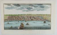
1750177186circa1750. Hand-coloured engraving 19.5 x 35.6 cm 25.5 x 41.6 cm sheet original folds two old paper repairs not affecting the image a trifle toned but in very good condition Attractive bird's-eye view town plan of Makassar in Sulawesi prepared for Abbé Prevost's monumental 'Histoire Générale des Voyages.' . unknown
19502080502106911445Not Available 1950. Soft Cover. Fine. The book is in fine condition. Not Available paperback
152774857X.Gpaperback. Good. Access codes and supplements are not guaranteed with used items. May be an ex-library book. paperback
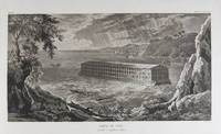
183318856Milano: Fortunato Stella e Figli 1833. First Italian edition. Hardcover. f to vg. Oblong folio 12 6/8 x 18 1/2". 1 leaf Title 38 leaves Plates 1 leaf List of content. Original half morocco over burgundy paper covered boards. Gold lettering and tooling on spine. Rare first Italian edition of Paul-Louis-Bernard Drach's atlas volume of his "Sainte Bible de Vence" a series which was originally published in 27 volumes in Paris from 1827 to 1833. The striking 38 engraved plates featured in this atlas are composed of 13 maps by A. R. Fremin and 25 engravings signed by Falkeisen Angelini and Lanzani. The engraved plates have been laid down on beautiful hand-made paper and describe the following: 1. Map of the place of Eden Mesopotamy and Persian Gulf; 2. Noah's Arch construction; 3. Noah's Arch; 4. Map of the land divided among Noah's sons; 5. The Babel Tower; 6. Map of the Land of Canaan; 7. Map of Jews' Pilgrimage; 8. The Jerusalem Sahnedrin; 9. The Temple of Jerusalem plans and sections; 10. The Temple of Jerusalem square plan; 11. Map of ancient Jerusalem; 12. The Temple of Salomon; 13. The Temple's foundations; 14. The East Gate; 15. The Buildings of the Temple; 16. Musical Instruments of the Jews; 17. Hebrew Alphabet; 18. Jew's Vestments and worship's objects; 19. Two Menorah; 20. High Priest's vestments and Golden Menorah; 21. Moses' Tabernacle; 22. The Loaves of Proposition; 23. Plan and section of the Tabernacle; 24. The encampment of the Israelites; 25. Map of the Holy Land South; 26. Map of the Holy Land North; 27. Map of Syria; 28.Map of Israel under Salomon; 29. Plan of the House of the Forest of Lebanon; 30. The House of the Forest of Lebanon; 31. The Bronze Sea; 32. The Washings; 33. The Altars of the Holocausts; 34. Map of the Persian Empire; 35. Map of the Land of Canaan according to Ezechiel; 36. Map of Herod's Reign; 37. Zachary's Vision; 38. Map of the travels of Saint Peter and Saint Paul. The plates measure appr. 12 1/2 x 18 1/4" image size appr. : 9 1/2 x 14 6/8". Binding rubbed on covers and along edges. Head and tail of spine chipped. Previous owner's Ex-libris Calvin Bullock on inside of front cover. Minor and sporadic foxing along paper margin not affecting plates. Title and captions in Italian. Binding in overall fair interior in very good plates in near fine to fine condition. About the author: "David Paul Drach aka Paul-Louis-Bernard Drach after his conversion 1791-1865 was a Catholic convert from Judaism and librarian of the College of Propaganda in Rome. Drach received his early education from his father who was a rabbi. After spending some time in various Talmudic schools he became a teacher at Rappoltsweiler though only sixteen years of age. The love of the secular sciences brought him to Paris where he was welcomed by his coreligionists and became tutor in a wealthy Jewish family. His reputation as a teacher brought him Christian pupils; and this may have had some influence on his subsequent conversion; in fact he had always manifested some leaning toward Christianity. Drach had already begun the study of Greek and Latin so as to become acquainted with the Christian doctrines in their original sources. Struck by the accusation of some of the Fathers that the Jews had corrupted the Hebrew text he began a comparative study of the Hebrew and the Septuagint which study he continued in spite of the remonstrances of the president of the Central Consistory. Drach was received into the Catholic faith in 1823 together with his two daughters and his son Paul who afterward became a priest and a distinguished Biblical scholar. In 1827 Drach accepted the position of librarian of the Propaganda in Rome which position he held until the year of his death." From the Jewish Encyclopedia. Fortunato Stella e Figli hardcover
19522092902141000174Bijutsu shubbansha 1952. Soft Cover. Fine. Size: A3 Bijutsu shubbansha paperback
19762080502106910374Not Available 1976. Soft Cover. Fine. The book is in fine condition. Not Available paperback
1845879864.Gmap. Good. Access codes and supplements are not guaranteed with used items. May be an ex-library book. unknown
1990MST13651Easton Press. Very Good with no dust jacket. 1990. Hardcover. Leather-bound hard cover published by Easton Press in 1990. No dust jacket. Black leather covers with gilt decorations and lettering. Corners are slightly bumped. Spine has three raised bands. Page edges are gilt-covered. Silk moire endpapers. Gray satin bookmark ribbon is attached to headband. Included are an unused and unattached bookplate from Easton Press and the Collector's Notes from Easton Press. Book is in very good plus condition. Large 8vo 366 pages 2.2 lb. ; Large 8vo 9" - 10" tall; 366 pages . Easton Press hardcover
Z1-F-060-01618BRGM. Used - Good. Ships from UK in 48 hours or less usually same day. Your purchase helps support Sri Lankan Children's Charity 'The Rainbow Centre'. Ex-library so some stamps and wear but in good overall condition. 100% money back guarantee. We are a world class secondhand bookstore based in Hertfordshire United Kingdom and specialize in high quality textbooks across an enormous variety of subjects. We aim to provide a vast range of textbooks rare and collectible books at a great price. Our donations to The Rainbow Centre have helped provide an education and a safe haven to hundreds of children who live in appalling conditions. We provide a 100% money back guarantee and are dedicated to providing our customers with the highest standards of service in the bookselling industry. BRGM unknown
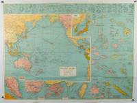
1945180206Sydney.: H.E.C. Robinson. Circa1945. Full colour inset maps principal cities and towns marked shipping routes international boundaries and railways. 99 x 73cm. Some small insect damage has been repaired on the verso visible on map as a few small lighter areas in the western Pacific. Pinpoint holes at folds paper repair along cover but a very good clean copy. From the Sydney publisher H.E.C. Robinson the firm founded in 1895 by Herbert Robinson 1857-1933 a founder of the Royal Geographical Society of Australasia. <br> <br>Although the map is undated North and South Korea are shown as divided which occurred in late 1945 and Manchuria is marked as still under Soviet occupation which only lasted until 1946 at which point it was handed over to Communist China. <br> <br>As well as what now would be considered Southeast Asia the main map shows the eastern half of India Tibet and parts of Mongolia the USSR and East Asia. Inset maps include: Caroline Islands Marshall Islands Federation of Malaya Singapore Hong Kong Taiwan Japan Hawaiian Islands Philippine Islands Midway Gaum and Wake Islands Fiji Islands Eastern & Western Samoa Santa Cruz and Solomon Islands New Caledonia Rabaul Tahiti Lord Howe etc. . H.E.C. Robinson. unknown
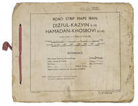
1944ABC_4794483 Rep Group. I.E." 1944. Original beige printed paper wrappers side stichted by hand through 3 holes with a reddish pink cloth ribbon. Oblong 21 x 255 cm. With 1 index map and 16 numbered folding strip maps. Exceptionally rare collection of folded strip maps of roads in Western Iran which was very likely meant for military use during the Second World War. The abbreviated inscription on the front wrapper possibly stands for "24th brigade branch transportation office" though it is unknown which 24th brigade this would have been. The maps were originally printed on quarter inch sheets in 1942 and have been significantly enlarged for this edition to a scale of 1 inch to 2 miles. We have not been able to trace any other copies of either the first or second edition of this work anywhere.With an owner's inscription on the front wrapper. The maps and back wrapper have been reinforced with bookbinder's gauze. The wrappers are somewhat soiled creased and the edges are somewhat frayed. The maps have slightly browned and the index map has a small brown stain in the lower outer corner without affecting the image. Otherwise in good condition. 83 Rep Group. I.E.", hardcover
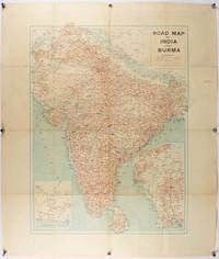
1940211089Bombay.: Joshi & Co. circa1940. Colour lithographic map 66 x 50 cms; 81.x 68.5 cms sheet two inset maps and on the verso a full sheet "Relief Map of India" original folds with fold splits archivally strengthened several city names have been neatly underlined “Agartala” inked in the margin overall in good condition. Scarce Bombay-published map of the pre-Partition Indian sub-continent with two small inset maps one showing roads around Karachi and the other Burma. Through Routes Other Main Roads and Motorable Roads Subject to Weather are marked. The "Relief Map of India" on the verso includes Railway Lines Canals Steamer Routes Rivers Air Routes Navigable Canals and Broadcasting Stations. . Joshi & Co. unknown
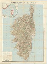
62609Paris: Cartes Tarides c.1922. Original separately issued colour-lithographed map of Corsica 105 x 81 cm dissected into 32 sections and backed onto linen with an inset map showing the navigation lines between Corsica France and Italy to upper left. Printed by Gaillae-Montrocq et Cie. Folding between drab paper covers. Some light spotting to verso most noticeable along folds some light marginal soiling generally a very good attractive example. The key to bottom left provides plenty of useful information to the motorist including the best roads those to avoid and the main summer seaside and thermal resorts which are highlighted in red. Paris: Cartes Tarides, [c.1922]. unknown
2009Alibris.0016896Evergreen: National Geographic Maps. 2009. Trade paperback. Good. Atlases. Audience: General/trade. . National Geographic Maps paperback
2005CL250404030XT1National Geographic Society Maps 2005-05-01. paperback. Good. 11x1x14. National Geographic Maps. Spiral binding--no marking on pages--cover good National Geographic Society Maps paperback
2000mon0000005082National Geographic Society Maps 5/1/2005 12:00:01 AM. paperback. Good. 1.0000 14.9000 11.4000. National Geographic Society Maps paperback
159775000X.Gpaperback. Good. Access codes and supplements are not guaranteed with used items. May be an ex-library book. paperback
2005Q-159775000XNational Geographic Society Maps 2005-05-01. spiral_bound. New. In shrink wrap. Looks like an interesting title! National Geographic Society Maps unknown
2005SONG159775000XNATIONAL GEOGRAPHIC 2005-05-01. paperback. Used: Good. 11.25x1.00x14.50. Buy with confidence. Excellent Customer Service & Return policy. NATIONAL GEOGRAPHIC paperback
0540089540.Gspiral_bound. Good. Access codes and supplements are not guaranteed with used items. May be an ex-library book. unknown