National Geographic MapsBiblio.com
1 660 résultats
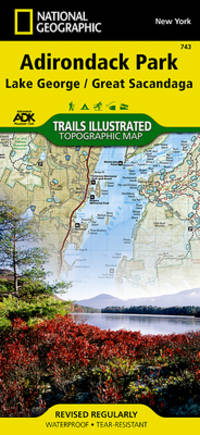
2001Q-156695357XNatl Geographic Society Maps 2020-01-01. Map. New. In shrink wrap. Looks like an interesting title! Natl Geographic Society Maps unknown
2023SKU0591397National Geographic Maps 2023-01-01. map. Good. 4x0x8. Textbook May Have Highlights Notes and/or Underlining BOOK ONLY-NO ACCESS CODE NO CD Ships with Tracking National Geographic Maps unknown
2023SKU0638904National Geographic Maps 2023-01-01. map. New. 4x0x8. New Textbook Ships with Tracking National Geographic Maps unknown
18819118Algiers: Adolphe Jourdan Libraire-Editeur 1881. First edition. 22x14cm vi 70 2. Large folding map "Carte du Sahara Central par M. Camille Sabatier" and table of contents at rear. Stitched in gray laid paper wraps. Single pencil annotation on pg. 47 else clean internally and nearly fine. <br /> <br /> Scarce French Algerian text by Camille Sabatier 1851-1919 lawyer and politician who wrote extensively on the geography and politics of the Sahara region. Sabatier was French deputy in Algeria from 1885-1889. He was a member of the geographical societies of Oran and Algiers and prepared the map in this text with the assistance of French cartographer Justin Pouyanne.<br /> <br /> The work focuses on the local tribes of the Sahara region including Hamyan Trafi Laghouati Chambaa Ait-Atta Arib and Doui-Menia their interactions religions etc. The text also details trade routes geography and climate of the region arguing the ignorance of seeing the Sahara as just "a sea of sands" leads to political surprise and disaster. <br /> <br /> OCLC cites 6 holdings 4 of them in France. <br /> <br /> <br /> . Adolphe Jourdan, Libraire-Editeur unknown
188074548Ottowa: Departement de L'Agriculture 1880. First edition. Octavo. Folding color map as frontispiece short tear 26 1 table of contents 9 ads two full page woodcuts of Manitoba farms and single page governments announcements pp. Publisher's pink printed wrappers. Split at spine but holding strong. A very good copy. Departement de L'Agriculture unknown
ANAIS-0881306355Thomas Brothers Maps. paperback. Good. 0x0x0. Buy with confidence. Excellent Customer Service & Return policy. Thomas Brothers Maps paperback
0881306355.Gpaperback. Good. Access codes and supplements are not guaranteed with used items. May be an ex-library book. paperback
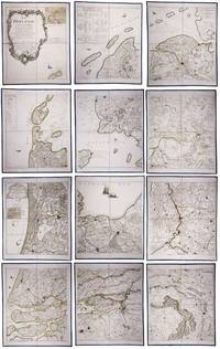
179023331Paris: Jean A. Dezauche successor of Delisle & Buache 1790. Each map in contemporary box with green morocco spines with titles 'Hollande' and 'Zelande' lettered in gold and green paper sides with ornamental gilt borders along the edges. Together ca. 230 x 155 cm. Engraved and etched map hand-coloured in outlines the cities coloured red. Printed on 12 sheets each divided into 4 segments numbered 1-48. The 48 segments are mounted on contemporary linen and folded the edges reinforced with blue ribbon. With: 2 LE ROUGE George Louis. Topographie de la Zelande en 9 feuilles traduitte de l'Hollandois. Second title: Partie orientale de la Flandre Hollandoise Paris Jean A. Dezauche 1790. Large engraved and etched wall map hand-coloured in outlines the cities coloured in red printed on 9 numbered sheets each divided in 4 segments numbered 1-36 size each sheet 48 x 56.5 cm; the 36 segments are mounted on contemporary linen the edges reinforced with blue ribbon. Two large complementary wall maps of the seven Dutch provinces covering 1 the provinces Holland Utrecht Friesland Groningen Overijssel and Gelderland and a part of Brabant bound to the line Steenbergen - Roermond and 2 Zeeland. Both are rare especially the map of Zeeland. They were the first maps of the Netherlands on such a large scale mostly about 1:105000 but with some eastern regions squeezed in at about 1:140000. Fully assembled the map of Hollande would measure about 230 x 155 cm and the map of Zeeland about 143 x 175 cm.Originally published in 1748 Le Rouge's 21 plates for the two maps were revised for publication in a second state by Jean Crepy ca. 1770. The map in its present third state was revised and published by Jean A. Dezauche in 1790. On the back of each sheet is an engraved label with the sheet number and the name of the region covered added in manuscript.From the library of Marco-Antonio III 1730-1800 Prince Borghese: on each box is the engraved armorial bookplate of the library of this Borghese Prince. Marc-Antonio's son Camillo Filippo Ludovico 1775-1832 married Napoleon's sister in 1803.Boxes are slightly scuffed. A remarkable copy with a princely provenance.l De Vries 'Een Franse wandkaart van Nederland uit 1748' in: Caert-Thresoor 1 1982 pp. 24-29; cf. BMC Printed maps VIII cols. 967 & 969 1748 edition; not in Donkersloot-de Vrij; Oehme A French world atlas in: Imago mundi 25 1971 pp. 55-64 on Le Rouge. Jean A. Dezauche, successor of Delisle & Buache, unknown
193974419Laboratoires Marinier 1939. map. <b>Carte géographique en français</b>. - Brochure de 24 pages. 15 x 23 cm. Légèrement défraîchie. <i>ref. 74419</i> Laboratoires Marinier unknown
20192-234315578XEditions L'Harmattan 2019. Paperback. New. 280 pages. French language. 8.46x5.31x0.70 inches. Editions L'Harmattan paperback
0666372810.Gpaperback. Good. Access codes and supplements are not guaranteed with used items. May be an ex-library book. paperback
0428684831.Ghardcover. Good. Access codes and supplements are not guaranteed with used items. May be an ex-library book. hardcover
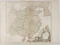
1751177606Paris. 1751. Engraved map 48 x 52.2 cm; 51 x 67.6 cm sheet provinces highlighted with outline hand-colour elaborate title cartouche central fold small tear at the foot affecting the border old paper repair on the verso affecting the margin only pin-holes to the four marginal corners margins a little browned and dusty a handsome map in good condition. Fine large format map showing China Korea Taiwan and parts of Central Asia prepared for De Vaugondy's "Atlas Universel". The beautifully foliated cartouche features a duo of joyful Chinese musicians one dancing and a diminutive figure holding a parasol. <br> <br>From the Estate of the late collector and scholar Arthur Hacker. . unknown
0259600024.Gpaperback. Good. Access codes and supplements are not guaranteed with used items. May be an ex-library book. paperback
1962174808Kuala Lumpur.: Survey Department Federation of Malaya. 1962. Very attractive large coloured folding map 108 x 83cm showing all the major hotels and rest houses throughout the country. Coloured references show rubber rice coconut and oil palm areas pineapple and miscellaneous cultivation areas mining land jungle built-up areas and shopping centres along with major features such as rivers principal roads minor roads and cart tracks railways lighthouses district state and international boundaries and triganometrical stations with heights. Scale 18 miles to an inch mile. Two inset maps of Northern Malaya and South Western Malaya are 9 miles to an inch. There are smaller inset maps of Ipoh; Malacca Singapore & Johor Bahru Penang Sungei Patani Kuala Lipis Kuantan Alor Star Kota Bharu Petaling Jaya Seremban Klang Batu Pahat Muar Segamat Johore Bahru and a small inset map of Malaya and adjacent territories. There is a large black & white table of approximate mileages. When folded the map is encased in the original printed manila covers measuring 21 x 14cm with a printed price of $2.50. A crisp bright map in very good condition. Survey Department Federation of Malaya No. 23. . Survey Department Federation of Malaya. unknown
19782081502112501891A5 1st edition with box history book company 1978. Soft Cover. Fine. Number of books: 1 A5 1st edition with box, history book company paperback
20131-1597755664NATIONAL GEOGRAPHIC MAPS DIVISION 2013. Paperback. New. lam map edition. 1 pages. 25.04x2.05x1.34 inches. NATIONAL GEOGRAPHIC MAPS DIVISION paperback
197539790Sturtevant Wisconsin U.S.A.: Rand McNally 1975. First Thus . Soft cover. Fine. 4to - over 9¾" - 12" tall. Very large sturdy softcover heavy glossy textured wrappers with color-illustration of raft upon the seas on front and back wrappers 165 heavy pages profusely illustrated color-illustrations of big fish inside front wrapper and adjacent end paper color maps with routes inside back wrappers and adjacent end paper. Price near top front tip inked out. Near Very Fine. <br/> <br/> Rand McNally paperback
19952091502135417324Not Available 1995. Soft Cover. Fine. Volume: 13 Not Available paperback
0881306959.Gpaperback. Good. Access codes and supplements are not guaranteed with used items. May be an ex-library book. paperback
0881306975.Gpaperback. Good. Access codes and supplements are not guaranteed with used items. May be an ex-library book. paperback
0881303658.Gpaperback. Good. Access codes and supplements are not guaranteed with used items. May be an ex-library book. paperback
0881302457.Ghardcover. Good. Access codes and supplements are not guaranteed with used items. May be an ex-library book. hardcover
1967203840Washington D.C.: Army Map Service. 1967. Two printed colour adjoining maps 73 x 55.6 cms and 55.6 x 73 cms original folds inked operational annotations to the Quan Long sheet multiple marginal legends noting aerodromes and radio facilities roads railroads and boundaries glossary of terms much of the text is in both English and Vietnamese in very good condition. Detailed U. S. Army maps of the Mekong Delta and Southern Vietnam extending from Rach Gia in the north to the area just south of Quan Long Ca Mau in the south and east including BacLieu and CanTho. The island of Con son is at lower right of the Khanh Hu'ng sheet. Operational notes are inked around Quan Long are marked and the U Minh Forest the impenetrable "forest of darkness" is noted in ink. <br> <br>. . Army Map Service. unknown
8170530164.Gpaperback. Good. Access codes and supplements are not guaranteed with used items. May be an ex-library book. paperback