[ISTANBUL - POST-TREATY OF LAUSANNE].Biblio.com
1 660 résultats
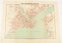
1925174961Constantinople.: The Anglo-American Book & Newsagency. 1925. Printed folding colour map 36 x 49.2 cm street grids for Stambul Pera Galata and Skutari railways and landing places marked small fold splits affecting the margins only now repaired with archival material two small holes at central folds pin-holes to the four corner some age-toning but in very good condition. A scarce map of the historic peninsula soon after the Republic of Turkey was founded and the capital moved to Ankara. Printed for the tourist market this map is a rare survival. . The Anglo-American Book & Newsagency. unknown
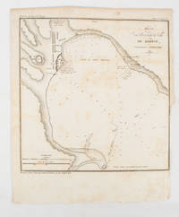
1839175248Paris.: Librairie de Gide. 1839. Engraved map 21.1 x 20.8 cm 27 x 22 cm sheet original folds trimmed to the inner margin with slight loss to the border only map spotted but otherwise in sound condition. Map of the Port of Kerch in Crimea prepared for the 1839 edition of the French Journal "Nouvelles Annales des Voyages." the editors for this edition amongst others the translator and geographer Jean-Baptiste Benoît Eyriès and Alexander von Humboldt founding members of the world's first geographical society the Société de Géographie. . (Librairie de Gide). unknown
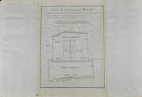
1749136794Paris. circa1749. Black and white engraved plan map of Peking on laid paper folded designed by the prominent French cartographer Jacques-Nicolas Bellin. This map is No. 18 Vol. 5 from the impressive 15-volume "Histoire Generale des Voyages" compiled by French novelist Antoine François Prévost. This city map shows two areas of walled cities: Ville Tartare Imperial city and the Forbidden City and Ville Chinoise ethnic Han residential area. <br> <br>Notes A and B represents buildings within the Forbidden City. A: Lieu de Plaisance ou l'on voit une Montagne faite a la main B: Grandes Cours du Palais de l'Empereur. Two missionary buildings French and Portuguese as well as the Tower of Mathematics illustrated within Ville Tartare. Two temples illustrated side by side near the south gate of the Ville Chinoise. <br> <br>Overall in good condition very light browning on edges and darker toning along the borders of the map. Text in French. Map measures 21 x 16.4cm. . unknown
2001DADAX1566958644National Geographic 2020-01-01. 2020. map. New. 5.20x0.60x9.20. Buy with confidence. Excellent Customer Service & Return policy. National Geographic unknown
2001SONG1566958644National Geographic 2020-01-01. 2020. map. Used: Good. 5.20x0.60x9.20. Buy with confidence. Excellent Customer Service & Return policy. National Geographic unknown
1566958644New. Brand new and still unused unknown
1566958644.Gmap. Good. Access codes and supplements are not guaranteed with used items. May be an ex-library book. unknown
1887749608.Gspiral_bound. Good. Access codes and supplements are not guaranteed with used items. May be an ex-library book. unknown
1998G093065711XI4N00Outdoor Books & Maps 1998. Paperback. Very Good. May have limited writing in cover pages. Pages are unmarked. ~ ThriftBooks: Read More Spend Less.Dust jacket quality is not guaranteed. Outdoor Books & Maps paperback
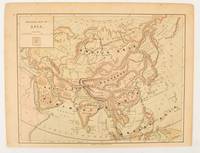
1875174830New York.: Harper & Brothers. 1875. Map printed in colour polar projection 21 x 27.1 cm marginal spotting and toning small edge tears to the inner margin but in god condition. Prepared for "Harper's School Geography" first published by Harper & Brothers in 1875. The map shows physical features mountains steppes plains rivers and deserts etc. together with sources of primary production: whale fisheries furs coffe tea minerals etc.The verso of the map with references and attractive line engravings part of the entry for Netherlands and Belgium. . Harper & Brothers. unknown
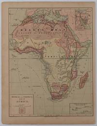
1877176015New York.: Harper & Brothers. circa1877. Chromolithographed map with outlne handcolour 27.1 x 21 cm major towns marked with a red cross relief by hachures ocean currents marked two inset maps of the Suez canal and Mascarene Island two very small marginal edge tears not affecting the map slight toning unrelated text on the verso prepared for "Harper's School Geography" in very good condition Interesting map of Africa before the escalation of the European race for colonial possessions from 1880. The map shows: the European possessions of the Cape Colony Transvaal Republic Orange River Republic and Natal; regions of the continent as fertile belts and desert belts; and indicates agricultural and other production such as palm oil ivory skins and cattle. Major cities are shown with important trade centers highlighted with a red cross. Prepared for US students in "Harper's School Geography" longitude is shown from the Greenwich prime meridian at the head of the map and from the Washington prime meridian at the foot. A small outline map of Ohio is included for relative scale. . Harper & Brothers. unknown
0881305383.Gpaperback. Good. Access codes and supplements are not guaranteed with used items. May be an ex-library book. paperback
0365854689.Gpaperback. Good. Access codes and supplements are not guaranteed with used items. May be an ex-library book. paperback
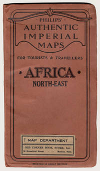
190029227London: George Philip & Son Ltd. ca.1900. Early printing of this map by the cartographic publishing company. Finely rendered in colours. Large multi-folding map approximately 22" x 27" publisher's original protective wrappers printed in black. A very fine copy pristine and very near to mint. George Philip was born in Huntly Aberdeenshire to a staunchly Calvinist family but in 1819 George traveled to Liverpool where his brother Robert who was a nonconformist minister lived. In 1819 he became assistant to the Liverpool bookseller William Grapel and in 1834 set up his own business as a bookseller and stationer in Paradise Street Liverpool. He rapidly expanded the business by producing books particularly educational works and maps. Within his first year of trading to keep up with demand he had to move his business into larger premises at the Atlas Buildings in South Castle Street. <br> Philip used cartographers such as John Bartholomew the elder August Petermann and William Hughes to produce maps on copper plates. Philip then had these printed and hand-coloured by his women tinters. By the time he produced his county maps of 1862 he was using machine coloured maps produced on power-driven lithographic presses. 'His maps ranged from the expensive Imperial Library Atlas 1864 to an atlas costing as little as 3d. and although the bulk of his production was for the commercial and particularly the educational market he also produced important scientific maps notably of North America especially the Arctic and Pacific Northwest Africa and of the West Indies.<br> This is a very fine copy of a scarce map showing the extent of European possessions in North-East Africa before the end of the colonial period. George Philip & Son, Ltd. unknown
1849071403.Gspiral_bound. Good. Access codes and supplements are not guaranteed with used items. May be an ex-library book. unknown
0540086606.Gpaperback. Good. Access codes and supplements are not guaranteed with used items. May be an ex-library book. paperback
4123666Philips. Paperback. Used; Very Good. Simply Brit welcome to our online used book store where affordability meets great quality. Dive into a world of captivating reads without breaking the bank. We take pride in offering a wide selection of used books from classics to hidden gems ensuring theres something for every literary palate. All orders are shipped within 24 hours and our lightning fast-delivery within 48 hours coupled with our prompt customer service ensures a smooth journey from ordering to delivery. Discover the joy of reading with us your trusted source for affordable books that do not compromise on quality. 03/11/2005 Philips paperback
3163575Philips. Paperback. Used; Good. Simply Brit welcome to our online used book store where affordability meets great quality. Dive into a world of captivating reads without breaking the bank. We take pride in offering a wide selection of used books from classics to hidden gems ensuring theres something for every literary palate. All orders are shipped within 24 hours and our lightning fast-delivery within 48 hours coupled with our prompt customer service ensures a smooth journey from ordering to delivery. Discover the joy of reading with us your trusted source for affordable books that do not compromise on quality. 10/01/2015 Philips paperback
3266937Philips. Paperback. Used; Good. Simply Brit welcome to our online used book store where affordability meets great quality. Dive into a world of captivating reads without breaking the bank. We take pride in offering a wide selection of used books from classics to hidden gems ensuring theres something for every literary palate. All orders are shipped within 24 hours and our lightning fast-delivery within 48 hours coupled with our prompt customer service ensures a smooth journey from ordering to delivery. Discover the joy of reading with us your trusted source for affordable books that do not compromise on quality. 03/11/2005 Philips paperback
5069824Philips 04/18/2019. Spiral_bound. Used; Good. WE SHIP WITHIN 24 HRS FROM LONDON UK 98% OF OUR ORDERS ARE RECEIVED WITHIN 7-10 DAYS. We believe you will be completely satisfied with our quick and reliable service. All orders are dispatched as swiftly as possible! Buy with confidence! Greener Books. Philips unknown
4395585Philips. Spiral-bound. Used; Very Good. Simply Brit welcome to our online used book store where affordability meets great quality. Dive into a world of captivating reads without breaking the bank. We take pride in offering a wide selection of used books from classics to hidden gems ensuring theres something for every literary palate. All orders are shipped within 24 hours and our lightning fast-delivery within 48 hours coupled with our prompt customer service ensures a smooth journey from ordering to delivery. Discover the joy of reading with us your trusted source for affordable books that do not compromise on quality. 07/23/2020 Philips unknown
DADAX1849075794hardcover. New. 8.98x0.39x12.05. Buy with confidence. Excellent Customer Service & Return policy. hardcover
0540088978.Ghardcover. Good. Access codes and supplements are not guaranteed with used items. May be an ex-library book. hardcover
1849073937.Ghardcover. Good. Access codes and supplements are not guaranteed with used items. May be an ex-library book. hardcover
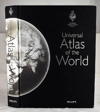
20082401030033Philip's 2008-10-06. Hardcover. Very Good. 12x2x17. Bound in publisher's cloth. Hardcover. Lacking slip case. Good binding and cover. Shelf wear. Corner chipped. Clean unmarked pages. 584 pages : illustrations chiefly color chiefly color maps ; 39 cm. <br> Includes maps of each state in the USA and large-scale maps of Britain and Ireland; Canada; Mexico; Scandinavia; Israel Lebanon and Jordan; Central Asia; Korea; Taiwan; Australia; New Zealand; and the islands of the Caribbean Indian Ocean and Pacific. This title includes a set of five ocean floor maps and maps of Moon and the night sky. <br> This is an oversized or heavy book which requires additional postage for international delivery outside the US. Philip's hardcover