Tom Harrison Maps (Firm)Biblio.com
1 660 résultats
1877689467.Gmap. Good. Access codes and supplements are not guaranteed with used items. May be an ex-library book. unknown
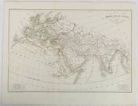
1820177230Paris. circa1820. Engraved map with original outline hand-colour 21.1 x 31.5cm original folds a few spots and a little creased but in very good condition. Latin map of the Ancient world encompassing Europe India Arabia the Middle East and North Africa by the French cartographer Jean Baptiste Poirson 1761-1831 finely engraved. . unknown
175961994W. Owen. London. 1759. First edition. Pages 461-964 8pp index. Contains the following fold-out maps: Poland Prussia and Lithuania opp. page 521 torn map of the area of London opp. page 561 Part of Persia opp. page 581 Chart of the English Channel opp. page 621 Commercial map of area around Leipzig opp. page 733 and Accurate map of the West Indies opp. page 937. A fold-out plate torn in two opp. page 833 18 engraved plates which incl. map of West Africa a view of Fort St. Louis in Senegal a path of the comet with the stars and the pictured constellations incl. Leo and Cancer in the bakground a sailing ship details of the Cherburg cannon and many natural history plates incl. enlarged louse. Half brown calf very worn and rubbed pages browned contents and binding sound. Please contact us for more information. unknown
1597755206-7-1-13National Geographic Maps. 2012. Acceptable. The item might be beaten up but readable. May contain markings or highlighting as well as stains bent corners or any other major defect but the text is not obscured in any way. National Geographic Maps unknown
2012SONG1597755206National Geographic Maps 2012-05-31. 2012. paperback. Used: Good. 10.50x0.25x14.75. Buy with confidence. Excellent Customer Service & Return policy. National Geographic Maps paperback
19302083002116201908Oriental Maps Masatoshi Yoshii 1930. Soft Cover. Fine. Number of books: 2 Oriental Maps Masatoshi Yoshii paperback
SHB-ALASKA-03-21-19Hardcover. Very Good. 1913 edition minor cover and edge wear. Previous owner's name on front flyleaf. Inside clean with no markings or writing all pull-out charts and maps very good. Nice copy satisfaction guaranteed. hardcover
T87-ODE-3EPHardcover. Very good. Imperial War Museum in association with The Battery Press 1992 V1. 380 pages V2. 517 pages red cloth hard covers with gold spine stamping no owner's mark or underlining tight and square very light wear. hardcover
1929000015669<p>London: Macmillan and Co. Limited 1929. 1929 reprint. hardcover. Very Good. Octavo red cloth covers xxvii 9 548 4 pages of ads for the series. Maps on endpapers and maps in the text. Corrections tipped in on several pages some red ink cross-outs text still readable. A few spots on covers and minor color bleeding into top margin of front map--does not affect image. Does not include separate map case. Part of the series: History of the Great War Based on Official Documents by Direction of the Historical Section of the Committee of Imperial Defense. 040414A</p> Macmillan and Co., Limited hardcover
1870423933.Ghardcover. Good. Access codes and supplements are not guaranteed with used items. May be an ex-library book. hardcover
193065119London / Nashville: Imperial War Museum / Battery Press 1930. 1st ed. thus. New Book. octavo. orig. cloth xvi 365pp. maps& plans appends. indexes Official History of the Great War. Facsimile of the original 1935 edition. Large folding map in rear pocket Imperial War Museum / Battery Press hardcover
1845878833.Gmap. Good. Access codes and supplements are not guaranteed with used items. May be an ex-library book. unknown
2006Q-2067119222Michelin Maps and Guides Firm 2006-01-01. Paperback. New. New. In shrink wrap. Looks like an interesting title! Michelin Maps and Guides (Firm) paperback
2067166174.Gpaperback. Good. Access codes and supplements are not guaranteed with used items. May be an ex-library book. paperback
1581743637.Gspiral_bound. Good. Access codes and supplements are not guaranteed with used items. May be an ex-library book. unknown
1999060925067Franklin Maps 1999. unknown_binding. Very Good. 0x0x0. Very good condition. Clean text without highlighting or underlining. Tight spine. Light wear to the exterior. Franklin Maps unknown
1928955363.Gunknown_binding. Good. Access codes and supplements are not guaranteed with used items. May be an ex-library book. unknown
1998G1877911666I3N00Franklin Maps 1998. Paperback. Good. Pages can have notes/highlighting. Spine may show signs of wear. ~ ThriftBooks: Read More Spend Less.Dust jacket quality is not guaranteed. Franklin Maps paperback
187791195X.Gpaperback. Good. Access codes and supplements are not guaranteed with used items. May be an ex-library book. paperback
SKU1023409Franklin Maps. Very Good. Franklin Maps; King of Prussia 1998. Softcover. A Very Good some handling/scuff marks to covers crease bottom rear cover corners binding solid and sturdy trace edge/corner wear a nice clean and unmarked copy in Oversize stapled Wraps. 4toquarto or approx. 9.5 x 12 inches approx. 151pp. 71 large scale maps 10300 streets indexed with zip codes and 1150 cultural features indexed with telephone numbers. We pack securely and ship daily with delivery confirmation on every book. The picture on the listing page is of the actual book for sale. Additional Scans are available for any item please inquire. Franklin Maps paperback
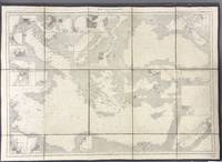
1914005933Paris: Dépôt des Cartes et Plans de la Marine 1914. Cloth Backed. Very good. This extensive uncolored sea chart provides comprehensive coverage of the entire Eastern Mediterranean Sea in multiple panels which have been assembled and backed with cloth to form a large composite map. Published by the official French hydrographic office in Paris the "Dépôt des Cartes et Plans de la Marine" which became the Service Hydrographique de la Marine around this time the chart is a practical navigational aid rather than a decorative one. It features a dense network of hydrographic data including numerous soundings indications of sea bed composition and detailed representations of coastlines and harbors. The chart's functional uncolored style is typical of official government maritime surveys designed for practical use by mariners with details corrected and augmented over time to reflect the most current surveys. Sheet dimensions: 76 cm x 107 cm approx. assembled from multiple sheets. Condition: Very Good. Sound paper uncolored as issued minimal signs of wear along seams where sheets are joined. Please see photos for full appraisal of condition. Dépôt des Cartes et Plans de la Marine unknown
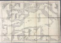
1914005930Paris: Dépôt des Cartes et Plans de la Marine 1914. Loose Sheet. Very good. This extensive uncolored sea chart provides comprehensive coverage of the entire Western Mediterranean Sea in multiple panels which have been assembled and backed with cloth to form a large composite map. Published by the official French hydrographic office in Paris the "Dépôt des Cartes et Plans de la Marine" which became the Service Hydrographique de la Marine around this time the chart is a practical navigational aid rather than a decorative one. It features a dense network of hydrographic data including numerous soundings indications of sea bed composition and detailed representations of coastlines and harbors. The chart's functional uncolored style is typical of official government maritime surveys designed for practical use by mariners with details corrected and augmented over time to reflect the most current surveys. Sheet dimensions: 76 cm x 107 cm approx. assembled from multiple sheets. Condition: Very Good. Sound paper uncolored as issued minimal signs of wear along seams where sheets are joined. Please see photos for full appraisal of condition. Dépôt des Cartes et Plans de la Marine unknown
19208575Paris 1920. French naval chart 63 x 91.5 cms black and white with beacons highlighted in yellow insets of Port dAbri the inner harbour at modern day Izmir and two coastal profiles slightly dusty lower margin one or two closed marginal tears blank verso. Engraved in 1866 after British charts by Copeland and Spratt this example of the map was printed in September 1920 during the Greek occupation of the Zone of Smyrna part of the territory awarded to Greece at the expense of the Ottoman Empire by the Allied powers after the Great War. Smyrna became an important base for Greek forces during the resulting Greco-Turkish War of 1919-1922 and in the bloody aftermath of the Greek withdrawal half the city was razed in the Great Fire of Smyrna also known as the Smyrna Catastrophe. Map unknown
0282753060.Gpaperback. Good. Access codes and supplements are not guaranteed with used items. May be an ex-library book. paperback
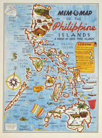
1945204557U.S.A.: Mem-O-Map Co. 1945. Colour pictographic / pictorial map 32.1 x 23.8 cms; 35.4 x 26.6 cms sheet very good condition. Rare pictorial map published in 1945 by John G. Drury aTechnical Officer who served with the 214th Ordnance Battalion to mark the end of World War II as souvenirs for the military. Military personnel could fill in banners "came in on good ship." and "departed on good ship." their name organisation and "Line of Advance or movement" blank in this example. Pictographs mark various memorable spots and wildlife including larger-than-life insects. A "Terrible Tillie Typhoon" looms over the coast at Luzon. <br>Drury published a series of five maps: Philippines and Okinawa in 1945; Japan and Korea Oahu and Europe in 1946. They are all scarce. “These almost whimsical maps are designed to support the creation of personalised geographies. At a time when digital mapping is beginning to experiment with the creation of personalised content that would render the same map in different ways for different users Mem-O-Maps demonstrate the principle in action." Kenneth Field ICA Commission on Map Design. . Mem-O-Map Co. unknown