SPRUNER, KARL AND MENKE,THEODORBiblio.com
1 660 résultats
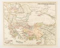
1877174915Gotha: Justus Perthes. 1877. Map with original colour and outline hand-colour 32.2 x 40 cm two inset maps text in German central fold in very good condition. A most handsome map detailing countries on the Aegean and Black Seas 1311 to 1390. The inset maps depict the kingdom of Stephan Duschan Serbia and the land of the Crimean Goths issued for the "Hand-Atlas für die Geschichte des Mittelatters und die Neueren Zeit". . Justus Perthes unknown
1998109297Granta Books London. 1998. Granta Books London. 1998. Paperback. Illustrated. Covers slightly worn to extremities. Page edges foxed and pages browned o/w clean and sound. SCARCE. paperback
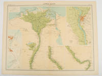
192047836London.: The Times. 1920. Map printed in colour 47 x 59.5 cm sheet showing cultivated land in green and desert in cream five insets: Port Said Suez Environs of Cairo and two showing continuations of the Nile; original fold two small edge tears but in very good condition. Attractive large map prepared as plate 79 from "The Times Survey Atlas and Gazeteer of the World". . The Times. unknown
20201-1566958695Natl Geographic Society Maps 2020. Paperback. New. fol map il edition. 6 pages. 9.25x4.25x0.71 inches. Natl Geographic Society Maps paperback
1566958695New. Brand new and still unused unknown
1566958695.Gmap. Good. Access codes and supplements are not guaranteed with used items. May be an ex-library book. unknown
1841390143.Gmap. Good. Access codes and supplements are not guaranteed with used items. May be an ex-library book. unknown
0881307661.Gpaperback. Good. Access codes and supplements are not guaranteed with used items. May be an ex-library book. paperback
X04I-00807Hippocrene Books. Used - Good. Good condition. A copy that has been read but remains intact. May contain markings such as bookplates stamps limited notes and highlighting or a few light stains. Hippocrene Books unknown
1910218723.Gmap. Good. Access codes and supplements are not guaranteed with used items. May be an ex-library book. unknown
1845879678.Ghardcover. Good. Access codes and supplements are not guaranteed with used items. May be an ex-library book. hardcover
1835000014144London: Cha. F. Cheffins 1835. Map. Ex-Library. 29 3/8" x 61.5". Linen-backed map done on two sheets. Map printed in black pink yellow and green hand-colored. Housed in a 8" x 5.5" green case with gilt lettering and a gilt device on the front board the front of the case states "London & Birmingham Railway. Map of the Line. above the device Incorporated 6th May 1833". A portion of the map backed with green goat in order to have it enter and exit the case more smoothly. A large and beautiful representation of the London to Birmingham railway line with the stops outlined at the bottom edge of the map. With two engraved vignettes showing the depots in Birmingham and in London. An early example of this captivating map. A bookplate and one stamp on the verso of the map otherwise no markings. The bookplate states that the map was a gift donated by James J. Hill a wealthy bibliophile from St. Paul to the University of Wisconsin Library. The map has three small spots of loss to its folds. The case has wear and light discoloration. Cha. F. Cheffins unknown
200237596London: Compass Maps 2002 Book. Fine. Hardcover. First Thus. Unique guidebook to London with pop-out maps. At the head of the spine is a compass to help get your bearings and inside is a small ballpoint pen for notetaking are both present and correct .Small size - only 17x10x1cm -easy to fit in a pocket. 84p. illus.col. NO copies found n Worldcat. Compass Maps hardcover
072343509X.Gpaperback. Good. Access codes and supplements are not guaranteed with used items. May be an ex-library book. paperback
0008496390.Gpaperback. Good. Access codes and supplements are not guaranteed with used items. May be an ex-library book. paperback
14486Without date or place. London Fire Force circa 1943. On one side of piece of 41 x 20.5 cm paper with lines and indications in light and dark blue red and green. In fair condition on aged paper with creasing and one closed tear towards the head. The map has Trafalgar Square at its head with the note that the two 'Basins' carry '40000 Galls. each' and Parliament Square at its foot. Whitehall and Parliament Street connect the two on the right of the map and to the left of the map is the lake in St James's Park: '200000 Galls Underground Tank Pumping Station 1400 Galls Pump 15 foot Gravity Main from Serpentine'. Also marked on the map are 'Inlet connections for L.F.F. Pumps and Pits' '6 Signle Outlet Suction Hydrants Round Thread' and 'Two 6 foot Steel Pipes in Subway Also under Embankment in Subway'. Down the centre of the map are the government buildings: the Admiralty Treasury Downing Street Foreign and Colonial Offices India Office and Home Office Office of Works Board of Education Board of Trade and Ministry of Health. No other copy found listed.Image on application. Without date or place. (London Fire Force, circa 1943.) unknown
19752090502113715761Not Available 1975. Soft Cover. Fine. The book is in fine condition. Not Available paperback
19782090502113712102Not Available 1978. Soft Cover. Fine. The book is in fine condition. Not Available paperback
19782090502113712103Not Available 1978. Soft Cover. Fine. The book is in fine condition. Not Available paperback
19631125558442Chicago: Denoyer-Geppert Social Science Maps 1963. Book. Very Good. No Binding. 1 map : color ; 69 x 105 cm folded to 42 x 28 cm. showing transport routes America wide.main lines and secondary routes divided in sections and laid on canvas eyelets for hanging very good conditionScale ca. 1:4500000 Denoyer-Geppert social science maps A19. Denoyer-Geppert Social Science Maps unknown
SKU1748713Academic Press 2017-04-20. paperback. New. 6x1x9. New Book Ships with Tracking Academic Press paperback
SKU0470112Academic Press 2017-04-20. Paperback. Good. Textbook May Have Highlights Notes and/or Underlining BOOK ONLYNO ACCESS CODE NO CD Ships with Emailed Tracking Academic Press paperback
Q-0316706078Little Brown & Company 1929-01-01. Hardcover. New. In shrink wrap. Looks like an interesting title! Little Brown & Company hardcover
193269128London: William Heinemann 1932. Hardcover. Very good. Hardcover. Sixth printing. xxix 577pp index; 14 maps. Name on front free endpaper scattered pencil underlining to text notes on half of rear endpaper some spotting to rear board else very good in publisher's red cloth. William Heinemann hardcover
1838021038London: T. McLean D.& P. Colnaghi and John F. Lewis 1838. 1838. Book. Illus. by John F. Lewis. Near Fine. Hardcover. First Edition. Folio approx. 55 x 36.5cm. Complete with all Lithographic plates as called for; tinted frontispiece tinted title-vignette further 27 tinted views on 25 leaves all by Lewis after Coke Smyth. A very clean bright copy. Finely bound in modern brown morocco to style with gilt lettering to the spine and gilt bands to the top and bottom of the spine. Contents clean and tight new light brown endpapers in keeping with the new binding two blank leaves to the front and rear all pages have been professionally cleaned and restored by a paper conservator minimal and unobtrusive water staining remains to some pages and plates mostly confined to the margins and blank areas most plates unaffected new archival paper guards to all plates no inscriptions. A fine complete copy beautifully rebound. References -. Abbey Travel II 394; Atabey 722; Blackmer 1015; Contominas 413; RIBA 1886. T. McLean, D.& P. Colnaghi and John F. Lewis [1838]. Hardcover