RUSSO-JAPANESE WAR CARTOGRAPHYBiblio.com

576 résultats
1904150900Berlin: Kartographische Abteilung der Königlich Preußischen Landesaufnahme 1904. One of just two known complete sets An exceedingly rare large 15-sheet map of China's strategically pivotal Liaodong Peninsula printed for senior German military commanders during the Russo-Japanese War and the Japanese siege of Port Arthur. We have traced one complete set at the Berlin State Library and the University and State Library Darmstadt has an incomplete set of six sheets. For the German army possessing up-to-date information on Liaodong was pressingly essential. Despite being officially neutral during the conflict Germany had significant geopolitical interests in north-eastern China having acted with Russia and France in 1895 to curtail Japanese expansion in East Asia after the First Sino-Japanese War. Russian-Japanese hostilities in particular the gruelling engagements around Port Arthur also threatened to spill over into Germany's nearby maritime territorial concession Qingdao. This highly detailed cartographic production printed at a scale of 1:42000 from Russian military maps from 1898-99 shows settlements of every size topography and spot-heights roads railway lines and other information of use in any potential military operation. 16 untrimmed photolithographed sheets 670 x 630 mm to 170 x 510 mm colour and black and white including 15 map sheets combining to form one large map as well as one key sheet with contemporary supplementary annotations. Generally clean and bright several sheets with fraying in margins 1 sheet with few tape repairs on verso 2 sheets with small loss at head in 1 case just crossing neatline occasional creases. A well-preserved set. unknown
1929356171929 Le Caire - Société Royale de Géographie d'Egypte - 1929 - 1952 - Complet en 7 volumes in-folio - 463 planches dont 38 en couleurs - Les trois premiers en reliure moderne, les 4 autres en cartonnage éditeur - Monumental ouvrage très rare complet car paru sur plus de 20 ans -
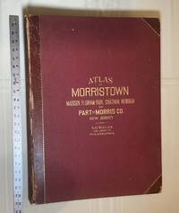
1910028278Philadelphia Pennsylvania: A. H. Muller Publisher 1910. Condition of the binding is Good but for rubbing at the corners and outer hinges cracked. SEE PHOTOS. Inner hinges are PERFECT having been reinforced by the publisher/bookbinder with sturdy maroon cloth. Housed in a Fine custom-made maroon cloth-covered clamshell case. SEE 2 PHOTOS its outside and both inner halves when opened. Condition of all maps is NEAR FINE - FINE. Pages are clean and unmarked. NO tears or foxing. SEE PHOTOS. This atlas consists of 25 i. e. 26 counting the Index map hand-colored lithographic linen-backed double page maps. The maps are color-keyed to the locations of each of the following: stone buildings brick buildings frame or half frame buildings stables or barns green houses steam railroads electric railroads water pipes sewers improved roads and fire hydrants. SEE PHOTOS. The double page maps open to an impressive 31.50" across by 22.25" tall. Each map did have a maroon leather numbered tab i. e. Index and 1-25 however the numbers for tabs 15-19 are broken/missing. SEE PHOTOS. Full title: "Atlas of Part of Morris Co. N. J. Embracing Town of Morristown The Boroughs of Madison Florham Park Chatham and Mendham: Morris Township and Parts of Chatham Hanover Mendham and Passaic Townships compiled from actual surveys official records and private plans by J. M. Lathrop and Thomas Flynn Civil engineers. Under the direct management and supervision of A. H. Muller Publisher 530 Locust Street Philadalphia PA. 1910." Collated and complete per table of contents. Includes a STREET INDEX. Bound in the original maroon cloth with maroon leather spine and corners. Gilt-stamping is still bright. SEE PHOTOS. The textblock could be easily rebacked with no re-sewing required since all pages/maps are still securely bound together. Oversize Hardcover. 17" wide by 22.50" tall. This massive extremely heavy book will require SUBSTANTIAL extra postage at our cost based on your location. LeGear ATLASES OF THE UNITED STATES L2343. Phillips A LIST OF GEOGRAPHIC ATLASES 3834. First Edition. Oversize Hardcover. Good - Fine condition/Fine clamshell case. Illus. by NOT a library discard. Atlas folio. Great Packaging Fast Shipping. A. H. Muller, Publisher Hardcover
1970404072Leipzig, Edition, 1970. Royal-Folio. M. 1 farb. Wappentaf. u. 53 (35 doppelblattgr.) Ktn. Ganzlederausgabe m. Goldschnitt, aufgeschlag. Superexlibris u. Beschlägen a. Vorder- u. Rückendeckel sowie 3 Schließen, auf 18 echte Bünde gearbeitet. Kommentarbd. Hldr. in Schuber. Am unteren Rücken leicht beschäd. Ohne d. Schutzkarton.
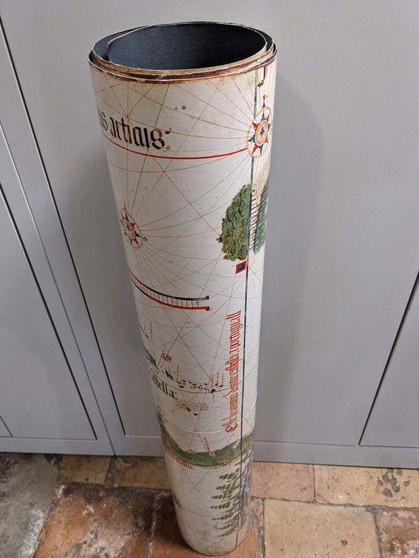
19833032FBZürich, Belser Verlag, 1983. Faksimileband: 62 x 46 cm. Kassette: 87 x 51 cm. 135, [2] Blatt; 80 Seiten. Original-Ganzlederband mit reicher Blind- und Goldprägung, 10 Messingbeschlägen und Lederriemenschließen mit Messingverschlüssen und Original-Pappband mit goldgeprägtem Titel in Original-Schmuckkassette aus Holz, die als Lesepult zusammengesetzt werden kann. [7 Warenabbildungen] (Codices e Vaticanis selecti, LIII).
19834043FBZürich, Belser Verlag, 1983. Faksimileband: 62 x 46 cm. Kassette: 87 x 51 cm. 135, [2] Blatt; 80 Seiten. Original-Ganzlederband mit reicher Blind- und Goldprägung, 10 Messingbeschlägen und Lederriemenschließen mit Messingverschlüssen und Original-Pappband mit goldgeprägtem Titel in Original-Schmuckkassette aus Holz, die als Lesepult zusammengesetzt werden kann. [8 Warenabbildungen] (Codices e Vaticanis selecti, LIII).
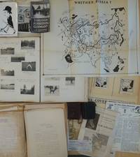
1950List2425Europe and California 1950. Includes two small diaries from 1901 and 1917 with sporadic entries a large photo album measuring 14 x 11 with appx. 400 small photographs from 1906-1909 attached to album pages most measuring 3 x 2 as well as a few larger format images laid in. With 100 plus pages of typed pages including retained correspondence story ideas and various other manuscripts. With eleven maps produced for his “Of Men and Maps†series including five copies of a large map entitled “Whither Russia†in varied states and in large sizes up to 30 by 36 inches and a handful of small ephemeral pieces. Generally near fine condition with the exception of the album which is missing its rear board and has some pages loose and torn. Very Good. J.M. de Beaufort a war correspondent for the London Daily Telegraph and New York American during World War I recounted his wartime adventures in the 1917 book "Behind the German Veil: A Record of a Journalistic War Pilgrimage." Originally arriving in Chicago in 1909 he married a steel magnate's daughter and pursued a career in show business. However by 1912 he had gone through a divorce and transitioned to newspaper work earning the moniker of the "Dude Reporter." Originally born in the Netherlands as Jacques Albert Uilenbroek he was thought to be a deserter. He spent the latter part of his life in the United States apparently jailed in San Francisco for a stint in the 1920s and eventually settled in Los Angeles. <br /> Offered here is an interesting smattering of material from the life of the mysterious De Beaufort which bookends his most unusual career and life with a large visual photographic record of his life in Europe as a young man and over a hundred pages of manuscript material from late in his life with a highlight being several maps in draft form for an apparently unpublished project called “Of Men and Maps.†As a group the material shows the work of an ex-con artist and war correspondent trying to regain his form while living in Los Angeles. He was still writing as a “Special Correspondent†at this point though the title seems to have been fully honorary. Also included are two small pocket journals with sporadic notations from his life in Europe in 1900 and in 1917. In its entirety the group gives an interesting visual and manuscript record of a literary fraudulent and imaginative transatlantic life and intellect. <br /> The cartographic highlight of the group is several iterations of a large map called “Whither Russia†in varied forms which show an interesting interpretation of the sphere of influence of the USSR and its growth from 1939 to 1946. Also included are two drafts of a map of Operation Market-Garden in the Netherlands in 1944 an unidentifed tactical map of a military battlefield a map called “Middle East Jackpot†showing the division of territory between the Allied and Axis powers a map called “Dawn’s Early Light some reproduced small format maps from the De Beaufort’s and a small map called “Gifts from Yalta.†De Beaufort was working on these maps for a column called “Of Men Maps and Memories†that was published in the East Los Angeles Tribune. He also sent the columns out in newsletter form from his address at 1635 N. Ogden Drive in Los Angeles. <br /> The collection of manuscripts drafts and retained correspondence tackle a range of subjects perhaps most interestingly those detailing De Beaufort’s creative process - drafts of stories lists of ideas for stories and letters. His over the top style is on display in a lot of the writings some of which are of unknown origin and purpose. The documents contain correspondence between De Beaufort and Edwin Pauley the oil man and presidential advisor. In one untitled essay he asks himself the question “What has been your most thrilling experience†and his reply is “ Silly questions. Who or at least what newspaperman of some 25 turbulent years standing - and falling - could answer such a question. A reporter’s life has a thousand thrills. There was that rainy day in Marcy 1915 in the fortress of Loetzen when I stood face to face with Hindenburg. Hm yes that was quite a thrill…†De Beaufort was entrenched in the Los Angeles journalistic scene at this point and the documents show the degree to which he relied on his former glories to attempt various career revitalizations endeavors. <br /> The album of photographs from 1906-1909 over 400 in total give a visual record of the young Uilenbroek’s life in Europe. The star of the collection is his bulldog Bob who travels throughout Europe with him and eventually comes to America by 1907. Mary who we presume to be his future wife is featured heavily in the images. It is unclear whether he was working at this point the images show affluent young people and their dog in varied cities and are purely of a personal nature. Other photographs laid in are relics from his war correspondent period. The loose photographs and ephemera are a mix of portraits from different periods from his life including two pictures of Sydney Turing Barlow Lawson one signed by his widow. The journals are sporadically filled and hard to decipher though one legible passage says “drinking all day.â€<br /> Overall the group gives evidence of this intriguing life and is the only extant group of material relating to Beaufort to our knowledge with the exception of a single journal from his time in Belgium during WWI that was sold at Bonhams and is still available in the trade as of this writing. unknown
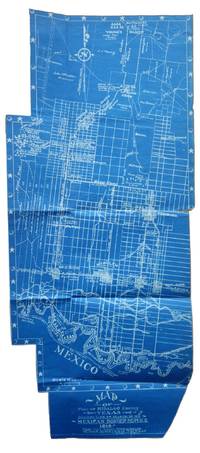
1917List2530VP 1917. Scrapbook measuring 15 ½ x 10 ½ inches. With forty leaves most with newspaper clippings and varied ephemera attached. Boards detached contents generally fine. Laid in is a blueprint map entitled Map of Part of Hidalgo County Texas Showing Line of March in my Mexican Border Service 1916. Made from Survey Notes taken on the march by Corp. C.A. Rice 74 Inf. N.G.U.S. Buffalo N.Y. Armory. Map measuring 33 ½ x 14 ¾ inches irregularly shaped and apparently complete. Very Good. A scrapbook documenting the military service of 1st Sergeant Samuel Gaffney of the 74th National Guard New York in the Mexican Border Service. Gaffney documents the campaign in great detail through printed matter - with each of the forty leaves containing material affixed including panoramic photographs advertisements from local businesses along the routes programs from entertainment offered to the troops military orders and official correspondence and many affixed newspaper articles and photographs. <br /> <br /> The scrapbook is most notable for the inclusion of an unrecorded map by Charles A. Rice the Buffalo native who would eventually map the campaign in larger fashion in a map entitled Map Showing Lines and March and Border Patrols in my Mexican Border Service 1916-1917. The map here just showing the route through Hidalgo County is unrecorded. The larger map - which was produced as souvenirs for the other members of the 74th - is quite scarce as well with five copies known to exist per OCLC with two different numbers. This blueprint map which appears to be complete cartographically and missing only the ornamental border on one portion shows the route taken early in the campaign in 1916. The Buffalo native Rice 1885-1931 who would eventually settle in Texas after the conflict also wrote a history of the 74th during the campaign. Rice published the maps and memoir himself. The map shows the route in great detail showing the location of wells farms roads and identifying landowners. Water quality and abundance is understandably a common theme in Rice’s notes. Some notes show the location of bandits smugglers and the like. We find no other examples of blueprint maps by Rice. <br /> <br /> Other highlights from the scrapbook include seven panoramic photographs of the 74th encamped at Pharr; a broadside advertisement for the shop of Agustin Acevedo in Pharr listing prices of goods; a handbill advertising the 74th’s Minstrels and Great Entertainment show on September 16 1916; an advertisement for a production entitled Glorious Liberty at the National Theatre in Pharr; two circulars instructing troop movement issued by Headquarters Brownsville District; several postcards with songs about the campaign; several snapshots; a mounted albumen photograph of troops at rest with the notation “Corp Frederick Paid†verso; a typed poem entitled “Home Again†and a notebook page describing his activities from January 1917 onward; and a thanksgiving menu for 1916 for the holiday spent at Pharr. The remainder of the scrapbook is composed of affixed newspaper clippings which provide extensive information on the 74th collected in a single volume. <br /> <br /> Overall a significant scrapbook with much information to glean for students of the 74th’s activities with the map providing a unique cartographic reference of the early days of the campaign. unknown
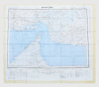
1963153757London: Geographical Section General Staff 1963. Scarce charts of Bahrain and the Straits of Hormuz A rare and historically interesting pair of adjacent maps of the Arabian Gulf covering six degrees of longitude each the geographical area encompassing the whole of Qatar Bahrain and part of what was to become the United Arab Emirates Al-Hofuf being the major city in the Al-Ahsa Oasis Eastern Province Saudi Arabia; sixth and fifth editions respectively. Maps of the period issued by the GSGS Geographical Section General Staff use a 7-colour tint scale to distinguish altitude and a glossary that highlights towns of significance and other standout features which provided steady references for army personnel to aid navigation in the challenging conditions of the region. The Bander Abbas map was compiled by the US Army Map Service Corps of Engineers from a number of sources including USAF Aeronautical Approach Charts of 1951-55 and the US Geological Survey of the Arabian Peninsula 1958. The Hofuf chart is based inter alia on 512 Field Survey Royal Engineers charts 1942-4. WorldCat lists just three individual copies for Hofuf NG39 SUNY at Buffalo University of Notre Dame and Eastern Illinois University alongside four copies of Bandar Abbas NG40 University of Exeter University of Notre Dame Eastern Illinois University and University of South Florida. It should be noted that major national institutions - BL for example - will have holdings of these maps within the complete GSGS series. Most copies would be discarded on supersession making these an important record of cartographic progress in the region. Two two-colour printed maps 1:1000000 scale 690 x 610 & 750 x 610 mm respectively. Ex- libris stamp of Arizona State Library both stamped "superseded" in blank margin and "withdrawn" on verso some pencilled marginalia; both in excellent condition. unknown
1956153759London: Geographical Section General Staff 1956 & 1957. Scarce maps of Oman and south-east Arabia dating to the Jebel Akhdar War A pair of decidedly uncommon and impressively sized regional maps both second editions Muscat-Musira following the first of 1945 S. E. Arabia first published in 1956. The Muscat-Masira map drawn up by D Survey of the Ministry of Defence reaches as far north as Khaburah Oman on the coast south beyond Masirah Island and westward reaching beyond Lahus and Hadhi. It is based on several mappings including Bertram Thomas's map of Rub' al Khali the "Empty Quarter" 1931 the sand desert covering most of the southern third of the Arabian Peninsula Samuel Barrett Miles 1910 map of Oman and Captain F. F. Hunter's map of Arabia 1935 revision. The aeronautical chart goes into greater detail reaching beyond Sur in the North South to Masirah Island and Manadhif and West to Uruq ash Shaybah UAE; this was drawn up by No. 1 SPC.RE i.e. Survey Production Centre Royal Engineers and is based largely on the USAF Aeronautical Approach Charts 1956 and World Aeronautical Chart 563 1951. During the mid to late-1950s Britain was involved in a number of disputes in Oman perhaps the most serious involving the Imam Ghalib al-Hinai and his brother Talib bin Ali who led the Imamate's revolt against Sultan Said bin Taimur which resulted in the Jebel Akhdar or Oman War 1954-1959. In this the RAF played a leading role not least because aircraft could at the same time expedite oil exploration operations in the interior of Oman. Pembrokes light transport aircraft and heavier Avro Ansons from 1417 Communication Flight RAF carried out reconnaissance "and other tasks during this operation against the Imamate and were the first aircraft ever to land at Nizwa marked "Nazwa" on the chart on a roughly cleared strip which proved extremely hazardous for the pilots but which was later transformed into a passable airfield" Lee p. 22. The present chart has two pencilled lines radiating from Masira airfield one of which passes through Nizwa near which is marked the "approx. position" of an airstrip. The chart bear the proviso that they should "not be taken as an authority on names" and that "the alignment of all tracks is approximate". Users were also directed to update information and highlight errors which were to be directly sent to the Director of the Military Survey in the War Office. There are noticeable graphical variations between the chart and map as fitting their usage. Before the Second World War pilots flew using landmarks - such as train tracks or roads - as pointers which meant that they relied on perfect weather conditions. However technological advances in aviation alongside the use of radio for more accurate navigation meant that to a degree pilots could work in more challenging conditions. This meant that maps with their focus on terrain and details relevant from the perspective of ground troops would become irrelevant when observed from a plane's altitude. Therefore a number of countries started to produce charts highlighting key information by reducing the contour structure and focusing on key landmarks necessary for aviators. The Muscat-Masira map uses a five-colour tint scale to distinguish altitude includes a glossary and key the latter identifying towns given four categories of importance significant ruins geographical features such as mountains hills marshes saddles and passes rivers water holes and man-made features such as railways roads tracks telegraph lines pipelines and pumping stations mosques and temples; tribal and regional names are also given. However reflecting the simplification required by pilots the S. E. Arabia chart only uses fives tones to highlight land mountains paths and the sea. These maps intended for use in the field would have had a high rate of attrition; WorldCat locates just a handful of copies of the Muscat-Masira map whilst S.E. Arabia 4802 is well represented institutionally but decidedly uncommon on the market. Two colour printed maps the first 1: 1000000 scale 860 x 640 mm the second 1:500000 scale 1100 x 825 mm. Both with creases from old folds and some minor marginal splits and spots the second with pencil lines marking a flight route from Masira Island and a notation in the margin; both remain very good. Sir David Lee The RAF in the Mediterranean and Middle East 1945-71 1978. unknown
1957182684London: War Office; Printed for D. Survey WO and AM by Balding and Mansell Ltd 1957. A bright example of this detailed Gulf map Classified "restricted" and issued for military use at the time of the Jebel Akhdar War this double-sided sheet shows much of the modern-day UAE extending northwards from the latitude of Abu Dhabi and the Buraimi Oasis as well as the eastern Arabian Peninsula from the Trucial Coast to Jubail. As with other contemporary GSGS maps the sheet covers six degrees of longitude and highlights towns of significance and other standout features for example oil pipelines and wells water systems and roads and railways. Rayon sheet 630 x 710 mm printed both sides in colour folded as issued. A fine example. unknown
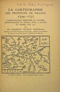
190827846Various places.: Various publishers 1908 to 1923. 10 volumes bound together in one volume. First Editions and all but one are inscribed by the author. Illustrated with cartographic cover art re-impressions of important works cartographic decorations and a number of maps including a number that are folding. 8vo the original printed wraps to each pamphlet are present and all are bound into the one cloth covered volume brown morocco label gilt. Each pamphlet can be considered fine and in exemplary condition some evidence of use and a bit of age to the cloth covers. A fine collection. A FINE COLLECTION OF INSCRIBED FIRST EDITIONS. Ranging from the cartography of the provinces of France 1594 to British and Irish Itineraries and Road-Books English Counties Welsh a pamphlet on the Evolution of the Maps of the Bristish Isles on the great engraver and mapmaker John Cary and two on France cartography and routes from the mid-1500's until the middle of the 19th century. ALL BOOKS ARE INSCRIBED BY THE AUTHOR. Various publishers paperback
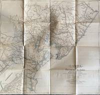
1928List1922Bahia 1928. Folded map. Fine condition. Fine. Teodoro Sampaio was an Afro-Brazilian cartographer engineer politician and historian who was very active in Brazil particularly in Bahia during the late nineteenth and early twentieth century. Offered here is Sampaio’s map of Bahia from 1928 which updates a map he produced in 1899 of the same region with updates of the settlement of the region including a detailed inset of the city of BBahio de Todos os Santos on the lower right corner. At the time of the map’s production Sampaio was an authority on Brazilian geography being a member of the Instituto Geográfico e Histórico da Bahia serving as president in 1922 and a member of the Instituto Histórico e Geográfico Brasileiro and the Instituto Geográfico e Histórico da Bahia and publishing several books on Brazilian geography. The period between 1899 when the first edition of this map was published and 1928 saw the development of rubber plantations in Bahia and the map provides detail on the region’s roads and population centers. We find no publicly held examples of this edition and one copy of the 1899 edition at Princeton though we do find a reference to this edition at the Brazilian National Archives. unknown
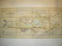
1912016735Borough of Hopatcong New Jersey 1912. Near Fine condition. SEE PHOTO. This is a beautiful and very scarce color map of Lake Hopatcong New Jersey. When unfolded it measures 18" tall by 38" wide. Some folds have been neatly reinforced on the blank side with archival-quality document repair tape. Buildings are represented by red squares water in green. Some of the properties and locations depicted are: Port Morris Landing Roxbury Township Borough of Mount Arlington Byram Township Nolans Point Atlas Powder Co. Brookland Borough of Hopatcong Byram Cove Henderson Bay Byram Bay Maxim Park Jefferson Township Woodport Hurdtown Hurd Mining Co. W. M. Force Estate John P. Lawless Mary Ingram estate Aaron Peck estate Raccoon Island Halsey Island Bertrand Island Theodore King Gertrude Otten Violet Littell Robert Dunlap estate etc. Full title: "Property Map of Lake Hopatcong New Jersey Prepared by Hudson Maxim for the Morris Canal Investigation Commission November 16 1912 Compiled from Various Maps and Actual Surveys by P. E. Boomer C. E.". First Edition. Folded map. Near Fine condition. 18" tall by 38" wide when unfolded. Borough of Hopatcong, New Jersey? Paperback
19941002CGModena, Biblioteca Estense, 1994. 103 x 220 cm. 2 Kommentarbändchen in Schuber. + Wichtig: Für unsere Kunden in der EU erfolgt der Versand alle 14 Tage verzollt ab Deutschland / Postbank-Konto in Deutschland vorhanden +, A
19941002CGModena, Biblioteca Estense, 1994. 103 x 220 cm. 2 Kommentarbändchen in Schuber.
19886977CBSüssen, Deuschle, 1988. 1 Atlas (30 Bl.) mehrfarbige Karten Kommentarband (102 S.). Orig.-Leinenkassette und Leinenband. + Wichtig: Für unsere Kunden in der EU erfolgt der Versand alle 14 Tage verzollt ab Deutschland / Postbank-Konto in Deutschland vorhanden +, A|B (Faksimileausgabe).
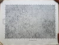
19693792<p>A very uncommon map of the Sea of Tranquility area that would be the site of the first moon landing in 1969. According to a description of a related larger-scale map in a 2020 Bonham's auction "NASA mission planners created this internal Manned Spacecraft Center chart a few months before the flight in 1969."</p><p>The map encompasses the area from 14 degrees South to 14 degrees North Latitude and from 0 degrees to 42 degrees East Longitude. The coordinates of the Eagle's landing site were 0.675 degrees Latitude North and 23.47 degrees Longitude East – very near the center of the mapped area.</p><p>The map is numbered "MSC – 6238 – 69" in the lower right margin. As it was meant for internal use only the map appears to be significantly less common than the LAC Lunar Chart series and the USGS geologic chart series. We were unable to locate an online reference to the map on the Lunar and Planetary Institute website.</p><p><strong>Condition: </strong>Rolled never folded. Some crinkling in the lower margin. Tear at extreme lower right corner with map number has been closed with archival tape on the reverse. Good.</p><p>ICN 7706.1.</p> NASA Manned Spacecraft Center
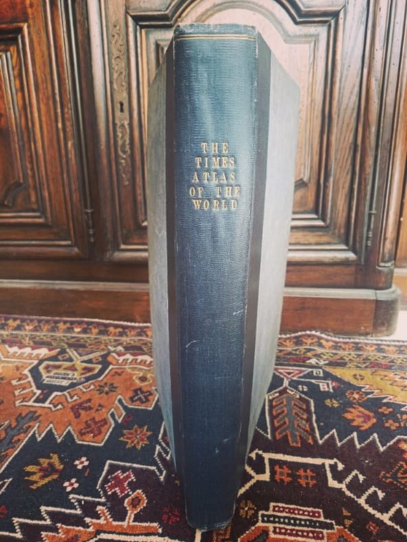
1922LCI-6530London, Printing House Square 1922 2 in -4 demi chagrin LE MONDE DE 1922 : SET GÉOPOLITIQUE SOUVERAIN. Ensemble exceptionnel comprenant le monumental Times Survey Atlas of the World (Bartholomew) et son rarissime Index de Prononciation in-quarto. Une archive totale des frontières post-Grande Guerre. Plus qu'une collection, c'est l'outil de référence absolu pour comprendre les racines des tensions mondiales actuelles. Un duo indissociable pour toute bibliothèque d'études stratégiques.
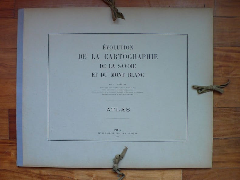
19226339Paris, Henry Barrère, 1922 ; 1 fascicule in-8 ; 32 pp., couverture imprimée ; 1 atlas in-plano oblong, en feuilles, de XXVI planches imprimées recto, reproduisant 123 cartes anciennes et 1 feuillet de titre, sous portefeuille cartonné gris imprimé, dos toile bleu passé, 6 lacets de fermeture.
192226951922 à Paris 1922. chez H. Barrère. Un Atlas in plano de 26 planches représentant 123 cartes anciennes. et une plaquette in 8 de 32 pages. plaquette à l' état de neuf, non coupée. Atlas en très bon état, cartonnage et intérieur. Quelques minimes taches claires au verso de quelques planches. COMPLET. TRES RARE. tirage à petit nombre.ref. Perret 4409.
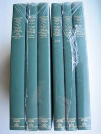
1995018762Storrs-Mansfield CT / Parsippany New Jersey: Martino Fine Books / About Books 1995. 6 separate volumes complete 5 volumes bound in 6 books WITH LARGE FOLD-OUT MAPS -- just like the first edition. SEE PHOTOS. Each of the 6 books in this 1995 large format edition measures 9.25" wide by 12.25" tall. This is NOT the later smaller format 3-volume reprint in which the maps are reduced in size. Unlike later reduced-size editions the maps in this 1995 six-volume edition measure as large as 21" by 33" when unfolded. SEE PHOTOS. As original co-publisher we are pleased to offer the few remaining sets of the 1995 large-format 6-volume edition recently rediscovered in our warehouse. They are BRAND NEW in perfect condition. STILL SEALED in the publisher's clear plastic SHRINKWRAP and the PUBLISHER'S CARDBOARD SHIPPING BOX. NO rubbing. NO fading. Bright clean square and tight. NO owner's name or bookplate. NOT a remainder. Fresh and crisp -- obviously never read. No date but 1995 First Martino/About Books printing "strictly limited to 350". Reprint of the original 1957-1963 six separate volumes: xiv 264; xiii 281; xiii 349; xiii 260; xix 222; iv 223-487pp. MAPPING THE TRANSMISSISSIPPI WEST is a monumental and exceptionally thorough work that is unlikely to be surpassed. The set is illustrated with a total of 376 maps including several that fold out. In this standard carto-bibliography are full descriptions of some 1300 maps from the year 1540 to about 1880. Wheat discusses each map showing the origins of its date and weighing its significance and accuracy. He also identifies the atlases and books in which the maps can be found. Norman Thrower: "Scholars and others who are interested in the American west have found Wheat's work indispensable." Ristow 382: "A comprehensive cartobibliography with many fine reproductions." The 6 volumes are uniformly bound in the original gilt-stamped green cloth. SEE PHOTOS. Oversize Hardcover. All 6 volumes measure 9.25" wide by 12.25" tall. This heavy set will require extra postage for Priority and International shipments. But for media mail you pay only our standard charge for 1 volume and we ship the other 5 volumes at no extra cost. First Martino/About Books printing. Oversize Hardcover. New/in publisher's shrinkwrap. Illus. by We ship all 6 volumes for cost of 1. 6 volumes: 9.25" wide by 12.25" tall. Great Packaging Fast Shipping. Martino Fine Books / About Books Hardcover
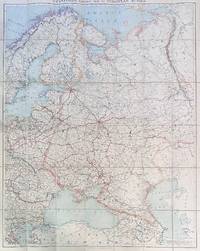
192284192London: Edward Stanford Ltd 1922. Large folding map. Lithograph in colors on uncoated paper dissected and laid down on linen as issued; overall dimensions 123cm x 97cm ca 48" x 38" folding to 20cm x 14cm 8" x 5-1/2"; card covers with publisher's slipcase of maroon cloth with printed paper title label. A bright clean well-preserved example Very Good to Near Fine. In the original slipcase cloth lightly rubbed at corners and a bit of soil to title label still easily Very Good.<br /> <br /> An impressive Revolutionary-era map of Russia in 42 sections scaled 1 inch to 50 miles. This revision dated March 1922 would appear to be the fourth and final edition of the map - it was preceded by editions in 1915 1917 and 1919. By December 1922 the Soviet Union would be formally established with Azerbaijan Georgia Belarus and Armenia which all appear here as independent states being absorbed into the Union of Soviet Socialist Republics. Edward Stanford, Ltd unknown
1985B119087Bruxelles, Crédit Communal de Belgique 1985-1991 La partie "Comté d'Artois" complet en 7 volumes, reliures cart. d'éditeur, jaquettes illustrées, 34cm., bel état, poids: 17.3 kg., [CONTENU: Tome I: Généralités, abbayes et villes (287pp., avec 122 planches en couleurs), II-III: Gouvernance d'Arras, première et deuxième partie (216 + 214pp., avec 180 pl.), IV-V: Comté de Saint-Pol, première & deuxième partie (253 + 251pp., avec 210 pl.), VI: Bailliages de Béthune et de Lens (279pp., avec 110 pl.), VII: Bailliages d'Aire, Bapaume, Béthune, Hesdin, Lens, Lillers et Saint-Omer, villes fortes (360pp., avec 134 planches], B119087
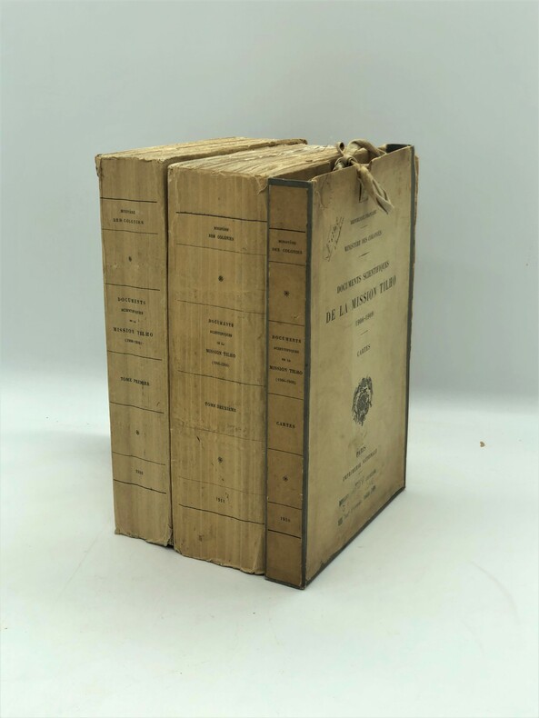
1910PHO-659Paris, Imprimerie Nationale, 1910-1911, in-4, 2 fort volumes brochés et un étui LX-412 pages et 76 planches et cartes (dont plusieurs dépliantes) + VIII-631-[1] pages, 131 planches et cartes ; 9 cartes(2 en double, manque la carte du Aïr), sous étui cartonné à rubans de l'éditeur, Unique édition, très rare avec les cartes. Ouvrage fondamental pour la connaissance des régions du Tchad et du Niger. Bon exemplaire, non coupé.