12 878 résultats
1718D14120Amsterdam: Aux dépens de la Compagnie 1718. Hardcover. Good. Contemporary speckled calf handsomely rebacked but one board detached; gilt-stamped lettering in tan leather spine label second compartment gilt-stamped ornament on 5 raised bands and direct in spine compartments; 3 volumes 12mo 163x95mm; pp. 10 336 35; 16 333 51; 14 468 32; with hand-colored engraved half-title in Volume I 18 hand-colored plates many folding hand-colored decorative head- and tail-pieces. Front rear board on volume one detached. Boards a bit scuffed along the edges; corners bumped; spines dry. Internally bright and clean; previous owner's tasteful bookplate. Plates are lovely. <br/><br/> Aux dépens de la Compagnie hardcover
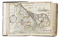
16525476Antwerp 1652. 4to 18 x 14.5 cm. Jan Huyssens Later 17th-century mottled calf sewn on 4 double cords gold-tooled spine and board edges. With a double-page letterpress title-page with a frame built up from typographic ornaments and 39 unnumbered double-page engraved maps of the northern and southern Low Countries by Jacob Aertsz. Colom each map coloured in outline. Interleaved with 38 blank leaves and with a manuscript table of contents 3 3 blank pp. at the end. Double-page title-page and 39 double-page maps. Second known copy of a pocket-atlas published at Antwerp but containing a selection of the maps of the Low Countries originally published by Jacob Aertsz. Colom at Amsterdam in 1635 with the title De Vyerighe Colom the title Colom had first used for his famous pilot guide in 1632 and the name he had given to his Amsterdam printing office where he worked from 1622 to his death in 1673 as a bookseller printer and mapmaker. The only other copy known is at the Royal Library in Brussels. The Vyerighe Colom with 47 maps and 3 plates and with extensive text in Dutch and French went through several editions in the 17th century but it was once thought that all editions before his death in 1673 had been published at Amsterdam by Colom himself. The Royal Library copy like the present one contains 39 maps but each contains one map not in the other so there are forty in total: the present copy includes Drentiae not in the Royal Library copy which includes Le terres entre la Meuse Vahal et Rhin not present here. The maps are also bound in a different order.The present edition is of great interest and gives cause to review Colom's activities. It is printed from Coloms plates so Colom may have licenced the Antwerp publisher to produce a variant edition of his Vyerighe Colom to broaden his market possibly reacting to the signing of the Peace of Münster in 1648 which finally ended the Eighty Years War and opened trade and communication between the northern and southern Low Countries. Jan Huyssens made an entirely new and practical atlas out of Colom's Vyerighe Colom. He omitted all text and the three plates that do not show maps and selected only maps of general interest leaving out the map of the ancient Low Countries and such typical Dutch maps as the separate maps of the polders De Zype Beemster Wormer Purmer Byllemermeer and Waterland also - at least in the present copy - completely rearranging the maps more in order of their geographical sequence. The title suggests that Huyssens originally planned to include a text so the present extremely rare edition may be the only surviving result of an abandoned project.l Koeman & Van der Krogt 365.23 IIIB pp. 644-645 2 copies: the present & Royal Library Brussels; UniCat 99095764 Royal Library Brussels only; cf. Koeman II Col 1 1635 Amsterdam ed.; not in KVK; STCV; WorldCat. unknown
189255835Chicago & New York: Rand McNally & Co. 1892. Thick elephant folio. 16.5 x 23 x 3 in. 597 1 pp. plus 4 pp. Classified List of Subscribers in Portland Oregon. With over 150 wax engraved colour maps colour diagrams and charts many double-page numerous black & white text maps for cities streets and townships. Full embossed brown morocco over beveled boards gilt lettering & embossed borders on front cover gilt decoration & lettering on spine gilt inner dentelles marbled endpapers spine rebacked w/ original laid back down minor repairs to leather on back cover some scuffing edgewear wear to corners still a VG copy with superb clean interior. First edition thus of the subscriber’s edition of Rand McNally & Co.’s famed Indexed Atlas which encompasses both Western and Eastern Hemispheres offering an essential cartographic and historic reference for the world at the height of the Victorian era on the eve of the 1893 Columbian Exposition in Chicago Illinois. The detailed maps for the United States drew upon the 1890 census results and presented the population of every city town village and settlement in America at the time including Alaska the Indian Territory and Oklahoma all with maps present as well as many large maps of major cities such as Chicago including the site of the forthcoming Columbian Exposition a Chicago Railway Terminal map as well as such cities as Baltimore Cincinnati Louisville San Francisco and many others. Rand McNally & Co. were famed for their relief plate engraving process was engraving which produced fine detailed maps with exceptional detail and colour in competition with such companies as Colton Asher & Adams of New York Matthews-Northrup Co. and George Cram. The atlas also encompasses large detailed maps of Africa India China Asia Europe the Russian Empire and more along with detailed economic and statistical charts across the World. This Indexed Atlas was also released in other variations such as two volumes for Eastern and Western Hemispheres as well as a more compact version with less maps and descriptive text and without the subscriber’s list although all were issued with the same title page. The subscriber’s list for Portland reads as a Who’s Who of the most important firms in the business at the time including the Weinhard Brewery Stranahan & Du Puy architects the Portland Bottline Works owned by Cordes & Johannsen Max Smith’s Vienna Cafe Edison General Electric the Portland Cracker Company and many more. Worldcat locates 7 copies California State Notre Dame & Toronto Complete w/ varying paginations; Univ. of Illinois & Rutgers Vol. I only Rutgers substantially incomplete; Case Western Reserve copy not listed as present in their catalogue LOC; See: Phillips & Le Gear A List of Geographical Atlases in the Library of Congress Vol. I 975. Rand, McNally & Co., hardcover
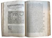
157643595Venice: Calignani & Porro 1576. Foliated 29.7 x 20.9cm a large complete untrimmed copy The enlarged Second Edition small folio 29.8 x 20.2cm 24201.1 colophon foliated with 47 copper plate maps decorated initial letters head and tail pieces in later full vellum red leather label gilt titles title page is lightly sprinkled with tiny spots a very good to fine large complete untrimmed copy of this enlarged edition containing 17 additional maps not in the first edition of 1752. fine. ~ ~ ~ ~ <br /> Header:. Porcacch. The Most Famous Islands Of The World. 1576. <br /> <br /> ~ ~ ~ Shirley. The Mapping of the World 127; The World Encompassed 87; Phillips. Atlases I67; European Americana 576/35; Sabin 64149; JCB I 263-264; Adams P-1905. This is one of the most beautiful works of its kind produced in the 16th century and is the ï¬rst to have maps engraved on copper rather than on woodblocks. "The popularity of Bordone's Isolario brought forth a successor which from both the cartographical and topographical point of view was far more distinguished. Porcacchi's description of the "most famous islands of the world" included the areas represented in the other atlas and devoted the third book to islands of the New World of the Pacific and the Indian Ocean. " "The ï¬rst world map is a ï¬nely-executed reduction of Camocio's large world map of 1567 one of the last in the long line of derivatives from Gastaldis prototype of 1546. The illustrated tract on islands presented here is said to be Porcacchi's most important work. - <br /> <br /> ~ ~ ~ Most of the maps included are: Iceland Hebridean islands and Orkney Gotland Hibernia Ireland England Scotland Sealand Maiorica Menorica Spain Malta Venice Italian archipelago corfu Curzolari Ionia Kefalonia island in the Ionian Sea Zante Morea Cerigo Candi of Indonesia Scarpanto Rhodi Santorini Milo Nixsia Cyrus Metellino Constantinople Stalimene Aegean Negroponte Greece Ciprus Temistitan Mondo Nuouo Spagnola Cuba San Lorenzo Peru S.Giovanni deL isole Molucche Indonesia and Del Mappamondo. The word Atlas was first used in the first collection of maps by Gerardys Mercator's "Atlas sive cosmographicae. 1585-1595 Calignani & Porro unknown
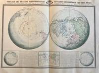
PR121406Five different perspectives of the world globe with regard to the circumpolars. Printed on one big sheet 580 x 860 mm. Map in French language with:Hemisphere Austral Hemisphere Boreal Figure pour l'inclimaison et declinaison tableau figuratif des lignes sans declinaison et sans inclinaison et notice sur les phenomenes magnetique decrits dans cette carte. Lithographed. Visible fold in the middle but further in good condition. Intersting boreal and austral hemispheres. From: Atlas Spheroidal & Universel de Geographie. Printed in Paris by Sarazin.Text above the globes: Tableau des Regions circumpolaires ou carte sphéroïdale des deux pôles avec le developpement complet des deux Hemispheres jusqu'a l'Equateur d'apres les lois de la perspective et l'explication des phenomenes Magnetiques de la Declinaison et de l'inclinaison de l'aiguille aimantee.NL Decoratieve atlas van de wereld Aardrijkskunde met boreale hemisfeer bovenkant aardbol en australe hemisfeer onderzijde aardbol. unknown
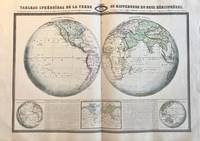
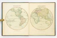
PR121407Five different perspectives of the world globe with regard to the hemispheres. Printed on one big sheet 580 x 860 mm. Map in French language with: Hemisphere occidental Hemisphere oriental aspect complementaire de l'hemisphere oriental and occidental and tableau des lignes isothermes ou carte d'egales températures.Text above the globes: Tableau sphéroïdal de la terre ou mappemonde en deux hémisphères ou la Projection donnant a la Terre l'aspect Concave est remplacee par la Projection plus rationnelle figurant sa Convexité et résumant à l'aide de Lignes Isothermes le Système de l'Egalité des Températures à differentes latitudes du Globe.NL Decoratieve atlas van de wereld Aardrijkskunde met isothermen hemisferen temperatuur lijnen etc. unknown
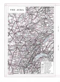
8371Paris: J. Barreau Imp. Edit.; Paris Lyons and Mediterranean Railway No Date. Quarto-sized booklet stapled in wrappers 26.5 x 19 cm. 19 1 pages. Illustrated with two maps in black and red and with two color plates and many black and white illustrations in the text. The text is a review of towns and cities in the Jura and Burgundy with small inset photographic images of famous buildings in each. In illustrated beige wrappers decorated and titled in dark green burgundy and gilt. Fine. J. Barreau, Imp. Edit.; Paris, Lyons and Mediterranean Railway unknown
194225894New York: Wilson Distilling Company Inc 1942. Fine. Unusual WWII era die cut atlas consisting of four circular panels printed on front and back with the 2 hemispheres of the globe in color on the front panels. These open to 2 panels of color illustrations featuring Wilson's Whiskey elegantly presented on a silver tray in front of a globe with the tag lines "No Better Whiskey in the World . Wilson That's All".<br /> <br /> The verso opens to 4 panels of printed text under the heading "Do You Know That" with interesting facts about nations around the world including this unusual information concerning Australia: "About one third of the adult population owns property and four fifths possess bank accounts."!<br /> <br /> Opens to 24 x 6 1/4"; folds to 6 x 6 1/4". Fine condition very bright and clean. Not found on Trove. OCLC: 1086382147 records only one copy at the Newberry Library. Wilson Distilling Company Inc unknown
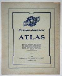
190427334Chicago: Rand McNally and Company; Chicago and North Western Railway Company 1904. First printing. Staplebound Wraps. Very good condition. Maps of the Russo-Japanese War five maps with a key printed in the margins comprised by the North-Western Line on inside front cover b&w World map; Asia; Eastern China; Japan and Korea all in color and 'the Only Double-Track Railway Between Chicago and the Missouri River and the Route of the Overland Limited' inside the back cover b&w. <br /> <br /> OCLC: 928938679 at Newberry Library Baskes Collection. Small folio printed paper wrappers grey covers with blue titles on front/back. Maps in color and b&w. Covers dusty slt. chip on foredge original folds. Rand McNally and Company; Chicago and North Western Railway Company unknown
1899867341899. ATLAS. ATLAS OF DORCHESTER WEST ROXBURY AND BRIGHTON CITY OF BOSTON in one volume. Boston: L. J. Richards 1899. Folio. 22" Street index plus 40 double page maps measuring 32" x 22". Bound in 1/2 leather which is largely absent. Front board is detached. Interiors are clean and free from staining with the exception of some light red or graphite pencil annotations on a few plates and soiled end-papers. Plates with pencil annotations: 28 29 30 37 39. Maps printed in as many as seven colors. A good copy. unknown
1896867391896. ATLAS. ATLAS OF THE CITY OF BOSTON VOLUME 6 WEST ROXBURY. Philadelphia: G. W. Bromley and Co. 1896. Second edition. Folio 22.5". Contains street index outline and index map and 30 double-page maps measuring 22.5" by 32". Maps have only minor soiling to margins and occasional pencil annotations plates 1 and 27. FFEP and title page have large chips. Bound in half leather now mostly chipping or absent. In need of rebacking front board detatched. unknown
1890867351890. ATLAS. ATLAS OF THE CITY OF BOSTON Vol. 7 BRIGHTON MASS. Philadelphia: G. W. Bromley & Co. 1890. Folio. 22" Contains 30 double page maps - outline and index map and 29 plates - measuring 32" x 22" with only slight marginal staining near spine at head. Maps are drawn at scale of either 600 100 or 150 ft/inch. Bound in 1/2 leather missing much of leather covering and has detached and chipped FFEP. Front hinge very weak. unknown
1899867361899. ATLAS. ATLAS OF THE CITY OF BOSTON: SOUTH BOSTON. Philadelphia: G. W. Bromley Co. 1899. Folio 23". Street index and 33 double-page maps - outline and index map and 32 plates - measuring 32.5" x 22.5". Ffep missing. Outline and index map has tear near bottom where sheet folds. Plate 1 partly detached. Plates 29 30 31 are detached. Plates 2 and 32 have pencil annotations. Bound in 1/2 leather which is flaking. Interiors are bright some soil. Good. unknown
1906867321906. ATLAS. ATLAS OF THE TOWNS OF REVERE AND WINTHROP SUFFOLK COUNTY MASS. Boston: Whitman & Howard 1906. Folio. 22". Double page maps measure 32" by 22". All plans are drawn to a scale of 150 feet to one inch except index map. Includes street index outline and index map and 25 double-page maps. Interiors are in good condition with some light staining throughout at head and spine pencil or ink annotations to title page and plates 3 4 5 8. Exteriors are fair with heavily worn half-leather with black cloth boards and gilt-stamped edges. A good copy. unknown
1896867401896. ATLAS. ATLAS OF THE CITY OF CHELSEA AND THE TOWNS OF REVERE & WINTHROP MASS. Philadelphia: G. W. Bromley and Co. 1896. Folio 22.5". Contains street index outline and index map and 22 double-page maps measuring 22.5" by 32". Maps have only minor soiling to margins and occasional pencil annotations plates 12 17 18 21 and 22. Bound in half leather now mostly chipping or absent. In need of rebacking front board detached. As is. unknown
178660376Antwerpen:: C. M. Spanoghe 1786. First Dutch translation. old paste-grain decorated paper boards sewn over tapes. Old ink ownership signature; a very attractive copy. 12mo. Engraved frontispiece 22 folding engraved maps with outline color and 2 folding plates. C. M. Spanoghe, hardcover
1922830191922. Ordnance Survey Southampton. 1922. Landscape 4to. Maroon cloth gilt to upper board. 24 linen-backed colour maps each measuring 75 x 35 cm. Extremities a llittle rubbed; a little mild soiling and some surface scratch marks to boards with discolouration to cloth at bottom edge of rear board; small white paint spots to spine. All maps clean and sound. hardcover
46641H.E.C. Robinson Ltd. Sydney. ND c1934. 8vo non paginated. Soft cover with simple green and pink artwork slighty soiled with a sound adhesive dark green spine and period advertising on both sides of rear cover in very good condition text in excellent condition with no tears or prior owner markings present. A series of 22 beautifully coloured and annotated maps sequentially bound together adequately describes this somewhat frail publication making it all the more rare in this very good condition H.E.C. Robinson Ltd. Sydney. ND (c1934) paperback
1809127861London: Printed for C. Smith Mapseller Extraordinary to his Royal Highness the Prince of Wales 1809. First Edition. Hardcover. Very Good. London Printed for C. Smith Mapseller Extraordinary to his Royal Highness the Prince of Wales 1809. Folio 404 × 330 mm engraved title leaf letterpress contents leaf and 43 hand-coloured copper-engraved maps numbered as 45 the map of Germany comprises two double-page sheets numbered 19-20 and 21-22. All leaves are printed one side only; all maps are dated 1808. Modern half calf and cloth with a gilt-lettered contrasting leather title-label on the spine; short scratch to the leather on the rear cover; title page a little tanned and discoloured around the margins by the leather corners of an earlier binding; scattered light foxing; insignificant short tears to some margins now sealed; trifling signs of age and use; overall in excellent condition. An attractive Georgian atlas 'on a Scale sufficiently large for the Purposes of general Reading and yet not too inconvenient for the Study or the Table' advertisement at the foot of the contents page. The three maps showing Australia 'Eastern Hemisphere' 'The World on Mercator's Projection' and 'Asia' all show the southern coast of the continent as uncharted. The expeditions of Flinders and Baudin had both charted this coast in 1802 but their maps were not published until 1814 and 1811 respectively. Printed for C. Smith, Mapseller Extraordinary to his Royal Highness the Prince of Wales hardcover
46644Geographia Ltd. London. 1923. Cr 8vo 128pp. Red cloth boards in fair condition with a fraying worn spine with early hinging and the title embossed in black on the front board and spine text is in very good condition though with significant tanning of title page and endpapers and prior owner highlightings of certain destinations. In an age of GPS navigation perusing a gem like this early road atlas is a real journey back in time and a must for any tourist from this era. It even includes a perpetual lamplighting table in Great Britain relative to London. Geographia Ltd. London. 1923. hardcover
1980122499New York: Times Books 1980. Hardcover. fine. Comprehensive edition. xl227pp. Folio. Illustrated with coloured maps and photos. Original black cloth with gilt lettering on front cover and spine in dust jacket. Fine condition. 1980 Times Books hardcover
D19537Philadelphia: Jacob Johnson. First American Edition. Hardcover. Very Good. Tree calf red leather spine label. 8 folded maps. Complete. Worn as almost always; front joint cracked spotting and toning creasing to maps. But a very respectable copy. <br/><br/> Jacob Johnson hardcover
1871894281871. ATLAS Bridgeman E.C. translated by Mitsukuri Genpo. RENPO SHIRYAKU 2 vols. Tokyo Zodiacal date of Meiji 4 1871. String-bound Japanese-style fukuro-toji. An interesting work by Bridgeman the Chinese missionary originally published in Chinese but here marked for reading as Japanese kanbun. Thus not a translation as we might understand the term but a long standing aid for literate Japanese to understand the original classical Chinese. With a number of bw and some color maps of the USA along with a text describing US history culture economics etc. A bit of cover soiling outside and the scattered signs of insect damage internally but overall a very good copy. Upon comparison to the original Japanese edition of 1861 there is not much to choose between them. unknown
1805D19536Boston: J. T. Buckingham for Thomas & Andrews 1805. Hardcover. Good. Two volumes. A matched set: volume one is a fifth edition with old stamps and bookplates from Meadville Theological School; volume two is a fourth edition bookplate of Anne and Clarence Kilburn. Both in contemporary calf spine labels; volume two with front board detached. Engraved maps throughout. Contents with occasional spotting and toning a few of the maps with creases and short edge tears but quite respectable relative to other sets. <br/><br/> J. T. Buckingham, for Thomas & Andrews hardcover
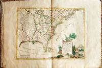
1778019206Venice: Antonio Zatta 1778. First Edition. Softcover. Some minor worming to inner marginal folds of maps occasional spotting. Complete with vibrant coloring. Close to Fine. Oblong folio 16 1/4" x 12" bound in contemporary limp decorated paper covers. Containing 15 double-page engraved maps including the double-page title each beautifully hand-colored depicting Bermuda; the east coast of North America from Nova Scotia to Florida west to the Great Lakes and south to "Luigiana" and "Messico"; Lake Superior and its coast with an inset of eastern Florida including the Keys and Bahamas; Canada between the Ottawa River and Hudson Bay; Labrador; Lake Michigan including parts of Michigan Illinois Indiana Wisconsin Minnesota and Iowa; Lake Huron Ontario Erie Ohio Pennsylvania New York the Hudson River Long Island and western New England; the Canadian and New England coast from Acadia and the Bay of Fundy down the coast to the Long Island Sound; Virginia the Mississippi and Missouri Rivers Louisiana and the Carolinas; Maryland New Jersey Virginia and the Carolinas; Jamaica; the Gulf of Mexico including the coast between Florida and New Orleans north into Indian territory; the east coast of northern Florida Georgia up to Cape Fear; Newfoundland and Cape Breton; and Hudson Bay. <br/><br/> Antonio Zatta paperback