LANGHANS (Paul).Livre Rare Book
12 878 résultats
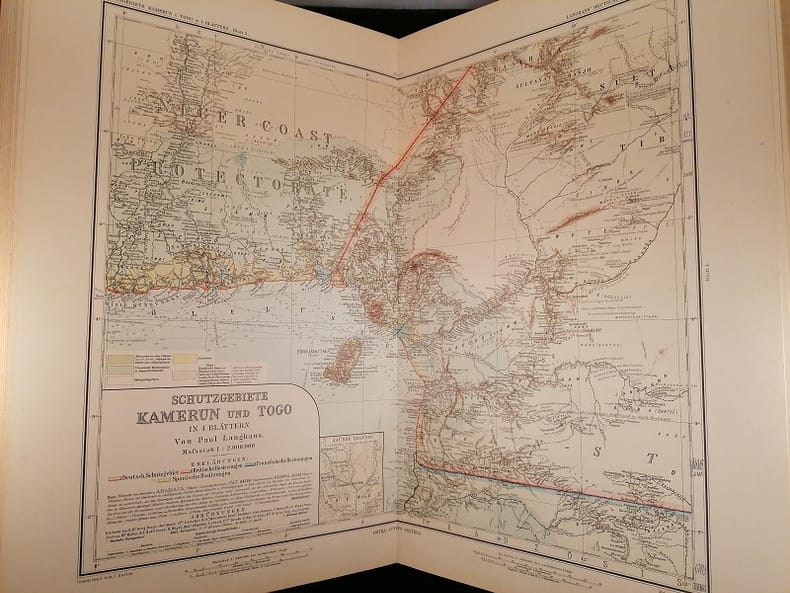
1897108945Gotha Justus Perthes 1897 1 vol. relié in-folio, demi-basane rouge à coins, dos à nerfs orné du titre et de fleurons dorés (reliure de l'époque frottée, particulièrement au dos et aux coins, quelques rousseurs éparses sans gravité). Bel atlas composé de 30 cartes en couleurs à double page montées sur onglets, intercalées de feuillets de légendes sur deux colonnes. Composé entre 1892 et 1897, l'atlas de Paul Langhans (1867-1952) est le premier recueil de cartes coloniales allemandes, et le seul répertoriant tous les protectorats de l'Empire allemand, il constitue un témoignage précieux de l'apport de la cartographie au discours colonial allemand de la fin du XIXe siècle. Rare.
1829237131829 PARIS, Eymery, Fruger et Cie Editeurs, 1829 - EDITION ORIGINALE - Bien complet des 50 cartes couleurs (certaines fortes traces d'humidité) - In-folio, 52,5 x 37,5 cm - 1/2 Reliure -1 mors fatigué - Dos lisse orné - 4 + 100 pages de texte (mouillures) puis 50 cartes gravées par Lallemand, en double pages montées sur onglet et colorées à la main excepté les 2 premières : systemes Planétaires et Planispheres Célestes qui sont en noir - Envoi rapide et soigné
PARIS, Eymery, Fruger et Cie Editeurs, 1829 - EDITION ORIGINALE - Bien complet des 50 cartes couleurs (certaines fortes traces d'humidité) - In-folio, 52,5 x 37,5 cm - 1/2 Reliure -1 mors fatigué - Dos lisse orné - 4 + 100 pages de texte (mouillures) puis 50 cartes gravées par Lallemand, en double pages montées sur onglet et colorées à la main excepté les 2 premières : systemes Planétaires et Planispheres Célestes qui sont en noir - Envoi rapide et soigné
18254775CBKarlsruhe, J. Velten, 1825-28. Atlas-folio. Doppelblattgr. Titel und Widmung, 3 Bl. Vorrede und Inhalt, 43 Doppelblatt mit 24 kol. Karten im Text. Halbleder d. Zt. + Wichtig: Für unsere Kunden in der EU erfolgt der Versand alle 14 Tage verzollt ab Deutschland / Postbank-Konto in Deutschland vorhanden +, 4775C
183847470S.l. [Hildburghausen] : Bibliographisches Institut, [ca. 1840] 1838. [117] Bl. : 115 Kt. (Stahlst.) ; quer8° gebundene Ausgabe, Halbleder, Seiten alters- und papierbedingt gebräunt, (stockfleckig) - sonst guter Zustand
1799PHO-1999À Paris, Chez F. Buisson, Imprimeur-Libraire, an VII (1799). 4 tomes TEXTE ; 3 volumes in-8°, 2ff.-VII-425pp.1f (catalogue), 2ff.-417pp.(2 tableaux dépliants), 2ff.-424pp., demi basane et coins, dos lisse avec pièce de titre et tomaison havane, tranches mouchetées bleues, petits frottements, accroc à une coiffe, petit travail de ver en coin sur qlqs feuillets (T2). ATLAS Voyage dans la Haute et Basse Égypte et Voyage en Grèce et en Turquie Paris, F. Buisson, An VII de la République (1799). In-4, 2 pp., 39 planches et une carte, mouillure angulaire à la carte, frottements, charnières fendillées et petit manque de matière, manque de papier au plat.
ORD-19735et les Nègres. Traduit de l'anglais par P. F. Henry. ATLAS seul.- Paris. Buisson. An VII de la République (1799). 1 volume in-4 (214 x 282 mm) dos à 5 nerfs et coins veau fauve, doubles filets dorés, pièces de titres maroquin rouge et noir, complet des 44 planches, certaines rempliées. Signature manuscrite sur la page de titre Stanislas Grabowski 1799. Quelques rousseurs pâles essentiellement marginales, reliure un peu frottée, petits défauts d'usage, planches en bon état.
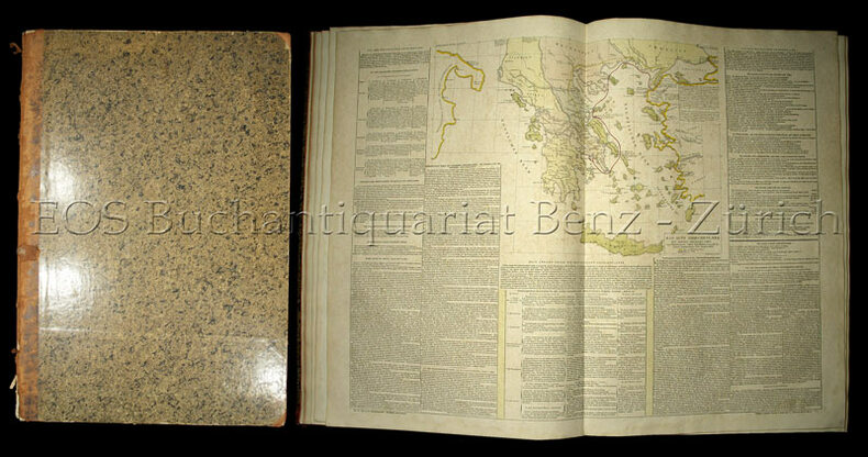
188058312Dressé par Ambroise Tardieu, revu et corrigé par A. Vuillemin, pour l'intelligence de la Géographie Universeklle de Malte-Brun Lavallée, 1 vol. in-folio reliure éditeur demi-percaline verte, Furne, Jouvet et Cie, Editeurs, Jouvet et Cie, Successeurs, Paris, 1880, avec 31 cartes : 1 : Empire Romain ; 2 : Empire d'Alexandre ; 3 : Géographie de la Bible ; 4 : Les Gaules ; 5 : Italie ancienne ; 6 : Grèce ancienne ; 7 : Espagne ancienne ; 8 : Mappemonde ; 9 : Europe ; 10 : France au Moyen-Age ; 11 : France par province ; 12 : France par départements ; 13 : Iles Britanniques ; 14 : Allemagne ou Europe Centrale ; 15 : Russie d'Europe ; 16 : Belgique et Hollande ; 17 : Suède et Danemark ; 18 : Espagne et Portugal ; 19 : Italie ; 20 : Turquie d'Europe et Grèce ; 21 : Asie ; 22 : Presqu'Ile de l'Inde ; 23 : Afrique ; 24 : Amérique Septentrionale ; 25 : Etats-Unis et Mexique ; 26 : Amérique Méridionale ; 27 : Océanie ; 28 : Algérie ; 29 : Environs de Paris ; 30 : Plan de Paris avec ses Fortifications ; 31 : Chemins de fer de l'Europe
Dressé par Ambroise Tardieu, revu et corrigé par A. Vuillemin, pour l'intelligence de la Géographie Universeklle de Malte-Brun Lavallée, 1 vol. in-folio reliure éditeur demi-percaline verte, Furne, Jouvet et Cie, Editeurs, Jouvet et Cie, Successeurs, Paris, 1880, avec 31 cartes : 1 : Empire Romain ; 2 : Empire d'Alexandre ; 3 : Géographie de la Bible ; 4 : Les Gaules ; 5 : Italie ancienne ; 6 : Grèce ancienne ; 7 : Espagne ancienne ; 8 : Mappemonde ; 9 : Europe ; 10 : France au Moyen-Age ; 11 : France par province ; 12 : France par départements ; 13 : Iles Britanniques ; 14 : Allemagne ou Europe Centrale ; 15 : Russie d'Europe ; 16 : Belgique et Hollande ; 17 : Suède et Danemark ; 18 : Espagne et Portugal ; 19 : Italie ; 20 : Turquie d'Europe et Grèce ; 21 : Asie ; 22 : Presqu'Ile de l'Inde ; 23 : Afrique ; 24 : Amérique Septentrionale ; 25 : Etats-Unis et Mexique ; 26 : Amérique Méridionale ; 27 : Océanie ; 28 : Algérie ; 29 : Environs de Paris ; 30 : Plan de Paris avec ses Fortifications ; 31 : Chemins de fer de l'Europe Bon état (coupes un peu frottées, qq. croquis anciens d'étudiants au crayon léger au verso des premières cartes) pour ce bel atlas en couleurs (hormis pour les cartes 28 et 31), au 31 cartes doubles, montées sur onglet. Français
182216881Paris, Delamarche et Dien, 1822. 2 Bll. (Titel und Inhalt). 33 (3 gefalt., 30 doppelblattgr). grenzkolorierte Kupferstichkarten. 4°. Mod. HKunstldr. mit Rücken- und Deckeltitel (bestoßen). [7 Warenabbildungen]
19835Paris: Dentu 1802. . 4to. pp.14 contemporary half green calf marbled paper-covered boards 37 copper-engraved plates and maps; upper margin of the first plate has been trimmed by the binder light wear to extremities of boards rubbing to spine a very good copy. Paris: Dentu, 1802. hardcover
Very Good Turkish, Ottoman (1500-1928) Original engraved map on the silk handkerchief made in Yildiz Palace for the 'Iane Sergisi' [i.e. Exhibition of the Social Assistance] in the period of Sultan Abdülhamid II. In its decorative frame. Frame size: 53,5x53,5 cm; map size: 38x38 cm. In Ottoman script. Scale: 1/600.000. Several minimal splits, minor foxing, and slight stains on cloth. Otherwise in good condition. A rare and decorative 1897 silk handkerchief map of the Greco-Turkish War in 1897, which was the only war in which the Ottoman army was victorious during the reign of Abdulhamid 2, is a fine example of Ottoman / Turkish cartographic textiles made in Ottoman court (Yildiz Palace textile workshops). This beautiful map depicts an attractive war scene from the 1313 Greek War on the upper half, and it's engraved a map of Balkan & Greek lands on its lower half. War painting has 'Melona' signature in Ottoman script. The map shows Thessaloniki [i.e. Salonica] Bay on the west; Yanya [i.e. Ioanna] Vilayat on the east; lands of Greece, Galos Bay, Uzi Strait on the south and Dimetoka and Avalonia areas in the Serefiye, Ergiri sanjaks on the north in its period. Written on the map, "Baht-i himâye-yi feyzvâne-i cenâb-i hilâfetpenâhide evlad-i süheda ve mecrûhin-i asakir-i sâhâne", [i.e. It was printed for the "Iane Sergisi" (i.e. The Social Help Exhibition) in the high memory of our soldiers who were martyred and veterans in the Greek War under the patronage of the Sultan.]. The Greco-Turkish War of 1897, also called the Thirty Days' War and known in Greece as the Black '97 (Mauro '97), or the Unfortunate War (Atychis polemos), was a war fought between the Kingdom of Greece and the Ottoman Empire. Its immediate cause was the question over the status of the Ottoman province of Crete, whose Greek majority long-desired union with Greece. Despite the Ottoman victory on the field, an autonomous Cretan State under Ottoman suzerainty was established the following year (as a result of the intervention of the Great Powers after the war), with Prince George of Greece and Denmark as its first High Commissioner. This was the first war effort in which the military and political personnel of Greece were put to test since the Greek War of Independence in 1821. For the Ottoman Empire, this was also the first war effort in which the reorganized military personnel were put to test. The Ottoman army was under the guidance of a German military mission led by Colmar Freiherr von der Goltz, who had reorganized it after the defeat in the Russo-Turkish War (1877-1878). The conflict proved Greece was wholly unprepared for war. Plans, fortifications and weapons were non-existent, the mass of the officer corps was unsuited to its tasks, and training was inadequate. As a result, the numerically superior, better organized, equipped and led Ottoman forces pushed the Greek forces south out of Thessaly. Almost all of the aids made to the families or disabled people of those who were martyred in the 1897 Ottoman-Greek War (such as printing this map) were made within the framework of the donations of "Evlâd-i Süheda and Malûlîn-i Guzât-i Asâkir-i Sahane". People and citizens of all classes and beliefs, including members of the Ottoman court, ministers, bureaucrats, civil servants, merchants and tradesmen, participated in this aid campaign at the end of the 19th, beginning of the 20th century. Not in OCLC.
1899867361899. ATLAS. ATLAS OF THE CITY OF BOSTON: SOUTH BOSTON. Philadelphia: G. W. Bromley Co. 1899. Folio 23". Street index and 33 double-page maps - outline and index map and 32 plates - measuring 32.5" x 22.5". Ffep missing. Outline and index map has tear near bottom where sheet folds. Plate 1 partly detached. Plates 29 30 31 are detached. Plates 2 and 32 have pencil annotations. Bound in 1/2 leather which is flaking. Interiors are bright some soil. Good. unknown
184618561Folio. Bound in one cont. hcalf., gilt back. Back slightly rubbed. With 32+66 fine steel-engraved maps made and drawn by Duvotenay and Defour. 2 maps handcoloured, a few brownspots, mostly marginal.
184618561Folio. Bound in one cont. hcalf. gilt back. Back slightly rubbed. With 3266 fine steel-engraved maps made and drawn by Duvotenay and Defour. 2 maps handcoloured a few brownspots mostly marginal. unknown
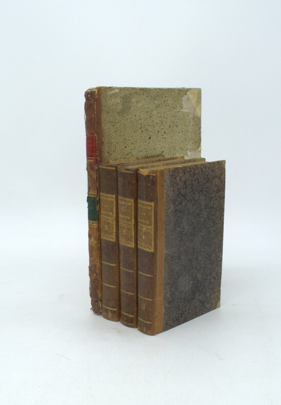
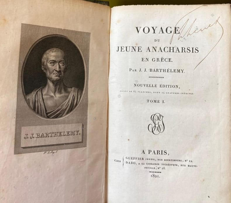
17994778Paris GUEFFIER ET DABO 1799 8 Paris, Gueffier et Dabo, 1821-1822 et 1799 pour l'Atlas, 7 vol. in-8 et l' atlas in-4, papier rel. marbré vert glacé, dos orné pour les sept volumes et veau moucheté, frise géométrique sur les plats, filet doré sur les coupes, dos orné de décors géométriques alternés, pièces de titres veau rouge et vert, pour l'Atlas.
180462956ABLyon, Cormon et Blanc. 1804. Seconde edition, 26,5 x 21 cm. 5 BL., 104 S. Text, 3 astronomische Tafeln, 30 Karten (Kupfer) kart. eingebunden in älterem Notenblatt (Missale) geringe Alters und Gebrauchsspuren,tls etwas fingerfleckig, auch stockfl. insgesamt wohl erhalten ,guter Zustand.
178840450ABA Londres (Paris, Lejay), 1788. Folio. 2 Bl., 4 S. 10 dpblgr. Kupferkarten, 93 (davon 5 dpblgr.) Kupfer u. 76 Tabellen in unterschiedlicher Größe. Kart. Ber. u. best., Rü. geplatzt. Gebr. u. stockfl., kl. Stempel a. Tit.-Bl. Selten.
126810aafLyon, Jean-Marie Bruyset, Père et fils, M. DCC. LXXXIV., (1784), pt. in-8°, frontispice gravé (Atlas porteur du globe terrèstre) + XII + 331 p. (+ 1 blanche) + 24 planches dépl. coloriées, dont une montrant la sphère et une montrant 3 figures de notre système solaire, ex libris enlevé reliure en veau raciné, dos orné en or.
18285099CBLondon, by the Author, 1828. Folio. 27 num. Doppelblätter, mit insgesamt 53 gest. mit handkolorierten Karten. Halbpergament d. 19. Jh. mit Rückenschild.
134368aafGraz, Akademische Druck- u. Verlagsanstalt, 1979, Gross-Folio, (ca. 60x40 cm), 67 S. (+1) + 48 Tafeln, davon 43 illuminierten Tafeln (nach Orig. kol. Kupferstiche mit Ansichten, Städten und Landkarten (8) der Schweiz), Weisser Ledereinband mit reicher Goldprägung. Einband identisch mit dem Original-Blaeu-Atlas des Prinzen Eugen v. Savoyen. (Wenige Kratzspuren u. Fleckchen).
122804aaf1794, in-4to, 2 engraved leaves : title and dedication + 14 p. general directions + 77 maps (1-81) incl. general map + 88 p. List of places, In contemporary soft brown leather covers, worn and bumped on corners and edges. (to be rebound).
18254775CBKarlsruhe, J. Velten, 1825-28. Atlas-folio. Doppelblattgr. Titel und Widmung, 3 Bl. Vorrede und Inhalt, 43 Doppelblatt mit 24 kol. Karten im Text. Halbleder d. Zt.
1880LBW-3189[Paris, Imprimerie Nationale, 1799-1880]. En six feuilles pouvant former un plan d'environ 1,41 x 1,65 m.
1708PHO-2180Amsterdam, aux dépens des Frères Châtelain, 1708. In-folio. [6] ff. n.ch., 90 pp. ; frontispice gravé par Sluyter d’après Romeyn de Hooghe ; planches gravées double page, tableaux chronologiques et chronologies généalogiques, tous présents et conformes à la table. Manque au dos, frottements, mouillure en marge, manque en marge planche 7.