ATLAS - LE SAGE, A (ie LAS CASES). i eBiblio.com

12 878 résultats
180855974Paris Didot L'Ainé 1808 1805-06. Folio. 54 x 39 cm. Contemp. hcalf. Wear to spine. Spine-ends repaired. Corners bumped.Titlelabel with gilt lettering on upper cover. 2 pp. recto: Atlas historique.- verso: Index listing 32 Engraved frontispiece: Les Fastes Napoléens de 1796 a 1808 with a small handcoloured map dated 1808. With 34 double-page uncut sheets ca. 53 x 72 cm. of which 16 are in letterpress text handcoloured 18 sheets are maps surrounded by text all handcoloured. Internally clean and fine in original colouring. Map-sheets dated 1805-06. The frontispiece having a dampstain. <br/><br/><em>Comprising maps from America Africa Asia Russia etc.etc. - See Phillips124-29 various editions. </em> unknown
CBS-9781469873206Lww Exclusive Np 45. New. Lww Exclusive Np (45) unknown
CBS-9781469873206Lww Exclusive Np 45. New. Lww Exclusive Np (45) unknown
184514296Firenze, per Vincenzo Batelli e compagni, 1845. 2 volumes in-folio demi-veau aubergine de 65-[3] pages suivies de tableaux pour le premier volume.
104727aafZürich, Orell, Füssli , 1981, in-Folio, 12 S., mit 19 gestochenen mit Seidenpapier abgedeckten Karten in Passepartout, Or. Leinen Kassette mit Titelschild ‘General-Carte der Schweiz’.
185121805Stuttgart, Krais & Hoffmann, (1851). 3 Bll., 136 S. mit einigen Textxylogr. 42 Falttafeln (davon 39 kolorierte lithographierte und 3 in Stahlstich). Quer-Gr.-4°. HLdr. der Zeit mit Deckeltitel (bestoßen und fleckig). [5 Warenabbildungen]
1 vol. in-folio reliure demi-chagrin noir, Andriveau-Goujon, s.d. [ circa 1876 ], 2 ff. et 32 grandes cartes doubles en couleurs Etat très satisfaisant (la carte 11 manquante a été rajoutée par une carte d'un autre exemplaire bruni et imprimé sur papier de moindre qualité, petits accrocs à 2 cartes en marge intérieure, qq. cartes d'autres atlas contrecollées au verso des cartes, rel. un peu frottée, bon état et belle fraîcheur intérieure par ailleurs) pour ce bel atlas imprimé sur beau papier. Français
1834PHO-1353Paris, Arthus Bertrand, 1834. 2 volumes in-8, (4)pp., 399pp.; ( 4), 416pp. , demi-veau havane, dos lisse avec titre, tranches jaunes ,complet des 10 planches qui ont été reliées en fin de tome II, second plat du tome II détachée , sinon bon état.
1802P1-2M-1Paris, Henri Agasse, An 10. - 1802. Un ATLAS in-4°, viii-[4]-67 pp.; 40 planches. 4 planches (n° 17, 25, 29 et 43) sont en déficit. Relié demi-basane, charnières faibles avec manque, reliure à restaurer. ÉDITION ORIGINALE de cet ouvrage peu courant, dédié aux armateurs et négociants, illustré de 43 gravures (40 pour celui-ci) + un frontispice du portrait de l'auteur, 16 cartes dépliantes et 27 scènes diverses : pêche à la tortue et poisson, cérémonie de mariage à Gorée, femmes Kazegut (Guinée-Bissau), danse des habitants de Sierra-Leone, "Maures occupés à ramasser la Gomme dans une forêt de Gommiers", "Les Maures poursuivant les Nègres pour les faire Esclaves", une dizaine de gravures de plantes (lentisque, aloé...) ou d'animaux (antilope, etc.). Durand (1742-1812), directeur de la troisième Compagnie du Sénégal, effectua un voyage jusqu'à Galam et conclut plusieurs traités avec les Maures, favorisant le commerce de la gomme. Mécontente de sa gestion, la Compagnie le rappela mais, lors du retour, son bateau fit naufrage. Son récit s'inspire d'autres écrivains dont Labat et contient le voyage à terre de l'un de ses employés, M. Rubault, à Galam. In fine se trouvent un vocabulaire wolof des chiffres, le coût des salaires des fonctionnaires, missionnaires, médecins et ouvriers blancs au Sénégal. L'Atlas contient les trois traités de commerce faits par l'auteur avec les princes du pays (impression en caractères arabes). ATLAS SEUL. DURAND : VOYAGE AU SENEGAL. Paris, Agasse, 1802. Atlas 4to, with engraved portrait, 40 plates, many folding. 4 plates are missing (N° 17, 25, 19 & 43). RARE, no foxing or water stains. Damaged binding.
39 x 57 cm), 24 pp. et 5 grandes cartes en couleurs à double page sur onglet Demi-toile de l'éditeur 1901, 1901, in-plano, 39 x 57 cm), 24 pp. et 5 grandes cartes en couleurs à double page sur onglet, Demi-toile de l'éditeur, Publication hors-série de l'EFEO, ce rare atlas est illustré de 2 cartes de l'Annam (sud et nord), 2 cartes du Cambodge (sud et nord) et d'une carte récapitulative de l'Indochine. Les tables présentent l'inventaire sommaire des monuments par circonscriptions administratives, et le répertoire alphabétique des points archéologiques. Préface de Louis Finot. Salissures au plat supérieur, restaurations d'angle. Quelques rousseurs. Cordier, Indosinica, 2816
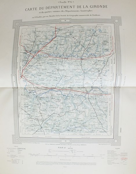
1876272611 vol. in-folio cartonnage pleine percaline éditeur, Marcelin Lacoste, Libraire éditeur, Bordeaux, gravé par J. Geisendörfer, imp. Lermercier et Cie, Paris, 1876-1878, en 9 feuilles
1770D18502Paris circa 1770. Paperback. Very Good. Chez Lattre Graveur Ordinaire de Monseigneur le Dauphin de Monseigneur le Duc d'Orleans et de la Ville. Engraved title-page dedication and 7 full-page engraved maps with original hand-color. 8vo format 10x6¾ inches original blue paste-paper wrappers light wear; minor worm track confined to the margins. A charming eighteenth-century traveler's guide from Paris to Compiegne. OCLC locates one copy listed under a different publisher. <br/><br/> paperback
8992647Short description: In Russian. Atlas Zakhary Veniaminovich. Money and Credit under Capitalism and in the USSR. Moscow; Leningrad: State Publishing House 1930 Moscow: type. The Red Proletarian . The image is provided for reference only. It may reflect condition of one of the available copies or only help in identifying the edition. Please feel free to contact us for a detailed description of the copies available. SKU8992647 unknown
Very Good Turkish, Ottoman (1500-1928) Original color map. Folded. Oblong folio. (35 x 52 cm). In Ottoman script. Color lithograph. A very detailed and attractive Ottoman map of America. Scale: 1:12.000.000. Otherwise a very good copy. Slightly chipped extremities. Dated Hegira: 1311 = [Gregorian 1895]. Ali Seref Pasa or Hafiz Ali Esref. He was a soldier, who was schooled in Paris as a cartographer around 1862. Already in Paris he published his first atlas with 22 maps, called 'Yeni atlas'. Upon his return to Istanbul he became a chief cartographer at the Maatbaa-i amire Printing Press in Beyazit, which was the successor of the Muteferrika press from 1727. Among others he translated the large Kiepert map of Anatolia to Ottoman. He died in 1907, leaving his large project of a gigantic map of Anatolia in 100 sheets unfinished. Ali's name is often misunderstood or even listed as two different people: Ali Seref Pasa and Hafiz Ali Esref. Until the surname law adopted on June 21, 1934, Turks did not have surnames. They were born with one first name and were until the adulthood described only as sons or daughters of their parent's names. Later they were given titles such as Effendi (Sir), Bey (Chief) or Hanim (Madam) for higher classes, or they were given names according to their work or class. The names were not inherited by children until 1934, when the surname law was enforced. The map maker Ali received names Seref, the honourable, and Pasa, the dignitary. He was also known as Hafiz, the memorizer of Qur'an and Esref, Proud. So Ali Seref Pasa would have a meaning 'Honourable Dignitary Ali, and Hafiz Ali Esref, Memorizer of Qur'an, Proud Ali. Daruttibaa - Matbaa-I Amire Printing Press: The first press in the Muslim world, called Daruttibaa, was founded in Istanbul by Ibrahim Muteferrika in 1727, with a permission of Sultan Ahmeet III. It was located in Muteferrika's house. The first book was published in 1729 and until 1742 sixteen other works followed. After Muteferrika's death, the press was supressed for printing, as printed books were considered dangerous. In 1796 the press was purchased by the government and moved to Uskudar in Istanbul, and in 1831 finally to Beyazit, where it was renamed to Matbaa-i Amire in 1866. The press was closed in 1901 and was reopened in 1908 under the name 'Âmire' In 1927 the name changed to State Printing House. The press still exists and is known for publishing school and educational books. Extremely rare. Not in OCLC.; Not in TBMM Map Collection.
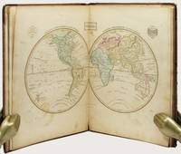
183533158Edinburgh: Oliver & Boyd ca. 1835. Early printing undated. Fully illustrated with 27 maps the map of the world double-page all hand-coloured. Two additional maps are affixed to the endpapers and are extra to those included in the book. These were sometime added by an owner of the volume. 4to publisher's original brown calf over brown cloth covered boards the spine lettered in gilt the upper cover with hand-printed titling label. vi 27 maps on 28 pages A very well preserved copy. The binding with some wear from time and use still strong and showing minor separation at the free-flies and pastedowns the maps all in good order clean and well coloured. EARLY PRINTING OF EWING'S GENERAL ATLAS. Now scarce as a complete book many copies have been broken up with the maps sold separately. The maps have been handcoloured and are preserved very well. A double-page world map is presented first and then the maps of the countries of European countries and Russia Asia Africa North America and South America. The U.S. map is quite interesting in that it includes only the states and territories recognized at the time of publication. The country is show bordering the Atlantic on the East but extending only into the Missouri Territory and Arkansas in the west. Oliver & Boyd hardcover
1896867391896. ATLAS. ATLAS OF THE CITY OF BOSTON VOLUME 6 WEST ROXBURY. Philadelphia: G. W. Bromley and Co. 1896. Second edition. Folio 22.5". Contains street index outline and index map and 30 double-page maps measuring 22.5" by 32". Maps have only minor soiling to margins and occasional pencil annotations plates 1 and 27. FFEP and title page have large chips. Bound in half leather now mostly chipping or absent. In need of rebacking front board detatched. unknown
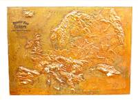
1907M11147Chicago: Atlas School Supply Co. 1907. Very Good. Notes: An interesting Relief Map of Europe. Size : 695x957 mm 27.36x37.68 Inches Coloring: Printed in Color Category: Maps Europe Continent; Atlas School Supply Co. unknown
194937964Toronto & Montreal: Underwriter's Survey Bureau Limited. 1949 1949. Hardcover. Very Good Rare. Atlas Folio. 55x31.5cm 18 linen backed double page scale maps a bit wrinkled green cloth covered boards Underwriter's Survey Bureau Limited. 1949 hardcover
190120341Paris, Octave Doin, Librairie Agricole, 1901. 2 volumes in-4, l'un broché de [4]-XLIII-[1]-956 pages, couvertures rempliées et l'autre relié en demi percaline de [4]-III-19 cartes en couleurs et 16 planches en chromolithographies.
177474141774 Paris, St, Julien, Boudet, 1774. Un volume in-4 plein veau d'époque, dos à nerfs, caissons ornés, pièce de titre de maroquin brun, triple filet en encadrement, reliure aux armes du Marquis de Clugny Thénissey (deux clefs entretenues), tranches dorées, [1] f., page de titre gravée, [1] f., 20 pp., 24 tableaux, 13 cartes rehaussées. Coins émoussés, mors fendus, rousseurs éparses.
183553619New York: Published by Huntington and Savage 216 Pearl St. 1835. Imperial 4to. 16 x 14 in. 10 leaves 8 engraved plates 2 double-page 7 hand-coloured minor foxing edgewear faint tidemark to lower margin of first few leaves. Original printed yellow softcovers mounted on thicker paper stock cover art woodcut of astronomer gazing at the stars w/ telescope testimonials printed on back cover soiling edgewear rubbing tide-mark to lower margin bumping to corners pencil drawings by child on verso of some plates trying to reproduce some of the figures still G copy. First edition thus stated “New Edition†which in actuality was an updated and revised edition with new engraved plates executed by W.G. Evans of New York fl. 1830-1845 who also engraved the famed Map of Lewis & Clark’s Track Across the Western Portion of North America in 1842 revised by Archibald M’Vickar. Burritt 1794-1838 an American astronomer and mathematician created his textbook and the later atlas as a low-cost alternative to celestial globes which were often too expensive for many schools in Jacksonian America. The atlas could be purchased for $ 1.25 at the time and the Geography of the Heavens textbooks and Atlases would prove immensely popular in classrooms up until 1876. Adapting most of his constellation figures from Alexander Jamieson’s A Celestial Atlas 1822 Burritt included a plan of the Solar System Celestial maps of the skies in January-March October-December April-June July-September South Pole North Pole and Planisphere of the Whole Heavens on Mercator’s Projection. This was the last decorative celestial reference in the 19th century and even served as inspiration of H.P. Lovecraft who notes it as prized possession in letter to Maurice Moe in 1915. See: Kidwell Elijah Burritt and the Geography of the Heavens Sky & Telescope Vol. 69 January 1985 pp. 26-28; Boston University Art Gallery Celestial Images: Antiquarian Astronomical Charts and Maps from the Mendillo Collection 2005 75. Published by Huntington and Savage, 216 Pearl St., paperback
1849azgsWilliam Blackwood and Sons Edinburgh and London 1849. 5th or later Edition. Hardcover. Very Good/No Jacket. 14 volumes plus atlas complete. All fully bound in leather with gilt decoration - to fascias spines and edges - and titling. All have marbled papertrims and frontis and end papers. This is a FABULOUS set of this popular loquacious history of Europe with the first major account of the French Revolution. It is smart handsome gentlemanly and very clubbable. Some of the books have wear from shelving and are scuffed but this only adds a genial dignity and character. All have binder labels T. Sowler Manchester - the very model of a Victorian businessman on the front pastedowns. Spines have five ridges and six panels. The Atlas 108 pages - published 1850 contains maps of countries and towns and plans of 'battles and sieges &c.' The covers are worn and scuffed. Within there are some small storage marks about. The pages are clean startlingly bright and clear finely detailed and the colours for various regiments fresh. Volume 1 633 pgs; 1849: wear to edges and spine but dignified and secure. The contents are tight and clean. Covers 1774-1789. Vol 2 693 pgs; 1849. In very good handsome condition. Light wear bright gilt. Inside the contents are clean and fresh. There is a silk bookmark. 1789 - 1793. Vol 3 635 pgs; 1749. The stamped decoration as with all other volumes is neat and unworn. The spine has some wear but is benign and kindly. The pages are clean and comfortable. Covers 1795. Vol. 4 654 pages; 1849. A lovely atmospheric copy. At last the story moves on beyond France. The pages are fresh. 1795-1799. Vol V 658 pgs. Neat contented bright. 1799 -1801. Vol 6 670 pgs. Nelson Pitt Napoleon! The odd storage stain. Otherwise very clean. 1801-05. Vol 7 690 pgs. Some age related marks. Tidy and handsome. Fox Prussia Clive of India! 1805-07. Vol 8 696 pgs. Tight confident clean. Some cover wear. Wellesley Napoleon Peninsula Wars. 1807-09. Vol 9. A happy book. Some wear. Spain George III! Pages exceptional. Vol. 10 630 pgs. Some scuffing and wear. Wellington the Emperor South America Turks Russians! Pages very clean. 1810-12. Vol 11 637 pgs. Some wear to the covers. Contents are smart. Moscow Germany Generals! 1812-13. Vol 12 640 pgs. Confident benign copy with some spine wear. Pages very secure and certain. Wellington in France Blucher Napoleon on the run. 1813-14. Vol 13 664 pgs. Edge and spine wear. Pages vigorous and healthy. Come-uppances America Vienna decides! 1814-1815 1814 is the date when Alison had the idea of this history. Vol 14 644 pgs. Some aged wear to the covers. The pages are startlingly healthy. Waterloo St Helena The First Reform Bill contemporary judgements. 1815 and index. Oh happy person who owns this THRILLING story as told in these wonderful and REMARKABLE volumes. fk. Our orders are shipped using tracked courier delivery services. William Blackwood and Sons, Edinburgh and London hardcover
1751654831 vol. in-4 (31,5 x 26 cm en marges) cartonnage ancien, dos à 3 nerfs, Chez R. Julien, à l'Hôtel de Soubise, Paris, 1751, 1 f. double (titre gravé à double page), 24 planches doubles de cartes, frontières rehaussées en couleurs, 3 ff. doubles (tables)
185652266Paris A. Combette 1856 In-folio, demi-veau noir, plats de papier noir estamps d'un motif froid, titre de l'ouvrage pouss or au centre du premier plat; doublures et gardes de papier marbr (reliure de l'diteur).Trs bel atlas comportant une page de titre illustre grave, un tableau grav donnant les statistiques de la France et de ses colonies, 92 cartes graves rehausses en couleurs (dont 86 cartes des dpartements et 6 cartes des colonies franaises), une mappemonde sur double page en couleurs, une carte de la France sur double page en couleurs, et 6 cartes rehausses de couleurs donnant l'Europe, l'Afrique, l'Amrique mridionale, l'Amrique septentrionale, l'Asie, l'Ocanie (100 cartes au total). Chaque carte est encadre d'un dcor figurant les paysages et les hommes clbres des dpartements ou des rgions.
9508Paris, Imprimerie Didot, 1757. In-4, (6)-471-(1) pp., reliure de l'époque plein veau brun, dos orné, tranches rouges (reliure frottée, coiffe inf. arasée; intérieur très frais).