Stieler, AAntiquariat.de

12 880 résultats
18817-0-644Gotha, Justus Perthes, 1881. gr.Folio(38x47cm), Titel, 1 nn.S.(Inhalt), 8 S., 95 Karten(Titel+94 Karten - so komplett), Halbledereinband
31470Rabat, Imprimerie officielle, Protectorat de la République Française au Maroc / Direction générale des travaux publics, Service des mines et de la carte géologique, Notes et mémoires n°33, 1936 - 4 volumes in-4 brochés, 1566 pages de texte, 63 figures in texte et 25 tableaux synoptiques sur les 2 premiers tomes, 4 tableaux synoptiques et 28 planches hors texte dans le tome III - Tome I : Les terrains primaires et le permo-trias - Tome II : Les terrains post-triasiques - Tome III : Paléontologie, pétrographie - Tome IV : Atlas des figures et des tableaux hors texte (contient 19 tableaux synoptiques, 17 schémas dépliants, 17 planches de dessins et de coupes, 3 planches de photographies - Bon état général, dos roussis, bords de couv. élimés, intérieurs impeccables - Avec dédicace autographe de l'auteur sur page de garde du tome I
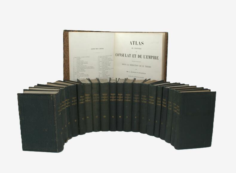
1845PHO-2027Paris, Paulin, 1845-1884, 20 volumes in-8 (tome 17 et 18 édité par Furne en 1884), percaline verte, dos lisse avec auteur et titre & un Atlas in-folio, 28 x 43,2 cm, relié demi veau époque, dos à caissons avec pièce auteur et titre noire et pièce de tomaison verte, griffures au dos, 4ff.- 66 planches montées sur onglets dont 7 à double page, certaines planches colorisées, quelques rousseurs au texte, un coiffe abimée.
"The aim of this Atlas is to bring the reader's attention to essential geographical facts, visible on large-scale Canadian maps. The author has tried to give some explanations for the various forms of relief and patterns of human settlements, roads and boundaries. A selected bibliography, which includes research papers, has been placed at the end of each chapter. The atlas is intended as a tool in the teaching of Canadian geography in universities and colleges, and to some extent - general geography on examples, selected from the eastern part of Canada." - from page 128. Includes 610 cartographical illustrations. Bilingual English/French. Sir George Williams University, Department of Geography - Publication No. 1. Oblong 11" x 17". Signed and inscribed upon title page by author to a fellow-Professor in 1974. Average wear. Unmarked. A sound copy Book
RO20020314"Evert Symons L.. fin 16e-début 17e. In-Plano. Broché. Bon état, Couv. convenable, Dos satisfaisant, Intérieur frais. Carte originale,en noir et blanc,( 60/51 cm), sur papier à la forme, (58/51 cm), échelle"" Milliara Germanica communia "",et ""Lieves de Gascongne"", légèrement fendu sur les bords de la carte. + 2 pages de texte en vieu français.. . . . Classification Dewey : 912-Atlas, cartes et plans"
RO20020300"IOANNIS IANSSONIUS EXC. 17ème-18ème s.. In-Plano. Broché. Bon état, Couv. convenable, Dos satisfaisant, Intérieur frais. Carte originale, sur papier à la forme, 56/42 cm, délimitation des provinces en couleurs, deux échelles ""Milliaria Germanica"" et Milliaria Gallica"".XVIII ème siècle environ.. . . . Classification Dewey : 912-Atlas, cartes et plans"
1700RO20020309"Chez I.B.Nolin. 1700. In-Plano. Broché. Bon état, Couv. convenable, Dos satisfaisant, Intérieur frais. Carte originale, sur papier à la forme, ( 80/56 cm), échelle :""Lieues communes de France à 25 au degré"", ""Lieues d'une heure de chemin , Lieues de Guienne"", "" Grandes lieues de Guienne de Gascgogne"".Légèrement abimée sur le milieu de la carte.Délimitation des provinces en couleurs.Légères mouillures sur les contours.. . . . Classification Dewey : 912-Atlas, cartes et plans"
2218Total 85 planches lecons et cartes en regard. 2e édition- lithographed coloured maps for the greater part folding 22 x 17 cm. oblong. Bruxelles : Callewaert Freres 1858 CALLEWAERT CONSTANT / ATLAS Very rare. Keywords Europe Europa history Geography Geographical Geographic cartography Book # 2218 unknown
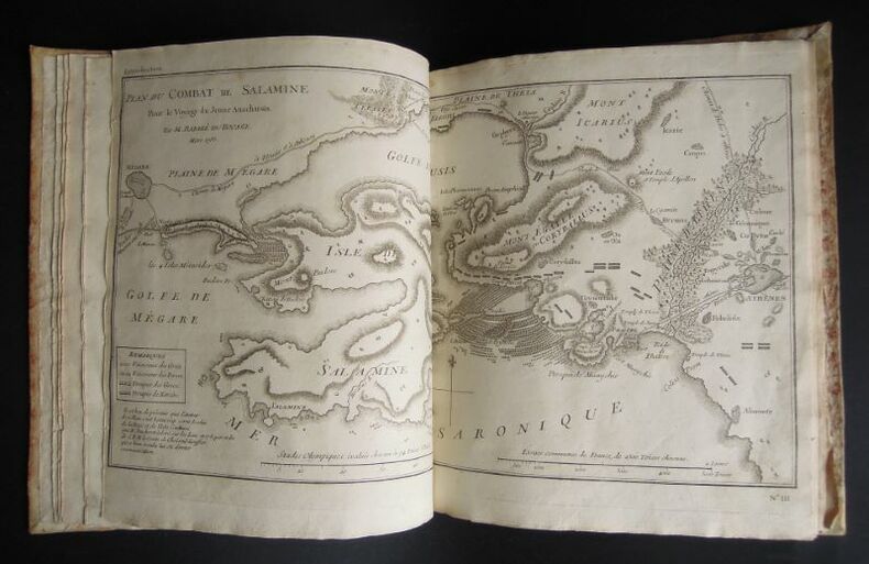
17931271793 s. l. [Venise ?], s. n. [Zatta ?], 1793, 1 vol. in-4° (26,3 x 21,7 cm) se composant de : 1 db-f. de gardes blanches, 1 f. de titre, 1 f. de table des illustrations avec leur répartition dans les neufs premiers tomes de texte de l'édition correspondante. 31 illustrations y sont annoncées, toutes reliées à l'exception de la première qui est une grande carte dépliante, simplement repliée et glissée entre deux autres f., 1 db-f. de gardes blanches. Roman historique sur la vie dans la Grèce antique et l'Orient méditerranéen. Atlas vraisemblablement issu de l'édition de 1791-1793 menée par Zatta à Venise, bien que celle-ci, en 12 volumes, soit au format petit in-8°: comme dans d'autres éditions de cet ouvrage, l'atlas final a un format plus grand. Les éditions postérieures (début XIXème) sont majoritairement au format in-12. Les illustrations gravées sont réparties au long du texte. Or ici, comme dans l'édition originale (Paris, 1788), elles sont regroupées en un atlas venant clôturer les tomes de texte. Au regard de l'année de publication, on en conclut qu'il s'agit de l'édition originale italienne, le texte ayant été traduit du français. Notons que seuls les feuillets de titre et de sommaire sont traduits, les cartes et illustrations, quant à elles sont légendées en français. Cet altas comporte 31 gravures au burin, pleine page, de différents formats, intitulées comme suit : I - La Grèce et ses isles, II - Plan du passage des Thermo-Pyles, III - Plan du combat de Salamine, IV - Essai sur la Bataille de Platée , 1 - Carte du Palus Méoti?e et du Pont Euxin, 2 - Plan du Bosphore et de Thrace, 3 - L'Helles-Pont, 4 - Plan des Environs d'Athènes, 5 - L'Attique, la Mégarde et partie de l'Isle d'Eubée, 6 - Plan de l'Académie et de ses Environs, 7 - Plan d'une Palestre Grecque, 8 - Plan d'Athènes, 9 - Plan et Elévations des Propylées, 10 - Plan du Temple de Thésée, Elévation de la Façade du Parthénon, Vue du Parthénon, 11 - La Phocide et la Doride, 12 - Essai sur les Environs de Delphes, 13 - Plan d'une maison grecque, 14 - La Béotie, 15 - La Thessalie, 16 - La Corinthie, la Sicy?nie, la Philiasie et l'Achaie, 17 - L'Elide et la Triphylie, 18 - Essai sur la topographie d'Olympie, 19 - La Messénie, 20 - La Laconie et l'Isle de Cythère, 21 - Essai sur la topographie de Sparte et de ses environs, 22 - L'Arcadie, 23 - L'Argolide L'Epidaurie. La Trézénie L'Hermionide, l'Isle d'Egine et la Cynurie, 24 - Platon sur le cap Sunium au milieu de ses disciples, 25 - Ancien Théâtre grec, 26 - Les Cyclades, 27 et dernier - Médailles tirées du Cabinet du Roi. La plupart sont des cartes, les autres, des plans d'édifices ou encore des perspectives aériennes, ainsi qu'une planche de médailles. Jean-Jacques Barthélemy (1716-1795) : auteur, historien, abbé, poète, philosophe, hélléniste, numismate. Jean-Denis Barbié du Bocage (1760-1825) : cartographe. Antonio Zatta (1722-1804) : libraire. Tardieu : graveur.
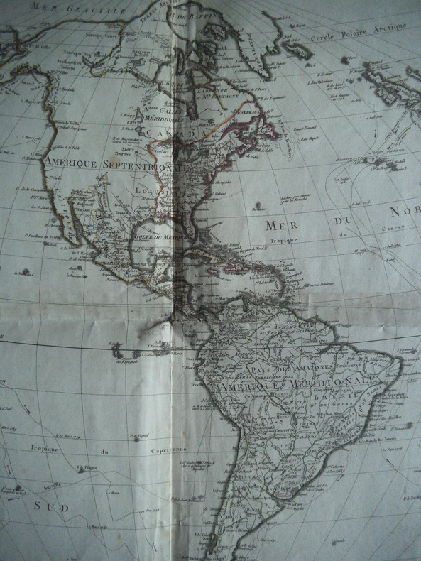
4997Où se trouvent les découvertes les plus nouvelles et les trois voyages de COOK.Dressée par HERISSON,A Paris chez Basset rue Jacques au coin de celle des Mathurins n°670. Format 780 x 540 mm.Contours coloriés d’époque.Une déchirure,avec manque,réparée,angle inférieur droit. Quelques renforts aux pliures,carte de format rare probablement publiée séparément
19057-10-678Berlin, Pharus-Varlag, 1905/06. 2°, 20 doppelblattgroße Karten, 194 S., LVI S; goldgepr. OHLn
BN66750Atlas Major Van Der Krogt Peter <br/><br/> unknown
18826274Chicago and Toledo: H.H. Hardesty & Co 1882. Hard Cover. Small Folio. Illustrated containing large scale copper plate maps of each state and territory of the United States and the provinces of Canada together with a complete reference map of the world topographical and railroad map of the United States thirteen comprehensive maps of Bible geography covering all the countries of Bible history with classified pronunciative index of each map printed in colors from plates secured by letters patent producing the clearest typographical effect of any known engraved plates accompanied by a general survey of the world history of the United States-History of each state and territory of the United States outline map and history of Lawrence County Ohio. Containing a condensed history of the County; Biographical sketches; general statistics; miscellaneous matters etc. Frontispiece depicts Geysers in the Yellowstone Valley 60 of 61maps present lacking #44 &45 which is the United States the five folding maps are on stubs and printed on a much thinner paper with the map of New York laid in closed tear on map #164 small loss at lower edge of map #165. Re-backed and cornered in brown leather retaining original gilt stamped brown cloth endpapers renewed. A very good copy with excellent maps. <br/><br/> H.H. Hardesty & Co hardcover books
5952122Short description: In Russian. Atlas Mariam Semyonovna. Development of banking systems in socialist countries. Moscow: Finance 1967. The image is provided for reference only. It may reflect condition of one of the available copies or only help in identifying the edition. Please feel free to contact us for a detailed description of the copies available. SKU5952122 unknown
5952122Short description: In Russian. Atlas, Mariam Semyonovna. Development of banking systems in socialist countries. Moscow: Finance, 1967. You are welcome to reach out to us for a detailed description of the copies currently available. Delivery of this book may take longer than usual including extended processing and pre-shipping time, no expedited shipping is available. Please advise us if you have a set date or a deadline to receive your order.SKU5952122
8992620"Short description: In Russian. Aseev, Nikolai Nikolaevich. A collection of poems. Moscow; Leningrad: State Publishing House, 1928-1930 (Moscow: type. Red proletarian ). You are welcome to reach out to us for a detailed description of the copies currently available. Delivery of this book may take longer than usual including extended processing and pre-shipping time, no expedited shipping is available. Please advise us if you have a set date or a deadline to receive your order.SKU8992620"
4to [31 x 23.5 cm]; 305 pp, 2 folding maps, 6 folding panoramas from photos, charts and sketches, numerous illus, index, tables. original green cloth with gilt lettering on front cover and spine and gilt map on front cover, light foxing on two leaves but a clean solid near fine copy, there was an atlas of maps sometimes found, not included here. A picture of this book is available Ricks p. 128. Wickersham 9375. A very well-illustrated survey of the border between Alaska and Canada.
185409794Gotha, Perthes, 1854. Hldr, Rücken gelöst, vorderes Gelenk gelockert, sonst gutes Exemplar, 2. Auflage
19785312DBEdited and with commentary by Georges Grosjean. Dietikon, Urs Graf Verlag, 1978. Folio. 95 S., 1 Bl. Mit 6 faks. Tafeln (lose). Halblederband.
191413240Berne, Bureau de Statistique du Département fédéral de l'intérieur, 1914. In-folio oblong de [2]-6 pages et 64 tableaux imprimés en couleurs. Coupes et coins légèrement frottés, plats un peu sali.
123448aafParis,Chez Jacques Lecoffre s.d., (ca. 1850), in-4° oblong, 1 page de titre avec ornements calligraphiques et ‘Globe Terrestre’ + 1 planche avec la table des cartes + 42 cartes avec frontières coloriées, premières 2 ff avec pt. manque de la marge, une feuille avec le nom ms. ‘A Isidore Jaquet Au Collège du St. Maurice 1856’ reliure rafistolée, en gardant les plats d’origine, bords et dos renforcé avec de la toile.
191656549Washington D.C. & Juneau A.T.: Superintendent of Documents U.S. Surveyor General’s Office 1916. Oblong Atlas Folio. 24 x 19 in. 14 colour maps 1 large folding 17.25 x 41.5 in. Printed softcovers stapled and paper reinforcement at gutter margin some minor toning & soiling to fore-edges edgewear to spine minor scuffing and a couple removed label ghosting still VG- bright copy. First edition of this remarkably scarce plat map atlas for the Matanuska coal fields and township sites surveyed by Walker & McDaniel during their surveys following those on the Kenai Peninsula. By 1912 with the act establishing Alaska as a U.S. Territory and in 1914 the authorization to construct an Alaska Railroad there became an increased need and demand for coal. The Matanuska mines located about 45 miles northeast of Anchorage first began production in 1916 and would stay in continuous production through both World War I and World War II and well into the 20th Century re-opening again in the 21st Century. Not only do these maps show available government lease sites for coal mines but also available Township sites for homesteaders as required by the original Homestead Acts of 1866 and the 1916 Act for Alaska requiring surveys and resurveys to accurately determine boundaries of unsold railroad lands and identify their boundaries. Worldcat locates 2 copies Anchorage Museum & Univ. of Calgary; See: Catalogue of the Public Documents of the Sixty-Fourth Congress Index Vol. 13 1922 p. 74; C. Albert White A History of the Rectangular Survey System 1983 p. 189. Superintendent of Documents, U.S. Surveyor General’s Office, paperback
ria9780805853285_inpHardcover. New. New Book; Fast Shipping from UK; Not signed; Not First Edition; Consistent with previous editions this book assembles in a single volume summaries of the treatment literature and treatment procedures of the most common childhood behavior disorders facing persons who practice in applied settings-cli hardcover
ria9780849335617_inpHardcover. New. New Book; Fast Shipping from UK; Not signed; Not First Edition; To meet society's increasing emphasis on food safety during production and storage this handbook provides in-depth descriptions of a tremendous range of media used for the cultivation of potential foodborne pathogens and food-spoilage hardcover
2007DADAX0843709545Hammond 2007-01-01. Revised. hardcover. New. 9.75x0.25x12.50. Buy with confidence. Excellent Customer Service & Return policy. Hammond hardcover