ATLASBiblio.com
990 résultats
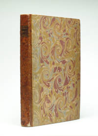
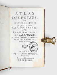
1784172751Lyons: Jean-Marie Bruyset 1784. A new and expanded edition of this popular teaching aid. Presented in a catechism-style question-and-answer format the text is accompanied by maps labelled with numbers and letters instead of place-names; the reader can test their ability to identify regions before checking their answers on the following page. It was published in Amsterdam in 1760. Duodecimo 156 x 93 mm pp. xi 1 331 1. Frontispiece of an infant figure of Atlas supporting the world 2 folding hand-coloured plates 22 similar maps all engraved after Guillaume Delisle head- and tailpieces. Contemporary mottled sheep spine with raised bands compartments decorated with elaborate floral design in gilt red morocco label floral patterned endpapers blue speckled edges red bookmarker. Later bookplate to front pastedown inscription noting purchase in 1793 to verso of first blank contemporary gift inscription to second blank later stamp to title page. Gilt a little rubbed rear board sprung corners bumped one worn small patches of stripping to front free endpaper from bookplate adhesive front hinge cracked but firm tidemark to fore edge margin occasional small ink marks. A very good copy. hardcover
#[37918]Rand McNally & Company 1994. Large folio. Original boards with dustjacket. With numerous coloured maps. hardcover
0243526725.Gpaperback. Good. Access codes and supplements are not guaranteed with used items. May be an ex-library book. paperback
0195211715.Ghardcover. Good. Access codes and supplements are not guaranteed with used items. May be an ex-library book. hardcover
1390677311.Gpaperback. Good. Access codes and supplements are not guaranteed with used items. May be an ex-library book. paperback
9786559774609-11-98694Editora Forense. New. Editora Forense unknown
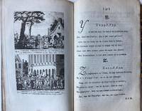
BB110059Half linnen binding 8º 205 x 125 cm. With 12 engraved pages each with 2 history prints in the period 1785-1789 the time of the Batavian Republic Bataafse republiek. BB110059Patriotten - patriots - ABC book - Schoolbook ABC- en geschiedenisboekje in enen waarin elke bladzijde getuigt van diepe liefde voor het Oranjehuis en zo mogelijk nog diepere afschuw van het landbedervend rot der patriotten. Elk van de 24 illustraties de letters J en X ontbreken gaat vergezeld van een zesregelig rijm en een beschrijving van de afgebeelde gebeurtenis. Op het alfabet volgen een dagboek op rijm waarin de gebeurtenisssen van de laatste vier vijf jaren op een rijtje zijn gezet en een vaderlandse geschiedenis in de toen zeer gebruikelijke vraag- en antwoordvorm beide eindigend met de gezegende omwenteling de restauratie van het stadhouderlijk gezag in 1787. Zeldzaam werk dat als een tegenhanger kan worden beschouwd van het ""Vaderlandsch A B boek voor de Nederlandsche jeugd""; dat de patriotsgezinde J.H. Swildens in 1781 had laten verschijnen. Lit.: Buijnsters BNK 1189 unknown
10626-0849335604Paperback. New. Book Condition is in New Paperback Eastern Economy Edition/Indian Edition textbook with identical content as the US version. May have been Printed in India with cover stating Not for sale in US. Fast shipping through the DHL FedEx Aramex And Delivered In 8-12 Days to all worldwide. paperback
2010Scientific-9780849335600Taylor & Francis India 2010. New. Taylor & Francis (India) unknown
2010Scientific-9780849335600Taylor & Francis India 2010. New. Taylor & Francis (India) unknown
10626-1469873206Paperback. New. Book Condition is in New Paperback Original Edition. Shipped Same Day. We do not ship APO and FPO. Will be dispatched fast. Please send me an email if you have any questions. 100% Satisfaction. paperback
2008Cambridge-9780521088305Cambridge University Press 2008. PAPERBACK. New. Cambridge University Press paperback
2008Cambridge-9780521088305Cambridge University Press 2008. PAPERBACK. New. Cambridge University Press paperback
1a203Übersichten für Wirtschafts- und Siedlungsplanung. Kartenband. Stalling Oldenburg 1936. 121 farb. gefalt. Karten. Maßstab 1: 800 000. orig. kart. Folio. NaT. unknown
0711027897.Ghardcover. Good. Access codes and supplements are not guaranteed with used items. May be an ex-library book. hardcover
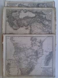
4aa173Perthes Gotha 1866-1872. Maße: ca. 40 cm x 335 cm verschiedene Maßstäbe teils Randläsuren/teils leicht wasserfleckig/teils randgebräunt. - Enthalten: Das Mittelländische Meer und Nord-Afrika Westliches Blatt / Das Mittelländische Meer und Nord-Afrika Östliches Blatt / Europa von A. Petermann / Spanien und Portugal gezeichnet von F. v. Stülpnagel / Spanische Halbinsel Blatt 1 2 3 und 4 von C. Vogel / Frankreich und die Schweiz bearbeitet von Hrm. Berghaus / Frankreich in IV Blättern bearbeitet von Friedrich v. Stülpnagel gestochen v. C. Poppey: Nordwestliches Nordöstliches und Südwestliches Südöstliches Frankreich / Die Britischen Inseln und das umliegende Meer von A. Petermann / Grossbritannien. Südliches Blatt: England ohne die nördl. Grafschaften u. Wales. Nördliches Blatt: Schottland u. der nördlichste Theil England's von A. Petermann / Irland von A. Petermann / Dänemark Schleswig Holstein u. Lauenburg nebst den dänischen Colonie'n von A. Petermann / Fluss und Bergkarte von Deutschland und den anliegenden Ländern entworfen und gez. von Adolf Stieler 1820 neue vermehrte Auflage 1857 / Süd-Afrika & Madagaskar von A. Petermann / Das Capland nebst den Süd-Afrikanischen Freistaaten und dem Gebiet der Hottentotten & Kaffern von A. Petermann / Nord-Amerika entworfen u. gezeichnet von F. von Stülpnagel / Verin-Staaten von Nord-America Mexico Yucatan u. A. gestochen v. C. Metzeroth / Verein-Staaten von Nord-America mit Ausnahme Florida's und der westlichen Territorien entworfen und gezeichnet von F. von Stülpnagel / West-Indien und Central-Amerika gezeichnet von Hermann Berghaus / Süd-America entworfen u. gezeichnet von F. von Stülpnagel / Süd-America in zwei Blättern gezeichnet von F. v. Stülpnagel neue berichtigte Auflage / Der südliche Theil von Süd-America / 4 Karten auf 1 Blatt: Neu-Seeland New-Zealand. West-Australien. Tasmania früher genannt van Diemen's Land. Der Isthmus von Auckland von A. Petermann / Australien von A. Petermann / Süd-Ost-Australien nach officiellen und authentischen Dokumenten von A. Petermann / Polynesien und der grosse Ocean Westliches Blatt von A. Petermann / Polynesien und der grosse Ocean Östliches Blatt von A. Petermann - unknown
1334616574.Gpaperback. Good. Access codes and supplements are not guaranteed with used items. May be an ex-library book. paperback
20277819-nnew. unknown
20277819like new. unknown
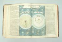
176130654Paris l'Auteur & Desnos vol. I Chec l'Auteur vols. 2-3 1761-62. Folio. 34x285 cm. 3 cont. hcalf. Backs worn tears to spine ends hinges weakening corners bumped. Vol.I: 57 double-folio leaves all engraved including engraved ornamental title in rococo-style leaves numb. 1-57. - Vol. II: 70 double-folio leaves all engraved including double-page engraved title different from the title in vol. 1 Table des Matieres. - Vol. III: 60 double-folio leaves all engraved including double-page engraved title the same as in vol. II Table des Matieres numb. 71-130. With in all 119 handcoloured engraved maps and astronomical plates. Further 68 other plates with tables text etc. All maps and illustrations having engraved text on both sides. On good thick paper. A few brownspots some dampstains mainly marginal 2 plates with small tears no loss. <br/><br/><em>First edition of this atlas which could be called an Atlas-series as the different parts were sold separately. The first volume having its own title deals with the historical development of cosmography geology astronomy oceanography winds streams etc. and illustrates this in a series of impressive pictures with globes spheres continents world-systems etc. having many maps of the continents globe-projections etc. - Volumes 2-3 deal mainly with historical geography and mapping having 84 handcoloured maps. Another volume which is not present here deals with contemporary geography. A fifth volume was announced but is unknown to the bibliographies. Phillips No. 628. - Shirley: T-buy 1a-2a. </em> unknown
179329054Paris Mondhare et jean 1793. Small folio. 36x31 cm. Cont. hcalf. Back somewhat rubbed and with some cracking along first hinges but tight and not loose. Engraved titlepage and engraved Table of maps bound at end - bottom a little shawed. With 64 double-page engraved maps the first 7 are hemispheres world-systems etc all handcoloured in outline. All maps have engraved text in borders. On good paper with only minor scattred brownspots in margins. Plates numb. 1-64. <br/><br/><em>Scarce last edition of Clouet's fine general atlas first issued 1767. Phillips records 2 other editions form 1787 Phillips No. 661 and 1791 Phillips No. 673 but not this. - Not in Shirley: Maps and Atlases in The British Library. </em> unknown
1878NF1958Illustrated Historical Atlas of the County of York and the Township of West Gwillimbury & Town of Bradford in the County of Simcoe Ont. Toronto: Miles & Co. 1878. Mika Studios N.d. a near fine copy of this reprint elephant folio facsimile edition with gold gilt stamping and lettering on the front cover. Mika Studios unknown
1996AME_9780781702829LWW 1996. 2nd. Hardcover. New/New. LWW hardcover
157418848Venetia Venice Giordano Ziletti 1574-73. 4to. Hcalf from ab 1820. Gilt back. Slight rubbing to spine. 78350 pp. and 65 double-page engraved maps with text on verso of plates 130 pp5665 pp. 6 textlvs. at end with brownspots in right margin sometimes a little browning to pages few brownspots and a few textlvs. with minor wormtracts. Complete with all 65 maps called for each measuring ab. 19 x 26 cm. A great part of the maps have some background shadowing from the printers ink mainly due to the fact that this is the third Ruscelli-edition where the plates have been used before. 3 printer's wood-cut devices and 20 smaller and larger woodcuts in the text. 2 woodcuts with Ptolemy shown observing. <br/><br/><em>Third edition of Ruscelli's translation from Venice 1561. The maps are printed from the same plates with the exception of Ptolemy's map of the world for which Malomba had returned to the original conical projection of Ptolemy. Moreover one map is added: the map of "Territorio di Roma". In general the maps are enlarged copies of Gastaldi's maps from the edition of 1548 which came out in 8vo. The Ruscelli translation contains an important innovation namely the division of the world map into two parts one for the Old World and one for the New as seen on the plate "Tavola Universal" depicting the 2 hemispheres. The atlas contains 27 ptolemaic maps and 38 new. 1 World 1 Hemisphere 10 Europe 4 Africa 12 Asia and 38 others. 10 of the maps relate to America.Philipps I:380. Sabin 66505. Nordenskiöld Nr. 34 p.27. </em> unknown
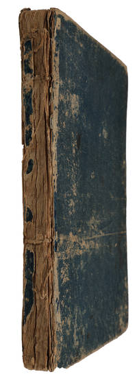
178335996Paris J. Barbou 1783. Large 8vo. 185x135 cm. Contemp. blue boards. Covers with wear and some scratches. Backstrip gone. Old owners names on title.V49 pp. and 20 double-page engraved maps of which 19 are handcoloured in outline paper measuring 18x22 cm. Textlvs. with traces of use. 2 maps with some smaller inkspots. Maps fine apart from some browning to margins. Maps unsigned but after the listing of the maps verso of titlepage is printed "Ces Cartes ont été gravées par M. André sur les dessins de M. Brion." <br/><br/><em>This military school atlas contains Mappemonde L'Europe L'Asie L'Afrique L'Amerique Sepetentrionale L'Amerique Méridionale etc. etc. - Not in Phillips Geogr. Atlases in the Libr. of Congress - Not in Shirley Maps and Atlasses of the British Library. </em> hardcover