ATLAS - STIELER, (A).Biblio.com
990 résultats
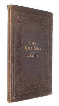
186633700Gotha Justus Perthes 1866. Folio. 38x245 cm. Orig. full cloth blindstamped and with title on front board in gilt lettering. Spine ends worn and a tear to upper part of first hinge. The printed title pasted on inside of front cover from the publisher. 2 pp. and 31 steel-engraved double-page coloured maps. The first Planeten-System lightly brownspotted otherwise fine with a few marginal brownspots to margins. <br/><br/><em>With maps of all the Continents Europe The Hemispheres etc. </em> hardcover
187957673Gotha Justus Perthes 1879-80. Folio-oblong. Contemp. hcalf. Gilt spine. Gilt lettering. Spine somewhat worn. Corners bumped. Wear to edges.Bound in front is "Vorbemerkungen zu Stieler's Hand-Atlas" 8 pp. Inhalt 2 pp. and 95 incl. title-page engraved and coloured maps. Maps dated 1879/1880 some undated. Maps clean and fine only few minor marginal brownspots. unknown
187357680Gotha Justus Perthes 1873-75. Folio-oblong. Contemp. hcalf. Titlelabel with gilt lettering. Spine somewhat worn and frontcover detached from spine. Stamp on title-page.Bound after title-page "Vorbericht zu Stieler's Hand-Atlas" 11 pp. Containing 89 engraved maps in outline colouring incl. title-page 1-24 26-90 A faint dampstain to some maps in upper right corners. Some underlining to German cities. Maps dated 1873 1874 a. 1875 mosly 1873. unknown
187642075Gotha Justus Perthes Maps dated 1876. Folio. Orig. full cloth blindstamped and gilt frontboard. Corners bumped edges worn covers with scratches. 2 pp. and 31 steel-engraved double-page coloured maps. Light browning to lower margins of some maps otherwise clean. <br/><br/><em>With maps of all the Continents Europe The Hemispheres etc. </em> hardcover
187743308Gotha Justus Perthes n.d. 1877-78 Folio. Orig. full blindstamped cloth. Frontcover with gilt title. Lower part of spine ca. 8 cm. lacks and top of spine with some wear otherwise fine. With 31 double-page 37x435 steel-engraved maps with outline colouring. All maps clean and fine. Maps dated 1877 a. the last 1878. hardcover
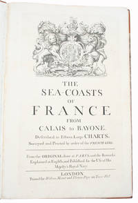
171534417London Printed for William Mount and Thomas Page on Tower Hall no date c. 1715. Folio. 53X35 cm. Cont. hcalf with marbled boards. Rebacked and recornered in old style with raised bands. Engraved typographical titlepage with a large engraved vignette showing the English King's Coat of Arms. With all 15 double-page engraved sea-charts numbered 1-15 in lower right corners. Neat repairs to inner margins of free endpapers and titlepage. Some browning to charts. Chart 5 45x755 cm having the right margin shaved reaching the printed frame. <br/><br/><em>Second edition of this scarce "Atlas Maritime". According to Shirley it was first published by Richard Mount and Thomas Page in 1701 and re-issued with undated title as this in ab. 1715 but with the charts unchanged and a new engraved titlepage. A third issue came out in 1737 with a dated title. The fine charts are copied from Pieter Mortier's famous "Neptune Francois" 1693-1702 and reduzed in size."The charts in this early Mount & Page atlas "The Sea-Coasts of France" are re-engravings reduzed in size from the charts in the French Neptune of 1693. The charts may also be found in the 1702 edition of Mount and Page's Atlas Maritimus Novus." Rodney Shirley. - Not in Phillips. - Shirley Vol. II: M.M&P - 12 b. </em> hardcover
177851680Edinburgh and London 1778. Large 4to. 32 x 245 cm. Contemp. hcalf. Raised bands. Title-label with gilt lettering. Top of spine lacks ca. 1 cm. of leather bottom of spine ca. 1/2 cm. Spine rubbed wear along hinges. Old owner inscription on top of title-page. Ex Libris Scholae Regis Edinensis. Engraved title-page and 23 double-page numb. 1-23 and all with original handcolouring. The map of the world 2 hemispheres: printed size 25 x 46 cm. sheet: 31 x 485 cm. Printed on heavy paper verso blank all clean and fine. <br/><br/><em>First edition. Not in Shirley. The copy described by Shirley I T.YOU - 1 a having another imprint dated 1782. All the maps in our copy is signed "Published as the Act directs 1st July 1778". Shirley mentions that the Atlas was doubtless intended for educational use. </em> hardcover
2903968330.Gpaperback. Good. Access codes and supplements are not guaranteed with used items. May be an ex-library book. paperback
BN66307Atlas and Synopsis Der Klinischen Dermatologie : German Version of Colour Atlas and Synopsis of Clinical Dermatology: Pleas Fitzpatrick <br/><br/> unknown
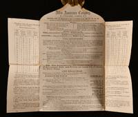
1869838G6London: Atlas Assurance Company 1869. Loose Pages Articles. Very Good Indeed. 8.5" by 10". None. An interesting letter from the Atlas Assurance Company in 1869 regarding their insurance policy. A scarce copy. In the original paper wraps. A letter addressed to one W. G. Bland stamped by the Atlas Fire & Life Assurance Office detailing their insurance policy. In addition the letter lists the company's directors and staff alongside the company's rates and accounts. The Atlas Assurance Company was a British life and fire insurance company established at the start of the nineteenth century. Although London based the company held branches in places as far as Buenos Aires Manila and Washington D.C. In the original paper wraps. Externally in smart condition. Some darkening to the edges and some light age-toning but otherwise generally bright and clean. Ink inscription detailing the address on the front. Some handling marks and pencil marks. Three postage stamps and one company ink stamp to the paper. Internally bright and clean with some light age-toning. Some edge wear. Light staining to the upper part of the letter which would have been stuck down. Very Good Indeed Atlas Assurance Company unknown
179655711Paris J.B. Delaval 1796/97. Folio-oblong. 40 x 55 cm. Contemp. modest hcalf. A paperlabel pasted on upper part of spine. Marbled paper on covers. A stamp on title-page. Engraved title-page and engraved Tableau dated AN V. With 67 engraved maps incl. Tableau numb. 1-65 53 bis and 58 bis. On title-page the name P.G. Chanlaire is erased. Engraved title-page slightly soiled Tableau the first and last map a bit brownspotted and last map with a closed marginal tear otherwise clean. <br/><br/><em>The atlas is based on the survey carried out by Count Joseph Ferraris in the late 1760s. On the "Tableau d'Assemblage" the last map concerning Belgium is no. 65 Luxembourg and also the last map here not in accordance with the mentioning of 69 on the title-page.According to Shirley "Maps in the Atlases of the British Library" T.CAP-1a the atlas should include 4 sheets covering Belgium on a smaller scale numb. 66-69 they are not present here but having all the regional maps. </em> unknown
63-9734London UK: Atlas Books 1995-1996. Six Dealer Catalogues. 8vo. ca. 50 pp. each Soft covers. B&W Plates. Very Good. London, UK: Atlas Books, 1995-1996. paperback
ria9798324432089_inpPaperback. New. New Book; Fast Shipping from UK; Not signed; Not First Edition; Dive into Atlas Carter's crazy world of Dinosaur hats.Embark on the adventure of a lifetime when prehistoric dinosaurs collide with a timeless accessory.Uncover the creative process behind art and Innovation.The Hats in this first serie paperback
B9798324432089Paperback / softback. New. paperback
0260169811.Ghardcover. Good. Access codes and supplements are not guaranteed with used items. May be an ex-library book. hardcover
20191-3337773788hansebooks 2019. Paperback. New. 364 pages. 8.50x5.99x0.82 inches. hansebooks paperback
45444334like new. unknown
1330864441.Gpaperback. Good. Access codes and supplements are not guaranteed with used items. May be an ex-library book. paperback
0007144989.Ghardcover. Good. Access codes and supplements are not guaranteed with used items. May be an ex-library book. hardcover
2019x-9813271795World Scientific Pub Co Inc 2019. Hardcover. New. 300 pages. 9.75x7.00x0.75 inches. World Scientific Pub Co Inc hardcover
B9783642445439Paperback / softback. New. Testing of individual subsystems began immediately with calibration systems and cosmic rays and by 2008 full detector systems could be operated with the planned infrastructure readout and monitoring systems. paperback
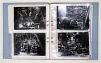
100974Selbstvlg. . 4° 52 Textbl. 8 Pläne 18 Orig.-Photographien der Firma Altas Copco u. Sandvik Coromant. Spiralordner mit eingelegten Bl. Tadell. Texte deutsch engl schwedisch.Der Gotthard-Strassentunnel italienisch Galleria stradale del San Gottardo ist mit 169 Kilometern Länge der viertlängste Strassentunnel der Welt und der längste Strassentunnel in den Alpen. Der Tunnel ist Teil der Schweizer Nationalstrasse A2 von Basel nach Chiasso. Die Autostrasse verbindet Göschenen im Kanton Uri mit Airolo im Kanton Tessin. Das Nordportal bei Göschenen liegt auf 108027 m ü. M. das Südportal bei Airolo auf 114557 m ü. M.1 Er wurde von 1970 bis 1980 erbaut und am 5. September 1980 durch Bundesrat Hans Hürlimann eröffnet. Der Gotthard-Strassentunnel ist der wichtigste Schweizer Korridor für Autos durch die Alpen für die Eisenbahn gibt es inzwischen den Gotthard-Basistunnel. Im Jahr 2012 wurde er durchschnittlich von 17'061 Fahrzeugen pro Tag befahren wovon 15 Prozent schwere Lkw waren. Die Verkehrsbelastung schwankt im Tagesgang und saisonal stark. Beispielsweise passierten an Spitzentagen im August 2012 über 34'000 Fahrzeuge den Tunnel. 010 Selbstvlg., unknown
17601<p>like new oversize pb expedited & international shipping not available</p> Atlas Copco paperback
B9781512345933Paperback / softback. New. paperback
1390507904.Gpaperback. Good. Access codes and supplements are not guaranteed with used items. May be an ex-library book. paperback