12 880 résultats
25368Paris, De Bure, 1789. 1 vol. in-4°, basane écaille, dos lisse orné de fleurons dorés, pièce de titre en maroquin brique, encadrement d'un triple filet doré sur les plats, tranches marbrées. Reliure de l'époque frottée, épidermures au dos, coiffe sup. élimée, coins émoussés. xlij pp. et 31 planches et cartes gravées en taille-douce, dont 16 repliées, par Guillaume de La Haye et Berthault, et 11 rehaussées en couleurs.
46641H.E.C. Robinson Ltd. Sydney. ND c1934. 8vo non paginated. Soft cover with simple green and pink artwork slighty soiled with a sound adhesive dark green spine and period advertising on both sides of rear cover in very good condition text in excellent condition with no tears or prior owner markings present. A series of 22 beautifully coloured and annotated maps sequentially bound together adequately describes this somewhat frail publication making it all the more rare in this very good condition H.E.C. Robinson Ltd. Sydney. ND (c1934) paperback
1809127861London: Printed for C. Smith Mapseller Extraordinary to his Royal Highness the Prince of Wales 1809. First Edition. Hardcover. Very Good. London Printed for C. Smith Mapseller Extraordinary to his Royal Highness the Prince of Wales 1809. Folio 404 × 330 mm engraved title leaf letterpress contents leaf and 43 hand-coloured copper-engraved maps numbered as 45 the map of Germany comprises two double-page sheets numbered 19-20 and 21-22. All leaves are printed one side only; all maps are dated 1808. Modern half calf and cloth with a gilt-lettered contrasting leather title-label on the spine; short scratch to the leather on the rear cover; title page a little tanned and discoloured around the margins by the leather corners of an earlier binding; scattered light foxing; insignificant short tears to some margins now sealed; trifling signs of age and use; overall in excellent condition. An attractive Georgian atlas 'on a Scale sufficiently large for the Purposes of general Reading and yet not too inconvenient for the Study or the Table' advertisement at the foot of the contents page. The three maps showing Australia 'Eastern Hemisphere' 'The World on Mercator's Projection' and 'Asia' all show the southern coast of the continent as uncharted. The expeditions of Flinders and Baudin had both charted this coast in 1802 but their maps were not published until 1814 and 1811 respectively. Printed for C. Smith, Mapseller Extraordinary to his Royal Highness the Prince of Wales hardcover
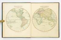
46644Geographia Ltd. London. 1923. Cr 8vo 128pp. Red cloth boards in fair condition with a fraying worn spine with early hinging and the title embossed in black on the front board and spine text is in very good condition though with significant tanning of title page and endpapers and prior owner highlightings of certain destinations. In an age of GPS navigation perusing a gem like this early road atlas is a real journey back in time and a must for any tourist from this era. It even includes a perpetual lamplighting table in Great Britain relative to London. Geographia Ltd. London. 1923. hardcover
1980122499New York: Times Books 1980. Hardcover. fine. Comprehensive edition. xl227pp. Folio. Illustrated with coloured maps and photos. Original black cloth with gilt lettering on front cover and spine in dust jacket. Fine condition. 1980 Times Books hardcover
200912999Paris, Les édiitons du sérail, 1990 ; in-8, 760 pp., cartonnage de l'éditeur(cartonnage abimé sur haut du dos, déchirure). Déchirure sur haut du dos.
200611827Paris, Fayard, 1983 ; in-8 oblon, 224 pp., cartonnage de l'éditeur. 2e edition revue, mise à jour et argumentée.
201224174Paris, Editions de deux coq d'or - les encyclopédies du livre d'or, 1975-1975 ; in-12, 180 pp., cartonnage de l'éditeur. Les 2 volumes. Très bon état tome 1 et 2 (autocollants eurojeunes sur le 1er plat).
201229587Colmar, Verlags anstast, 1912 ; in-12, 140 pp., cartonnage de l'éditeur. Bon état - ouvrage en allemand.
201229586Munchen, Lehmanns verlag, 1910 ; in-12, 141 pp., cartonnage de l'éditeur. Bon état - ouvrage en allemand.
200505261Rennes, Ouest-France, 1997 ; in-8, 48 pp., broché, couverture illustr.
200505258Rennes, Ouest-France, 1997 ; in-8, 48 pp., broché, couverture illustr.
200505260Rennes, Ouest-France, 1997 ; in-8, 48 pp., broché, couverture illustr.
200505262Rennes, Ouest-France, 1992 ; in-8, 48 pp., broché, couverture illustr. Nouveaux pays : Arménie, Azerbaidjan, Bélarus, Ukraine, Croatie, Slovénie.
200505263Rennes, Ouest-France, 1993 ; in-8, 48 pp., broché, couverture illustr. Départements et Territoires d'Outre-Mer.
63674P., Girard et Boitte, sans date (1889), petit in 4° relié demi basane brune, dos à nerfs orné à froid ; petits frottis d'usage.
200505023Baume-les-Dames, 1987 ; in-4, 255 pp., cartonnage de l'éditeur .
201808863Paris, Société des atlas pittoresques editions attinger , s.d. ; in-4, cartonnage de l'éditeur. Les 4 volumes. En 4 volumes très bel état.
201320921Paris, Société des atlas pittoresques editions attinger , s.d. ; in-4, cartonnage de l'éditeur. Les 4 volumes. En 4 volumes très bel état.
201322916Paris, Societe des atlas pittoresques , s.d. ; in-4, cartonnage de l'éditeur. Les 3 volumes. En 3 volumes.
202103085Paris, Librairie hachette et cie , 1894 ; in folio , cartonnage de l'éditeur. Reliure demi cuir frotté intérieur bel état.
201309414Paris, Le grand livre du mois, 1983 ; in-4, 48 pp., cartonnage de l'éditeur. Ouvrage en bon état.
200816364Paris, A alexandre libraire, s.d. ; in-8 oblong, 70 pp., demi cuir frotté.
9765Paris, 1738-1760. In 4° plein veau écaillé, dos lisse orné, triple filet doré sur les plats (dos passé, coiffes usagées, coins émoussés) comprenant 74 cartes simples, doubles ou dépliantes.
D19537Philadelphia: Jacob Johnson. First American Edition. Hardcover. Very Good. Tree calf red leather spine label. 8 folded maps. Complete. Worn as almost always; front joint cracked spotting and toning creasing to maps. But a very respectable copy. <br/><br/> Jacob Johnson hardcover