990 résultats
1865291848New York: J. H. Colton 1865. Second Edition. Colored engraved map with a bit of creasing at the fold. 11 3/4 x 9 1/2â€. From the second edition of Colton’s Condensed Octavo Atlas of the Union. J. H. Colton unknown
197058684Taipei Taiwan: Ch’eng Wen Publishing Co. P.O. box 22605 1970. Folio. 8.25 x 13.25 in. 112 pp. With 84 colour maps & diagrams many double-page. Blue linen gilt lettering on spine NF copy. First Taipei Ch’eng Wen reprint edition of this uncommon atlas first issued by Harvard University press in 1935. The colour maps trace China’s geography and political development from 1900 B.C. through 1930 with detailed maps charting the evolution of Asia and Asiatic empires. Of particular interest are the two final maps tracing the Chinese diaspora throughout the world and specifying population numbers of Chinese-Americans in the U.S. between the Wars. Ch’eng Wen Publishing Co., P.O. box 22605, unknown
187551587Montreal Toronto & London: George N. Tackabury Printed by the Burland-Desbarats Lithographic Co. 1875. Folio. 14.25 x 17.75 in. 251 1 pp. Colour lithograph illustrated title page showing the Parliament Building in Ottawa Canada from photograph by W. Notman 53 colour lithograph maps many double-page many tables. Publisher’s plum-coloured embossed cloth gilt decorative lettering on front cover marbled endpapers nicely rebacked in simulated black calf corners renewed some wear & rubbing to corners 1 leaf w/ repairs to creases minor tidemark to upper right corner not affecting maps still G copy. First edition of this fine atlas of Victorian-era Canada including maps of climatology possessions provinces prior to Alberta Saskatchewan & Newfoundland becoming provinces plat maps of counties Railways as well as maps of the United States and Europe. Of particular interest are the city maps of Quebec Ottawa London Hamilton Kingston Toronto and Montreal. This excellent reference work also provides a comprehensive list of railways in Canada steamships in use lists post offices railway stations cities and populations as well as business cards located by city and town. George N. Tackabury, [Printed by the Burland-Desbarats Lithographic Co.], hardcover
2218Total 85 planches lecons et cartes en regard. 2e édition- lithographed coloured maps for the greater part folding 22 x 17 cm. oblong. Bruxelles : Callewaert Freres 1858 CALLEWAERT CONSTANT / ATLAS Very rare. Keywords Europe Europa history Geography Geographical Geographic cartography Book # 2218 unknown
1830D19538Boston: Crocker & Brewster 1830. Hardcover. Very Good. Publisher's cloth boards gilt modern cloth over spine. 26 hand-colored engraved maps some folded. Contents lightly toned some offsetting as typical; generally speaking a nice copy. <br/><br/> Crocker & Brewster hardcover
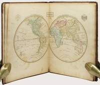
183533158Edinburgh: Oliver & Boyd ca. 1835. Early printing undated. Fully illustrated with 27 maps the map of the world double-page all hand-coloured. Two additional maps are affixed to the endpapers and are extra to those included in the book. These were sometime added by an owner of the volume. 4to publisher's original brown calf over brown cloth covered boards the spine lettered in gilt the upper cover with hand-printed titling label. vi 27 maps on 28 pages A very well preserved copy. The binding with some wear from time and use still strong and showing minor separation at the free-flies and pastedowns the maps all in good order clean and well coloured. EARLY PRINTING OF EWING'S GENERAL ATLAS. Now scarce as a complete book many copies have been broken up with the maps sold separately. The maps have been handcoloured and are preserved very well. A double-page world map is presented first and then the maps of the countries of European countries and Russia Asia Africa North America and South America. The U.S. map is quite interesting in that it includes only the states and territories recognized at the time of publication. The country is show bordering the Atlantic on the East but extending only into the Missouri Territory and Arkansas in the west. Oliver & Boyd hardcover
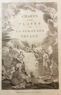
179843609London: Published as the Act directs Nov 1st 1798. by G.G.& J. Robinson 1798. Folio. 43x 27cm. 17" x 14.5". Atlas Volume First English Edition foliated engraved frontis portrait and engraved title-page 68 fine engraved plates maps charts and views many double page and include several plate illustrations on botanical and ornithological subjects. The plates are numbered 2 - 69 without the world map as usual plates are all very good to fine in contemporary half crimson morocco and marbled boards binding heavily dust worn similar wear on the edges upper hinge loose internally very good to fine condition. The map of the world is sometimes described as wanting however it would usually be in the two volume and is not call for in the list of plates <br /> <br /> ~ ~ ~ Hill #'s 972-979. "La Perouse expedition was one of the most important scientific explorations ever undertaken to the Pacific and North West Coast of North America. Hill. "Sabin 38960; Cox I-67. Fine copy of this Important 'Surveying Atlas' to the Pacific and west coast of North America. 1798. The plates are spectacular. - Atlas to the English edition of the report of the famous voyage around the world. Cook Bougainville and La Pérouse contributed decisively to the exploration of the Pacific. <br /> On the unexpected publication of this famous voyage at Paris in the previous year 1797 there was considerable competition among English publishers to bring out the English translation. Three different translations were made and published during 1798-99 and different engravers were employed for making the plates. Stockdale's appeared first in June 1798. Robinson's edition of 1799 is the most esteemed edition in English later editions being usually based on it." The atlas bears the date 1798 in the imprint but was published together with two text volumes in 1799. Published, as the Act directs, Nov, 1st, 1798. by G.G.& J. Robinson unknown
199414585Stockholm: SNA Publishing 1994. First edition. Blue Full Leather With Gilt Lettering. Very good condition but mild ex-library. Folio pp. 160. Indexed profusely illustrated in b/w and color. A very nice ex-library copy of this scarce volume of the National Atlas of Sweden. SNA Publishing hardcover
199414586Stockholm: SNA Publishing 1994. First edition. Blue Full Leather With Gilt Lettering. Very good condition but mild ex-library. Folio pp. 160. Indexed profusely illustrated in b/w and color. A very nice ex-library copy of this scarce volume of the National Atlas of Sweden. SNA Publishing hardcover
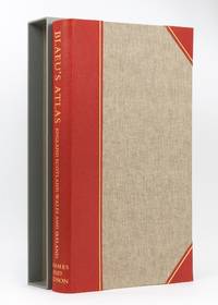
1970129115London: Thames and Hudson 1970. Hardcover. Fine. London Thames and Hudson 1970s facsimile edition/ 1645 and 1654. Folio xvi pages plus 115 double-page maps 5 in colour and 2 facsimile colour title pages all plates printed one side of each leaf only. Half morocco and cloth; tiny light mark to the leading edge; endpapers slightly discoloured by the leather turn-ins; essentially a fine copy with the lightly scuffed slipcase. Number 26 of only 500 copies; with an introduction by R.V. Tooley. Thames and Hudson hardcover
195910437Cleveland OH: Bloch and Compant 1959. First edition. Hard Cover. Very Good mild ex-library. Folio pp 10 per volume. Full set consists of Set 1: North America feat. maps produced in 1757; Set II: South America feat. maps produces 1753-57; Set III: Mexico Central America and the West Indies feat. maps produced 1754-58; Set IV: Africa feat. maps produced 1738-46; and Set V: Asia feat maps produced 1748-52. In very good condition only minor library markings. This series is a good set of old reference maps from around the world. Bloch and Compant hardcover
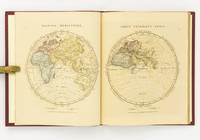
1828142642London: The Author 1828. First Edition. Hardcover. Very Good. London The Author 1828. Large quarto 358 × 295 mm vi pages engraved title dedication and index printed rectos only plus 53 extensively hand-coloured maps all printed recto or verso only with all but the last one - the Western Hemisphere - presented as facing pairs modern followed by ancient. Later quarter red morocco and cloth spine lettered in gilt; top corners slightly bumped; all edges speckled red; a few small inkspots to the top edge with minimal bleeding into a few top margins; all maps offset; blotted ink marks to the top corner of the map of 'Terra Sancta' map 20; trifling signs of age and use; overall in excellent condition. The extensive hand-colouring would appear to be the exception rather than the rule hand-coloured in outline only. The Author hardcover
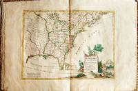
1778019206Venice: Antonio Zatta 1778. First Edition. Softcover. Some minor worming to inner marginal folds of maps occasional spotting. Complete with vibrant coloring. Close to Fine. Oblong folio 16 1/4" x 12" bound in contemporary limp decorated paper covers. Containing 15 double-page engraved maps including the double-page title each beautifully hand-colored depicting Bermuda; the east coast of North America from Nova Scotia to Florida west to the Great Lakes and south to "Luigiana" and "Messico"; Lake Superior and its coast with an inset of eastern Florida including the Keys and Bahamas; Canada between the Ottawa River and Hudson Bay; Labrador; Lake Michigan including parts of Michigan Illinois Indiana Wisconsin Minnesota and Iowa; Lake Huron Ontario Erie Ohio Pennsylvania New York the Hudson River Long Island and western New England; the Canadian and New England coast from Acadia and the Bay of Fundy down the coast to the Long Island Sound; Virginia the Mississippi and Missouri Rivers Louisiana and the Carolinas; Maryland New Jersey Virginia and the Carolinas; Jamaica; the Gulf of Mexico including the coast between Florida and New Orleans north into Indian territory; the east coast of northern Florida Georgia up to Cape Fear; Newfoundland and Cape Breton; and Hudson Bay. <br/><br/> Antonio Zatta paperback
1805D19536Boston: J. T. Buckingham for Thomas & Andrews 1805. Hardcover. Good. Two volumes. A matched set: volume one is a fifth edition with old stamps and bookplates from Meadville Theological School; volume two is a fourth edition bookplate of Anne and Clarence Kilburn. Both in contemporary calf spine labels; volume two with front board detached. Engraved maps throughout. Contents with occasional spotting and toning a few of the maps with creases and short edge tears but quite respectable relative to other sets. <br/><br/> J. T. Buckingham, for Thomas & Andrews hardcover
D19537Philadelphia: Jacob Johnson. First American Edition. Hardcover. Very Good. Tree calf red leather spine label. 8 folded maps. Complete. Worn as almost always; front joint cracked spotting and toning creasing to maps. But a very respectable copy. <br/><br/> Jacob Johnson hardcover
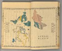
1871894281871. ATLAS Bridgeman E.C. translated by Mitsukuri Genpo. RENPO SHIRYAKU 2 vols. Tokyo Zodiacal date of Meiji 4 1871. String-bound Japanese-style fukuro-toji. An interesting work by Bridgeman the Chinese missionary originally published in Chinese but here marked for reading as Japanese kanbun. Thus not a translation as we might understand the term but a long standing aid for literate Japanese to understand the original classical Chinese. With a number of bw and some color maps of the USA along with a text describing US history culture economics etc. A bit of cover soiling outside and the scattered signs of insect damage internally but overall a very good copy. Upon comparison to the original Japanese edition of 1861 there is not much to choose between them. unknown
1899867341899. ATLAS. ATLAS OF DORCHESTER WEST ROXBURY AND BRIGHTON CITY OF BOSTON in one volume. Boston: L. J. Richards 1899. Folio. 22" Street index plus 40 double page maps measuring 32" x 22". Bound in 1/2 leather which is largely absent. Front board is detached. Interiors are clean and free from staining with the exception of some light red or graphite pencil annotations on a few plates and soiled end-papers. Plates with pencil annotations: 28 29 30 37 39. Maps printed in as many as seven colors. A good copy. unknown
1896867391896. ATLAS. ATLAS OF THE CITY OF BOSTON VOLUME 6 WEST ROXBURY. Philadelphia: G. W. Bromley and Co. 1896. Second edition. Folio 22.5". Contains street index outline and index map and 30 double-page maps measuring 22.5" by 32". Maps have only minor soiling to margins and occasional pencil annotations plates 1 and 27. FFEP and title page have large chips. Bound in half leather now mostly chipping or absent. In need of rebacking front board detatched. unknown
1890867351890. ATLAS. ATLAS OF THE CITY OF BOSTON Vol. 7 BRIGHTON MASS. Philadelphia: G. W. Bromley & Co. 1890. Folio. 22" Contains 30 double page maps - outline and index map and 29 plates - measuring 32" x 22" with only slight marginal staining near spine at head. Maps are drawn at scale of either 600 100 or 150 ft/inch. Bound in 1/2 leather missing much of leather covering and has detached and chipped FFEP. Front hinge very weak. unknown
1899867361899. ATLAS. ATLAS OF THE CITY OF BOSTON: SOUTH BOSTON. Philadelphia: G. W. Bromley Co. 1899. Folio 23". Street index and 33 double-page maps - outline and index map and 32 plates - measuring 32.5" x 22.5". Ffep missing. Outline and index map has tear near bottom where sheet folds. Plate 1 partly detached. Plates 29 30 31 are detached. Plates 2 and 32 have pencil annotations. Bound in 1/2 leather which is flaking. Interiors are bright some soil. Good. unknown
1906867321906. ATLAS. ATLAS OF THE TOWNS OF REVERE AND WINTHROP SUFFOLK COUNTY MASS. Boston: Whitman & Howard 1906. Folio. 22". Double page maps measure 32" by 22". All plans are drawn to a scale of 150 feet to one inch except index map. Includes street index outline and index map and 25 double-page maps. Interiors are in good condition with some light staining throughout at head and spine pencil or ink annotations to title page and plates 3 4 5 8. Exteriors are fair with heavily worn half-leather with black cloth boards and gilt-stamped edges. A good copy. unknown
1896867401896. ATLAS. ATLAS OF THE CITY OF CHELSEA AND THE TOWNS OF REVERE & WINTHROP MASS. Philadelphia: G. W. Bromley and Co. 1896. Folio 22.5". Contains street index outline and index map and 22 double-page maps measuring 22.5" by 32". Maps have only minor soiling to margins and occasional pencil annotations plates 12 17 18 21 and 22. Bound in half leather now mostly chipping or absent. In need of rebacking front board detached. As is. unknown
178660376Antwerpen:: C. M. Spanoghe 1786. First Dutch translation. old paste-grain decorated paper boards sewn over tapes. Old ink ownership signature; a very attractive copy. 12mo. Engraved frontispiece 22 folding engraved maps with outline color and 2 folding plates. C. M. Spanoghe, hardcover
1922830191922. Ordnance Survey Southampton. 1922. Landscape 4to. Maroon cloth gilt to upper board. 24 linen-backed colour maps each measuring 75 x 35 cm. Extremities a llittle rubbed; a little mild soiling and some surface scratch marks to boards with discolouration to cloth at bottom edge of rear board; small white paint spots to spine. All maps clean and sound. hardcover
46641H.E.C. Robinson Ltd. Sydney. ND c1934. 8vo non paginated. Soft cover with simple green and pink artwork slighty soiled with a sound adhesive dark green spine and period advertising on both sides of rear cover in very good condition text in excellent condition with no tears or prior owner markings present. A series of 22 beautifully coloured and annotated maps sequentially bound together adequately describes this somewhat frail publication making it all the more rare in this very good condition H.E.C. Robinson Ltd. Sydney. ND (c1934) paperback