277 résultats
1786601891 vol. in-4 reliure de l'époque demi-basane marbrée, dos orné, toutes tranches marbrées, s.l.n.d. [ Chez la Veuve Desaint, Paris, 1786 ], 36 planches souvent à double page : L'Italie - Plan de Turin - Plan de Milan - Plan de Pavie et de son faubourg en 1768 - Plan de Crémone - Plan de la ville de Plaisance - Parme - Plan de Modène - Plan de Bologne - Plan de Florence - Plans de Sienne, Livourne, Pise - Plan de Lucques - Vue de St Pierre de Rome et du Palais du Vatican - Plans des églises St Paul de Londres et St Pierre de Rome - Plan de Rome (extrait du plan de J. B. Nolli de 1748) - Fontaine de Trevi à Rome - Place Colonne à Rome - Entrée de Rome par la Porte du Peuple - Plan de Capoue - Plan de Naples - Vue des ruines de l'ancienne ville de Poestrum - Plan de la ville et du port d'Ancone - Plan de Rimini - Plan de Ravenne - Plan de Ferrare - Carte du païs situé entre Bologne et Ferrare - Plan de Venise - Plan de Padoue en 1780 - Plan de Vicense - Plan du théâtre Olympe de Vicence - Plan de Vérone - Plan de Mantoue - Plan de Brescia - Plan de Bergame - Plan de la ville de Gênes - Plan de Nice.
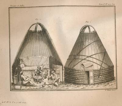
1794124716Maradan A Paris, chez Maradan An II. 1794. Atlas in-Folio relié sous couverture d'attente cartonnée de l'époque. Le papier est manquant en dos de la reliure. Traduit de l'Allemand par le Cit. Gauthier de la Peyronie. Nouvelle édition revue et enrichie de notes par les C C. Lamarck, Professeur de géologie au Muséum National d'Histoire Naturelle ; Langlès, Sous-Garde des manuscrits de la Bibliothèque Nationale, pour les langues Arabe, Persane, Tatane-Mantchoue, & Billecocq, Homme de lettres. Contenant la Carte générale de l'Empire de Russie, d'après la nouvelle division de cet Empire en quarante-deux gouvernemens ; dix Cartes Géographiques ; soixante-dix-sept planches de botanique ; douze autres représentant des fourneaux, moulins, monumens & ; onze d'idoles et costumes ; et onze d'animaux, d'Histoire naturelle, d'Hiéroglyphes, &. Atlas bien complet des 108 planches dont douze dépliantes. Celles-ci sont toutes montées sur onglets et classées selon la disposition de l'édition in-8. Déchirure sans manque au bas de la planche 33 - 33 bis, sans manque.
17994778Paris GUEFFIER ET DABO 1799 8 Paris, Gueffier et Dabo, 1821-1822 et 1799 pour l'Atlas, 7 vol. in-8 et l' atlas in-4, papier rel. marbré vert glacé, dos orné pour les sept volumes et veau moucheté, frise géométrique sur les plats, filet doré sur les coupes, dos orné de décors géométriques alternés, pièces de titres veau rouge et vert, pour l'Atlas.
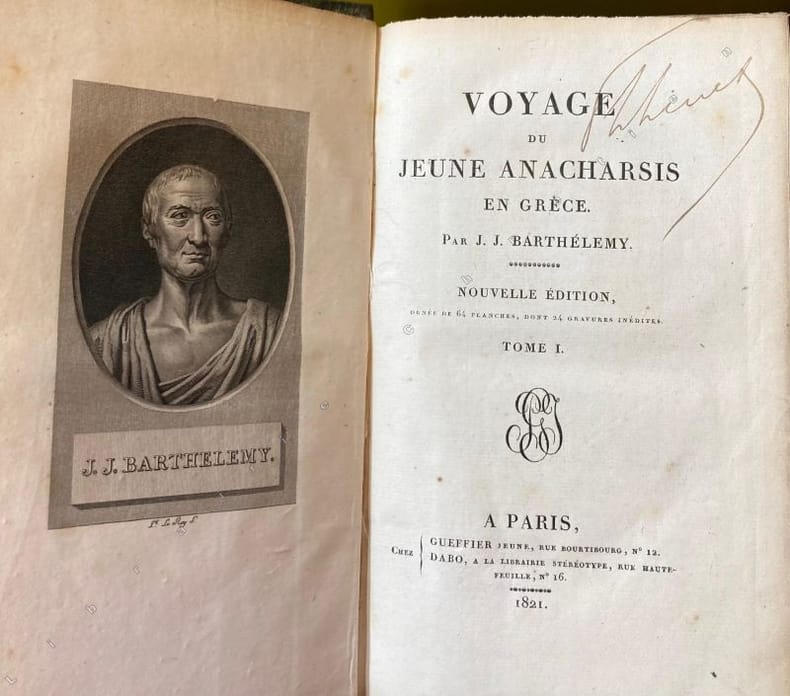
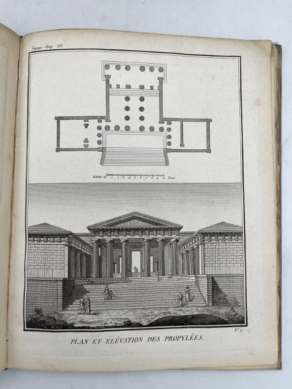
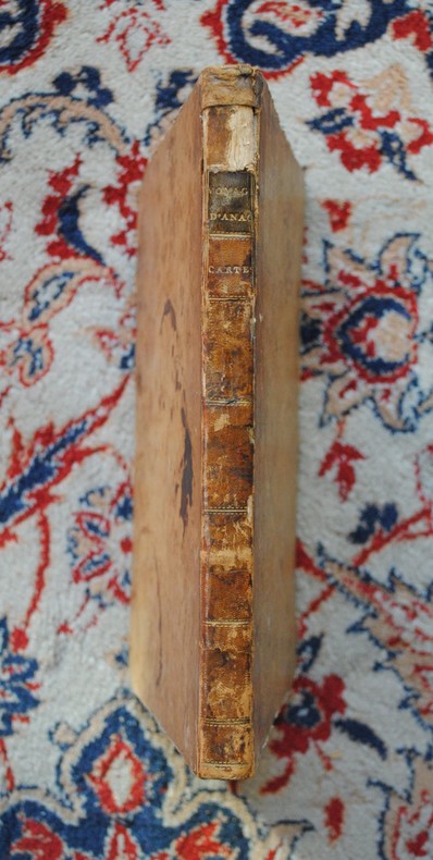
1792177172de Bure A Paris, chez de Bure l'ainé, 1792. 9 volumes In-12 reliés plein veau blond de l'époque, dos à nerfs fleurons dorés, pièces de titre et de tomaison, tranches mouchetées. 1773. Petits accrocs aux coiffes tomes 1, 2, 6. Petti manque en queue destomes 2,4. XXIV + 383 pages et une grande carte dépliante + 396 + 388 + 372 + 408 + 379 + 403 + 420 + 283 pages. Pour l'atlas : Recvueil de cartes géographiques, plans, vues et médialles de l'ancienne Grèce, relatifs au voyage du jeune Anacharsis, précédé d'une analyse critique des cartes. Paris, Garney, 1819. Petit In-4 carré (relioure abuimé avec plat décolidarisé) XIX + 32 planches dépliantes pour la plupart.
1799G43465Paris, Didot jeune An 7 [1799] 8 volumes: viii,367 + viii,517 + viii,496 + viii,507 + viii,495 + 454 + viii,552 pp. & "Receuil" (Paris, Garnery, 1819): 19pp.texte + 32 planches (cartes et gravures, dont la plupart dépliantes), 4e éd., reliures plein-cuir avec titres et fleurons dorés aux dos (sauf tome 8: reliure cart.avec dos en toile), tranches et feuilles de garde marbrés, qqs.petites cachets aux pages de titre, bel état, G43465
179021191Paris De BURE Ainé 1790 in-8 plein-veau 7 volumes + 1 volume d'Atlas, reliure plein veau marbré et moucheté blond in-octavo + un atlas demi-veau blond in-quarto (19,7 x 13 cm pour les volumes de texte + 25,5 x 21 cm pour l'Atlas, dos à nerfs décoré "or" et à froid (gilt and blind stamping decoration), titre et tomaison frappés "or" ( gilt title and volume numbering), pièce de titre sur fond havane avec double filets "or" en encadrement, pièce de tomaison sur fond vert foncé avec double filets "or" en encadrement, roulette "or" en place des nerfs avec un filet à froid de part et d'autre des nerfs, entre-nerfs à fleuron "or" dans un encadrement à double filets "or" avec rinceaux "or" aux angles, plats décorés "or", d'une roulette chainette or avec un filet "or" de part et d'autre en encadement, plats trés légèrement épidermés, filet "or" sur les coupes (gilt line on the cuts) avec légers manques de dorure (blurred gilding), toutes tranches lisses jaunes, sans illustrations pour les volumes de texte, l'Atlas contient XLII pages de texte + 31 plans, cartes et illustrations en noir en doubles-planches, (XII + 382) + (2 p. de tables + 568) + (2 p. de tables + 560) + (2 p. de tables + 564) + (2 p. de tables + 543) + (511) + [2 p. de tables + 130 + (2) + CCCXXII + (1)] + (XLII + 31 gravures doubles pages pour l'Atlas) pages, 1790 Paris Chez De BURE Ainé Libraire Editeur,
1794PHO-1908Paris, Maradan 1794, folio, demi basane et coins, dos lisse avec titre et tomaison, frottements, coins usés, coiffes arasées, frottements, ATLAS seul, en seconde édition de 105 planches (107), réparations à une planche, carte de Russie en 2 parties détachée.
1799PHO-1997À Paris, Chez F. Buisson, Imprimeur-Libraire, an VII- IX (1799-1801). 7 volumes en 6 tomes TEXTE Voyage dans la haute… Égypte ; 3 volumes in-8°, 2ff.-VII-425pp.1f (catalogue), 2ff.-417pp.(2 tableaux dépliants), 2ff.-424pp., demi basane et coins, dos lisse avec pièce de titre et tomaison havane, tranches mouchetées bleues, petits frottements, accroc à une coiffe, petit travail de ver en coin sur qlqs feuillets (T2). Voyage en Grèce et en Turquie ; plein veau raciné époque, dos lisse avec titre et tomaison, tranches jaunes. 2ff-460pp-460pp-2ff., un cahier de la table mal relié. ATLAS Voyage dans la Haute et Basse Égypte et Voyage en Grèce et en Turquie Paris, F. Buisson, An VII de la République (1799). In-4, (2)-2 pp., 39 planches sous serpente et une carte ,déchirures à la carte sans manque (Égypte ), trace de brunissure (carte), mouillure sans atteinte aux planches. Avec Voyage en Grèce et en Turquie, Fait Par Ordre De Louis XVI et avec l’Autorisation de la Cour Ottomane ; par C.S. Sonnini, de plusieurs Sociétés Littéraires et Savantes de l’Europe, et des Sociétés d’Agriculture de Paris et des Observateurs de l’Homme. Paris, Buisson, 1801, in-4, une page de titre-1 f. non chiffré [Liste des planches] -1 très grande carte au contours colorées [980 x 1030 mm] et 6 planches h.-t. [I- VII], réparations à la carte (Grèce) , mouillures, planche du Firman déchirée sans manque et mal pliée, relié demi cuir vert époque , dos lisse avec tomaison et titres , légère fente au dos, frottements, coiffe usée.
1799PHO-1999À Paris, Chez F. Buisson, Imprimeur-Libraire, an VII (1799). 4 tomes TEXTE ; 3 volumes in-8°, 2ff.-VII-425pp.1f (catalogue), 2ff.-417pp.(2 tableaux dépliants), 2ff.-424pp., demi basane et coins, dos lisse avec pièce de titre et tomaison havane, tranches mouchetées bleues, petits frottements, accroc à une coiffe, petit travail de ver en coin sur qlqs feuillets (T2). ATLAS Voyage dans la Haute et Basse Égypte et Voyage en Grèce et en Turquie Paris, F. Buisson, An VII de la République (1799). In-4, 2 pp., 39 planches et une carte, mouillure angulaire à la carte, frottements, charnières fendillées et petit manque de matière, manque de papier au plat.
172017031(Augsburg). (Um 1720). Format ca. 16,5 x 22,5 cm (Mit leichten Längsknick in der Mitte u. etwas fleckig).
171023945Amstelaedami H. Wetstenium ; Trajecti ad Rhenum : apud G. Van de Water 1710 in-12 plein-veau un volume, reliure plein veau brun raçiné in-douze (16,3 x 10 cm), RELIURE D'EPOQUE, dos à nerfs (spine with raised bands), décorations "or" et à froid (gilt and blind stamping decoration), titre frappé "or" dans un encadrement d'un filet perlé "or" et tomaison frappée "or"dans un encadrement d'un filet perlé "or" avec rinceaux "or" aux angles, pièce de titre et de tomaison sur fond bordeaux, entre-nerfs à fleurons "or" dans un encadrement d'un filet perlé "or" avec rinceaux "or" aux angles, filet à froid de part et d'autre des nerfs, roullette large "or" en pied, coiffe de tête quasiment manquante avec un léger manque de cuir en tête due moins d'1/3 de cm2, plats décorés à froid, d'un filet à froid en encadrement, roulettes "or" sur les coupes avec manque de dorure, coins écornés, toutes tranches lisses jaspées rouges, orné d'un frontispice de J. Goeree représentant TITE-LIVE gravé sur bois en noir + 14 planches géographiques dépliantes [Geographia Liviana] gravées sur bois en noir in-fine, 363 pages d'Index revu et augmenté par Jean Le Clerc + 14 planches de cartes géographiques dépliantes [Geographia Liviana], 1710 Amstelaedami : apud H. Wetstenium ; Trajecti ad Rhenum : apud G. Van de Water Editeurs,
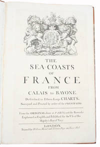
171534417London, Printed for William Mount and Thomas Page on Tower Hall, no date (c. 1715). Folio. 53X35 cm. Cont. hcalf with marbled boards. Rebacked and recornered in old style with raised bands. Engraved typographical titlepage with a large engraved vignette showing the English King's Coat of Arms. With all 15 double-page engraved sea-charts (numbered (1)-(15) in lower right corners). Neat repairs to inner margins of free endpapers and titlepage. Some browning to charts. Chart 5 (45x75,5 cm) having the right margin shaved reaching the printed frame.
171534417London Printed for William Mount and Thomas Page on Tower Hall no date c. 1715. Folio. 53X35 cm. Cont. hcalf with marbled boards. Rebacked and recornered in old style with raised bands. Engraved typographical titlepage with a large engraved vignette showing the English King's Coat of Arms. With all 15 double-page engraved sea-charts numbered 1-15 in lower right corners. Neat repairs to inner margins of free endpapers and titlepage. Some browning to charts. Chart 5 45x755 cm having the right margin shaved reaching the printed frame. <br/><br/><em>Second edition of this scarce "Atlas Maritime". According to Shirley it was first published by Richard Mount and Thomas Page in 1701 and re-issued with undated title as this in ab. 1715 but with the charts unchanged and a new engraved titlepage. A third issue came out in 1737 with a dated title. The fine charts are copied from Pieter Mortier's famous "Neptune Francois" 1693-1702 and reduzed in size."The charts in this early Mount & Page atlas "The Sea-Coasts of France" are re-engravings reduzed in size from the charts in the French Neptune of 1693. The charts may also be found in the 1702 edition of Mount and Page's Atlas Maritimus Novus." Rodney Shirley. - Not in Phillips. - Shirley Vol. II: M.M&P - 12 b. </em> hardcover
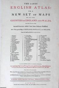
1760373384Robert Sayer London c.1760. Unframed Print. Very Good Condition. The letterpress title page of The Large English Atlas adopts a dignified full-folio design declaring the works grand ambition and learned purpose through finely set serif type. The title itself dominates in full capitals while italic accents lend emphasis and rhythm. Clear hierarchies and generous spacing enhance legibility and poise. Stripped of decoration or ornament the page conveys assurance through restraint confident in its authority. Letterpress 25 x 49; sheet 39 x 58 cms. Category: PRINTS : Antiquarian Interest; PRINTS : Historic Interest; Printed before 1800; Special Features. This item may require more postage than the rates shown for delivery outside the UK. If extra postage is required we will contact you before processing your order and you will be given the details and option to decline the extra cost. Robert Sayer unknown
17945887<p>THE FIRST ENGLISH SEA ATLAS OF AMERICA</p><p>Folio 47.7 x 31 cm 66 pp. with pagination errors with 26 engraved maps 21 of which are double-page or folding the first chart with letterpress text attached as called for numerous woodcuts in the text. Bound in contemporary sheep rebacked blind-tooled borders to upper and lower covers. Minor rubbing to covers. Some spotting to the fourth map Verner no. 62 and adjacent letterpress pages small tear to fold of map 10 Verner no. 60 two small circular mends to title page not affecting text otherwise remarkably well preserved.</p><p>A spectacular copy of the final edition of the <em>English Pilot</em> <em>The Fourth Book</em> the first wholly English sea atlas of American waters. The work was sufficiently in demand to justify 37 legitimate editions from 1689 to 1794 and three pirated editions. All editions are rare. During the history of this title its charts underwent numerous changes. The first edition contained only 18 maps whereas this 1794 final edition contained 26.</p><p>"<em>The English Pilot</em> was the first major sea-atlas produced in England. In its final form it consisted of five separate books and <em>The Fourth Book</em> was the first wholly English sea-atlas of American waters. Although the idea originated with John Seller he was involved in producing only the first two books. William Fisher and John Thornton produced <em>The Fourth Book</em> in 1689 and their successors Mount and Page continued to print it for over 100 years Seller's proposal for a 'Sea Waggoner' resulted in the production of <em>The English Pilot</em> which consisted of five separate volumes with a common generic title. Book One included the southern navigation and Book Two the northern. Book Three was concerned with the Orient Book Four with America and Book Five contained Africa. Each book or volume has its own independent publishing history and appeared in numerous editions. The five separate books constitute a set only by virtue of the general title and under that title <em>The English Pilot</em> is the first great sea-atlas produced in England. Of the five books the fourth has the longest publication history and is the best known" Verner p. v.</p><p>Throughout its history <em>The Fourth Book</em> showed very few changes in textual matter and the content of the volume was established between the editions of 1706 and 1721.</p><p>The present example of the 1794 edition is complete and contains the following maps see Verner pp. xv-xx for full list of editions and charts from 1689 to 1794:</p><p>1. A New and Correct Chart of the Western and Southern Oceans Showing the Variations of the Compass with letterpress text attached</p><p>2. A New and Correct Chart of the North Part of America from New Found Land to Hudson's Bay</p><p>3. A New Generall Chart for the West Indies of E. Wright's Projection</p><p>4. A New and Accurate Chart of the Vast Atlantic or Western Ocean by Eman. Bowen</p><p>5. Harbour of Casco Bay Capt. Cyprian Southicke 1720 Em. Bowen</p><p>6. A New and Correct Chart of the Coast Line of Newfoundland from Cape Raze to Cape Bionavista</p><p>7. Island of St. Peters </p><p>8. Chart of the South East Coast of Newfoundland</p><p>9. New and Correct Chart of the Sea Coast of New-England from Cape Cod to Casco Bay Henry Barnsley</p><p>10. A Map of the Coast of New England from Staten Island to the Island of Breton Capt. Cyprian Southack</p><p>11. A Chart of New York Harbour with the Banks </p><p>12. Virginia Maryland Pennsylvania East & West New Jersey </p><p>13. A Draught of Virginia by Mark Tiddeman</p><p>14. Barbados copperplate in text</p><p>15. A New Mapp of the Island of St. Christophers Survey taken by Mr. Andrew Norwood</p><p>16. A Large Draft of the Island of Antegua copperplate in the text</p><p>17. A Draught of South Carolina and Georgia from Sewee to St. Estaca by Andrew Hughes</p><p>18. A Correct Chart of the Caribee Islands</p><p>19. A Correct Chart of Hispaniola with the Windward Passage by C. Price</p><p>20. A Draught of the West End of the Island of Porto Rico </p><p>21. A New & Correct Chart of Cuba Streights of Bahama Windward Passage </p><p>22. A New and Correct Draught of the Bay of Matanzas by Rob.t Pearson</p><p>23. Bermudas copperplate in text</p><p>24. A New and Correct Chart of the Island of Jamaica</p><p>25. A Chart of the Coast of Guayana By R. Waddington</p><p>26. A New and Correct Chart of the Trading Part of the West Indies</p><p> <em>The English Pilot: The Fourth Book</em> Amsterdam 1967 with an introduction by Coolie Verner.</p> Printed for Mount and Davidson hardcover
1748453058299xbvk(Paris), Avec Privilège, 1748. Gravure en taille-douce avec des frontières coloriées (copperplate-engraving with coloured borders); ca. 24 x 38 cm (feuille / sheet), ca. 17 x 21 cm (carte géographique / map).
17116292Paris, Le Conte & Montalant, 1711. In-12 de [12]-226-[14]-XXXVI-153-[3]p., plein veau marron, dos à nerfs orné de filets dorés, pièce de titre rouge, petit manque de peau au premier plat, petite auréole dans la marge des 14 premiers feuillets.
1748453058304xbvk(Paris), Avec Privilège, 1748. Gravure en taille-douce avec des frontières coloriées (copperplate-engraving with coloured borders); ca. 24 x 38 cm (feuille / sheet), ca. 17 x 21 cm (carte géographique / map).
177064868Ohne Ort, ohne Verlag bzw. Drucker, o. J. (um 1770). Qu.-4° (32,5 x 28 cm). Mit gest. Titel von J. J. Mezger u. 19 grenz- u. flächenkolor. Kupferkarten. Einfacher grüner Kart.-Umschlag d. Zt. m. handschriftl. Deckeltitel.
178011723(Ohne Ort und Drucker, um 1780). 66 altkolorierte meist doppelblattgr. Kupferstichkarten bzw. Kupfertafeln. Gr.-Fol. HLdr. der Zeit mit modernen Marmorpapierbezügen (Rücken mit kl. Wurmgängen, etw. beschabt und bestoßen).
1748453058300xbvk(Paris), Avec Privilège, 1748. Gravure en taille-douce avec des frontières coloriées (copperplate-engraving with coloured borders); ca. 24 x 38 cm (feuille / sheet), ca. 17 x 16 cm (carte géographique / map).
17555788A Paris, chez Le Rouge, s.d. [1755]. 1755 1 vol. in-8° (194 x 120 mm.) de : [3] ff. (titre gravé, table) et 89 ff. comportant au total 134 plans de villes fortifiées. Ex libris gravé "St Marcel Eysseric". Reliure de l'époque recouverte de papier marbré, dos à nerfs titré à l'encre brune.
1760M131151760 1760 P , sd ( v 1760 ) , in8 relliure d ' attente recouverte de papier marbré , 130 plans de places fortes gravés sur 89 planches. Bon exemplaire. Très légere trace d' humidité marginale sur quelques pages . Manque la page de titre.
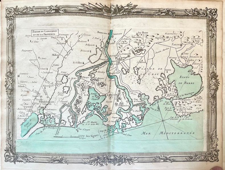
17574746Paris, Desnos, 1757-1766. 1757 1 vol. in-folio (300 x 220 mm) entièrement gravé et monté sur onglets de : 1 titre gravé sur double-page ; 1 carte générale dépliante et 50 cartes gravées sur double page numérotées de 1 à 50 (NB : Sur la carte générale figure une carte N° 14 des iles anglo-Normandes qui nest pas reliée dans les exemplaires, remplacée par une carte « 26 deuxième Partie de la Bretagne). Mer aquarellée d'époque pour la carte générale, les cartes 1 à 20 et 44 à 50. (Quelques brunissures au dos des cartes). Demi-basanne d'époque, dos à nerfs orné, pièce de titre de maroquin rouge et lettres dorées, fleurons dorés dans les caissons, tranches rouges, (mors fendus mais solides, défauts d'usage aux coiffes et aux coins).
1790P1-4D-7Paris, Chez de Bure, 1790. In-4° (260x200) relié demi-basane époque, dos lisse, pièce de titre, manque au dos. XLIIpp. Et 31 planches doubles de cartes et plans, contours couleurs, troisième édition, tâche marron sur quelques pages. 31 copper engraved maps plans and plates with several hand coloured in outline, many double page. 42 pages of text, small 4to.