Galit AtlasBiblio.com

990 résultats
23976831like new. unknown
A9781138789609Paperback / softback. New. paperback
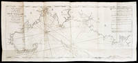
17945887<p>THE FIRST ENGLISH SEA ATLAS OF AMERICA</p><p>Folio 47.7 x 31 cm 66 pp. with pagination errors with 26 engraved maps 21 of which are double-page or folding the first chart with letterpress text attached as called for numerous woodcuts in the text. Bound in contemporary sheep rebacked blind-tooled borders to upper and lower covers. Minor rubbing to covers. Some spotting to the fourth map Verner no. 62 and adjacent letterpress pages small tear to fold of map 10 Verner no. 60 two small circular mends to title page not affecting text otherwise remarkably well preserved.</p><p>A spectacular copy of the final edition of the <em>English Pilot</em> <em>The Fourth Book</em> the first wholly English sea atlas of American waters. The work was sufficiently in demand to justify 37 legitimate editions from 1689 to 1794 and three pirated editions. All editions are rare. During the history of this title its charts underwent numerous changes. The first edition contained only 18 maps whereas this 1794 final edition contained 26.</p><p>"<em>The English Pilot</em> was the first major sea-atlas produced in England. In its final form it consisted of five separate books and <em>The Fourth Book</em> was the first wholly English sea-atlas of American waters. Although the idea originated with John Seller he was involved in producing only the first two books. William Fisher and John Thornton produced <em>The Fourth Book</em> in 1689 and their successors Mount and Page continued to print it for over 100 years Seller's proposal for a 'Sea Waggoner' resulted in the production of <em>The English Pilot</em> which consisted of five separate volumes with a common generic title. Book One included the southern navigation and Book Two the northern. Book Three was concerned with the Orient Book Four with America and Book Five contained Africa. Each book or volume has its own independent publishing history and appeared in numerous editions. The five separate books constitute a set only by virtue of the general title and under that title <em>The English Pilot</em> is the first great sea-atlas produced in England. Of the five books the fourth has the longest publication history and is the best known" Verner p. v.</p><p>Throughout its history <em>The Fourth Book</em> showed very few changes in textual matter and the content of the volume was established between the editions of 1706 and 1721.</p><p>The present example of the 1794 edition is complete and contains the following maps see Verner pp. xv-xx for full list of editions and charts from 1689 to 1794:</p><p>1. A New and Correct Chart of the Western and Southern Oceans Showing the Variations of the Compass with letterpress text attached</p><p>2. A New and Correct Chart of the North Part of America from New Found Land to Hudson's Bay</p><p>3. A New Generall Chart for the West Indies of E. Wright's Projection</p><p>4. A New and Accurate Chart of the Vast Atlantic or Western Ocean by Eman. Bowen</p><p>5. Harbour of Casco Bay Capt. Cyprian Southicke 1720 Em. Bowen</p><p>6. A New and Correct Chart of the Coast Line of Newfoundland from Cape Raze to Cape Bionavista</p><p>7. Island of St. Peters </p><p>8. Chart of the South East Coast of Newfoundland</p><p>9. New and Correct Chart of the Sea Coast of New-England from Cape Cod to Casco Bay Henry Barnsley</p><p>10. A Map of the Coast of New England from Staten Island to the Island of Breton Capt. Cyprian Southack</p><p>11. A Chart of New York Harbour with the Banks </p><p>12. Virginia Maryland Pennsylvania East & West New Jersey </p><p>13. A Draught of Virginia by Mark Tiddeman</p><p>14. Barbados copperplate in text</p><p>15. A New Mapp of the Island of St. Christophers Survey taken by Mr. Andrew Norwood</p><p>16. A Large Draft of the Island of Antegua copperplate in the text</p><p>17. A Draught of South Carolina and Georgia from Sewee to St. Estaca by Andrew Hughes</p><p>18. A Correct Chart of the Caribee Islands</p><p>19. A Correct Chart of Hispaniola with the Windward Passage by C. Price</p><p>20. A Draught of the West End of the Island of Porto Rico </p><p>21. A New & Correct Chart of Cuba Streights of Bahama Windward Passage </p><p>22. A New and Correct Draught of the Bay of Matanzas by Rob.t Pearson</p><p>23. Bermudas copperplate in text</p><p>24. A New and Correct Chart of the Island of Jamaica</p><p>25. A Chart of the Coast of Guayana By R. Waddington</p><p>26. A New and Correct Chart of the Trading Part of the West Indies</p><p> <em>The English Pilot: The Fourth Book</em> Amsterdam 1967 with an introduction by Coolie Verner.</p> Printed for Mount and Davidson hardcover
9652241075New. Brand new and still unused unknown
29644629-nnew. unknown
2017x-9652241075Moshe Dayan Ctr for Middle Eastern 2017. Paperback. New. 310 pages. 9.50x6.50x0.50 inches. Moshe Dayan Ctr for Middle Eastern paperback
2004Q-0974882011Your Business Press 2004-11-01. Paperback. New. New. In shrink wrap. Looks like an interesting title! Your Business Press paperback
2010Q-0982591047Your Business Press 2010-08-06. Perfect Paperback. New. In shrink wrap. Looks like an interesting title! Your Business Press paperback
1989647820.Gpaperback. Good. Access codes and supplements are not guaranteed with used items. May be an ex-library book. paperback
51418110like new. unknown
1989647820New. Brand new and still unused unknown
1333115717.Gpaperback. Good. Access codes and supplements are not guaranteed with used items. May be an ex-library book. paperback
0843709529New. paperback. New. Satisfaction Guaranteed or your money back. paperback
2007Q-0843709529Hammond World Atlas Corporation 2007-04-13. Paperback. New. New. In shrink wrap. Looks like an interesting title! Hammond World Atlas Corporation paperback
2007DADAX0843709529Langenscheidt 2007-04-13. Revised 2007 Edition. paperback. New. 9.25x0.25x12.25. Buy with confidence. Excellent Customer Service & Return policy. Langenscheidt paperback
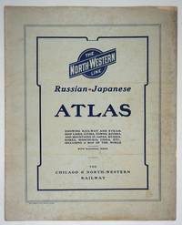
190427334Chicago: Rand McNally and Company; Chicago and North Western Railway Company 1904. First printing. Staplebound Wraps. Very good condition. Maps of the Russo-Japanese War five maps with a key printed in the margins comprised by the North-Western Line on inside front cover b&w World map; Asia; Eastern China; Japan and Korea all in color and 'the Only Double-Track Railway Between Chicago and the Missouri River and the Route of the Overland Limited' inside the back cover b&w. <br /> <br /> OCLC: 928938679 at Newberry Library Baskes Collection. Small folio printed paper wrappers grey covers with blue titles on front/back. Maps in color and b&w. Covers dusty slt. chip on foredge original folds. Rand McNally and Company; Chicago and North Western Railway Company unknown
19762859.1973<p>1976 Institute of Mediaeval Music hardcover; no dust jacket; lightcover wear; pages clean/tight; good condition</p> Institute of Mediaeval Music hardcover
SKU05900Institute of Mediaeval Music. Very Good. Please note! this is a 2 vol set!!Vol 1 Commentary Vol 2 TranscriptionsNo DJ Previous Owner name inside Vol. 1 VG on both books Green cloth binding Free of any markings and no writing. For Additional Information or pictures Please Inquire. Institute of Mediaeval Music hardcover
199032897Knoxville TN U.S.A: Whittle Communications. As New. 1990. Hardcover. 0962474533 . FREE UPGRADE to Courier/Priority Shipping Upon Request - IN STOCK AND IMMEDIATELY AVAILABLE FOR SHIPMENT - TEXT PRISTINE & UNMARKED CRISP TIGHT TO THE SPINE - Discusses leading figures such as the late Allan Bloom. Educational values and standards vs. Test scores. 91pp. -- with a bonus offer-- . Whittle Communications hardcover
1830D19538Boston: Crocker & Brewster 1830. Hardcover. Very Good. Publisher's cloth boards gilt modern cloth over spine. 26 hand-colored engraved maps some folded. Contents lightly toned some offsetting as typical; generally speaking a nice copy. <br/><br/> Crocker & Brewster hardcover
066608016X.Ghardcover. Good. Access codes and supplements are not guaranteed with used items. May be an ex-library book. hardcover
0282567704.Gpaperback. Good. Access codes and supplements are not guaranteed with used items. May be an ex-library book. paperback
1805D19536Boston: J. T. Buckingham for Thomas & Andrews 1805. Hardcover. Good. Two volumes. A matched set: volume one is a fifth edition with old stamps and bookplates from Meadville Theological School; volume two is a fourth edition bookplate of Anne and Clarence Kilburn. Both in contemporary calf spine labels; volume two with front board detached. Engraved maps throughout. Contents with occasional spotting and toning a few of the maps with creases and short edge tears but quite respectable relative to other sets. <br/><br/> J. T. Buckingham, for Thomas & Andrews hardcover
46644Geographia Ltd. London. 1923. Cr 8vo 128pp. Red cloth boards in fair condition with a fraying worn spine with early hinging and the title embossed in black on the front board and spine text is in very good condition though with significant tanning of title page and endpapers and prior owner highlightings of certain destinations. In an age of GPS navigation perusing a gem like this early road atlas is a real journey back in time and a must for any tourist from this era. It even includes a perpetual lamplighting table in Great Britain relative to London. Geographia Ltd. London. 1923. hardcover
1908276101The Twentieth Century Peerless Atlas. The Crowell Publishing Company 1908. Map. Sheet 13.5 x 21.7 inches with map 12 x 20 inches. Printed in black blue green yellow and pink. Western part of Texas on inset bottom right. Very good copy. Archival tape repair on verso to closed tear on left. Map previously folded. Map will be shipped folded.<br> The Twentieth Century Peerless Atlas. The Crowell Publishing Company unknown