990 résultats
198744496Anchorage AK: Salmon Atlas. VG. 1987. 1st Edition. Paperback. Paperback in Very Good condition. . 4to 11" - 13" tall. 92 maps covering the Kenai Peninsula Mat-Su the Anchorage area West Cook Inlet Prince William Sound and Kachemak Bay. . Quick Shipping All Books Mailed in Boxes Free Tracking Provided . Salmon Atlas paperback
1992Q-0963024310Book Pub Co 1992-09-01. Paperback. New. In shrink wrap. Looks like an interesting title! Book Pub Co paperback

1590211502.Gpaperback. Good. Access codes and supplements are not guaranteed with used items. May be an ex-library book. paperback
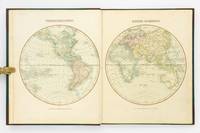
1809127861London: Printed for C. Smith Mapseller Extraordinary to his Royal Highness the Prince of Wales 1809. First Edition. Hardcover. Very Good. London Printed for C. Smith Mapseller Extraordinary to his Royal Highness the Prince of Wales 1809. Folio 404 × 330 mm engraved title leaf letterpress contents leaf and 43 hand-coloured copper-engraved maps numbered as 45 the map of Germany comprises two double-page sheets numbered 19-20 and 21-22. All leaves are printed one side only; all maps are dated 1808. Modern half calf and cloth with a gilt-lettered contrasting leather title-label on the spine; short scratch to the leather on the rear cover; title page a little tanned and discoloured around the margins by the leather corners of an earlier binding; scattered light foxing; insignificant short tears to some margins now sealed; trifling signs of age and use; overall in excellent condition. An attractive Georgian atlas 'on a Scale sufficiently large for the Purposes of general Reading and yet not too inconvenient for the Study or the Table' advertisement at the foot of the contents page. The three maps showing Australia 'Eastern Hemisphere' 'The World on Mercator's Projection' and 'Asia' all show the southern coast of the continent as uncharted. The expeditions of Flinders and Baudin had both charted this coast in 1802 but their maps were not published until 1814 and 1811 respectively. Printed for C. Smith, Mapseller Extraordinary to his Royal Highness the Prince of Wales hardcover
1999Q-0717288587Grolier Books 1999-01-01. Hardcover. New. In shrink wrap. Looks like an interesting title! Grolier Books hardcover
ria9780521271349_inpPaperback. New. New Book; Fast Shipping from UK; Not signed; Not First Edition; This anthology is intended to make Pope's major prose work more widely available. It includes the critical prefaces to his own work to Homer and to Shakespeare; the mock-critical treatises A Key to the Lock and The Art of Sinking in paperback
2010DADAX0826517056Vanderbilt University Press 2010-06-28. 1. hardcover. New. 7.00x1.20x10.00. Buy with confidence. Excellent Customer Service & Return policy. Vanderbilt University Press hardcover
20100826517056Vanderbilt University Press 2010. New/New. <p><strong>Author:</strong> John Atlas</p><p><strong>Publisher:</strong> Vanderbilt University Press</p><p><strong>ISBN:</strong> 9780826517050</p><p><strong>Release Date:</strong> 2010</p><p><strong>Languages:</strong> English</p><p><strong>Binding:</strong> Hardcover</p><p><strong>Number Of Pages:</strong> 284</p><p><strong>Details:</strong> <br>Continues.Excerpted from Seeds of Change by John Atlas. Copyright © 2010 John Atlas. Excerpted by permission of Vanderbilt University Press. <br>All rights reserved. No part of this excerpt may be reproduced or reprinted without permission in writing from the publisher.<br>Excerpts are provided by Dial-A-Book Inc. solely for the personal use of visitors to this web site.</p> Vanderbilt University Press hardcover
2009Q-1416580840Atria Books 2009-04-07. Paperback. New. In shrink wrap. Looks like an interesting title! Atria Books paperback
3656438153.Gpaperback. Good. Access codes and supplements are not guaranteed with used items. May be an ex-library book. paperback
18-0523Germany: Justus Perthes 1870s - 1880s. 9 x 12 inches. Very Good. Some foxing from age. Folded hand-colored map of Germany Norway and Denmark. Text in German. Germany: Justus Perthes, [1870s - 1880s?]. unknown
2197Herzien door B.A. Kwast. 28e verbeterde en vermeerderde druk.- 47 double-spread col. maps with legenda 24x39 cm. Groningen : J.B. Wolters 1923 ATLAS - BOS R. & J.F. NIERMEYER The rare 28th edition of this renown school-atlas of the world. Although cover in bad condition maps are clear. Keywords Cartography Atlases Book # 2197 unknown
0843708646New. paperback. New. Satisfaction Guaranteed or your money back. paperback
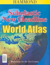
20041-0843708646Hammond World Atlas Corp 2004. Paperback. New. 2nd revised edition. 52 pages. 10.50x8.00x0.25 inches. Hammond World Atlas Corp paperback
2004Q-0843708646Hammond World Atlas Corp 2004-12-15. Paperback. New. New. In shrink wrap. Looks like an interesting title! Hammond World Atlas Corp paperback
DADAX08437086460000-00-00. Revised. paperback. New. 8.00x0.25x10.50. Buy with confidence. Excellent Customer Service & Return policy. paperback
0571143563.Ghardcover. Good. Access codes and supplements are not guaranteed with used items. May be an ex-library book. hardcover
181832926Uden Sted ca. 1818-30. Lille 4to. 195x17 cm. Beskedent hshirtbd. Indre false itu men blokken som består af kortbladene intakt. Indeholder 44 af Holms kortblade skårne i træ og herefter grænsekolorerede i hånden. Her og der med lidt brunpletter og brugsspor. Et kort med rift repareret uden tab. Et kort med lidt tab i øverste venstre hjørne. <br/><br/><em>Det lidt naive men charmerende atlas er selvom det er produceret til skolebrug det første danske atlas. Det udkom med et varierende antal kort og sammensætning men ialt er der registreret 50 udgivne blade. Omfatter Danmark Slesvig og Holsten herefter kort over "Norge og Sverrig" "Rusland" "Tydskland" "Preussen" "Österrige Ungern og Gallicien" "Tÿrkiet" "Italien" "Spanien og Portugal" "Frankrige" "Nederlandene" "Storbrittanien" "Asien" "Afrika" "America" og "Australien". - Bibliotheca Danica II:391. </em> unknown
181956069København 1819. Folio. 44 x 27 cm. Original blue wrappers with some dampstains and rear somewhat soiled. With the engraved oval title on upper wrapper. In a later hcloth portfolio. With 19 all engraved maps charts plans coastal profiles of which 7 are double-page. Maps numbered in letters A-K profiles numbered I-IX.The maps depicting the main harbours with townplans and anchorages. Maps with a few small marginal closed tears. <br/><br/><em>Extremely scarce Danish edition a compilation from Vicente Tofino's "Atlas Maritimo" where the sheets have Danish text. This maritime-atlas was probably intended to accompagny Løvenørn's "Beskrivelse til det voxende Kaart over Kysterne af Spanien og Portugal." 1818.Bibl. Danica II 362 a. 367. - Luisa Martín-Merás: Catálogo analítico de los Atlas del Museo Naval de Madrid 2007". No 232. </em> hardcover
A9798887404455Hardback. New. hardcover
46857803-nnew. unknown
46857803like new. unknown
9798887404455New. unknown
1922933155.Gpaperback. Good. Access codes and supplements are not guaranteed with used items. May be an ex-library book. paperback
46641H.E.C. Robinson Ltd. Sydney. ND c1934. 8vo non paginated. Soft cover with simple green and pink artwork slighty soiled with a sound adhesive dark green spine and period advertising on both sides of rear cover in very good condition text in excellent condition with no tears or prior owner markings present. A series of 22 beautifully coloured and annotated maps sequentially bound together adequately describes this somewhat frail publication making it all the more rare in this very good condition H.E.C. Robinson Ltd. Sydney. ND (c1934) paperback