4 996 résultats
18985545Portland ME: Lefavor-Tower Co. 1898-1915. First Editions. Hardcover. Near Fine to Very Good Textblocks Fine. No DJ. Light shelf/edge wear tips of Vol. 3 gently bumped spine of Vol. 3 shows light toning Vol. 3 shows lightening at front lower corner Vol. 4 shows lightening spot near tail presentation inscription at fep of Vol. 4 bookplate lifted from Vol. 4 else tight bright and unmarred. Navy boards gilt lettering and decorative elements teg. 352pp plus errata; 349pp; 357pp; and 344pp. Illus. b/w plates. Index. <br/><br/>Arguably the more important collection of Maine related Civil War papers. Includes several essays from Joshua Chamberlain the capture of Mobile AL and Richmond VA an essay on "Colored Troops" the "Attitude of Women" about the war etc. Uncommon to find as a complete set and this one was clearly "built". Volume Four bears a presentation inscription to the Paris Hill Library N.B. there are no library markings from Henry W. Lyon "The first paper Hamlin Centennial Celabration will interest all citizens of Paris Hill." Overall a handsome set. Lefavor-Tower Co. hardcover books
216172Laval, Imprimerie-librairie Goupil, 1911-1945 3 vol. in-8, brochés (vol. I et II) ; en feuilles sous chemise imprimée (volume III).
234389S.l. [Le Mans], s.d. (1929) in-folio, [2] ff. n. ch., 160 pp., texte sur 3 colonnes, avec des gravures et illustrations photographiques dans le texte, et un grand plan dépliant de la ville hors texte (daté de 1929), demi-toile modeste bordeaux, dos lisse orné de filets à froid (reliure de l'époque). Reliure salie.
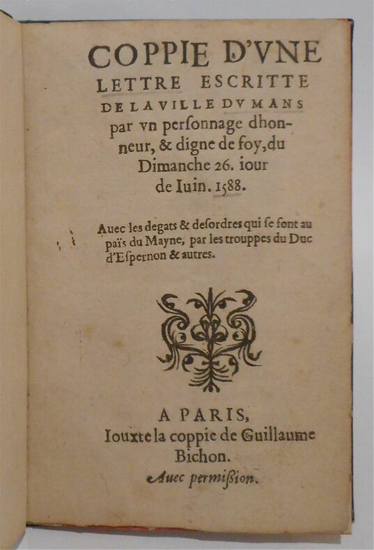
222018Paris, iouxte la coppie de Guillaume Bichon, s.d. (1588) petit in-8, 6 pp., un f. vierge, cartonnage de papier bouteille, tranches rouges (rel. du XIXe s.).
186390S.l., s.d. (1844) in-8, 491 pp., couvertes d'une écriture fine et lisible (environ 20 lignes par page), feuillets réglés, demi-basane bouteille à coins, dos lisse cloisonné et orné en long, tranches mouchetées (reliure de l'époque). Coins et dos un peu frottés.
160021613Paris 1600 une liasse de 2 document, 1 de 2 pages (dont 1 page manuscrite) (18 x 19 cm) + 1 de 6 pages (dont 4 manuscrites) (19 x 28 cm), manuscrit à l'encre brune sur papier vergé crème ligné et filigrané (filigrane représentant un pot détain avec couvercle et anse surmonté dune croix avec noté en pied F.L.), fait à Paris, le 13 OCTOBRE 1600
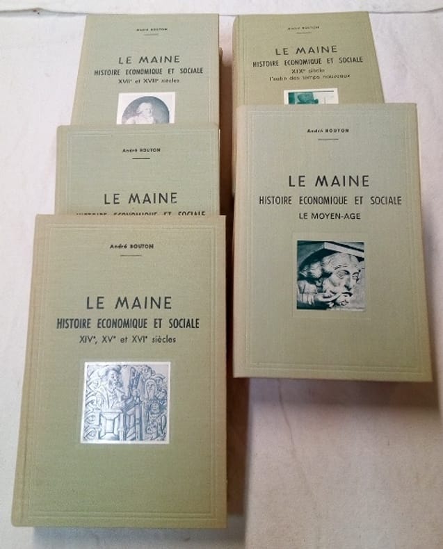
110DtLe Mans 0 Le Mans , Monnoyer ou A compte d'Auteur selon les volumes - 1970,1972,1974,1975 et 1976 - Forts In8 ( 17 x 25 cm) - reliure toilée avec photographies contre-collées et titres imprimés - 220 + 757 + 1026 +661 + 559 pages - Impressionnante iconographie in et hors texte - très nombreux plans et tableaux - dos insolés - Une Somme !
178254Laval, Chailland, (1918) 4 vol. in-8, pl., index, broché. Dos abîmé au tome 1.
232295Le Mans, Leguicheux-Gallienne, 1880 in-8, XVI-370-[2] pp., front., index, demi-chagrin rouge, dos à nerfs, filets dorés (rel. de l'époque).
217451Le Mans, 1908-1914 9 fascicules in-4, grav. h.t. et nbses ill. in-t., broché sous étui et emboîtage papier marbré Emboitage légt défraîchi.
198550Angers, Germain et G. Grassin, 1889 fort in-4, 669 pp., 11 planches dont 8 dépliantes (tableaux généalogiques), index, demi-basane caramel, dos à nerfs orné de fleurons dorés, premier plat de couverture conservé (reliure de l'époque). Dos passé.
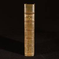
1949977Q25London and Glasgow : Collins 1949 . Leather. Near Fine. 8.5" by 5.5". None. A sumptuous Sangorski & Sutcliffe bound copy of the collected works of Oscar Wilde comprising his much celebrated novels plays poetry and other writings. Bound by Sangorski & Sutcliffe in half crushed morocco with cloth boards. The second impression of this "New Collected Edition" published by Collins. An anthology of the collected works of Oscar Wilde including his poetry plays essays and stories. Notable mentions include 'The Picture of Dorian Gray' 'The Importance of Being Earnest' 'The Sphinx' The Ballad of Reading Gaol' and more. Edited and with an introduction by G. F. Maine. Illustrated with a frontispiece of the author from a painting by Toulouse-Lautrec. Bound by Sangorski & Sutcliffe in half crushed morocco with cloth boards. Externally excellent with a few light marks to boards and spine. Slight fading to spine as is common with calf of this colour. Internally firmly bound. Pages are bright and clean with just one or two spots to the fore edge. Near Fine Collins hardcover
17864185Hambourg, Paris, Strasbourg, chez François FAUCHE, Imprimerie L. Cellot, 1786 5 vol. in-8 (210 x 135 mm.), vol. 1 : [J.-P.-L. de La Roche du Maine], Hambourg, chez François Fauche, 1786, 74 pp., vol. 2 : (Me Doillot, Avocat), Paris, L. Cellot, 1786, 109 pp., vol. 3 : Strasbourg, 1786, 83 pp., vol. 4 : (Me Doillot, Avocat), Paris, L. Cellot, 1786, 93 pp., vol. 5 : ( Me Doillot, Avocat), Paris, Cellot, 1786, 96 pp.Brochure d'attente sous papier bleu, non-rognée, vol. 1 : petite auréole en marge inf., vol. 2 : page de titre tachée (mouillure), vol. 3 : un feuillet déchiré et froissé en marge, vol. 4 : auréole de mouillure sur quelques feuillets, papiers d'attente défraîchis, dos absents.
196110537GOLDMANN WILHELM 1961. 1. hardcover. GOLDMANN, WILHELM hardcover
LAVAL, Imprimerie de L. Moreau - 1886 - Grands in-8, 255 x 170 mm - Edition originale limitée à 424 exemplaires - Trois [3] tomes en deux [2] volumes- Reliure 1/2 basane beige - Dos à 2 nerfs - Couverture conservée -Un plan dépliant de Laval en 1753, deux index (tables alphabétiques) - XXVII+410, 398 & 122 pages - traces de mouillures sèches, Sinon Bon exemplaire - PHOTOS sur DEMANDE. Charles Maucourt de Bourjolly , Saint-Ouën-des-Vallons [autrefois Saint-Ouën-des-Oies] au Château de la Roche-Pichemer, le 19 novembre 1645, Laval, lieu dit la Féaudière, 10 août 1721, Avocat et historien du Maine, et en particulier de la Mayenne
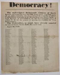
184037337South Berwick ME 1840. Broadside 11-3/4" x 14-1/2." Text as recited above in bold type of various sizes. Beneath are the printed signatures in smaller type of about 200 local citizens endorsing the call for assembly. Old folds as usual with several small pinholes along the folds which do not affect text. Ink signature on blank verso "Micajah Grant" preceded by "Mrs" "Hon.". Good plus.<br /> <br /> South Berwick Democrats seek support for the re-election of Maine Governor John Fairfield 1797-1847. Elected in 1838 he beat his Whig i.e. "Federalist" opponent in the 1840 campaign. <br /> Not located on OCLC as of May 2024 or online AAS Bowdoin Colby U ME U So. ME sites. unknown
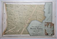
18883832<p>This attractively executed map/plan is for a proposed development by the Maine Central Railroad conveniently located "near terminus of the Mt. Desert Branch" of the railroad. The plan was "laid out by Joseph H. Curtis landscape engineer from surveys by J.G. Kelley." The completion of the Mt. Desert Branch in 1884 made possible an all-rail journey from Portland and points south to the Mt. Desert area. The proposed development apparently did not occur since a note on OCLC states: "Later maps show no evidence of the planned roads or lots."</p><p>Scarce with OCLC locating examples at the University of Maine at Orono Yale and Columbia. The Osher Map Library also has an example.</p><p><strong>Condition:</strong> Litho in green blue and brown. Very good with a small smudge at the middle of the right blank margin and remnants of mounting tape on the reverse.</p><p>ICN 7807.2</p> Heliotype Printing Co.
192141274Washington D.C.: Published by the United States Coast and Geodetic Survey 1921. Large folding nautical chart printed on heavy paper stock. Colored. A rare original coastal survey of Maine around Casco Bay including Cape Elizabeth Portland Yarmouth Freeport and Harpswell.<br/> <br/> Established by President Thomas Jefferson in 1807 as the Survey of the Coast the U.S. Coast and Geodetic Survey was the United States' first civilian scientific agency. This agency has followed its mission to survey the U.S. coastline create nautical charts of the coast and help increase maritime safety since its founding and has often played fascinating roles in significant chapters of U.S. history. It served in all theaters of the Civil War in the service of the Union Army and Navy pioneered acoustic exploration in the wake of the sinking of the Titanic and during WWI it worked to detect enemy submarines. In addition this agency worked to survey and produce detailed maps and renderings of the U.S. coast. These nautical survey maps commonly referred to as "T-sheets" provide fascinating insights into the history of the United States coastline which has and will continue to shift. These maps are the most important data source for understanding the physical and ecological characteristics of the U.S. shoreline. The present map is a highly detailed and accurate sea chart of Casco Bay and an important historical view of developing Maine. Published by the United States Coast and Geodetic Survey unknown
192041271Washington D.C.: Published by the United States Coast and Geodetic Survey 1920. Large folding nautical chart printed on heavy paper stock. Colored. A rare original coastal survey of Penobscot Bay including Belfast Isleboro Deer Isle Stonington North Haven Vinalhaven Rockland Camden and Rockport.<br/> <br/> Established by President Thomas Jefferson in 1807 as the Survey of the Coast the U.S. Coast and Geodetic Survey was the United States' first civilian scientific agency. This agency has followed its mission to survey the U.S. coastline create nautical charts of the coast and help increase maritime safety since its founding and has often played fascinating roles in significant chapters of U.S. history. It served in all theaters of the Civil War in the service of the Union Army and Navy pioneered acoustic exploration in the wake of the sinking of the Titanic and during WWI it worked to detect enemy submarines. In addition this agency worked to survey and produce detailed maps and renderings of the U.S. coast. These nautical survey maps commonly referred to as "T-sheets" provide fascinating insights into the history of the United States coastline which has and will continue to shift. These maps are the most important data source for understanding the physical and ecological characteristics of the U.S. shoreline. The present map is a highly detailed and accurate sea chart of Penobscot Bay and an important historical view of developing Maine. Published by the United States Coast and Geodetic Survey unknown
192041279Washington D.C.: Published by the United States Coast and Geodetic Survey 1920. Large folding nautical chart printed on heavy paper stock. Colored. A rare original coastal survey of St. George River and the Muscle Ridge Channel including Thomaston Cushing and St. George.<br/> <br/> Established by President Thomas Jefferson in 1807 as the Survey of the Coast the U.S. Coast and Geodetic Survey was the United States' first civilian scientific agency. This agency has followed its mission to survey the U.S. coastline create nautical charts of the coast and help increase maritime safety since its founding and has often played fascinating roles in significant chapters of U.S. history. It served in all theaters of the Civil War in the service of the Union Army and Navy pioneered acoustic exploration in the wake of the sinking of the Titanic and during WWI it worked to detect enemy submarines. In addition this agency worked to survey and produce detailed maps and renderings of the U.S. coast. These nautical survey maps commonly referred to as "T-sheets" provide fascinating insights into the history of the United States coastline which has and will continue to shift. These maps are the most important data source for understanding the physical and ecological characteristics of the U.S. shoreline. The present map is a highly detailed and accurate sea chart of Maine and an important historical view of the developing state. Published by the United States Coast and Geodetic Survey unknown
192041277Washington D.C.: Published by the United States Coast and Geodetic Survey 1920. Large folding nautical chart printed on heavy paper stock. Colored. A rare original coastal survey of West Penobscot Bay including Camden Rockport Rockland the Fox Islands and Islesboro.<br/> <br/> Established by President Thomas Jefferson in 1807 as the Survey of the Coast the U.S. Coast and Geodetic Survey was the United States' first civilian scientific agency. This agency has followed its mission to survey the U.S. coastline create nautical charts of the coast and help increase maritime safety since its founding and has often played fascinating roles in significant chapters of U.S. history. It served in all theaters of the Civil War in the service of the Union Army and Navy pioneered acoustic exploration in the wake of the sinking of the Titanic and during WWI it worked to detect enemy submarines. In addition this agency worked to survey and produce detailed maps and renderings of the U.S. coast. These nautical survey maps commonly referred to as "T-sheets" provide fascinating insights into the history of the United States coastline which has and will continue to shift. These maps are the most important data source for understanding the physical and ecological characteristics of the U.S. shoreline. The present map is a highly detailed and accurate sea chart of Penobscot Bay and an important historical view of developing Maine. Published by the United States Coast and Geodetic Survey unknown
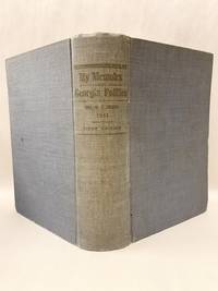
191151933Atlanta Ga: Self Published 1911. First Edition. Hardcover. Very good. 680p quarto illustrated. "It was her husband's request that she should collect qnd publish the story of his Congressional and Legislative life as connected with Georgia politics from 1874 during more than 20 years of public service in State and National Legislature" Salley Eugenia Brown's copy with her ownership signature on the front fly leaf. Brown 1862-1942 Miss Brown the daughter of Joseph E Brown Civil War Governor of Georgia. Martha "Pat" Simmons Garroway of Sargentville Maine related the story of Sally as a little girl watching General Sherman's troops march through Atlanta. Later she summered in Sargentville Mine and had a house at the end of Caterpillar Hill Road where it intersects with Reach Road. Inner hinges cracked but a surprisingly very good copy. <br/><br/> Self Published hardcover
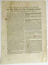
186334396Augusta 1863. Broadsheet 6-5/8" x 9". Caption title as issued. Each page printed in two columns. Some spotting Good.<br/><br/> "The voluntary enlistment of Veteran Regiments and the rapid organization of Negro Brigades in the South will amply recruit the tanks of the Union Armies." If the Administration's policies are "generously sustained by the free and loyal voters of the North" there will be no further draft. "But if the Administration is crippled hindered and embarrassed" in its recruiting another draft will be necessary. <br/> Bradbury the Copperhead candidate for Governor has promised to withdraw Maine's support for the War. If elected he will render inevitable "a fresh draft under the Conscription Act." Maine's Democrats seek deliberately to "precipitate a collision between Maine and the General Government." Men like Bradbury are "Jeff. Davis' Only Hope!"<br/>Not located on OCLC as of October 2017. unknown books
184037337South Berwick ME 1840. Broadside 11-3/4" x 14-1/2." Text as recited above in bold type of various sizes. Beneath are the printed signatures in smaller type of about 200 local citizens endorsing the call for assembly. Old folds as usual with several small pinholes along the folds which do not affect text. Ink signature on blank verso "Micajah Grant" preceded by "Mrs" "Hon.". Good plus.<br/><br/> South Berwick Democrats seek support for the re-election of Maine Governor John Fairfield 1797-1847. Elected in 1838 he beat his Whig i.e. "Federalist" opponent in the 1840 campaign. <br/>Not located on OCLC as of January 2021 or at the online AAS site. unknown books