[Maine]Biblio.com

2 671 résultats
192041281Washington D.C.: Published by the United States Coast and Geodetic Survey 1920. Large folding nautical chart printed on heavy paper stock. Uncolored. A rare original coastal survey of Maine from Nash Island to Cross Island including Jonesport Jonesboro Great Wass Island Preserve and Bucks Harbor.<br/> <br/> Established by President Thomas Jefferson in 1807 as the Survey of the Coast the U.S. Coast and Geodetic Survey was the United States' first civilian scientific agency. This agency has followed its mission to survey the U.S. coastline create nautical charts of the coast and help increase maritime safety since its founding and has often played fascinating roles in significant chapters of U.S. history. It served in all theaters of the Civil War in the service of the Union Army and Navy pioneered acoustic exploration in the wake of the sinking of the Titanic and during WWI it worked to detect enemy submarines. In addition this agency worked to survey and produce detailed maps and renderings of the U.S. coast. These nautical survey maps commonly referred to as "T-sheets" provide fascinating insights into the history of the United States coastline which has and will continue to shift. These maps are the most important data source for understanding the physical and ecological characteristics of the U.S. shoreline. The present map is a highly detailed and accurate sea chart of coastal Maine from Cross Island to Nash Island and an important historical view of the developing state. Published by the United States Coast and Geodetic Survey unknown
192141280Washington D.C.: Published by the United States Coast and Geodetic Survey 1921. Large folding nautical chart printed on heavy paper stock. Colored. A rare original coastal survey of Maine from Petit Manan to Quoddy Roads including Harrington Addison Jonesport and Machias.<br/> <br/> Established by President Thomas Jefferson in 1807 as the Survey of the Coast the U.S. Coast and Geodetic Survey was the United States' first civilian scientific agency. This agency has followed its mission to survey the U.S. coastline create nautical charts of the coast and help increase maritime safety since its founding and has often played fascinating roles in significant chapters of U.S. history. It served in all theaters of the Civil War in the service of the Union Army and Navy pioneered acoustic exploration in the wake of the sinking of the Titanic and during WWI it worked to detect enemy submarines. In addition this agency worked to survey and produce detailed maps and renderings of the U.S. coast. These nautical survey maps commonly referred to as "T-sheets" provide fascinating insights into the history of the United States coastline which has and will continue to shift. These maps are the most important data source for understanding the physical and ecological characteristics of the U.S. shoreline. The present map is a highly detailed and accurate sea chart of coastal Maine from Quoddy Roads to Petit Manan and an important historical view of the developing state. Published by the United States Coast and Geodetic Survey unknown
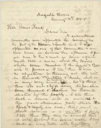
185545251Augusta House Augusta ME 1855. Very good folded small tear to one edge minor soiling and ink bleed through. 3 pp. Bifolium. 8 x 10 inches. Letter dated January 4th 1855 one day after the Maine elections from Maubec Mitchell Rawson newly elected Whig member of the Maine House of Representatives to fellow Whig party member and candidate for Governor Isaac Reed reporting on the efforts to fix the vote in favor of Reed's opponent Anson Morrill. Rawson had been appointed as a member of a gubernatorial committee that morning so was privy to the shenanigans: "Much talk is made about the course which some members of the Senate & House wish to pursue. I tell them I have no objections to throwing out the votes in the Hancock Plantation & thereby elect or in any way assist Mr. Milliken but to throw them all out & by so doing disfranchise some thousand & declare Mr. Morrill elected by the people. I tell them such a course will be suicidal to the great American party which Mr. Reed & myself are one."<br /> <br /> He goes on to report who is opposed to these moves and who might be witnesses: "When I see you I will inform you who are the men who are so conscientious about this matter. I am perfectly quiet & cool but I have been at work. most of the time for the last 24 hours. They the Committee propose to spend the night in the committee room so as to have it said that we are doing up business in shape but they are more anxious to declare Mr. Morill Gov by the dear people. I have heard nothing from you but I think my course is patriotic or an honest one & I shall pursue it unless you suggest otherwise. Don't show my letters to anyone. I shall be glad when this session shall close."<br /> <br /> Anson Morrill 1803-1887 was elected Maine's Governor in 1855 and served until 1856. He had been a candidate under the Know Nothing and then Republican parties.<br /> <br /> John F. Milliken however was not among the list of Representatives in 1855 but seems to have gotten himself appointed Postmaster in his hometown.<br /> <br /> Isaac Reed 1809-1887 was a merchant and shipbuilder. He served in the Maine Senate 1839-1840; 1850 1863; the Maine House of Representatives 1842-1843; 1846; 1870-1871; as State Treasurer 1856; and in the U.S. House of Representatives 1852-1853.<br /> <br /> Maubec Mitchell Rawson b. 1825 was from Waldoboro Maine. unknown
2016x-1138890715Routledge 2016. Hardcover. New. 232 pages. 9.25x6.25x0.75 inches. Routledge hardcover
2023SKU0637338Carolina Academic Press 2023-01-01. hardcover. New. 0x0x0. New Textbook Ships with Tracking Carolina Academic Press hardcover
187310250Boston: J.R. Osgood & Co 1873. First edition. Frontispiece and 12 plates. 1 vols. Oblong folio. Original tan pictorial boards black calf spine. Bottom half of spine perished some cover wear internally fine. 1873 Christmas gift inscription on title. First edition. Frontispiece and 12 plates. 1 vols. Oblong folio. An account of the adventures of a group of friends vacationing at Mt. Desert Maine recounted in humorous verse and equally humorous drawings evidently by two members of the party. Summer romances the hazards of the communal dining table days of genteel ennui and other activities with the first names of the participants indicated as a partial aid to social historians a few of them are named in pencil on the title page are described in double columns of rollicking verse narrative and accompanying plates. A charming period piece and a not insignificant bit of amusing Americana. J.R. Osgood & Co unknown
192041272Washington D.C.: Published by the United States Coast and Geodetic Survey 1920. Large folding nautical chart printed on heavy paper stock. Uncolored. A rare original coastal survey of Maine from Little River to Petit Manan including Milbridge Addison Great Wass Island Preserve Jonesport Machias and an inset map of Moose-a-Bec Bar and Pig Island in top left corner.<br/> <br/> Established by President Thomas Jefferson in 1807 as the Survey of the Coast the U.S. Coast and Geodetic Survey was the United States' first civilian scientific agency. This agency has followed its mission to survey the U.S. coastline create nautical charts of the coast and help increase maritime safety since its founding and has often played fascinating roles in significant chapters of U.S. history. It served in all theaters of the Civil War in the service of the Union Army and Navy pioneered acoustic exploration in the wake of the sinking of the Titanic and during WWI it worked to detect enemy submarines. In addition this agency worked to survey and produce detailed maps and renderings of the U.S. coast. These nautical survey maps commonly referred to as "T-sheets" provide fascinating insights into the history of the United States coastline which has and will continue to shift. These maps are the most important data source for understanding the physical and ecological characteristics of the U.S. shoreline. The present map is a highly detailed and accurate sea chart of coastal Maine and an important historical view of the developing state. Published by the United States Coast and Geodetic Survey unknown
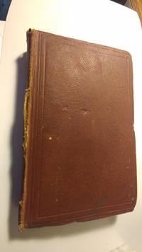
18614446150<p>23cm by 14cm 415pp first edition full leather front cover has discolouration spine is faded and tear along one edge corners bumped hinges cracked but text block still square and firm no loose pages some pencil notes on front flyleaf light spotting throughout otherwise unmarked.</p> John Murray hardcover
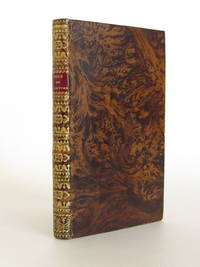
178466690à Amsterdam: S. n. 1784. Fine. S. n. à Amsterdam 1784 9 x 14.7 cm relié Several editions appeared the same year in Paris London Berlin. Full brown flamed sheep binding late 19th century. Smooth spine richly decorated in Restoration style. Red morocco title label. Fine copy. Armorial bookplate engraved from a private library. Satirical and cynical description of Parisian life and customs. The author discusses theaters prisons fashions promenades the Tuileries. S. n. unknown
1950024219Maine ATC 1950. Staple Wraps. Very Good. 4to - 11" Tall. The collection of hiking accounts by George H. Witherle renamed thus and mimeographed by the Maine ATC in 1950 this remains a very uncommon publication. Original typed titles on tanned wrappers stapled twice on the side with 43 pages mimeographed 1 side. Page ghost and original likely owners name to upper FC rear clean light edge wear. A nice example of an exceedingly scarce early AMC/MATC item. <br/> <br/> Maine ATC paperback
18420008084State of Maine 1842. Soft cover. Very Good. This is a document from John Fairfield Governor and Commander-in-Chief of the State of Maine. To Elisha Morton of Oxford Gentlemen Greeting: You having been elected Lieutenant of the B Company of Light Infantry in the first Regiment of the first Brigade and Sixth Division of the Militia of this State to take rank from the eighth day of July A. D. one thousand eight hundred and forty two. Reposing special trust and confidence in your ability courage and good conduct I do by these presents in the name of the State Commission you accordingly. You will therefore with honor and fidelity discharge the duties of said office according to the Laws of this State and to Military Rule and Discipline. And all inferior Officers and Soldiers are hereby commander to obey you in your said capacity; and you will yourself observe and follow such Orders and Instructions as you shall from time to time receive from the Commander-in-Chief or others your superior Officers. Given under my Hand and the Seal of the State the twelfth day of August in the year of our Lord one thousand eight hundred and forth two; and in the sixty-seventh year of the Independence of the United States of America. By the Governor Hand signed by John Fairfield in addition hand signed by the Secretary of State Philip C. Johnson and hand signed by the Adjutant General Alfred Redington. Registered Volume 5 No. 4370. The document has been folded once vertically and three times horizonally. The paper document has large brown spots in the upper right hand and lower left hand corners. Smaller brown spots are present elsewhere. The Seal of the State of Maine is in the upper right hand corner. On the reverse side of the document is the signature of Lieut. Elisha Morton. In addition on the reverse side of the document is that day's equivalent of an appearance before a notary public and taking the oaths required by the Constitution of this State. This document has been in my possession since the 1940's. It was acquired from Forrest L. Morton who had no children to pass it on to. About 15 or so years ago this document was taken to a book-binder preserver and a fee of around $100.00 was paid to further preserve the paper document. It would need to be shipped in a round tubed container. I do not at this time have the ability to put out pictures. If one has serious interest in purchasing but has further questions please call me on my phone listed on my Abe webpage. <br/> <br/> State of Maine paperback
2016x-1472579674Bloomsbury USA Academic 2016. Hardcover. New. translation edition. 210 pages. 8.00x5.50x0.75 inches. Bloomsbury USA Academic hardcover
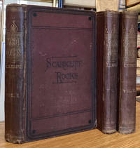
187574778London: Smith Elder & Co. 1875. Small 8vo. 3 vols. 282; 290; 314 pp. Dark purple cloth binding. Vol. 3 binding coming loose held together by rear joint. Rubbing to bindings wear to corners and marks to boards. Spines faded. Foxing to endleaves and light marks otherwise edges of leaves toned. Copac records 4 copies in BL; OX; CAMBS; NLS. . Good. Publisher's Cloth. First Edition. 1875. Smith, Elder & Co. 1875 hardcover
2008x-041596461XRoutledge 2008. Hardcover. New. 1st edition. 262 pages. 9.00x6.25x0.75 inches. Routledge hardcover
192041289Washington D.C.: Published by the United States Coast and Geodetic Survey 1920. Large folding nautical chart printed on heavy paper stock. Colored. A rare original coastal survey of Maine and New Hampshire including Portsmouth York Ogunquit Kennebunkport Biddeford and Cape Elizabeth.<br/> <br/> Established by President Thomas Jefferson in 1807 as the Survey of the Coast the U.S. Coast and Geodetic Survey was the United States' first civilian scientific agency. This agency has followed its mission to survey the U.S. coastline create nautical charts of the coast and help increase maritime safety since its founding and has often played fascinating roles in significant chapters of U.S. history. It served in all theaters of the Civil War in the service of the Union Army and Navy pioneered acoustic exploration in the wake of the sinking of the Titanic and during WWI it worked to detect enemy submarines. In addition this agency worked to survey and produce detailed maps and renderings of the U.S. coast. These nautical survey maps commonly referred to as "T-sheets" provide fascinating insights into the history of the United States coastline which has and will continue to shift. These maps are the most important data source for understanding the physical and ecological characteristics of the U.S. shoreline. The present map is a highly detailed and accurate sea chart of the coasts of Maine and New Hampshire and an important historical view of the developing states. Published by the United States Coast and Geodetic Survey unknown
192041286Washington D.C.: Published by the United States Coast and Geodetic Survey 1920. Large folding nautical chart printed on heavy paper stock. Colored. A rare original coastal survey of the Damariscotta and Medomak rivers including Bristol Waldoboro and Damariscotta.<br/> <br/> Established by President Thomas Jefferson in 1807 as the Survey of the Coast the U.S. Coast and Geodetic Survey was the United States' first civilian scientific agency. This agency has followed its mission to survey the U.S. coastline create nautical charts of the coast and help increase maritime safety since its founding and has often played fascinating roles in significant chapters of U.S. history. It served in all theaters of the Civil War in the service of the Union Army and Navy pioneered acoustic exploration in the wake of the sinking of the Titanic and during WWI it worked to detect enemy submarines. In addition this agency worked to survey and produce detailed maps and renderings of the U.S. coast. These nautical survey maps commonly referred to as "T-sheets" provide fascinating insights into the history of the United States coastline which has and will continue to shift. These maps are the most important data source for understanding the physical and ecological characteristics of the U.S. shoreline. The present map is a highly detailed and accurate sea chart of the Damariscotta and Medomak rivers and an important historical view of developing Maine. Published by the United States Coast and Geodetic Survey unknown
192041275Washington D.C.: Published by the United States Coast and Geodetic Survey 1920. Large folding nautical chart printed on heavy paper stock. Uncolored. A rare original coastal survey of the Fox Islands including Vinalhaven and North Haven.<br/> <br/> Established by President Thomas Jefferson in 1807 as the Survey of the Coast the U.S. Coast and Geodetic Survey was the United States' first civilian scientific agency. This agency has followed its mission to survey the U.S. coastline create nautical charts of the coast and help increase maritime safety since its founding and has often played fascinating roles in significant chapters of U.S. history. It served in all theaters of the Civil War in the service of the Union Army and Navy pioneered acoustic exploration in the wake of the sinking of the Titanic and during WWI it worked to detect enemy submarines. In addition this agency worked to survey and produce detailed maps and renderings of the U.S. coast. These nautical survey maps commonly referred to as "T-sheets" provide fascinating insights into the history of the United States coastline which has and will continue to shift. These maps are the most important data source for understanding the physical and ecological characteristics of the U.S. shoreline. The present map is a highly detailed and accurate sea chart of the Fox Islands and an important historical view of developing Maine. Published by the United States Coast and Geodetic Survey unknown
192041269Washington D.C.: Published by the United States Coast and Geodetic Survey 1920. Large folding nautical chart printed on heavy paper stock. Colored. A rare original coastal survey of Maine from Nash Island to Schoodic Island including Gouldsboro Prospect Harbor Steuben Milbridge Cherryfield Addison and Harrington.<br/> <br/> Established by President Thomas Jefferson in 1807 as the Survey of the Coast the U.S. Coast and Geodetic Survey was the United States' first civilian scientific agency. This agency has followed its mission to survey the U.S. coastline create nautical charts of the coast and help increase maritime safety since its founding and has often played fascinating roles in significant chapters of U.S. history. It served in all theaters of the Civil War in the service of the Union Army and Navy pioneered acoustic exploration in the wake of the sinking of the Titanic and during WWI it worked to detect enemy submarines. In addition this agency worked to survey and produce detailed maps and renderings of the U.S. coast. These nautical survey maps commonly referred to as "T-sheets" provide fascinating insights into the history of the United States coastline which has and will continue to shift. These maps are the most important data source for understanding the physical and ecological characteristics of the U.S. shoreline. The present map is a highly detailed and accurate sea chart of coastal Maine and an important historical view of the developing state. Published by the United States Coast and Geodetic Survey unknown
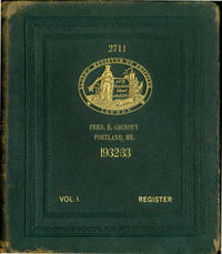
63-6143London: Lloyd's Register Of Shipping 1932-1933. 4to. Gilt Full Leather Boards ca. 2000 pp. Good with marginal tears some extremities worn to boards shelf wear. Includes bookplates and stamps of previous owner at back of volume SF Maritime Museum. Text in English & French.Very heavy volume will cost extra for shipping. London: Lloyd's Register Of Shipping, 1932-1933. hardcover
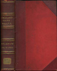
190131931Portland: Commandery of the State of Maine 1901. First edition. Three quarter morocco over red boards four raised bands ruled in gilt gilt titles. A very good copy with shelf sticker on foot of backstrip. 8vo. The Military Order of the Loyal Legion of the United States begun in Philadelphia in 1865 was modeled on the Society of the Cincinnati and formed to protect the republic amid rumors of a plot to destroy the government after the assassination of Abraham Lincoln. Among its members were Presidents Ulysses S. Grant Rutherford B. Hayes Benjamin Harrison and William McKinley. By 1899 it had over 8000 members which included nearly every officer of note. This volume contains 155 Maine circulars 22-179 for the years 1881 to 1901 Contains circulars meeting notices black bordered "In Memoriam" notices biographies of the deceased. Many items annotated and signed by the recorders Eward M. Rand and Henry S. Burrage. A wealth of information. [Commandery of the State of Maine ] hardcover
2004SONG0890894310Brand: Carolina Academic Press 2004-01-01. hardcover. Used: Good. 7.50x1.25x10.50. Buy with confidence. Excellent Customer Service & Return policy. Brand: Carolina Academic Press hardcover
197221562PABEL/MOEWIG VERLAGSUNION 10/1972. 1. softcover. SF/UTOPISCHE ROMANE PABEL/MOEWIG VERLAGSUNION paperback
176338819Amsterdam: Chez Marc-Michel Rey 1763. 2 parts in 1 vol. Small 8vo 14x8 cmContemporary leather spine gilt faded with morocco title-label covers with loss of small pieces of leather marbled endpapers. xl128;ii189iii pp. First title soiled otherwise good copy. Barbier I171 mentions 2 editions: This first edition and Londres 1789 Chez Marc-Michel Rey hardcover
ria9780415728072_inpHardcover. New. New Book; Fast Shipping from UK; Not signed; Not First Edition; Dialogic Readers: Children talking and thinking together about visual texts celebrates the sophisticated and dynamic discussions that primary-aged children can have as they talk together to make meaning from a variety of texts and it h hardcover
2017x-1138518867Taylor & Francis 2017. Hardcover. New. 460 pages. 9.02x5.98x9.00 inches. Taylor & Francis hardcover