3 218 résultats
188854141Montpelier VT: S.W. Corse Landscape Photographer and Crayon Artist; A.N. Blanchard Photo. ca. 1888. Twelve boudoir albumen photos sized from 4.5 x 7.5 in. up to 5 x 8 in. mounted on beige-coloured studio boards sized 5 x 8 in. up to 5.25 x 8.5 in. a few w/ inventory number w/in negative at lower margin of image 7 w/ studio imprint on verso or lower blank margin of board minor dustsoiling some edgewear slight foxing to a couple of the images still VG collection with strong contrast. This collection of albumen boudoir photographs provide an excellent visual depiction of Montpelier Vermont at the end of the 19th century. An opening series of photographs offer birds-eye views of the town setting along the Winooski River and its tributaries showing factories homes the historic Vermont State House in the background homes and roads under construction and dam in the downtown area. Two of the images show nicely graded streets lined with Victorian homes street lighting installed and mature trees. In addition there are views of an unidentified family camping excursion with canvas tent erected next to hammocks well-to-do couple in horse and buggy in front of large Victorian home including an image of the interior as well. Corse fl. 1889-1903 was a popular landscape and portrait photographer in Barre VT before moving his studio to Montpelier in 1890 where he carried the latest photographic apparatus and was well-known for his children’s portrait photography as well as photos for state publications. Blanchard 1843-1923 served with the 1st U.S. Sharpshooters Company F in the Civil War and first established his studio in Barre VT in 1865 and later located to Montpelier from 1880 to 1887 according to city directories. See: Vermont: Its Resources and Industries Embracing Historical and Descriptive Sketches 1889 p. 69; Blanchard Feathered Lady of Montpelier Vermont The Cabinet Card Gallery 2016. S.W. Corse, Landscape Photographer, and Crayon Artist; A.N. Blanchard, Photo., hardcover
665611Editions Méditerranéennes Du Prado Marseille 1987 In-4 oblong "à l'italienne" ( 300 X 390 mm ) de 123 pages, en feuilles sous chemise imprimée et gaufrée au nom de l'artiste dans un coffret-emboîtage toilé havane. EDITION ORIGINALE et premier tirage des 22 lithographies en couleurs hors-texte d'Yves BRAYER. 1 des 185 exemplaires numérotés sur Rivoli blanc des papeteries Arjomari, bien complet de la LITHOGRAPHIE ORIGINALE signée et justifiée par Yves BRAYER sous portefeuille toilé décoré à l'identique du coffret-emboîtage toilé havane ( dans un format légèrement supérieur ) . Très bel exemplaire à l'état de neuf.- L'ouvrage comprend également une biographie d'Yves BRAYER ainsi qu'un feuillet intitulé "Principaux livres illustrés par Yves BRAYER". Cette liste reprend dans leur presque totalité, les informations contenues dans le catalogue de l'exposition Brayer Graveur, que la Bibliothèque Nationale a présenté en 1977 catalogue rédigé par M. Claude Bouret, conservateur au Cabinet des Estampes.
La carta viene preparata da Gerard Mercator per il suo Italia, Sclavoniae et Graeciae tabula geographicae (Duisburg, 1589) che comprende un frontespizio allegorico e 22 carte geografiche della penisola, dei Balcani e della Grecia. Successivamente le carte sono ristampate nell’Atlantis Pars Altera (1595) pubblicato postumo alla morte del Mercatore, dallo stampatore di Duisburg Albert Buys, sotto la supervisione del figlio Rumold Mercator. Composto da sei parti – pubblicate separatamente tra il 1589 e il 1594 – comprende 107 mappe, tutte tranne la carta del mondo di Rumold, firmate da Gerard Mercator. Le lastre vennero poi acquistate da Jodocus Hondius, che tra il 1606 e il 1630 le utilizzò per il suo Atlas Sive Cosmographicae Meditationes de Fabrica Mundi, integrandole ed aggiornandole con proprie “nuove” carte. Delle mappe di Mercator sono note anche ristampe curate da Johannes Janssonius. Le edizioni Hondius e Janssonius ebbero un grande successo commerciale e furono stampate in più lingue, con il testo al verso della carta in latino, francese, tedesco e olandese. La carta è incisa con i connotati tipici dell'opera mercatoriana. Le montagne sono allineate in un concetto di area montuosa, non per indicare vere catene o valli, ed hanno una struttura con qualche differenza nella dimensione, ma simile per quanto riguarda la forma, con pendici verticali e cime piatte. Le città sono mostrate attraverso castelli più o meno grandi caratterizzati da tetti slanciati ed aguzzi, simili a cappelli di mago. ESEMPLARE DALLA PRIMA EDIZIONE DI ATLANTIS PARS ALTERA. Incisione in rame, in buono stato di conservazione. Bibliografia cfr. Koeman II Me 11 e Koeman II Me 13A, 1595); Van der Krogt 1:002; J. Keuning, The History of an Atlas, in “Imago Mundi” IV (1947) pp. 37-43; World Encompassed p. 134. The map is prepared by Gerard Mercator for his Italia, Sclavoniae et Graeciae tabula geographicae (Duisburg, 1589), which includes an allegorical frontispiece and 22 maps of Italy, the Balkans and Greece. Later, the maps are reprinted in the Atlantis Pars Altera (1595) published posthumously after the death of Mercator, by the Duisburg printer Albert Buys, under the supervision of his son Rumold Mercator. Composed of six parts - published separately between 1589 and 1594 - it includes 107 maps, all except Rumold's map of the world, made by Gerard Mercator. The plates were then purchased by Jodocus Hondius, who between 1606 and 1630 used them for his Atlas Sive Cosmographicae Meditationes de Fabrica Mundi, integrating and updating them with his own "new" maps. Of Mercator's maps are also known reprints edited by Johannes Janssonius. The Hondius and Janssonius editions had a great commercial success and were printed in several languages, with the text on the back of the map in Latin, French, German and Dutch. The map is engraved with the typical connotations of Mercatorian work. The mountains are aligned in a mountainous area concept, not to indicate true chains or valleys, and have a structure with some differences in size, but similar in shape, with vertical slopes and flat tops. The cities are shown through more or less large castles characterized by slender and pointed roofs, similar to wizard hats. Copper engraving, in good condition. Bibliografia cfr. Koeman II Me 11 e Koeman II Me 13A, 1595); Van der Krogt 1:002; J. Keuning, The History of an Atlas, in “Imago Mundi” IV (1947) pp. 37-43; World Encompassed p. 134; L. Piloni, "Carte geografiche della Sardegna", tav. XXXII.
Carta tratta dalla rara raccolta di carte geografiche denominata Atlante Geografico, prima stesura delle opera dell’abate Bartolomeo Borghi, pubblicata in Siena dal Pazzini Carli. Molte delle carte, datate tra il 1788 ed il 1800, sono incise da Agostino Costa e poi successivamente inserite nell’opera Atlante generale dell'ab. Bartolommeo Borghi, pubblicato a Firenze nel 1819.Bartolomeo Borghi, che Vermiglioli (Biografia degli scrittori perugini, 1829) definisce "uno dei migliori geografi dell'Europa", nacque nel 1750 a Monte del Lago, piccola frazione del comune di Magione, in provincia di Perugia, sulle rive del Trasimeno. Ordinato sacerdote nel 1774, trascorse i primi anni del suo mandato nel paese natale, poi a Magione e quindi a Sorbello (Cortona).Appassionato studioso di geografia, applicò dapprima le sue conoscenze all'analisi delle terre a lui più familiari: nel 1770 scrisse Descrizione geografica, fisica e naturale del Lago Trasimeno (che sarà tuttavia data alle stampe per la prima volta solo nel 1821), e nel 1791 pubblicò negli atti dell'Accademia etrusca di Cortona una Dissertazione sopra l'antica geografia dell'Etruria, Umbria e Piceno, arricchendo entrambe le opere di una carta delle regioni descritte. Intanto la sua fama di cartografo, oltre che di geografo, cresceva, tanto da fargli ottenere le nomine a membro delle Accademie Cortonese e Reale di Firenze, e procurargli l'incarico, da parte di Pietro Leopoldo, di delineare la carta del catasto pubblico di Cortona e del contado di Castiglione.Nello stesso tempo gli orizzonti geografici della sua attività si allargavano sensibilmente, e se nell'Atlante Novissimo, illustrato ed accresciuto sulle osservazioni, e scoperte fatte dai più celebri e più recenti cartografi di Antonio Zatta (Venezia 1779-1785) il suo contributo fu ancora legato all'area toscana, nell'Atlante geografico che si pubblicò a Siena da Pazzini Carli tra il 1798 ed il 1800 il Borghi tracciò la maggior parte delle carte e spaziò dalle province del Sud-Est dell'Inghilterra, al Regno di Danimarca, alla Romania.Una sorta di prova generale, quest'ultima, della sua opera più importante, quell'Atlante generale dell'ab. Bartolommeo Borghi, pubblicato a Firenze nel 1819. L'Atlante, corredato da brevi descrizioni storiche, politiche, civili e naturali che introducono le carte relative ai territori afferenti a ciascun Impero o Regno illustrato, rispecchia il nuovo assetto geo-politico attuato dal Congresso di Vienna. Incisione in rame, in buone condizioni. Map taken form the very rare Atlante Geografico, the first draft of the abbot Bartolomeo Borghi, published in Siena by Pazzini Carli. Many of the mapss, dated between 1788 and 1800, are engraved by Agostino Costa and then later incorporated in the work of AB Atlante Generale di Bartolomeo Borghi, published in Florence in 1819.Bartolomeo Borghi, who Vermiglioli (Biography of writers Perugini, 1829) calls "one of the best geographers of Europe", was born in 1750 in Monte del Lago, a small fraction of the town of Mansfield, in the province of Perugia, on the shores of Lake Trasimeno. Ordained in 1774, spent the first years of his term in his hometown, then to Mansfield and then Sorbello (Cortona).A passionate student of geography, first applied his knowledge to the analysis of land more familiar to him: he wrote in 1770 Description geographical, physical and natural Lake Trasimeno (which will however be given to the press for the first time only in 1821), and 1791 published in the Proceedings of Etruscan Cortona a dissertation on the geography of ancient Etruria, Umbria and Piceno, enriching both the works of a map of the regions described. Meanwhile, his fame as a cartographer, as well as a geographer, was growing, so that he get the nomination as a member of the Royal Academies of Florence and Cortona, and give him the job, by Pietro Leopoldo, to outline the paper's public land Cortona and the county of Castiglione.At the same time the geographical horizons of its activities widened considerably, and if in the Atlas Novissimo, illustrated and amplified the observations and discoveries made by the most recent and most famous cartographer Antonio Zatta (Venice 1779-1785) his contribution was still related area of Tuscany, in the Atlas geographic monthly published in Siena by Pazzini Carli between 1798 and 1800 the villages drew most of the cards and spaced from the provinces of South-East of England, the Kingdom of Denmark, Romania.A sort of dress rehearsal, the latter, his most important work, quell'Atlante General of AB. Bartolomeo Borghi, published in Florence in 1819. The Atlas, accompanied by brief descriptions of historical, political, civil and natural to introduce the papers relating to the territories belonging to each United Empire or illustrated, reflects the new geo-political structure implemented by the Congress of Vienna.
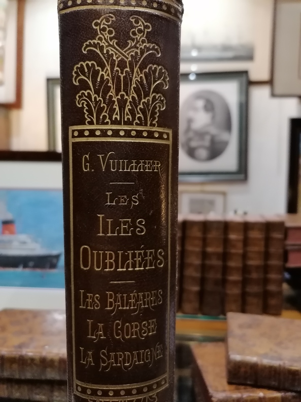
OPERA IN DUE VOLL. IN 8° COSI' RIPARTITI : VOL.1°) SPAGNA DI GIUSEPPE LAVALLEE' E DI ADOLFO GUEROULT, pp.506, c.1, TAVV.52, DUE CARTE GEOGRAFICHE + v.r. ( SPAGNA ANTICA, SPAGNA E PORTOGALLO ). VOL. 2°) SPAGNA DALL'ESPULSIONE DEI MORI SINO ALL'ANNO 1847 DI GIUSEPPE LAVALLEE', pp.479, TAVV. DA 53 a 80. ISOLE BALEARI E PIZIUSE DI FEDERICO LACROIX, pp.30, TAVV. 3. ISOLA DI SARDEGNA DI G. DE GREGORY, pp. 51.<BR>STORIA DELLA CORSICA DAI TEMPI PIU' REMOTI SINO A' GIORNI NOSTRI, DI C. DE FRIESS - <BR>COLONNA, pp. 166. SEGUONO, TAVV. 12 PER LA SARDEGNA DI CUI LA PRIMA CON LA CARTA DELL'ISOLA DEL 1832. TAVV. 12 PER LA CORSICA DI CUI LA PRIMA CON LA CARTA DELL'ISOLA DEL 1845. TOTALE DELLE TAVV. PER I DUE VOLL.109. OPERA FACENTE PARTE DELLA COLLANA " L'UNIVERSO " O STORIA E DESCRIZIONE DI TUTTI I POPOLI, ECC. TRADUZIONE DI FRANCESCO FALCONETTI, TESTO SU DUE COLONNE. LEGATURE D'EPOCA IN MEZZA PELLE CON TITOLI E FREGI AL DORSO IN ORO, PIATTI RIGIDI MAREZZATI. OTTIMA CONSERVAZIONE DI QUEST'OPERA RARA A TROVARSI COMPLETA DI TUTTE LE TAVOLE. ID, 5391
36910Paris, Hachette en 1893. Petit in-folio en reliure éditeur, ornée de figures et d'arabesques dorées sur un demi-maroquin à coins entourant un papier couvert de branchages fleuris. Dos décoré à l'identique. Tranches dorées. Impressions de Voyage, illustrées par l'Auteur. 498 pages et Table des Chapitres. Bon exemplaire ave des rousseurs dans les 5 premières pages. Reliure signée Magnier et ses Fils. Etiquette de Féret 15 Cours de l'Intendance , Bordeaux.
17001377PARIS. L'AUTEUR. 1700. GRANDE CARTE IN-PLANO DE 64 X 50 CENTIMETRES ENVIRON, GRAVEE EN NOIR, LIMITES COLORIEES D'EPOQUE (MARGES 74 X 53), DANS UN CADRE BAGUETTE ACAJOU ET DORE. DEFAUTS AU CADRE, SINON CARTE EN BEL ETAT.
6438Bastia, Batini, an X(1802). In 8 couverture dominotée muette de l’époque (mouillure pâle tout du long).
2 voll. in 4, cm. 24,5 x 33, pp. (8) + 620 con 29 tavole fuori testo in fotocalcografia (in volume a parte). Mezza pelle coeva. Il Corpus Nummorum Italicorum noto anche come CNI, e' stato scritto da Vittorio Emanuele III di Savoia coadiuvato dai piu' esperti numismatici dell'epoca. Primo tentativo di un catalogo generale delle monete medievali e moderne coniate in Italia o da Italiani in altri Paesi. È ancora oggi fondamentale per lo studio e la classificazione delle emissioni delle diverse Zecche italiane a partire dal Medioevo.
552241Librairie Ernest Leroux Paris 1939 In-8 ( 250 X 165 mm ) de 223 pages, pleine toile verte, dos lisse janséniste avec pièce de titre et d'ordre de maroquin rouge, couverture conservée. 5 cartes dépliantes hors-texte. Edition originale très rare. Tampons sur les premiers feuillets de l'ancienne bibliothèque de "l'Assemblée de L'union Française" dissoute en 1958. Bel exemplaire.
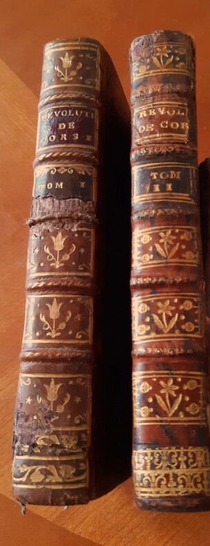
1771412EDITION ORIGINALE. Ed. Chez Herissant, Paris :1771. 2 vol. In -12 ( 17 X 10 cm) , pleine reliure de l’époque de basane fauve mouchetée, dos à nerfs et à caissons ornés et dorés. Pièces de titre de maroquin grenat , pièces de tomaison de maroquin vert à caractères et filets dorés. T1 : 329 p.p., 4 p. De corrections et additions. T2 : 316 p.p.2 p. De corrections et additions , 2 p. Approbation et privilège du Roi.
849298Buisson Ferney - Paris 1789 3 volumes in-12 ( 185 X 105 mm ) de XII-315 335 et 288 pages, cartonnage de papier marbré à la bradel, superbe papier dattente de lépoque conservé à lintérieur de louvrage ( Reliures signées de LOBSTEIN LAURENCHET ). EDITION ORIGINALE. Mouillure claire à quelques feuillets, quelques déchirures en marge sans atteinte au texte. Beaux exemplaires agréablement reliés. ( Attribué à RETIF DE LA BRETONNE par Barbier "Dictionnaire des ouvrages anonymes et pseudonymes" ).
15801000184AGum 1580. Altkolorierter Kupferstich aus Cosmographia, Bildformat 31 x 36 cm, [6 Warenabbildungen]
15841000170AGAntwerpen, 1584. Altkolorierte Kupferstich aus Ortelius, Theatrum Orbis Terrarum. rückseitig lateinischer Text. Bildformat 33 x 49 cm, [Van den Broecke, Ortelius Atlas Maps; 137], [5 Warenabbildungen] Mittelfalte, kräftiges Kolorit,
Carta geografica della Sardegna edita ad Amsterdam verso la metà del XVIII secolo. Incisione in rame, bella coloritura coeva, in ottimo stato di conservazione. Rara. Carta geografica della Sardegna edita ad Amsterdam verso la metà del XVIII secolo. Incisione in rame, bella coloritura coeva, in ottimo stato di conservazione. Rara.
23589Aquarelle sur papier, 21 x 28.7 cm.
1836GITf270Paris Furne 1839. 4 volumes in-8 XVI 384, 416, 430, 375pp. Veau glacé bleu nuit, dos à 4 nerfs élégamment orné de cadres de filets gras-maigres et de grandes pastilles dorés, plats encadrés d'un double filet doré gras-maigre, coupes filetées, dentelle dorée sur bordure intérieure, tranches marbrées, reliure de l'époque (Brigandat). Orné de 57 planches hors texte représentant des portraits, des vues ou scènes de batailles et des cartes (6 de celles-ci dépliantes). Quelques rousseurs par endroits. Exemplaire bien complet, conforme à la description de Vicaire VI, colonnes 224 à 226.
174747Caen, A. Hardel ; F. Poisson ; B. de Laporte, 1843-1847 6 pièces en un vol. in-8, demi-chagrin noir, dos à nerfs fleuronné (rel. de la fin du XIXe s.). Coiffe sup. presque arasée mais bon exemplaire.
La carta proviene dall'Urbis terrarum veteribus cogniti del 1720. La scritta col titolo è circondata da nove medaglioni colorati che ricordano altrettante monete antiche. In alto a sinistra in una cornice quadrangolare è inserito il disegno di una parte della Corsica e l'isola d'Elba che non sono comprese nella carta generale. In basso a sinistra, in un'altra cornice, è l'isola di Malta, qui col nome latino Melita. La semiologia è la stessa nei vari disegni delle isole: l'orografia è rappresentata con mucchi di talpa ombreggiati, i fiumi con un tratto marcato, le coste tratteggiate esternamente. La vegetazione è indicata con alberelli; le città con diversi simboli a seconda della loro importanza. Sono anche ricordati i nomi latini delle antiche popolazioni.Incisione in rame, bellissima coloritura coeva, in ottimo stato di conservazione. Unusual historical map showing Sardinia and Corsica together with a cartouche depicting Malta. Taken from the "Descriptio Orbis Antiqui" edited in Nuremberg. Copperplate, beautiful contemporary colour, in very good conditions.
179937904London: Peter Elmsly Printer To the Royal Society. Good with no dust jacket. 1799. Hardcover. Late 19th century morocco backed library cloth with library stamps and bookplate. Vi 348 8pp. 21 engraved plates some folding. Front board detached included. Includes a paper by Everard Home: An account of the Dissection of an Hemraphrodite Dog. To Which are Prefixed some observations on Hermaphrodites in General pp. 157-178. Other papers included. Contents are VG. ; Large 8vo 9" - 10" tall; 348 pages . Peter Elmsly, Printer To the Royal Society hardcover
Roy. 8vo. First Edition thus with a frontispiece 7 plates and endpaper maps; navy buckram vellum back black label lettered in gilt gilt top uncut silk marker a very good bright clean copy in publisher's card slip-case the latter mildly worn at edges and c EDITION LIMITED TO 400 COPIES. Published in 'The Yale Edition of the Private Papers of James Boswell'.
Incisione in rame (mm 293x452 e margini). Curiosa composizione che raffigura le linee costiere di Corsica e Sardegna. Tratta dall' atlante nautico "Recueil de plusieurs Plans des Ports et Rades et de quelques Cartes particulières de la Mer Méditerranée, avec les figures des Terres remarquables pour les reconnoissances des Atterrages", edito tra il 1732 ed ll 1746. Jacques Ayrouard, idrografo francese, risulta attivo tra il 1730 ed il 1750; il raro atlante dei porti del Mediterraneo rimane la sua unica opera. Questo atlante nautico sarebbe stato successivamente disegnato da numerosi idrografi, in particolare William Heather che cita Ayrouard nel suo "New Mediterranean Pilot" del 1802. L'incisore, Louis Corne, è noto a Tooley esclusivamente da questo lavoro. Bell'esemplare in buono stato di conservazione, numerata a mano nell'angolo superiore sinistro, qualche piccola macchietta rossa.. The Map Collector, Issue 24, p.49..
17351000347AGNürnberg, Homann Erben, 1735. Kupferstich mit Grenz- und Flächenkolorit nach Wieland und Schubarth, oben links figürlich allegorische Titelkartusche oben rechts Legende 1-38, unten links Entfernungskartusche. Bildformat 55 x 48 cm, unter Passepartout und Glas in Holzrahmen mit Schnitzereien 73 x 66 cm, [6 Warenabbildungen] einzelne grössere aber schwache Stockflecken, etwas fliegenverschmutzt, der Rahmen fußseitig etwas bestossen, grosses dekoratives Blatt,
176718416Amsterdam 1767 Deux parties en 1 volume in-12, demi-veau blond à petits coins, dos à nerfs, filets bruns et doré, 6- 158- 8- 28 pp. 9 planches dépliantes gravées sur cuivre. La pièce de titre manque, charnières usées fragiles, coiffes usées. Int. frais.
203665Bastia, Imprimerie de C. Fabiani, s.d. (mars 1852) placard grand in-folio (66 x 5,6 cm), en feuille.