365 résultats
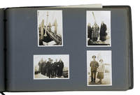
1931ABC_46004Greece Palestine Iran Iraq Egypt 1931. Oblong photograph album 20.5 x 32 cm. With 72 sepia photographs ca. 6 x 8.5 cm. Album of personal photographs commemorating a journey in 1931-1932 to the oilfields in modern Iran and Iraq by a trio of travellers which included the Reverend Philip "Tubby" Clayton 1885-1972 the founder of the Toc H movement. Several photographs show Galilee Jerusalem Rutbah Wells Ar-Rutbah and about 10 show "fields" mostly the main oilfield at Masjed Soleyman and its gas separator.In 1931 Clayton was invited by the director of the Anglo-Persian Oil Company the predecessor of the British Petroleum Company "to inspect the work among the Company units in Persia and the Middle East generally" Harcourt. Accompanied by two friends he travelled by plane train and boat to Lake Tiberias and further by plane to Rutbah Wells a British airfield where the group spent Christmas Eve with British Dutch and German travellers. On Christmas Day they reached Abadan and from there visited the oilfields near Tehran Ahvaz Haftkel Mohammerah Basra and Masjed Soleyman. After a journey to Cairo and Alexandria they boarded an oil tanker for the return journey to Britain. This journey inspired Clayton to plead passionately for improvements to the life of the crews of oil tankers. He described "carrying oil by sea" as "the most lonely job on the world's waters" Clayton. In 1940 he became chaplain of Anglo-Saxon Petroleum's tanker fleet and would subsequently sail on multiple tankers.The photographs must have been taken by Henry Pegg Chappell 1909-1997 since the other members appear he is the only member not present in the photographs and he does not and only Clayton who completed the journey by oil tanker. A carbon copy of a typed list describing all photographs is inserted in the album. Since typed and handwritten additions to the carbon paper refer to Clayton in the third person he probably typed the original list and gave Chappell this carbon copy to insert in his album.With an inscription probably by the three travellers on the title page. Binding slightly worn at the extremities. Paperclip and staple on the typescript rusted. In very good condition.l Clayton "In a tanker" in: The Times 9 March 1932 p. 15; Harcourt The impudent dreamer pp. 216-219. unknown
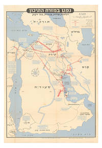
1957ABC_46260Tel Aviv: Israel Defence Forces General Staff 1957. Folded. 56 x 82.5 cm. Chromolithographic map of the Arabian Peninsula from Turkey in the north to the Indian Ocean in the south and covering Saudi Arabia Egypt Israel Palestine Jordan Syria Lebanon Iraq Iran Kuwait Bahrain Qatar United Arab Emirates Oman North and South Yemen. Scale 1:5000000. Scale and key in Hebrew inset to top-right inset explanatory panels in Hebrew and English compass rose in Saudi Arabia. Extremely rare Israeli strategic map of the Arabian Peninsula showing oilfields and associated infrastructure. Printed in black red and blue the map demarks the political boundaries of the time along with the areas covered by oil companies concessions. Pipelines form a web across the northern part of the Arabian Peninsula shown in an uncommon vertical orientation while oilfields and refineries large and small are also marked. The IDF probably made the map in responce to the 1956 Suez Crisis and its associated geopolitical shifts. With the Egyptians operating the Suez Canal and the USA forcing Britain and France to abandon their post-imperial plans Israel now counted in both U.S. and Soviet plans for their control of Middle Eastern politics. Britain had to anchor its Middle Eastern influence in Cyprus Aden and Iraq while the increased American influence can be seen in the huge swathe of territory assigned to Aramco. We have located only one institutional copy of this map in the National library of Israel.With traces of pins from former wall mounting. A couple of small light stains some uneven creasing and tears at the edges of some folds and a couple tiny holes where the folds cross. Otherwise in good condition. Israel Defence Forces, General Staff, unknown
1952ABC_46142Al Ahmadi: Kuwait Oil Company 1952. Loose sheets stapled together at the left top corner with holes punched in the left margin. Small folio 33 x 20.5 cm. Duplicated typescript printed on the rectos only in purple ink probably with a spirit duplicator. Unrecorded information guide for new employees of the Kuwait Oil Company KOC who would be residing in Al Ahmadi headquarters of the Company. The Kuwait Oil Company was founded in 1934 a joint venture between the British Anglo-Persian Oil Company and the American company Gulf Oil. In the same year the sheik of Kuwait Ahmad Al-Jaber Al-Sabah reigned 1921-1950 granted them rights to the oil concession which they were to retain until 1975. The first oil was discovered in 1938 in Burgan field followed by discoveries in Magwa in 1951 Al Ahmadi in 1952 and many more regions. In 1946 the first commercial shipment took place. Because the initial development of the KOC coincided with the end of the British Raj in India many British and Indian people in its service were transferred to Kuwait in particular to Al Ahmadi. Al Ahmadi was set up to house these workers.This unrecorded guide is quite rare especially because it seems to be a quite cheaply produced and ephemeral document which was issued only in small numbers for in-house circulation.At some places very slightly frayed and creases along the edges and corners staple a little rusted leaves slightly toned some leaves a little cut short at the foot with no loss except for some of the catch-words but overall in remarkably good condition. A rare and unrecorded guide for employees of the Kuwait Oil Company in Ahmadi. Kuwait Oil Company, unknown
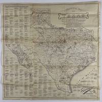
192012758Fort Worth: Standard Blue Print Map & Eng. Co 1920. Very good. Folding map 25.75 x 25.75 inches on thin paper. Old folds minor edge wear several short closed edge tears a couple of small areas of loss at crossfolds. Overall good condition and a wonderful display item. A rare and detailed Texas oil map produced by a Fort Worth firm just after World War I and here present in the larger 25-x-25-inch issue advertised in the promotional text on the map itself. The map shows the distribution of oil wells and derricks across the Lone Star State in 1920 prints the names of the most prominent oil fields and lists the names of Texas counties along with the oil companies active in each county. The map also shows the types of soil and rock deposits encountered throughout Texas counties with a legend of abbreviations for each at bottom right. The area of the map is crowded in places but still quite attractive and legible and is a good encapsulation of the rapidly developing oil industry in Texas at the time. Contemporary advertisements for the publisher of this map Standard Blue Print Map and Engineering promote the availability of over 200 oil maps of Texas Oklahoma New Mexico Louisiana and Arkansas from the firm. A rare map rarer still in this larger size; we locate just two copies at SMU one issued with a slightly later "May 1920" copyright notice with a larger "photocopy" reported at Denver Public Library and the Colorado School of Mines. Standard Blue Print Map & Eng. Co unknown
1943540Venezuela 1943. Very good. 48 original photographs each 8 x 10 inches. Quarto. Plain leather boards twin-bolt binding. Some photos detached from mounts some wear to covers but images generally fine with typed captions affixed beneath each photo. A rare photographic document of Venezuelan oil production in the early 20th century. This album contains nearly fifty large-format original images that depict the construction of a 157-mile crude oil pipeline from Las Mercedes Del Llano Guanico to a deep-sea terminal at Pamatacual in 1943 by the Sociedad Anonima Petrolera las Mercedes owned jointly by the Texas Company later Texaco and British-controlled Caracas Petroleum S. A. Venezuelan oil reserves attracted foreign investment as early as 1908: "In 1908 General Juan Vicente Gomez took power to become the strongest dictator of the 20th century with 27 years in office. He opened the gate to foreign oil investors.World War I was the trigger introducing Venezuela into the world oil market. After 1919 the investment and the exportation of Venezuelan oil increased tremendously. By 1922 Venezuela became an important supplier of oil in the world and biggest reserves of oil were discovered in the Lake of Maracaibo. During World War II Venezuela was the most secure provider of oil to the United States." -- Johannes Alvarez and James Fiorito Venezuelan Oil Unifying Latin-America. Venezuela increased its production 42 percent in 1943 and 1944 to satisfy the Allied demand for wartime oil. The images contained in the present album show various features of the pipeline oil wells and storage facilities at the inland stations as well as the path of the pipeline through the jungle to the sea. Several photos depict groups of men at work on the line in several locations. Another series of images depict views of the terminal station and the construction of its structures as well as its shipping facilities and the operations surrounding the loading of tankers there. From a research perspective this album is a fascinating look into the development of the now-critical oil industry in a lesser known region of mid-20th century Venezuela the involvement of American in this case Texan companies in South American industrial growth as well as the importance of South American resources to the United States war effort during World War II. We were unable to find any examples of large format photographs from the Venezuelan oil industry from this period in auction records or on the market. Photographs of Venezuelan oil production from outside of the Lake Maracaibo region where the bulk of early oil development occurred are equally difficult to locate. The printed title page suggests that more than one of these albums was produced but we are unable to uncover another example in OCLC or archived sales records. unknown books
1970ABC_50132Iran 1970. The collection is housed in a plastic file folder with each photograph also separately kept in a plastic folder. Various sizes. With 10 photographs. Collection of ten beautiful press photographs of the oil industry in Abadan Iran which was home to the largest oil refinery in the world at the time these photographs were taken. They show various parts of the industry such as the oil refinery oil tankers pipelines and fire department. The photographs were take by various French and German news agencies.With the stamps of various French and German news agencies on the back of each photograph. Some of the photographs are slightly creased. Otherwise in good condition. unknown
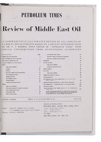
1948L2EG76GNBQ6GLondon: Brettenhem house 1948. Later cardboard binder. 30 x 23.5 cm. With many reproductions of photographs ground plans maps and cross-sections. Extract from the periodical The Petroleum Times containing an extensive article on oil in the Middle East. It opens with a list of Middle East oil companies and their concessions accompanied by a map showing their oil fields followed by a section on the future of Middle East oil. Individual chapters are devoted to the oil industry in Iran Iraq Bahrein Saudi Arabia Haifa Israel and Kuwait describing the area's geology oil fields reservoirs and more illustrated with photographs and cross-sections of the soil. The first 25 and last 16 pages consist of advertisements. Lacking the first 4 leaves of the preliminaries probably advertisements but the article itself complete some leaves slightly creased otherwise in very good condition. Brettenhem house, unknown
1958163043Kuwait: 1958. A fitting gift for a veteran oil man This evocative image was likely captured at dawn and shows two Bedouin engaged in the daily Fajr prayer both wearing the traditional shemagh headdress . Although not marked as such this was presented to William K. Whiteford 1900-1968 president of Gulf Oil in 1958 - the 20th anniversary of the discovery of oil in Kuwait. In 1934 Gulf Oil formed an alliance with the Anglo-Persian Oil Company to create the Kuwait Oil Company. It received concession rights in 1934 started drilling in 1936 and discovered oil two years later in the massive Burgan oil field. In 1957 Whiteford was described by Time magazine as "burly aggressive Bill Whiteford who started as an oilfield roughneck out of Stanford University was brought into Gulf in 1951 from the presidency of Canada's British American Oil Co. Ltd. made chief administrative officer in 1953 under Sidney A. Swensrud who moved up from president to board chairman. Whiteford shook up Gulf's management strengthened its domestic and Western Hemisphere holdings firmly but unofficially took over much of the executive authority". 1958 was also the year in which Whiteford published a short in-house history Gulf and the World Oil Industry. The image of Bedouin at their sunrise prayers may be an intentional hommage to the dawn of the Kuwaiti oil industry. Original colour photograph measuring 232 x 347 mm; mounted and glazed in brown wood frame by the Kendrick Bellamy Company Denver overall 407 x 507 mm. Pencilled date below framer's label "5-14-57". Light damp staining to bottom edge of mount a few scratches to frame and minor loss to backing. Overall in excellent condition. Time 25 March 1957. unknown
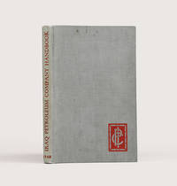
1948183725London: Compiled in the Companies' Head Office 1948. An informative survey of the Middle East and its oil industry First edition of this excellent handbook for IPC employees outlining the operations and expanding importance of the petroleum industry and surveying the history and current condition of states in Arabia the Gulf and the Levant. Chapter 1 describes the IPC's formation the mechanisms for opening a new concession the history of its prospecting and extraction projects and the Mediterranean pipeline. A chapter on the culture of the Arab world is followed by regional breakdowns that draw on company and government reports. Concerning the Gulf the handbook emphasizes the potential of oil exploration to transform the region. In Qatar where an oil field was discovered in the late 1930s "the population is scanty and wretchedly poor. The Company's present operations supply almost the sole source of wealth. The building of necessary roads jetties dwellings offices workshops stores and the like has advanced simultaneously with drilling" pp. 15 & 69. Accompanying the text are valuable plates showing IPC operations in Kirkuk and near Tripoli views of Qatar and Bahrain from the air and a well with head fittings and flow lines. The folding regional map details oil fields refineries and pipelines both built and projected. A useful tabular appendix summarizes the present state of the IPC's concessions including the area they cover and the rights granted as well as current exploration licenses. Octavo. Half-tone portrait frontispiece of King Faisal and 26 plates folding area map at rear maps in text. Original grey cloth spine lettered in red company logo in red on front board. Ownership inscription "L. B. Griffiths Tripoli 21.11.1948" on front free endpaper. Light sunning marking at head of front board top edge foxed: very good. hardcover
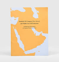
1954170939New York: Standard Oil Company New Jersey 1954. A new era in Middle East oil Revised and updated edition following the first of 1947 of this glossy guide illustrated with three colour maps of the Arabian Peninsula showing oil fields and concessions pipelines and refineries. Recognizing the potential of Saudi Arabia's vast oil reserves in 1946 Standard Oil Company New Jersey acquired a 30 percent stake in the Arabian American Oil Company. A colour bar chart illustrates Saudi Arabia's rapid growth as an oil producer after 1946. The introduction stresses the region's importance to emerging Cold War geopolitics: "Middle Eastern oil is a major element in the economies of Europe and the East. It is essential to the defence of the free world" p. 5. Quarto. Colour reference maps in text as well as photographic half-tones. Original wrappers front cover lettered in black against outline of Arabian Peninsula wire-stitched as issued. Front cover bright rear wrapper lightly soiled a little internal creasing from handling: a near-fine copy. unknown
1920666DGca. 1920. Oel auf Leinwand. Format: 88 x 113 cm. Mit Holzrahmen: 103 x 129 cm. + Wichtig: Für unsere Kunden in der EU erfolgt der Versand alle 14 Tage verzollt ab Deutschland / Postbank-Konto in Deutschland vorhanden +
192549705Pittsburgh PA & Port Arthur TX: Gulf Refining Co. ca. 1925. Folio. 11.5 x 14.25 in. 5 large oversize folding leaves of typed descriptions measurements specifications; mounted 7 linen-backed photo leaves 2 folding -- w/ 39 images printed on 34 silver gelatin photos. Original split-pin post-binder blue silk red cloth corners brass split pins minor edgewear rubbing minor fraying to corners first typed leaf w/ creasing minor closed tears still a VG exemplar from the library of John W. Jackson former Marketing & Sales executive with Gulf Oil Corporation Tulsa OK. This spectacular packaging catalogue for Gulf Oil Company petroleum products in the 1920s provides an incomparable photographic reference for all of the available products their dimensions sizes specific directions about tin lithograph colours as well as the cardboard and wooden shipping crates. Gulf Oil Corporation was initially organized in May 1901 by J.M. Guffy Andrew W. Mellon and others. By 1907 they had built a 400-mile pipeline from Port Arthur to the Glenn Pool Field in Oklahoma and started refining Oklahoma crude by 1907. By the 1920s this integrated Oil Company had built service stations across the country sold Good Gulf Gasoline and actively promoted automobile travel with Gulf Maps marketing promotions and more. This catalogue begins with photos of 1 5 10 and 25 lb. tins of Gulf Supreme Grease Transmission Grease Red Top Axle Grease Gulf Petrol-atum Gulf High Pressure Grease and Gulf Lubricant with all of the product tins carefully sized by stack showing their side graphics sizes lids and lid configurations. The oil cans include Tractor Oil Auto Oil Harvester Oil Gulf Motorcycle Oil small illustration of 1920s era motorcycle with Gulf Logo and even the blank tin soldered cans of assorted sizes. Of particular interest are the images of all the specialty products Gulf Oil was marketing during the Flapper Era including Venom pesticide & bug killer in glass bottles with screw-top tin lids & corks; Gulf Gas-o-Clenz cans in 1/2 pint 1 pint 1 quart and 1 gallon sizes; Gulf Gleam Cans Gulf Jelly Clens tubes Gulf Grease tubes and more. The last group of photos show all of the varieties of Gulf Venom Jelly-Clenz Gulf Pressure Grease Gulf Gleam cardboard and wooden packaging complete with printed labels lithograph labels Venom hand-sprayers and packaging and crates in assorted sizes and amounts. These types of photographic sales catalogues for the Petroleum industry are quite scarce and often unique items. Gulf Refining Co., hardcover
1920666DGca. 1920 Oel auf Leinwand. Format: 88 x 113 cm. Mit Holzrahmen: 103 x 129 cm.
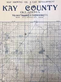
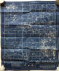
19351420Wichita: Wichita Mapping & Engineering Co 1935. Very good. Large blueline map 40.75 x 47 inches. Rolled. Some excess blue ink along bottom edge. Light wear at edges. Minor toning and dust soiling. Scattered neat contemporary manuscript annotations. Imposing and detailed oil and gas map showing developments in Kay County Oklahoma bordering Kansas directly south of Wichita. The present map delineates all the oil and gas wells being planned and drilled and all wells actively producing and abandoned. These are several large concentrations of activity the largest being between the towns of Blackwell Braman Dilworth and Peckham northeast of the Chikaskia River with others located near Tonkawa Ponca City and between Newkirk and Kaw. The map also notes land ownership for every section of every township in the county."The oil and gas industry stimulated an economic boom in the early 1900s. As early as 1894 gas had been discovered on the Marcus McClaskey farm southeast of Newkirk. However he kept the discovery a secret until he could prove up his land claim. By 1902 approximately six gas wells had been drilled northeast of Blackwell. In 1910 Ernest W. Marland founder of the 101 Ranch Oil Company drilled seven gas wells on the Millers' 101 Ranch. However the great oil boom in Kay County was precipitated by the discovery of oil by Marland on the Ponca allotment of Willie Cries Crys-for-War in June 1911. Louis H. Wentz soon entered the foray to locate oil in Kay County. The oil boom and bust created temporary peaks in population and several ghost towns such as Mervine Dilworth and Three Sands" - Encyclopedia of Oklahoma History and Culture.Not in OCLC. We locate records for four other maps produced by the Wichita Mapping & Engineering Co. with only one being noted in any appreciable amount of copies. Wichita Mapping & Engineering Co unknown books
1963169036Kuwait: Matba at hukumat al-kuwayt 1963. Kuwaiti oil policy in the state's earliest years First edition first printing of this rare pamphlet which is at once a statistical record of Kuwaiti oil production and a policy document arguing for oil as the key factor in the development of the country. When this pamphlet was published Kuwait had only been independent for about two years. The text is accompanied by a superb fold-out map showing the state's oil fields and the companies that ran them at the time. Following a very brief outline of Kuwait's geography climate and history the first chapter is devoted to oil production. Kuwait is named as the fourth-largest producer of oil in the world after the United States the Soviet Union and Venezuela. Subsequent sections are given over to each of the five oil companies operating on Kuwaiti territory: Kuwait Oil Company Ltd Aminoil Japan's Arabian Oil Company Shell Kuwait and Kuwait National Petroleum Company. The most expansive sections give precise information on how many fields and wells the companies ran how many barrels each field produced per year and the annual volume of exports by country with accompanying fold-out colour bar charts. The second chapter is devoted to revenues again broken down by company and details the concessions paid by the American and Japanese concerns to the state of Kuwait. The third chapter discusses Kuwaiti oil policy including the state's role in the foundation of OPEC in 1960 to avoid unilateral decreases in the price of oil as well as its commitment to train home-grown talent in the oil sector and thereby reduce dependence on foreign expertise. Octavo. With 6 black and white illustrations 3 fold-out colour bar charts fold-out colour map. Text in Arabic. Original white wrappers wire-stitched as issued lettered and illustrated in black. Wrappers nicked rear wrapper split at head and soiled along the spine fold-out map nicked. A very good copy. unknown
19361182Los Angeles: Brooks Bros 1936. Very good plus. Blueprint map 21.5 x 18.25 inches. Old fold lines minor wear. A few pencil annotations. An interesting and quite attractive blueprint map that shows the oil and gas fields of New Mexico where oil was first discovered in 1924. The map was compiled and drawn by Fabius and Sam Brooks Los Angeles publishers and was based on a 1931 map by Dean Winchester and "corrected to date" likely in the mid-1930s. The map shows the locations of oil and gas fields across the state and delineates sites of oil drilling their proprietors and the depths at which they hit oil or gas. Also included are the routes of major gas and oil pipelines. At the lower left corner of the map is a list of principal lease holders in New Mexico broken into tiers by acreage with Standard Oil holding over a million acres and the next group holding 100000 to 500000 each down to 5000 individuals and small companies who hold anywhere from 40 to 5000 acres. We locate a handful of copies of the Winchester map and one copy of a later dated Brooks map with a different title but none of the present issue. A highly attractive and informative New Mexico oil map. Brooks Bros unknown books
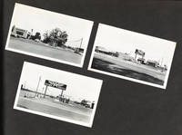
1948BB.23.032<em><strong>Silver prints 158; 3 x 5 and 7 x 9 inches; Some with identifying locations recto and others with photographer's hand stamp verso.</strong></em> This compelling photo album compiled between 1948 and 1957 offers a view into the rapid development of roadside infrastructure that took place in California during the transformative period of post-war prosperity.<br /><br />As California experienced a surge in car ownership and a growing reliance on automobiles for transportation the need for accessible and conveniently located gas stations became increasingly apparent. The album shows how Associated Oil Company by this time a subsidiary of Tidewater Oil owned by Getty strategically positioned their now-iconic "Flying A" gas stations to cater to the burgeoning market up and down the West Coast. This album presents prospective locations some depicted with realtors' advertising boards scenes of construction and improvements and views of recently completed service stations spanning from the Southern Bay Area to Los Angeles.<br /><br />The album is mostly un-captioned with just a few prints having notations on the rectos but many scenes are identifiable by the signage of local businesses and vehicles or the sharp and visible street-signs. Some identifiable locations include: San Jose Saratoga Los Gatos San Marino Canoga Avenue in Woodland Hills and Nordhoff & Terra Bella Streets in Los Angeles among numerous others.<br /><br />A fantastic album which captures the relationship between changing consumer needs swiftly-increasing land development and the iconic roadside gas stations that have become synonymous with California's roadside landscape.
1961016282köln Galerie Haro Lauhus 1961 Dépliant in-8 En feuilles
19321450Various places mostly Texas Tennessee Kentucky and Virginia 1932. Overall good plus. Eighty-five typed and manuscript letters including thirty mimeographed copies of a form response. Moderate chipping and wear to a few letters most previously folded but otherwise in strong condition. A fascinating collection of correspondence relating to spurious Depression-era claims on the famed Beaumont estate of Pelham Humphries 1810-1835. In 1834 Humphries a colonist in the disputed lands along the US border with Mexico filed a claim for a league some 4428 acres of land to the west of the Neches River a few miles south of what is now Beaumont in Jefferson County Texas. The land a patchwork of swamp and grassland good only for grazing was deemed valueless until oil was discovered there in 1901 by which time it had become known as Spindletop and the area became the epicenter of the Texas oil boom. <br/><br/>No one made more money than William Perry Herring McFadden 1856-1935 a rancher who had bought Spindletop in 1883 but ownership of the land was in dispute when he made the purchase. Humphries had died in obscurity possibly killed in a gunfight or perhaps hanged for stealing horses and there was no clear transfer of title. The first suit over the Humphries Land Grant was filed in 1880. McFadden purchased the rights of both parties in the suit but later claimants argued that neither had had a legitimate interest. When geologists stuck oil hundreds of people discovered their fortunate genealogy as a story swiftly spread that the heirs to the Humphries estate were due a share in the profits from the great companies that extracted oil from Spindletop. Numerous lawsuits followed beginning shortly after the discovery and continuing through the 2010s some extending over decades and involving thousands of claimants.<br/><br/>After one such suit entitled Anderson v. Lucas was settled in 1906 the Humphries story appears to have been forgotten for several decades before it emerged again during the depths of the Great Depression. Humphries reportedly hailed originally from Tennessee and in October 1931 the Knoxville Journal reported that members of the Humphreys family were gathering in Madisonville Tennessee to discuss their options. In November another meeting was held in Knoxville drawing over 200 attendees. Responding to the growing number of inquiries sent to his office W. T. Blackmon the Jefferson County Clerk wrote to the Knoxville Journal to set the record straight - "the Humphreys have absolutely no chance of getting $40000000 worth of oil land" the Journal summarized. "And so far as he is concerned he had rather hear no more about it. . He informed the Journal that he had quit opening letters from the Tennessee Humphreys." But Blackmon's letter had no effect. The next day the paper ran a piece in which Oscar Humphrey a stringer for the Associated Press voiced his suspicion at the clerk's response and urged people to fight for their millions.<br/><br/>The documents present here constitute Blackmon's file of inquiries from various Humphries claimants and their representatives all dated 1931 to 1932. A defiant letter here from Oscar Humphrey encloses clippings from the Knoxville Journal and informs Blackmon that "You may rest assured that I am going to have these stories reproduced in other papers in several cities in Tennessee and Georgia." The bulk of the archive consists of over fifty letters containing requests and claims from eleven states including Tennessee Virginia Kentucky Louisiana and Texas as well as the District of Columbia suggest that Humphrey's threat was not an idle one. Some of the letters are a few typed lines and comprise simple requests for information while others are handwritten and run on for pages with elaborate descriptions of the supplicant's claims and genealogy. Also present are carbon copies of general Blackmon's response which he adapted as a mimeographed form letter as well as copies of two more personalized . To dissuade inquirers from further correspondence his form letter notes that a full abstract of the survey of claims to Spindletop would cost "about $2500.00." Additional material here suggests that this may have been side scam Blackmon had with Earl Singleton the proprietor of the Jefferson County Abstract Company. At any rate the fresh rounds of claims on Spindletop delineated here came to nothing and Blackmon gave up his duties as County Clerk and accepted a new position as tax assessor and collector for Jefferson County the pursuit of tax delinquents perhaps seeming a restful occupation by comparison.<br/><br/>An excellent collection of documents detailing one episode in the long saga concerning the rights to the Spindletop fortune. unknown books
1934792DG1934. Ölgemälde. 90 x 64 cm. + Wichtig: Für unsere Kunden in der EU erfolgt der Versand alle 14 Tage verzollt ab Deutschland / Postbank-Konto in Deutschland vorhanden +, A
1940570CGZürich, o.J. (um 1940). Öl auf Leinwand. Bildformat: 65 x 56 cm. + Wichtig: Für unsere Kunden in der EU erfolgt der Versand alle 14 Tage verzollt ab Deutschland / Postbank-Konto in Deutschland vorhanden +
1932569CGZürich, 1932. Öl auf Holzpanel. Bildformat: 61 x 50 cm. + Wichtig: Für unsere Kunden in der EU erfolgt der Versand alle 14 Tage verzollt ab Deutschland / Postbank-Konto in Deutschland vorhanden +, 569CG
1934792DG1934. Ölgemälde. 90 x 64 cm.
1940570CGZürich, o.J. (um 1940). Öl auf Leinwand. Bildformat: 65 x 56 cm.
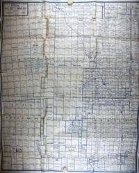
19301996Fort Worth: Oil City Map Co 1930. Very good. Large blue line map 34.25 x 27.5 inches. Folded. Scattered contemporary pencil annotations. Minor wear and a couple of short separations along fold lines. Small cut into neat line near upper right corner. Rare and detailed oil map of the oil fields in Shackelford and Callahan Counties just east of Abilene Texas. The map indicates the locations of well being drilled those producing gas wells dry holes and abandoned wells. The owners of the mineral rights are named and well as many of the surface owners which include various railroads and also the Lunatic Asylum. Deaf & Dumb Asylum Bayland Orphan Asylum and other institutions. A large number of the producing wells both oil and gas were owned by Texas Company Texaco the Magnolia Petroleum Co. but many major and small oil companies had obtained mineral rights on lands in the area when this map was produced. The area around the town of Moran as indicated by the number of wells in the vicinity was one of the major sites of oil production in Texas during the 1920s and was indicative of the spread of the oil business to the western and southern portions of the state during that decade. The publishers of this map the Oil City Map Company of Fort Worth were not particularly prolific -- we locate six examples of their other cartographic work all recorded in single institutional copies and no copies of the present map. Oil City Map Co unknown books