190 résultats
1846WRCAM17477New Braunfels 1846. Printed indenture 10 1/2 x 8 1/2 inches executed in ink. Some old folds light soiling. "55" written in red pencil in top blank margin. Very good. Printed indenture executed in ink and signed in full by John O. Meusebach as Trustee of the German Emigration and Rail-Road Company drawing on the banking firm of H. Flersheim in Frankfurt for the sum of $3000 to be deposited to the account of the Company dated December 12. Meusebach a highly educated and civilized man came to Texas from Germany in 1845 to succeed Prince Carl of Solms-Braunfels as commissioner-general of the Verein zum Shutze Deutscher Einwanderer in Texas in the course of which he assumed Texas citizenship oversaw the affairs of the colonists and accomplished the 1847 treaty with the Comanche chiefs which made colonization possible. This document coming from the period of his service to the Verein no doubt represents a draft for funds to further the establishment of the colony the cities of New Braunfels and Fredericksburg and the attempted settlement of the financial horror show which Prince Carl left behind. A superb piece signed by one of the major figures of early Texas colonization. unknown books
183523580MÉXICO: Impreso por Ignacio Cumplido 1835. Primera edición.- 4º.- Plena piel jaspeada de época lomera con filetes y florones dorados.- 2 tomos en 1 volumen.- I: 32 páginas.- II: 56 páginas.- III: 44 páginas. El Apéndice de documentos no indica lugar ni año. El primer documento lleva la fecha de México 24 de febrero de 1835 y el último es de 23 de mayo del mismo año. Procedencia: Ejemplar de Joaquín Gómez de la Cortina Marqués de Morante. Palau 111572 para la segunda edición y 74785 Impreso por Ignacio Cumplido unknown
183539444México: Impreso por Ignacio Cumplido 1835. Paperback. Good. 44p wrps. Gutiérrez Estrada 1800-1867 was Secretary of Interior and Exterior Relations under Santa-Anna and Barragán in 1834 and 1835. Here he explains and documents that his resignation was not an attempt to discredit the government but to respond to his federalist convictions. Later he was forced into exile served as ambassador in several posts and was named head of the commission to offer the throne of Mexico to Maximillian. Impreso por Ignacio Cumplido paperback
183016204Washington: Other. Very Good. 1830. Hardcover. Disbound; 17; 17 pages light foxing; backstrip splitting; charts and tables and reports regarding construction of the Cumberland Road; Good . Other hardcover books
185316365Philadelphia: John C. Clark 1853. Original printed wrappers stitched 20pp. A bit of edge chipping to the wraps else Very Good. Statutes beginning with the Act of Incorporation under Pennsylvania law in 1850 relating to this railroad with the Act of the Virginia legislature authorizing a right of way through that State. FIRST EDITION. Haynes 13907. Not in Sabin Eberstadt Decker BRE BEAL. John C. Clark unknown
185316365Philadelphia: John C. Clark 1853. Original printed wrappers stitched 20pp. A bit of edge chipping to the wraps else Very Good. Statutes beginning with the Act of Incorporation under Pennsylvania law in 1850 relating to this railroad with the Act of the Virginia legislature authorizing a right of way through that State. FIRST EDITION. Haynes 13907. Not in Sabin Eberstadt Decker BRE BEAL. John C. Clark unknown books
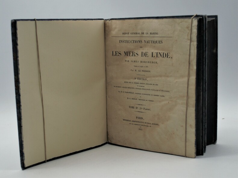
1853PHO-1002Paris, Imprimerie Administrative de Paul Dupont, 1853/55, 2 Volumes In-4 (270x225), premier tome et première partie du second tome. XXIII, 598pp, 1ff, Ap.-211,XXXIX; IV, 328 pp, Ap.-36 .Reliure en demi-percaline noire, dos lisse avec titre et tomaison, tranches bleues , accroc à la coiffe ,déchirure au dos, petite mouillure claire en début du tome 2 .
184010777New York: Bryant and Boggs. 1840. Original printed wrappers with wrapper title as issued. pp 157-217 as issued. Several rubberstamps spine reinforced. Disbound. Good. With the first annual report of the directors of the Housatonic Rail Road Company its engineer's report and the report of the engineer of the Berkshire Rail Road Company. The Joint Special Committee's Report examines the feasibility of links between the Housatonic Road-- via Bridgeport CT and Stockbridge MA-- and New York City and its system of railroads. FIRST EDITION. Thomson 2535 7. AI 40-4958 no locs. or collation. Not in Sabin. Bryant and Boggs. unknown
184010777New York: Bryant and Boggs. 1840. Original printed wrappers with wrapper title as issued. pp 157-217 as issued. Several rubberstamps spine reinforced. Disbound. Good. With the first annual report of the directors of the Housatonic Rail Road Company its engineer's report and the report of the engineer of the Berkshire Rail Road Company. The Joint Special Committee's Report examines the feasibility of links between the Housatonic Road-- via Bridgeport CT and Stockbridge MA-- and New York City and its system of railroads. FIRST EDITION. Thomson 2535 7. AI 40-4958 no locs. or collation. Not in Sabin. Bryant and Boggs. unknown books
1852180552London.: Longman Brown Green & Longmans. Second Edition. 1852. 5 folding mathematical projections at the rear. v 143pp plus 5 pages of publisher's adverts. Original cloth lettered in gilt on the spine and ruled in blind title page slightly browned head & tail of spine slightly chipped else a lovely clean copy. A presentation copy "With the Author's Cordial Regards' dated July 6th" 1854. 17.5x 10.5cm Born in Westminster London in 1818 William Hughes was a prolific mapmaker geographer engraver printer and publisher. . Longman, Brown, Green, & Longmans. hardcover
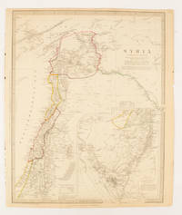
1843174934London.: Chapman & Hall. 1843. Engraved map with outline hand colour 39.4 x 31.4 cm inset map "Continuation from the Dead Sea to Mount Sinai" with finely engraved notes and a key to the Divisions under control of the Turkish Government manuscript pagination in an early hand to the top right edge tear nicks and browning but in very good condition. A most attractive map with detailed notes published when Syria was still under control of the Ottoman Empire. . Chapman & Hall. unknown
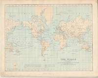
1874174897London.: Virtue & Co. circa1874. Printed colour map 18.4 x 24.1 cm edge wear marginal spotting and on the verso but the map in very good condition. Unusual map showing time differences east and west of Greenwich before the atomic clock and well before satellites! The explanatory text notes aso that: "The space comprehended between the meridiens of 120 & 160 E. is repeated in order to show the relative position of England to Australia both eastward and westward." . Virtue & Co. unknown
1895AUB-9511Paris, Tresse & Stock 1895. Bel exemplaire relié, reliure demi toile avec plats marbrés, dos avec étiquette, date et titres dorés, pet in-8 (12x19), 458 pages.
18822111902160200908Ikaho bussan 1882. Soft Cover. Fine. Volume: 1 Ikaho bussan paperback
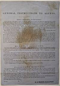
1855466Chicago: ICRR 1855. Broadside sheet. 280 x 195 mm. 11 x 8 /12 inches. Printed on blue paper folded brown stain in center portion of the sheet otherwise quite a good sound copy. Rare ICRR broadside containing instructions to their agents regarding freight accounts and passenger business with emphasis on recording and submitting Monthly Reports on all activities at their stations. It is signed by R. B. Mason General Sup't and though undated is from the early 1850's. Col. Roswell B. Mason was associated with the Illinois Central Rail Road from its inception overseeing construction of the line from 1852 to 1856 until he resigned in 1869 to become Mayor of Chicago. He was mayor during the fire of 1871 and used his power to declare martial law in its immediate aftermath. It is known that Abraham Lincoln served as counsel for Illinois Central in the early 1850s earning a fee of $5000 that occasion a law suit for nonpayment. Rare: this broadside in not among the Illinois Central Rail Road publications of the 1850s listed in OCLC. Not in Checklist of Ante-Fire Imprints 1851-1871. Not in Byrd Cecil B. Bibliography of Illinois Imprints 1814-1858 although three similar broadsides issued by Roswell Mason as General Superintendent are cited published in 1852 2 and 1855 1 all of which are in single copies at the Chicago Historical Society. (ICRR unknown
1855466Chicago: ICRR 1855. Broadside sheet. 280 x 195 mm. 11 x 8 /12 inches. Printed on blue paper folded brown stain in center portion of the sheet otherwise quite a good sound copy. Rare ICRR broadside containing instructions to their agents regarding freight accounts and passenger business with emphasis on recording and submitting Monthly Reports on all activities at their stations. It is signed by R. B. Mason General Sup't and though undated is from the early 1850's. Col. Roswell B. Mason was associated with the Illinois Central Rail Road from its inception overseeing construction of the line from 1852 to 1856 until he resigned in 1869 to become Mayor of Chicago.  He was mayor during the fire of 1871 and used his power to declare martial law in its immediate aftermath. It is known that Abraham Lincoln served as counsel for Illinois Central in the early 1850s earning a fee of $5000 that occasion a law suit for nonpayment. Rare: this broadside in not among the Illinois Central Rail Road publications of the 1850s listed in OCLC. Not in Checklist of Ante-Fire Imprints 1851-1871. Not in Byrd Cecil B. Bibliography of Illinois Imprints 1814-1858 although three similar broadsides issued by Roswell Mason as General Superintendent are cited published in 1852 2 and 1855 1 all of which are in single copies at the Chicago Historical Society. (ICRR unknown books
183928837Washington 1839. 25th Cong. 3d Sess. H.Rep.322. 167pp disbound. Six folding maps and chart. Several text leaves browned Very Good plus. <br/><br/> Reviewing proposals and data for a canal route including a memorial from Matthew Carey. <br/>Morrison 5 noting only 3 maps. unknown books
189840873N.P.: Sentinel and Gazette Steam Press 1851. 1898. 8 1/2" x 5 1/2" in light peach wrappers though missing the front wrapper. 15 pp. Illustrations. Map. Although it eventually became a transcontinental railroad the railroad that became the Milwaukee Road began as the Milwaukee and Waukesha Railroad whose goal was to link the developing Lake Michigan port city of Milwaukee Wisconsin with the Mississippi River. The company incorporated in 1847 but changed its name to the Milwaukee and Mississippi Railroad in 1850 before construction began. A report to the Board of Directors explaining that the railroad is not completed to Waukesha as was expected and offering reasons for the delay in its completion. "Considering our small beginning only a little over one year ago - that we have relied solely on the resources of the people of Wisconsin for the means of prosecuting this enterprise - without seeking foreign aid - with only the small contributions of each of our thousand Stockholders and the credits based on the securities of our city and citizens we have in that time completed the grade of our Road for twenty and a half miles laid the Track and brought into actual use the half of that distance - and will have the whole completed and in successful operation by the middle of February next." Information on estimated and actual costs of the First Division extending the road from Milwaukee to Waukesha. It appears that actual costs far exceeded estimates "but that has been the result of peculiar circumstances under which the work has been performed and by the adoption of a rail of greater weight than that estimated." It was determined that the contractors to whom jobs had been given at lower costs were inexperienced and inefficient resulting in their work having to be re-done. Furthermore the delay was caused by some stockholders not promptly paying the small installment of only 5% every three months thus leaving a deficit. Also a bank in a marsh sunk and had to be built back up. Th cost of constructing the first twenty and 1/2 miles is only $9495 per mile. Report ends with the reassurance that the Road will be complete by February and if weather permits perhaps even earlier. 8 1/4" x 21 1/2" map of the Milwaukee and Mississippi Rail-Road. Map is neatly torn in half at one fold and has 1 1/2 - 2" closed tears to tops of a couple folds. Front wrapper missing along with 3" split to toe of spine and with light wear to the extremities. Sentinel and Gazette Steam Press, 1851]. unknown
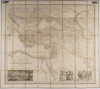
1853176118Paris.: Ministère d'Etampes et de Géographies. 1853. Engraved map with outline hand colour 67.2 x 75.1 cm sectioned and linen-backed two large vignettes: a view of Constantinople; and costumed Turks and European soldiers facing off across a stream the linen browned with some loss but not affecting the map with the fine nineteenth century label of Charles Delarue & Hivert on the verso. Fine map with beautiful vignettes by Adrien Toussaint Lallemand 1793 - c.1856 geographer and engraver at the Depôt de la Guerre. Lallemand was appointed at a precociously young age and later set up in business on his own the quality of his work assuring him of the continued business of the Depôt. <br> <br>Highly attractive map of the Ottoman Empire published at the outset time of the Crimean War 1853-1856. <br> <br>This item is held off-site. Please note there may be a few days delay while it is brought into our shop for viewing or mailing to you. Thank you for your understanding. . Ministère d'Etampes et de Géographies unknown
1840018232London: Printed and Published By J. Barfield 1840. Book. Very Good. Hardcover. Fourth Edition. Folio 30 x 46cm. "Revised Collated and Considerably Enlarged by John Satchell Esq." Seventy-four double-page engraved genealogical tables and geographical maps all with original hand colouring contemporary . half black morocco gilt with green cloth boards. Binding good with some general wear and rubbing leather chipped with loss to the base of the spine joints rubbed but still strong corners worn. All edges gilt./ Contents clean and tight contemporary ink stain effecting the fore-edges of the first few pages but not affecting text or maps most noticeable to the front end papers with also have a pencil inscription dated 30 November 1935. All maps and charts in very good condition. Notwitstanding wear to the binding a very good copy. Printed and Published By J. Barfield Hardcover
1838021038London: T. McLean D.& P. Colnaghi and John F. Lewis 1838. 1838. Book. Illus. by John F. Lewis. Near Fine. Hardcover. First Edition. Folio approx. 55 x 36.5cm. Complete with all Lithographic plates as called for; tinted frontispiece tinted title-vignette further 27 tinted views on 25 leaves all by Lewis after Coke Smyth. A very clean bright copy. Finely bound in modern brown morocco to style with gilt lettering to the spine and gilt bands to the top and bottom of the spine. Contents clean and tight new light brown endpapers in keeping with the new binding two blank leaves to the front and rear all pages have been professionally cleaned and restored by a paper conservator minimal and unobtrusive water staining remains to some pages and plates mostly confined to the margins and blank areas most plates unaffected new archival paper guards to all plates no inscriptions. A fine complete copy beautifully rebound. References -. Abbey Travel II 394; Atabey 722; Blackmer 1015; Contominas 413; RIBA 1886. T. McLean, D.& P. Colnaghi and John F. Lewis [1838]. Hardcover
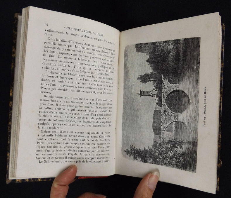
1883pq2305Librairie Hachette et Cie Relié 1883 In-8 (17.5 x 11.5 cm.), relié demi-toile rouge grainée, 269 pages, 29 illustrations en noir et blanc (gravures sur bois), gouttière tachetée ; coin supérieur découpé sur la page de faux-titres, dos légèrement insolé et incurvé, bords inférieurs frottés, quelques traces d'usage aux plats, intérieur frais, bon état. Livraison a domicile (La Poste) ou en Mondial Relay sur simple demande.
1898203128Wien, Luksch, 1898. 96 Seiten. Mit 49 Illustrationen. 20 cm. Originalbroschur.
1824PHO-2191Paris, Everat, 1824, in-4 (260x210mm), 2ff-LIV-568pp-1ff , avec en fin d’ouvrage la liste des membres de la Société de Géographie, relié demi toile, dos lisse avec étiquette de titre, éditeur et tomaison, frottements aux plats et étiquette usée, vieille mouillure claire en coin, piqures.
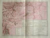
1805570721805. Copper engraving with handcolouring map shows the border of the Austrian Empire and Hungary Vienne sic and the Danube can be seen at the top of the map Two keys and scale inset. Few closed tears and some browning edges otherwise a clean and bright image. Map measures approximately 34 x 44cm. Map of Germany <br>indicating the present division of this empire as well as the new possessions of the princes who make up the Germanic body and including Batavia and Helvetia Switzerland with their divisions. by E. Mentelle a member of the institute and P. G. Chanlaire one of the authors of the National Atlas. An xiii 1805. Paris. There is a key to the explanation of the signs and an explanation of the colours used for the district of the various states contained in this map. . unknown