Estrada, Salvador (Editor)Biblio.com

4 344 résultats
2023x-3031166760Palgrave Macmillan 2023. Hardcover. New. 511 pages. 8.25x5.75x1.50 inches. Palgrave Macmillan hardcover
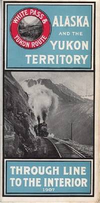
1907110968Seattle Wash.: White Pass & Yukon Route 1907. Softcover. very good. 24 Columnspp. Square Octavo folded once into narrow Octavo. Illustrations from photos and double-paged centrefold "Map of White Pass & Yukon Route. Original pictorial wrappers stapled as issued - minor rusting with map on rear cover. very good 1907 White Pass & Yukon Route paperback
2024x-3031166795Palgrave Macmillan 2024. Paperback. New. 546 pages. 8.27x5.83x1.11 inches. Palgrave Macmillan paperback
2019x-0367318180Taylor & Francis 2019. Hardcover. New. 291 pages. 9.01x5.98x0.87 inches. Taylor & Francis hardcover
2017x-1138081574Routledge 2017. Hardcover. New. 224 pages. 9.25x6.25x0.75 inches. Routledge hardcover
2023x-1032473819Routledge 2023. Hardcover. New. 248 pages. 9.19x6.13x0.70 inches. Routledge hardcover
2018x-1138572047Routledge 2018. Hardcover. New. 192 pages. 9.00x6.25x0.75 inches. Routledge hardcover
2026x-0367675374Taylor & Francis Ltd 2026. Hardcover. New. 184 pages. 9.18x6.12x9.45 inches. Taylor & Francis Ltd hardcover
2025x-1032558792Routledge 2025. Hardcover. New. 154 pages. 9.18x6.12x9.45 inches. Routledge hardcover
19812091502135413297Hubangi Publishing House 1981. Soft Cover. Fine. Number of books: 5 Hubangi Publishing House paperback
1986SONG9061935431Springer 1986-06-30. 1. hardcover. Used: Good. 7.00x0.94x10.00. Buy with confidence. Excellent Customer Service & Return policy. Springer hardcover
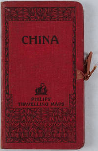
1920161936no date. circa1920. Linen backed colour folding map of China insets of Peking and Environs and Hongkong and Canton in lower left corner. 54 x 63.8cm. Table of place names at upper left gives the cities that "By a recent ordinance of the Republic all 'Fu' 'Chow'' and 'Ting' cities have been nominally reduced to the rank of 'Hsien'. The following parallel list gives the 'Fu' cities the names of which have been officially changed together with the new form adapted." Map folds into a red cloth covered case with ribbon ties 19 x 10.3cm. Title and decoration printed in black on upper cover. Trifle foxed on linen backing a little insect damage case in a few small places otherwise a very good clean map. . hardcover
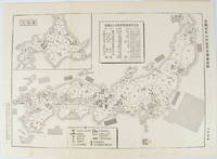
1955172396No publication details. Circa1955. Chinese black and white military map of Japan based on a map issued by 赤旗報 Shimbun Akahata on 24 June 1953. No scale given inset map of Hokkaido upper left corner legend lower section showing air and navy bases military exercise bases ammunition dump shooting ranges for the air force and navy headquarters of the coast guard etc. Text upper section provides details of the different types of US military bases and infrastructure. Text in traditional Chinese. 25.8 x 35.8cm. . No publication details. unknown
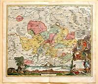
171761880Nuremberg.: Johann Baptist Homann. 1717. A beautifully engraved hand coloured map of North East Germany showing the area around Erfurt in detail. In the centre of the map is a small plan of Erfurt which is also shown as a panoramic view at the foot of the map and titled 'St. Petersburg'. An elaborate decorative title cartouche in the lower right corner depicts allegorical figures surrounded by the produce of the land including sheaves of wheat; a beehive; and a cornucopia of fruits. Cherubs holding a coat of arms float up from the scene on the right while on the lower left a centaur sits meditatively beneath a pine tree amongst slaughtered cattle. Physical features of the area are illustrated and farming areas shown by fields which criss-cross across the map. A clear dark impression the work of an outstanding German cartographer who in 1715 was appointed as imperial geographer by Emperor Charles VI. This map also includes "Schwan See" Swan Lake under a town of the same name which has since disappeared. Hand coloured two very minor splits at upper and lower edges on centre fold and not affecting engraved area a handsome map 54 x 61.5 cm. . [Johann Baptist Homann.] unknown
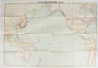
169329東京. Tokyo.: 九段書房.Kudan shobo. 大正十四 1925. Coloured folding Japanese map showing the military strength of Japan the United States and the United Kingdom in the Pacific original pictorial envelope scale not given. Some small holes at folds occasional light foxing a prior owner's signature on reverse minor wear envelope. Very good copy in like envelope. Map measures 54.4 x 78.8cm. The explanatory text in Japanese printed on the reverse in blue summarises the colonial possessions of the US and the UK as well as providing a comparison between the land size naval presence natural resources immigration issues and maritime transport capacities of Japan the United States and the United Kingdom. Legend indicates national regional provincial territorial boundaries canals undersea cables airline routes metropolitans capital cities mining fields hot springs ancient battle fields major trade ports Japanese embassies and consular offices. A large area marked 日本委任统治 "South Pacific Mandate" highlighted in a box is adjacent to Australian occupied Papua New Guinea. . 九段書房.[Kudan shobo]. unknown
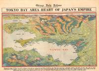
1945209335Chicago.: Chicago Daily Tribune. 28 July1945. Colour bird's eye view map 22.4 x 39.3 cms on a newspaper leaf trimmed to a half sheet 29.8 x 41.6 cms including caption slight toning at an old central fold the map in very good condition. <br>Unrelated black and white photographic illustrations on the verso "Pre-flight Trainers used in Chicago to give ground instruction to would-be pilots" and "New rekindled Montauk Light Long Island N.Y." Map published in the Chicago Daily Tribune days before the bombing of Hiroshima on August 61945. <br>"Perspective map of Tokyo bay and contiguous land and sea areas showing Tokyo Yokohama the Yokosuka naval base industrial sections and other features .In this map north is at the right instead of at the top - an expedient adopted to show all of the bay as large as possible in half page space." caption . Chicago Daily Tribune. unknown
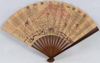
1718220781Japan.: 大海扇子商會. Taikai Sensu Shōkai. Meiji 17 1884. Black and white printed map with handcoloured pink highlights 23.5 x 39cm date stamped on reverse. A little minor wear at folds but overall very good. This fascinating fan was produced as a commemorative item marking a climb to the summit of Mount Fuji. A stamp on the reverse is dated 27 July Year 17 and appears to have been applied at the summit. This date likely refers to Meiji 17 or 1884. Commemorative fans of this type were popular at the time and the paper printing and general style appear consistent with that period. The red printed patterns and characters on the reverse also back up our belief that the fan was obtained at the summit. The pictorial map of the mountain shows four different routes to the summit marked in red with distance charts printed above. <br> <br>Mount Fuji is Japan’s highest peak. Long perceived as a sacred mountain it has a Shinto shrine at the summit and the climb has traditionally been regarded as a form of pilgrimage. . 大海扇子商會. [Taikai Sensu Shōkai]. unknown
1795210851795 1 feuillet avec en-tête préimprimé : MARINE LIBERTE, EGALITE, FRATERNITE et orné d'une vignette en noir, manuscrit à l'encre brune sur papier vergé ligné filigrané, format 20 centimètres de large par 30,8 centimètres de haut, Lettre écrite à bord de la Frégate "LA NEREÏDE", le 13 Floréal An 3, signature manuscrite de Jean-Pierre PILLET
179521642Lorient 1795 1 feuillet avec en-tête préimprimé en noir : Liberté Egalité Fraternité et orné en tête d'une grande vignette en noir (avec symboles révolutionnaires : l'Oeil, la balance, les lauriers, les cornes d'abondances et le bonnet Phrygien avec imprimé en haut "département du Morbihan"), manuscrit à l'encre brune sur papier vergé bleuté ligné filigrané, format 20 centimètres de large par 31,5 centimètres de haut, Lettre écrite à LORIENT, e 17 nivose An 3 (6 janvier 1795) de la République Française, une et indivisible, signature manuscrite de PHILIPPE-ALEXIS-LAURENT HENRY, Chef de Division, Commandant des Armes au port de LORIENT,
179521640Lorient 1795 1 feuillet avec en-tête préimprimé en noir : Liberté Egalité Fraternité et orné d'une vignette en noir (avec symboles révolutionnaires : faisceaux d'Armes et bonnet Phrygien et marianne avec imprimé en bas "république Française"), manuscrit à l'encre brune sur papier vergé bleuté ligné filigrané, format 20 centimètres de large par 31 centimètres de haut, Lettre écrite à LORIENT, le 27 Messidor An 3 (15 juillet 1795) de la République Française, signature manuscrite de PHILIPPE-ALEXIS-LAURENT HENRY, Chef de Division, Commandant des Armes au port de LORIENT et de Mr BIVAUX secrétaire du Bureau de l'Etat Major Général de la Marine de Lorient
179621091Lorient 1796 1 feuillet avec en-tête préimprimé en noir : Liberté Egalité Fraternité et orné d'une vignette en noir (avec symboles révolutionnaires : faisceaux d'Armes et bonnet Phrygien et marianne avec imprimé en bas "république Française", manuscrit à l'encre brune sur papier vergé ligné filigrané, format 21,5 centimètres de large par 33,5 centimètres de haut, Lettre écrite à LORIENT, le 20 floreal, An 4 (1796), de la République Française, signature manuscrite de PHILIPPE-ALEXIS-LAURENT HENRY, Chef de Division, Commandant des Armes au port de LORIENT et de Mr BIVAUX secrétaire du Bureau de l'Etat Major Général de la Marine de Lorient,
18705388<p>Gall & Inglis' 1870's-1880's. Paperback. Very good. VGC.Gall & Inglis'.No date given but probably 1870's to 1880's prior to London Tower Bridge build which is not included on the map.Green hardbacksmall dentsnicks and light shelf wear on the cover with folded map in VGC.The map is in VGC but with small stain marks and foxing marks on the edgessmall tear on the edge of the map.The map is hand coloured and includes:RailwaysRailway StationsSteamer RoutesOmnibus and Tramway RoutesParks.The size of the map is: 30x20 inch.The scale of the map is: 3 3/4 to 1 mile.The map covers: From Hyde Parkincluding parts of Kensington Palace to Blackwall and from Mildmay Park to South Lambeth.The map is in VGC for its age. A collectable and scarce map.</p> Gall & Inglis' paperback
8vo., First Edition, with 48 plates on 24, 8 coloured maps, and 7 full-page maps in the text; original green cloth, gilt back, a near fine copy in unclipped dustwrapper. SIGNED BY THE AUTHOR ON TITLE, AND WITH A PRESENTATION A.L.s. FROM THE AUTHOR ON HIS PERSONAL LETTERHEAD TO DONALD EALES-WHITE. The first of Lyall Grant's masterly analyses of the Burma war and forerunner of 'The Japanese Invasion' (co-written with Tamayama and similarly privately printed some six years later). In this outstanding analysis, using extensive fresh information from both British and Japanese sources, Grant produces the most authoritative history to date. Includes command structures, OOB, statistical appendices and bibliography. An outstanding contribution to the history of WWII. Signed copies are very scarce. Graham & Cole E20.