Abril CaminoBiblio.com

4 344 résultats
20209781099933790-2025Independently published 2020. Hardcover. New/New. <p><strong>Author:</strong> Abril Camino</p><p><strong>Publisher:</strong> Independently published</p><p><strong>Binding:</strong> Hardcover</p><p><strong>ISBN:</strong> 9781099933790</p><p><strong>Release Date:</strong> 2020</p><p><strong>Number Of Pages:</strong> 247</p><p><strong>Details:</strong> Esta es la historia de un encuentro que no tendría que haberse producido.Es la historia de cuatro días en una casa en las montañas.La historia de dos personas que ya no tienen ninguna razón para ser familia.O quizá sí.Esta es la historia de un duelo.De un amor roto.De una vida que se acabó demasiado pronto y dejó otras dos partidas por la mitad.Es una historia de secretos que se desvelan al calor de una chimenea.De recuerdos que se clavan en el alma.De rencor culpa y pena.Esta es la historia de la vida que queda después de que a alguien se le acabe la suya.Es una historia de supervivencia.De familia.Y de amor.</p> Independently published hardcover
175692353Thomas Baskett. London. 1756. First edition. 1756. 36 pages with title page not bound but held together with paper clips. Page edges very chipped last blank page lacks portions and is very torn and worn. Stain to top of title. Was originally folded in half so paper clip marks are visible to right margin of title. SCARCE. unknown
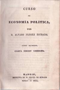
698521Imprenta de D. Miguel de Burgos 1835 Madrid. 22x15. Pasta española con hierros y tejuelo. 385 y 508 pgs. Cantos tintados en amarillo. N12243 Imprenta de D. Miguel de Burgos, 1835, Madrid. hardcover
19092111902160200634Higashi-Tsukima-gun Office 1909. Soft Cover. Fine. Volume: 1 Higashi-Tsukima-gun Office paperback
20082081502111901867chinese science and technology 2008. Soft Cover. Fine. The book is in fine condition. chinese science and technology paperback
Features: New York to Paris - around the world in one hundred and seventy days - from the files of George Schuster; 1957 Glidden Tour; World's Largest Antique Auto Meet - the national fall meet at Hershey; The "One Car" Club - Road Testing a 1913 Merz Cyclecar; The Eastbourne Battle of Flowers in May, 1896; Basket Case on a Budget - or - Who Needs Money When He Has a Friend? - a three-year restoration of a Ford Town Car - article with photos; Self-Propelled Vehicles from 1400 to 1900 - today's automobile got its start in the dark ages - article with photos; 7th annual "Old Car Festival" at Ford's Greenfield Village; America's Fastest Antique Car - Thomas J. Lester's 1913 LozierIn Duster and Veil; Opel and Vauxhall celebrate anniversaries with introduction to American Market - article with photos; Memories of a DuPont Special; Sixtieth Anniversary for Olds; Ford Facts - Black Radiator Restorations; Index for November, 1945, Volume 9, No. 3-4 to Fall, 1957, Volume 21, No. 3 *39 Pages*; and more. Average wear. Unmarked. A sound copy. Magazine
1993CBS-9780817637163Sp Springer 1993. New. Sp Springer unknown
1993CBS-9780817637163Sp Springer 1993. New. Sp Springer unknown
2540692-nnew. unknown
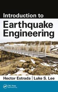
CBS 9781498758260USA Edition . New. Brand New! Fast Delivery US Edition and ship within 24-48 hours. Deliver by FedEx and Dhl & Aramex UPS & USPS and we do accept APO and PO BOX Addresses. Order can be delivered worldwide within 6-10 days and we do have flat rate for up to 2LB. Extra shipping charges will be requested if the Book weight is more than 5 LB. This Item May be shipped from India United states & United Kingdom. Depending on your location and availability. unknown
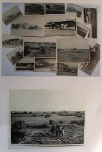
19300559431930. Photographic Image. Very Good. No Binding. A collection of 15 black and white photographic prints 1 Drigh Road RAF camp 1921 8x6 ins; 2 ms note on the back " Imperial Airways machine crashed at Jack Persia Sept 1929 3 killed" 8x5 ins; 3 plane with personnel and buildings ms note "Long distance flight French Drigh Road 14/12/29"; 4 crashed plane ms note "First Wapiti crash Drigh Road 8x5 ins; 5 Farey-Napier monoplane; 6 Iris biplane on water 8x5 ins; 7 West Camp shops RAF Cranwell; 8 plane "Pride of Detroit" in hanger ms note Drigh Road air base Sept 4th 1927" 5x3 ins; 9 plane with ground crew and hangers ms note Drigh Road Sept 15th 1927"; 10 biplane GB-EKBU with onlookers ms note "first Moth to fly to India Leake & Stark 10.1.27 5x3 ins; 11 Blackburn Dart at Cranwell with 4 other photographs of Drigh and unidentified locations. All in very good condition. T.E. Shaw was at Drigh Base from 7.1.27 until 26.5.28. A nice collection. unknown
2540692like new. unknown
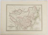
1837177519Paris. circa1837. Engraved map with original outline hand-colour 22 x 30 cm; 28.8 x 38.6 cm sheet marginal repair to the lower corner not affecting the map sheet lightly age-toned in very good condition preserved in a window mount. Fine map of China Japan and Central Asia noting Manchuria "Mandchourie" bordering Northern India and Turkestan in the West and Russia "Russie d'Asie" in the North. <br> <br>From the estate of the late collector and scholar Arthur Hacker with his pencilled catalogue mark on the verso. . unknown
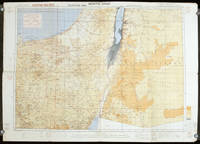
1942207841London.: Royal Engineers. July1942. Printed colour topographical map mounted on linen 56.7 x 79.2 cms; 64.6 x 89. 5 cms sheet original folds edgewear small marginal chips a little dusty but in good condition. Detailed World War II operational map of Egypt and the Middle East issued by 512 Army Field Survey Company of the Royal Engineers. The map is marked "Not to be Published" in the upper right margin. Railways roads camel tracks telegraph lines boundaries altitudes towns and villages are marked. . Royal Engineers. unknown
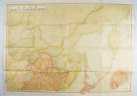
1419171112東京. Tokyo.: 伊林書店. Ibayashi Shoten. 昭和14 1939. Colour printed folding map 78 X 109cm minor damage original envelope 27.5 x 20cm. Very good copy. This map offers comprehensive information on northern China Manchuria the Soviet Union and Hokkaido including Kuril Islands under the Japanese control. It also includes the Jewish Autonomous State which existed in the late 1930s. The inset map provides detailed information on the border area of Japan Manchuria and the Soviet Union. Legends include national borders railways major cities iron mines and oil wells. <br> <br>Published in 1939 this map is an expression of the tension Japan felt in its relationship with the Soviet Union. At the time the Soviet Union was seen as the mighty threat to the lying just north of Manchuria and Japan . . 伊林書店. [Ibayashi Shoten]. unknown
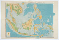
1572160538東京.Tokyo.: 日本名所圖繪社.Nihon Meisho Zuesha. 昭和16 1941. Folding colour Japanese map of the Malay Archipelago and Thailand scale 1: 8500000 with attractive original pictorial paper envelope. This map also shows the Dutch French and American colonies. Hainan Province and the South China Sea are shown in the north. Agricultural and mineral resources indicated across the map. Few small holes at holes and other light signs of wear. Slipcase lttle torn. Text in Japanese and English. 53.3 × 78.2cm. . 日本名所圖繪社.[Nihon Meisho Zuesha]. unknown
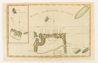
1784174895London.: Alexander Hogg at the King's Arms. circa1784. Engraved map on laid paper 21.4 x 33.7 cm inset of Gower's Simson's and Carteret's Island early outline hand colour trimmed to the plate mark at the top edge three small edge tears affecting the upper margin only slight paper toning but a most attractive map in very good condition. Fine impression of the Queen Charlotte's Islands Solomon Islands. It features the Swallow's track the ship's route taken by Captain Philip Carteret in 1767 the British naval officer and explorer who participated in two of the Royal Navy's circumnavigation expeditions in 1764–66 and 1766–69. . Alexander Hogg at the King's Arms. unknown
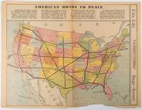
1938215547Los Angeles.: Los Angeles Examiner. Sunday 1 May1938. Printed colour pictorial map 33 x 48 cms; 41.8 x 54.5 cms sheet central fold sheet toned corners chipped with some loss to the bottom border and at the central fold in good condition; and on the verso "Movie-Go-Round" by Louella O. Parsons black and white photos and advertisements. Pictorial map printed for the weekend supplement of the Randolph Hearst owned newspaper the Los Angeles Examiner. The map-maker and artist Howard Burke had also worked for the San Francisco Examiner and was known for pictorial maps many with a persuasive or rhetorical edge and as here were designed to shore up American patriotism and defences against a wider world in the increasingly turbulent pre-war 1930s. The caption to this map outlines a multi-billion dollar 25 year proposal by Congressman J. Buell Snyder for a network of coast to coast transcontinental highways "in case of an attack by a foreign power at any point along the border". Buell Snyder earned the soubriquet "the father of superhighways" and during the War he was assigned to a Congressional Committee in charge of appropriations for the War Department. Scarce. . Los Angeles Examiner. unknown
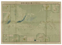
1819155215統正社 Tōseisha . Showa 18 1943. Colour folded map 54. x 76.5cm. Pinholes at corners light even browning good copy. This Japanese map of Micronesia shows the Mariana Islands Eastern and Western Caroline Islands Marshall Islands and Gilbert Islands. The separate maps around the edge are clockwise from the upper right corner: Jaluit Atoll Guam Island Rota Island Saipan Island Palau Islands Yap Island Hall Islands Pohnpei Island Truk Islands and Kusaie Island. . 統正社 [Tōseisha ]. unknown
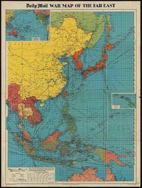
1944205765London.: George Philip & Son. 1944. Full colour folding map 101.5 x 76cm sheet inset maps legend folding into title wrapper 25.7 x 19.4 cms covers a little dusty and discoloured a few short fold splits without loss but the map in very good bright condition. Map of the Pacific Theatre of World War II with borders drawn as they stood in 1937 - complete with Chinese claims on Mongolia Tuva and Tibet. <br> <br>Shows transportation routes principal railways oil fields Allied naval bases territory occupied by the British Empire French Empire and the United States. This map shows only the northernmost section of Australia which allows for much better detail of the countries of East Asia. Small inset map of the Hawaiin Islands at mid right. Inset map of the Pacific Ocean at upper left. . George Philip & Son. unknown
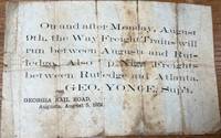
185836085Augusta: Georgia Rail Road 1858. Broadside. Fair. Broadside. Approximately 5" x 7.5". Paper is folded creased toned with two small holes. Tears at the splits. Tape repair on the blank reverse side. Fair condition only. Obscure. No other copies of this advertisement were found during a recent search. Georgia Rail Road unknown
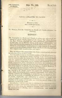
183928837Washington 1839. 25th Cong. 3d Sess. H.Rep.322. 167pp disbound. Six folding maps and chart. Several text leaves browned Very Good plus. <br /> <br /> Reviewing proposals and data for a canal route including a memorial from Matthew Carey. <br /> Morrison 5 noting only 3 maps. unknown
193859631Portland OR: Works Progress Administration of Oregon ca. 1938. 4to. 4 pp. 41 leaves unnumbered. including mimeograph map embossed “Mimeograph†paper watermark at fore-edges of some leaves. Contemporary quarter simulated calf over embossed “Writing Portfolio†boards fuzzy textured brown endpapers light interior uniform toning scuffing edgewear very faint off-gassing odor still VG exemplar from library of Alfred Powers. First edition of No. 5 in the Historical Records Survey of Oregon series reproducing and detailing the intricacies of the preserved original abstract of the Willamette Valley & Cascade Wagon Road Co. held in Prineville OR. WV & CWR Co. The Wagon Road co. was originally incorporated in March 1864 by Luther Elkins D.W. Balland Morgan Kees John Settle and others opening a route connecting Albany OR with the bunchgrass range in Central Oregon. The toll road was finally finished by 1868 using Chinese-American labor with Jason Wheeler overseeing construction and later J.A. White. In 1884 C.E.S. Wood began practicing law in Portland OR specializing in maritime and corporate law as well as serving as land agent for Lazard Freres the New York banking firm controlling the WV & CWR Co. wagon road grant stretching from Albany OR to the Idaho border. Subsequent to the details included in this abstract Wood would negotiate the sale of the wagon road to Louis HIll son of railroad tycoon James J. Hill and the million-dollar commission allowed him to retire and relocate to northern California with Sara Bard Field. The wagon road was converted to US Highway 20 the Santiam Highway and completed in September 1939. Worldcat locates 8 copies LA Nat Hist. Mus Boise SU OR Hist. Soc. Lib. U of W Wash State Lib. Yale OR State Lib. U of O; See: Bingham Charles Erskine Scott Wood 1990 pp. 8-9 47; See: Griffith Works Progress Administration Oregon June 1936 p. 10. Works Progress Administration of Oregon, hardcover
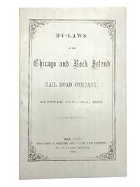
185830039New York: Benjamin Corlies 1858. Original printed glossy wrappers light fading to lettering. Stitched. 10 2 blanks pp. Near Fine.<br /> <br /> Founded in 1847 as the Rock Island and LaSalle Rail Road Company the Chicago and Rock Island reincorporated in 1851 and adopted these bylaws in 1858. In 1880 the Company was reorganized as the Chicago Rock Island and Pacific Railway. <br /> 131 Eberstadt 354. Benjamin Corlies unknown
1858406267New York: Benjamin F. Corlies 1858. A very good to near-fine copy with one closed tear and some light discoloration to the wrappers. 8vo. 10 pages. Original glazed-paper printed wrappers. Nine articles outline the structure of the company which had formed in 1847 as the Rock Island and LaSalle Rail Road Company and reincorporated under its new name in 1851. OCLC 4997635. Eberstadt catalogue 131 item 354. <br/><br/> Benjamin F. Corlies unknown books