Wintersportverein Kitzb?hel (bearb., hrsg.)Antiquariat.de

4 344 résultats
1935K-2157M?nchen, Oscar Brunn Verlag, [um 1935]. Formatangabe ca 51 x 67 cm, gefaltet zu 20 Segmenten, Ausgabe: einf?rbig mit Wald- und Wasseraufdruck, farbige Skiroutenmarkierungen ; Zustand: Kartenblatt entlang Falzkanten stellenweise offen, Broschurvorderseite lose (Umschlag), sonst gut
2009x-0719077796Manchester Univ Pr 2009. Hardcover. New. 1st edition. 256 pages. 9.50x6.25x0.75 inches. Manchester Univ Pr hardcover
DADAX0198726457OXFORD UNIVERSITY PRESS 2015-05-19. 1. hardcover. New. 9.85x0.74x7.64. Buy with confidence. Excellent Customer Service & Return policy. OXFORD UNIVERSITY PRESS hardcover
SONG0198726457OXFORD UNIVERSITY PRESS 2015-05-19. 1. hardcover. Used: Good. 9.85x0.74x7.64. Buy with confidence. Excellent Customer Service & Return policy. OXFORD UNIVERSITY PRESS hardcover
19642407100220xbvkKyoto, Jimbunkagaku Kenkyusho Kyoto University, 1964. 889 (1) pages. - Publisher's gilt titled orange-colour cloth-binding in the publ. slipcase; 4to.(ca. 26 x 19 x 5 cm; ca. 2 kg.).
19652407100221xbvkKyoto, Jimbunkagaku Kenkyusho Kyoto University, 1965. 20 p., pages 883-1.825 (1) pages. - Publisher's gilt titled orange-colour cloth-binding in the publ. slipcase; 4to.(ca. 26 x 19 x 5 cm; ca. 2 kg.).
19602407100214xbvkKyoto, Jimbunkagaku Kenkyusho Kyoto University, 1954/1960. 120 (1) / 178 (1) pages. - Publisher's gilt titled orange-colour cloth-bindings in the publ. slipcases; 4to.(ca. 26 x 19 x 4 cm; ca. 2 kg.).
19602407100218xbvkKyoto, Jimbunkagaku Kenkyusho Kyoto University, 1960. 887 (2) pages. - Publisher's gilt titled orange-colour cloth-binding in the publ. slipcase; 4to.(ca. 26 x 19 x 5 cm; ca. 2 kg.).
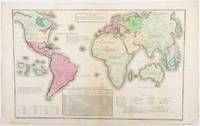
1835203763Philadelphia.: W. Marshall. Circa1835. Handcoloured engraved map 26.5 x 41.3 cms; 29.6 x 48.3 cms sheet central fold insets of "Oceanica" and "New Holland" central table some light staining in the image and margins in good condition. Eurocentrism laid bare. This 19th Century map includes a "State of Society" for each part of the world declared with a symbol to represent "Barbarous Half Civilized Civilized and Enlightened Societies" as well as noting religion and ethnicity. It includes a table of distances between chief towns or capitals and between these towns and Washington DC. Australia "New Holland" is styled principally as pagan barbarous unexplored and African a thin sliver of what is now New South Wales and Victoria is labelled civilized European and Protestant. Scarce. . (W. Marshall). unknown
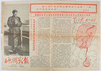
1967169746Beijing.: 地图戰報.Di tu zhan bao. September1967. Maps printed in red and black single sheet printed on both sides folded scale not given photographic image of Mao Zedong. Some light browning at edges with tears and losses on left edge still good. Text in Chinese. Sheet measures 26.5 x 38.4cm. Includes a map of Autumn Harvest Uprising and also shows the routes of the military advancing towards Jinggangshan between September and October 1927. On reverse left section a map shows the route along which Chairman Mao led the Fourth Army of the Chinese Red Army marching towards south of Anhui and Jiangxi Provinces in 1929. On reverse right section a map titled "The Long March of The Chinese Workers' and Peasants' Red Army October 1934-October 1935". Quotations of Chairman Mao about the Long March insert on corners of the map. <br> <br>Issue no. 6 of a series of maps with text issued by the Red Guards organisations in the form of Cultural Revolution tabloid-sized newspaper. This issue is designed to celebrate the 40th anniversary of the Autumn Harvest Uprising which was one of the earliest armed uprisings organised by the Chinese Communist Party. . 地图戰報.[Di tu zhan bao]. unknown
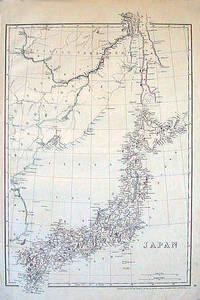
1852185246London.: Cassell Petter & Galpin. circa1852. Map with outline handcolour 42.5 x 30.1 cms; 49.2 x 34.3 cms sheet margins a little toned small corner crase but in very good condition. Very detailed map of the Japanese islands with Sakhalin above and the coast of Manchuria and Korea. . Cassell, Petter & Galpin. unknown
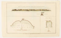
1784174896London.: Alexander Hogg at the King's Arms. circa1784. Engraved map in triptych on laid paper 20.1 x 32.7 cm three insets: cross section of the north side of Queen Charlotte's Islands Solomon Islands with detail of a volcano "6 leagues North"; Swallow's Bay Harbour; and Byron's Harbour early hand colour trimmed to the plate mark at the top edge neat sealed tear affecting the publisher's caption slight edge wear and paper toning but a most attractive map in very good condition. Attractive engraving of the Queen Charlotte's Islands Solomon Islands. The Islands were named for the consort of King George III by Philip Carteret the British naval officer and explorer who participated in two of the Royal Navy's circumnavigation expeditions in 1764–66 and 1766–69. His ship the Swallow gave her name to the Bay and Carteret's commanding officer on the first of his voyages John Byron to the Harbour depicted in this most attractive early chart. . Alexander Hogg at the King's Arms. unknown
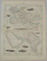
1850177525London.: The London Printing and Publishing Company. circa1850s. Lithographed map with original outline hand colour 33 x 24.5 cm including border and captions seven vignette illustrations two reference keys decorative border central fold light toning mainly at the central fold and to the verso of the sheet in very good condition preserved in a window mount. Attractive decorative map with fine vignettes of the London Post Office Suez Bombay Madras. Aden Malta Gibraltar and a wonderful camel train led by a carriage and horses crossing North Africa originally by the great mapmaker and publisher John Tallis. The two reference keys note steam packet routes railways electric telegraph and the Suez Canal. . The London Printing and Publishing Company. unknown
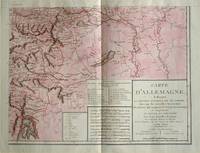
1805570721805. Copper engraving with handcolouring map shows the border of the Austrian Empire and Hungary Vienne sic and the Danube can be seen at the top of the map Two keys and scale inset. Few closed tears and some browning edges otherwise a clean and bright image. Map measures approximately 34 x 44cm. Map of Germany <br>indicating the present division of this empire as well as the new possessions of the princes who make up the Germanic body and including Batavia and Helvetia Switzerland with their divisions. by E. Mentelle a member of the institute and P. G. Chanlaire one of the authors of the National Atlas. An xiii 1805. Paris. There is a key to the explanation of the signs and an explanation of the colours used for the district of the various states contained in this map. . unknown
1935215892Lahore.: Government Printing. Revised Edition. 1935. Four folding colour maps xi 311 pages 26.5 x 18 cms; original papered boards spotted and a trifle scuffed linen backstrip with paper title label worn; foredges and endpapers spotted a few leaves toned but on the whole in very good condition the maps particularly bright and clean. A remarkable association copy: the author Frederick Blyth Wace's copy with his inked initials to the front free endpaper and his humorous unpublished foreword tipped in opposite the preface together with a dedication leaf both in Wace's hand and his business card loose within. As a further dedication makes clear this copy was given by Wace's son a couple of his loose notes on scrap paper are included the eminent botanist Nigel Morritt Wace 1929-2005 late head of the Australian National University's department of Biogeography and Geomorphology in 2003 to his fellow academic and marsupial biologist Dr. Hugh Tyndale-Biscoe. Both Wace and Biscoe were born in India and began their schooling in Kashmir at the school founded by Tyndale-Biscoe's father a Christian missionary and for whom the school is named. <br> <br>From the collection of Hugh Tyndale-Biscoe. . Government Printing. hardcover
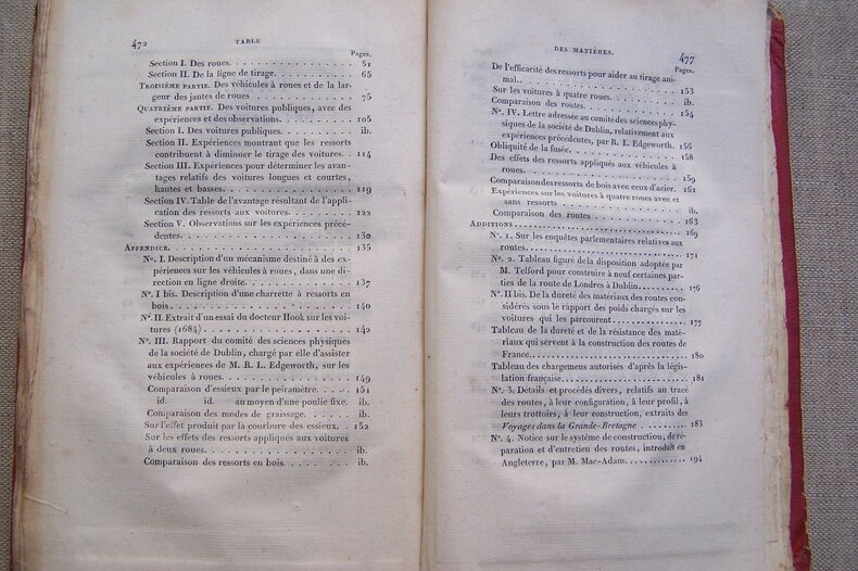
P34Paris, Anselin et Pochard, 1827. In-8, 477 pages, 4 tableaux dépliants, 5 planches dépliantes contenant de nombreux croquis, cartonnage. Rousseurs.
188210744Paris, s.n., novembre 1882 ; in-folio, broché ; 59 pp., couverture grise imprimée, 75 plans côtés, texte manuscrit lithographié.
48514Gd.in-4 en feuilles sou étui fermé.Art et Bibliophilie.1967.Ex.430.Dessins en couleurs de Fontanarosa. Bel exemplaire.
104243BBParis, Louis Vuitton Malletier, (2018). 4°. [304] S. mit meist doppelblattgr. Farbtafeln. OLn. mit farb. Deckelbildern. (Louis Vuitton Fashion Eye).
L13445Cuba. Casa de Las Americas, 1963. In-4 br. Texte en français, anglais et espagnol d'Ezequiel Martinez Estrada, dessins de Siné. E.O.
136 pages. Several pages of black and white photos of Tom T. Hall plus two pages of biographical information. Includes sheet music for piano and voice with guitar chords for these songs: Back When We Were Young; The Bourbon Man; Canadian Woman (Canadian Clubs); Candy in the Window; Coot Marseilles Blues; Country Cabin-itis; Country Is; Forget It; God Came Through Belleville Georgia; Gone to Hell in a Basket; Grandma Whistled; I Feel Like Flying Away; I Know Who I'll Be Seeing in New Zealand; I Love; Joe Don't Let Your Music Kill You; Last Hard Town; The Loneliest Girl in the Crowd; The Man Who Hated Freckles; Me and Jesus; The Monkey That Became President; More About John Henry; Never Having You; Old Dogs, Children and Watermelon Wine; One More Song for Jesus; Original Traveling Man; Pamela Brown; Pay No Attention to Alice; A Piece of the Road; Pratt Street; The Promise and the Dream; Ravishing Ruby; The Rolling Hills of Middletown; Running Wild; She Gave Her Heart to Jethro; Souvenirs; Spokane Motel Blues; St. Louis Named a Shoe After Me; The Story of Your Life is in Your Face; Subdivision Blues; That Song is Driving Me Crazy; Turn it On, Turn it On, Turn it On; When Nobody Wants Your Body Anymore; Who Needs a Baby; Windy City Anne; You Love Everybody But You. Average wear. Unmarked. Binding intact. A sound vintage copy of this great Tom T. Hall memento. Book
252 pages. Author's inscription and signature upon opening leaf. Recounts early Canadian legal incidents. Chapter titles include: A Norland Nemesis; When Toronto was Stirred to the Depths; The Shot Heard Round the World; When the Middle Road Knew Terror; When a Province Sympathized with a Republic; The Brawling Brood of Bribers; Who Killed the Treasurer of Ancaster?; When Three Lives Were Given for One. Above-average wear. Binding intact. Two-inch opening to base of front cover at spine. Covers partially detached from textblock. Still a worthy copy. Book
52 pages. Loaded with black and white reproductions of wonderful archival photos supplemented with informative text. Unmarked with average wear. A sound copy of this informative local history. Book
48 pages. Circa early 1960s. Includes music and lyrics to: Call Me Irresponsible; (The) First Night of the Full Moon; I Get Along Without You Very Well; King of the Road; Lollipops and Roses; Love Letters; Love with the Proper Stranger; Lush Life; (The) Mood I'm In; Moonlight Becomes You; (The) Race is On; This Love of Mine; We'll Be Together Again; Where Love Has Gone; Wives and Lovers. Average wear. Binding sound. Original bookseller's ink stamp upon table of contents. Binding intact. A sound copy of this nostalgic compilation of classic hits. Book
Features: What Pearson won by losing; Why Diefenbaker lost Canada; Real Caouette's Road to Power - 26 Socreds upset Quebed and split Canada; The Long Watch; Birth of a Labor Party? - Tommy Douglas lost farmers and won union men; The Back-room Conspiracy - who does the thinking for the top party strategists; The Rosy World of Nutri-Bio - part cult, part showmanship, the 'food supplement' business is mostly profit; Spectacular last mile - the last, highest and costliest stretch of the Trans-Canada Highway - bridge-building in BC - great photos; The Glass Robin in our Coal Bin - how to haunt wrecked castles and build a dream house that scares architects. Nice colour Molson Canadian ad inside back cover. Coke ad on back cover. Closed four inch tear to top edge of front cover else average wear. A quality copy. Book