Turner, Reverend MrBiblio.com

4 345 résultats
1766016077London: Printed for S. Crowder 1766. Book. Very Good. Hardcover. The Second Edition. Folio 21 x 32cm. The second edition with additions and improvements; pp. iv 45 iii publisher's adverts; engraved frontispiece map of the world five further engraved plates of maps and one engraved plate of globes ten engraved figures and diagrams within the text. Contemporary half textured calf binding with marbled paper boards expertly restored with a new spine in matching style re-corned. contents clean and tight a few small marks/reading wear; frontispiece plate with a couple of short edge-tears expertly and inconspicuously repaired a few corners re-tipped. A very good well-presented copy. Scarce. Printed for S. Crowder Hardcover
156 p. Bookseller's blind stamp of Amer & Gerber, Lancaster PA on first fly leaf. Early manuscript ownership of A.J. Eberly, April 11, 1866 on page 23. Adam John Eberly (1840-1901) was a prominent attorney in Lancaster, PA. 12mo. 200 mm. Original full leather binding. Front board detached. Spine perished. Hardbound. Text good. Binding poor. The Appendix includes: 'Acts of Assembly relating to the Cumberland Road'. Also known as the The National Road, the Cumberland Road was the first major improved highway in the U.S. built by the federal government. Constructed between 1811 and 1837, the 620-mile road connected the Potomac and Ohio Rivers and was a main transport path to the West for thousands of settlers. First edition. PAIMP 10
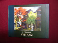
2001217040London.: King Road Gallery. 2001. First edition. . Decorated hard cover. . Fine copy. . Octavo. . Illustrated in black white and color. Important reference work. Very scarce in this condition. King Road Gallery. hardcover
2005500150651Black Swan 2005 384 pages 12 8x19 6x3 3cm. 2005. Broché. 384 pages.
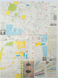
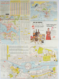
1977161880Hong Kong.: A-O-A Ltd. June/July1977. Coloured tourist maps of Hong Kong printed both sides on a sheet folded. One general area map of Hong Kong and three detailed street maps featuring Kowloon Peninsula Tsimshatsui and Central District. Generally in very good condition text in traditional Chinese English and Japanese. Sheet measures 58.2 x 43cm. The tourist maps include currency rate tourist advice advertisements for foreign and local brands and shops e.g. A-O-A Gambling Handbook for Macau Duty Free shopping centres Chinese Arts & Crafts centres acupuncture clinic etc. The maps of Central and TST have the names of many hotels businesses post offices etc marked on them. . A-O-A Ltd. unknown
1976161881Hong Kong.: Walter K. Hoffman. January/February1976. Coloured tourist map brochure of maps of Hong Kong printed both sides six maps in total folded. Brochure also includes advertisements currency rates. Minor tears along folds otherwise in good condition. Text in traditional Chinese English and Japanese. Sheet measures 58.2 x 43.4cm. Sheet includes 6 individual maps: Map of British Crown Colony of Hong Kong Map of the Urban Area with routes for public transportation Map of Tsimshatsui large scale street map Map of Central District large scale street map Map of Wanchai large scale street map Map of Causeway Bay large scale street map Map of Portuguese Overseas Province of Macau. On the maps of Central and TST the names of many businesses hotels etc are marked. . Walter K. Hoffman. unknown
Book in as new unread condition. 240pp. A comprehensive collection of cars and their makers with 380 manufacturers listed and 650 photographs of these classic cars.
0749529768.Gpaperback. Good. Access codes and supplements are not guaranteed with used items. May be an ex-library book. paperback
No marks or inscriptions to contents. No creasing to covers or to spine. A lovely clean tight copy with bright unmarked boards and no bumping to corners. Maps plus 224pp.
Elephant folio, 92 pages, colour maps. Covers creased. eng
Fine English Paperback. Pbo. Cr. 8vo. (20 x 14 cm). In Turkish. [vi], 167 p. ABAY'in 150. yilinda Ipek Yolu güzergahlari. Bayir - Bucak / Nahcivan. Türkmenistan / Kazakistan / Kirgizistan / Özbekistan / Kuzey Afganistan (Güney Türkistan). Silk Road itineraries.
Name to title page. No other marks or inscriptions. Creasing to covers. Clean tight pages with unmarked well-sunned boards, rubbed spine and no bumping to corners. 105pp. Beginning with Motoring Memories of 1947, momth by month, the book lists all the British manufacturers of cars for 1948 with at least one photograph from every make. With a fascinating price list for all models at the end.
Three registration letters underlined. No other marks or inscriptions. Light creasing to covers. A clean copy with dusty/tanned covers and page edges. 72pp. Photographs and technical specifications for all the British marques in 1959. Lists of international and British registration letters. Scarce edition.
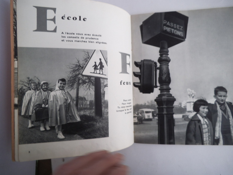
9658Abécédaire in 8 cartonné souple, couverture illustrée, titre ; 32 pages, illustrations photos de Robert Le PAJOLEC. Les éditions sociales françaises, 30 avril 1960. Edition originale Très bon état
2000Q-0738504734Arcadia Publishing 2000-10-14. Paperback. New. In shrink wrap. Looks like an interesting title! Arcadia Publishing paperback
1531602924.Ghardcover. Good. Access codes and supplements are not guaranteed with used items. May be an ex-library book. hardcover
2000DADAX0738504734Arcadia Publishing 2000-10-14. paperback. New. 6.50x0.30x9.25. Buy with confidence. Excellent Customer Service & Return policy. Arcadia Publishing paperback
1883178272Paris.: Service hydrographique et océanographique de la marine. 1883 but1894. Engraved hydrographical chart on watermarked double sheet 99 x 63 cm soundings in metres lighthouses picked out in yellow and red inset map of the port and town of Tenedos central fold a few very slight edge tears to the generous margins light spotting and surface soiling but in very good condition. Fine and impressive large naval chart of this strategically important strait then still under the control of the Ottoman Empire. <br> <br>From a private collection; "Lord John Fitzroy Royal Yacht Squadron" in manuscript on the verso. . Service hydrographique et océanographique de la marine unknown
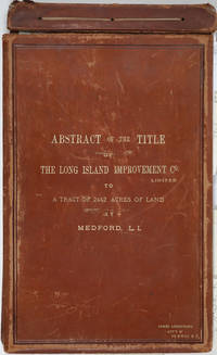
188525162Riverhead New York 1885. Hardcover. Very good condition. The original manuscript title to a very large tract of land near Brookhaven Long Island acquired by John A. Bowman from the individual proprietors and conveyed here by Bowman in its entirety to the Long Island Improvement Company Ltd. <br /> <br /> The Long Island Improvement Company was formed by Austin Corbin then president of the L. I. Rail Road and others in 1881. Corbin sought the land in order to develop expensive summer residences on Long Island; Bowman was acting as Corbin's agent in the acquisition of this valuable property. Austin Corbin 1827 – 1896 was an American railroad executive plantation owner resort operator banker and robber baron. In Iowa as a bank president he engaged in mortgage scams. Later through theft and corruption he consolidated the individual rail lines into the profitable Long Island Rail Road. He was widely despised in his day: Puck Sept 1882 printed a caricature in which Corbin appears at a Louis XIV styled party where he carouses with Jay Gould and other robber barons. <br /> <br /> The Abstract a bound sml. folio volume records that Bowman paid $5 per acre for most of the parcels in 1882 then conveyed January of 1883 the incalculably valuable entire tract to the LI Improvement Co for $1. The Abstract volume concludes with the Suffolk County embossed seal and is signed by the Clerk at Riverhead 1st June 1885. It includes the ownership history of each parcel as well as a history of the town of Brookhaven from its founding.<br /> <br /> The Abstract volume is accompanied by the original hand colored manuscript map on architectural vellum of the entire tract with silk ribbon binding showing the 25 property owner names and parcel sizes. Surveys were conducted by Justus Roe. The map is titled "Map of Property of the Long Island Improvement Company Limited at Medford LI". The scale is 300 feet to the inch. The northern boundary of the tract shows the Brewster Terry Property and Horse Block Road; the western edge defined by Tunnel and Progues Road and the Austin Roe and Daniel Gerard property; the southern boundary with Georgianna Rider property and Canaan and Medford Roads; the eastern boundary with the Robinson property and Lime Road. The Long Island RR can be seen running from east to west at approximately one third of the way through the tract at the north side. The map signed in ink at the lower right corner E. H. H. Forder.<br /> <br /> The Abstract bound in full gilt tan leather 9 x 14 3/4" attorney's name stamped in gilt at lower corner James Armstrong Attny 115 B'Way N. Y. Boards slightly rubbed; front board detached but present. Pages very bright and clean. The map 67 x 44" a few short splits at folds but very bright and clean in very good condition.<br /> <br /> A remarkable record of Long Island land speculation in the late 1880s. hardcover
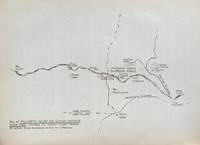
193859631Portland OR: Works Progress Administration of Oregon ca. 1938. 4to. 4 pp. 41 leaves unnumbered. including mimeograph map embossed “Mimeograph†paper watermark at fore-edges of some leaves. Contemporary quarter simulated calf over embossed “Writing Portfolio†boards fuzzy textured brown endpapers light interior uniform toning scuffing edgewear very faint off-gassing odor still VG exemplar from library of Alfred Powers. First edition of No. 5 in the Historical Records Survey of Oregon series reproducing and detailing the intricacies of the preserved original abstract of the Willamette Valley & Cascade Wagon Road Co. held in Prineville OR. WV & CWR Co. The Wagon Road co. was originally incorporated in March 1864 by Luther Elkins D.W. Balland Morgan Kees John Settle and others opening a route connecting Albany OR with the bunchgrass range in Central Oregon. The toll road was finally finished by 1868 using Chinese-American labor with Jason Wheeler overseeing construction and later J.A. White. In 1884 C.E.S. Wood began practicing law in Portland OR specializing in maritime and corporate law as well as serving as land agent for Lazard Freres the New York banking firm controlling the WV & CWR Co. wagon road grant stretching from Albany OR to the Idaho border. Subsequent to the details included in this abstract Wood would negotiate the sale of the wagon road to Louis HIll son of railroad tycoon James J. Hill and the million-dollar commission allowed him to retire and relocate to northern California with Sara Bard Field. The wagon road was converted to US Highway 20 the Santiam Highway and completed in September 1939. Worldcat locates 8 copies LA Nat Hist. Mus Boise SU OR Hist. Soc. Lib. U of W Wash State Lib. Yale OR State Lib. U of O; See: Bingham Charles Erskine Scott Wood 1990 pp. 8-9 47; See: Griffith Works Progress Administration Oregon June 1936 p. 10. Works Progress Administration of Oregon, hardcover
20172-6202235985Editorial Académica Española 2017. Paperback. New. 72 pages. Spanish language. 8.66x5.91x0.17 inches. Editorial Académica Española paperback
3001Trenton: The Company; Press of the Emporium 1846. . 8vo self-wrappers side-stitched Not found in OCLC. Trenton: [The Company]; Press of the Emporium, 1846. unknown
3001Trenton: The Company; Press of the Emporium 1846. . 8vo self-wrappers side-stitched Not found in OCLC. Trenton: [The Company]; Press of the Emporium, 1846. unknown books
0483757543.Ghardcover. Good. Access codes and supplements are not guaranteed with used items. May be an ex-library book. hardcover
193764935Couverture souple. Broché. 167 pages. Couverture légèrement défraîchie.