190 résultats
189457598San Francisco CA: Standard Asphalt Company of California Printed by Bosqui Printing & Engraving Co. 1894. 8vo. 8 pp unpaginated. printed in red & black. Black printed softcovers white lettering front cover company logo illust. on back cover minor shelfwear slight rubbing very slight chip to upper right corner still VG copy. First edition of this scarce promotional brochure by this pioneering California oil and mining company initially drawing upon petroleum and asphalt mines near Bakersfield California by the late 1880’s. They had originally drawn upon deposits in Asphalto and Hazleton but later these were played out due to high production costs to refine out the clay but later the company made a large discovery in 1893 just prior to the publication of this promotional piece touting 79% level of bitumen and production of asphalt vital for use in lacquers paints and road construction. Worldcat locates 1 copy UC Berkeley; See: Asphaltum Mineral Resources of the United States 1893-1894 1895 pp. 633-634; Asphaltum Standard Asphalt Company of California Los Angeles Herald April 5 1891 p. 6. Standard Asphalt Company of California, Printed by Bosqui Printing & Engraving Co., paperback
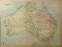
188456997Edinburgh.: A & C Black. 1884. Printed colour map of Australia some light foxing few minor tears browned edges still a clear and bright image. Map measures approximately 42 x 55cm. . A & C Black unknown
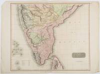
1816185242London.: Thomson. 1816. Engraved map with full handcolour 50.5 x 59.7 cms ; 53.9 x 73.8 cms sheet central fold a few minor edge tears one intruding into the top border the map unscathed marginal edgewear two corners with some loss but the map in very good crisp condition. An elegant map with great detail prepared for John Thomson's influential "New General Atlas" 1814-1821. Showing India from 20 degrees to 7 degrees north of the equator and includes the northern half of Ceylon with territorial interests attractively coloured. . Thomson. unknown
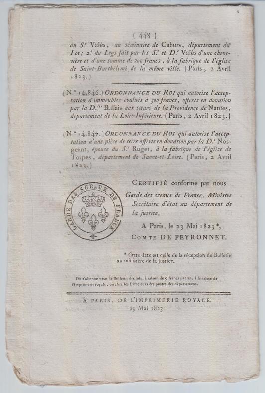
1823SPN-781Paris : Imprimerie royale, 23 mai 1823. Brochure de 16 pages en feuilles (433-448).
1811SPN-782Paris : Imprimerie impériale, s.d. [1811]. Brochure de 16 pages en feuilles (113-128).
185830039New York: Benjamin Corlies 1858. Original printed glossy wrappers light fading to lettering. Stitched. 10 2 blanks pp. Near Fine.<br /> <br /> Founded in 1847 as the Rock Island and LaSalle Rail Road Company the Chicago and Rock Island reincorporated in 1851 and adopted these bylaws in 1858. In 1880 the Company was reorganized as the Chicago Rock Island and Pacific Railway. <br /> 131 Eberstadt 354. Benjamin Corlies unknown
1858406267New York: Benjamin F. Corlies 1858. A very good to near-fine copy with one closed tear and some light discoloration to the wrappers. 8vo. 10 pages. Original glazed-paper printed wrappers. Nine articles outline the structure of the company which had formed in 1847 as the Rock Island and LaSalle Rail Road Company and reincorporated under its new name in 1851. OCLC 4997635. Eberstadt catalogue 131 item 354. <br/><br/> Benjamin F. Corlies unknown books
185830039New York: Benjamin Corlies 1858. Original printed glossy wrappers light fading to lettering. Stitched. 10 2 blanks pp. Near Fine.<br/><br/> Founded in 1847 as the Rock Island and LaSalle Rail Road Company the Chicago and Rock Island reincorporated in 1851 and adopted these bylaws in 1858. In 1880 the Company was reorganized as the Chicago Rock Island and Pacific Railway. <br/>131 Eberstadt 354. Benjamin Corlies unknown books
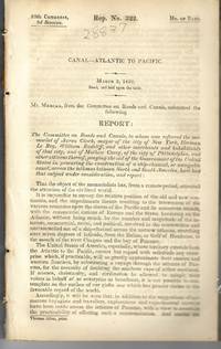
183928837Washington 1839. 25th Cong. 3d Sess. H.Rep.322. 167pp disbound. Six folding maps and chart. Several text leaves browned Very Good plus. <br /> <br /> Reviewing proposals and data for a canal route including a memorial from Matthew Carey. <br /> Morrison 5 noting only 3 maps. unknown
183928837Washington 1839. 25th Cong. 3d Sess. H.Rep.322. 167pp disbound. Six folding maps and chart. Several text leaves browned Very Good plus. <br/><br/> Reviewing proposals and data for a canal route including a memorial from Matthew Carey. <br/>Morrison 5 noting only 3 maps. unknown books
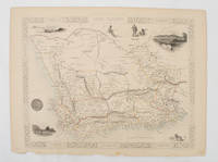
1851174666London.: Tallis John. 1851. Lithographed map 24.2 x 32 cm districts picked out in original hand colour inset vignette illustrations decorative border lower margin ragged but the attractive map in very good condition. Attractive decorative map from "Tallis's illustrated atlas and modern history of the world." one of the last great illustrated series of world maps. The fine vignettes are of Cape Town Graham Town and entrance to the Knysha Heads. . (Tallis, John). unknown
1840354279Mexico: Impresso Por Igancio Cumplido 1840. 964pp. plus one plate. Contemporary pictorial wrappers. Spine reinforced with archival tape minor dust soiling. Very good. 964pp. plus one plate. Variant issue without priority also printed in New Orleans in the same year. The text of a letter sent to Mexican president Anastasio Bustamente calling for a convention to address various ills affecting the newly independent state of Mexico. Estrada is heavy on political theory and with good reason. At the time of publication Mexican democracy was in a crisis. In July Gen. Urrea acting on behalf of Valentine Farias actually stormed the National Palace and took Bustamente prisoner. Bustamente soon escaped but the ensuing conflict between Farias and Bustamente for legitimacy had a devastating effect on hopes for a true democracy of the kind Estrada extols here. An excellent sample of Mexican political history and thought. SUTRO COLLECTION p.739 OCLC 7320339 Impresso Por Igancio Cumplido unknown
1840WRCAM29920Mexico: Impresso Por Igancio Cumplido 1840. 964pp. plus one plate. Contemporary pictorial wrappers. Spine reinforced with archival tape minor dust soiling. Very good. Variant issue without priority also printed in New Orleans in the same year. The text of a letter sent to Mexican president Anastasio Bustamente calling for a convention to address various ills affecting the newly independent state of Mexico. Estrada is heavy on political theory and with good reason. At the time of publication Mexican democracy was in a crisis. In July Gen. Urrea acting on behalf of Valentine Farias actually stormed the National Palace and took Bustamente prisoner. Bustamente soon escaped but the ensuing conflict between Farias and Bustamente for legitimacy had a devastating effect on hopes for a true democracy of the kind Estrada extols here. An excellent sample of Mexican political history and thought. SUTRO COLLECTION p.739 OCLC 7320339. Impresso Por Igancio Cumplido unknown books
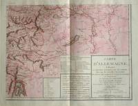
1805570721805. Copper engraving with handcolouring map shows the border of the Austrian Empire and Hungary Vienne sic and the Danube can be seen at the top of the map Two keys and scale inset. Few closed tears and some browning edges otherwise a clean and bright image. Map measures approximately 34 x 44cm. Map of Germany <br>indicating the present division of this empire as well as the new possessions of the princes who make up the Germanic body and including Batavia and Helvetia Switzerland with their divisions. by E. Mentelle a member of the institute and P. G. Chanlaire one of the authors of the National Atlas. An xiii 1805. Paris. There is a key to the explanation of the signs and an explanation of the colours used for the district of the various states contained in this map. . unknown
1830009582Paris - 21 Quai Voltaire: Rosselin 1830. Map. Fine. Map. A fine map hand-coloured in outline folding into original marbled paper boards with title label to the front board. Boards rubbed conrners worn. The map measures 74 x 55cm and is in very good condition with the paper bright. A very good to fine copy of this rare map. Rosselin hardcover
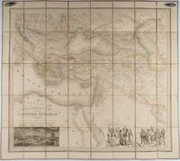
1853176118Paris.: Ministère d'Etampes et de Géographies. 1853. Engraved map with outline hand colour 67.2 x 75.1 cm sectioned and linen-backed two large vignettes: a view of Constantinople; and costumed Turks and European soldiers facing off across a stream the linen browned with some loss but not affecting the map with the fine nineteenth century label of Charles Delarue & Hivert on the verso. Fine map with beautiful vignettes by Adrien Toussaint Lallemand 1793 - c.1856 geographer and engraver at the Depôt de la Guerre. Lallemand was appointed at a precociously young age and later set up in business on his own the quality of his work assuring him of the continued business of the Depôt. <br> <br>Highly attractive map of the Ottoman Empire published at the outset time of the Crimean War 1853-1856. <br> <br>This item is held off-site. Please note there may be a few days delay while it is brought into our shop for viewing or mailing to you. Thank you for your understanding. . Ministère d'Etampes et de Géographies unknown
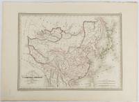
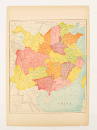
1837177519Paris. circa1837. Engraved map with original outline hand-colour 22 x 30 cm; 28.8 x 38.6 cm sheet marginal repair to the lower corner not affecting the map sheet lightly age-toned in very good condition preserved in a window mount. Fine map of China Japan and Central Asia noting Manchuria "Mandchourie" bordering Northern India and Turkestan in the West and Russia "Russie d'Asie" in the North. <br> <br>From the estate of the late collector and scholar Arthur Hacker with his pencilled catalogue mark on the verso. . unknown
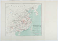
1898214719Paris.: Erhard Frères. 1898. Lithographed folding colour map 44.5 x 49.5 cms; 54.6 x 76.3 cms sheet towns and cities items of production and trade routes highlighted in red original folds in very good clean condition. Detailed map prepared for the Lyon Chamber of Commerce Mission to China under the direction of a young Henri Brenier 1867-1962 with the purpose of advancing French colonial expansion and shoring up the interests of the dominant Lyon silk trade. <br> <br>The map shows the principal centres of population production waterways roads telegraph lines and railroads togther with the centres of production and distribution for coal iron tin gold and silver opium tea rice sugar peanuts cinnamon wool medicinal plants and leather. The trade mission was organized following the Treaty of Shimonoseki and the end of the Sino-Japanese War: the Chamber of Commerce of Lyon understood that end of this war would signal a profound economic development and change. . Erhard Frères hardcover
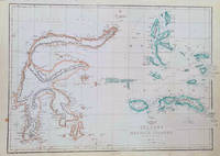
1860184035London.: Weekly Dispatch Atlas. circa1860. Map with outline handcolour 31.3 x 43.3; 33.3 x 48.7 cms sheet 12 x 17 inches small marginal bloom not affecting the map in very good condition. Detailed mapping of these two island groups by Edward Weller 1819–1884 from the ‘Weekly Dispatch Atlas’ an atlas published in monthly instalments from 1855 for subscribers to the long running newspaper. Weller was a pioneer in lithography and was sought after for his skill in producing detailed and accurate maps. . Weekly Dispatch Atlas. unknown
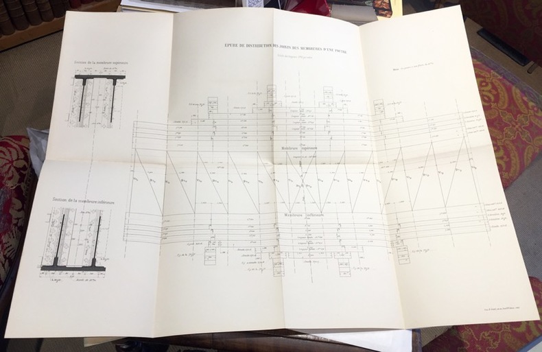
1891108701891 ; dossier petit in-folio (22 x 32 cm) ; composé d’une chemise cartonnée bleu-clair imprimée, dos toile et rubans de fermeture ; 8 grandes planches dépliantes lithographiées.I- Epure et distribution des joints des membrures d’une poutre ; II- Ensemble du tablier. Elvation et plan ; III- Demi-élévation extérieure d’une poutre au 1/10e et détails ; IV- Coupe transversale et assemblages ; V- Garde-grèves ; VI- Platelage ; VII- Détails des appuis des poutres ; VIII- Détails des garde-corps.
1900174904circa1900. Map printed in colour text in English provinces shaded in colour 28.3 x 23.2 cm central fold paper toned a small edge tear confined to the outer margin but in good condition. . unknown
189410764Paris, Gauthier-Villars, Ecole Professionnelle supérieure des Postes et Télégraphes, 1894 ; in-8, broché ; (4), II, 313 pp., 202 figures, couverture bleue imprimée.
1862969821862 A Lyon, Imprimerie Administrative de Chanoine - 1862 - In-8, demi basane marron, titre et année en doré au dos - 104 p.
1873697671873. Hardcover. Good. Circa 175 pages of holograph text; remainder of book blank. Scuffed leather minute book. 34cm. Ruled pages. This railroad seems to been relatively short running from the Connecticut border south of Longmeadow Massachusetts to East Hartford. At the final 1887 meetings of the stockholders and directors recorded in this minute book the Company appeared to be facing a foreclosure suit by the Connecticut State Treasurer. The railroad appears to have ceased in 1887. hardcover
1873697671873. Hardcover. Good. Circa 175 pages of holograph text; remainder of book blank. Scuffed leather minute book. 34cm. Ruled pages. This railroad seems to been relatively short running from the Connecticut border south of Longmeadow Massachusetts to East Hartford. At the final 1887 meetings of the stockholders and directors recorded in this minute book the Company appeared to be facing a foreclosure suit by the Connecticut State Treasurer. The railroad appears to have ceased in 1887. <br/><br/> hardcover books