Noia Campos, CaminoBiblio.com

2 245 résultats
9788481584837New. unknown
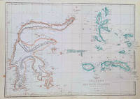
1860184035London.: Weekly Dispatch Atlas. circa1860. Map with outline handcolour 31.3 x 43.3; 33.3 x 48.7 cms sheet 12 x 17 inches small marginal bloom not affecting the map in very good condition. Detailed mapping of these two island groups by Edward Weller 1819–1884 from the ‘Weekly Dispatch Atlas’ an atlas published in monthly instalments from 1855 for subscribers to the long running newspaper. Weller was a pioneer in lithography and was sought after for his skill in producing detailed and accurate maps. . Weekly Dispatch Atlas. unknown
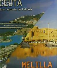
MW1865San Marcos 2001 Madrid. 31x25. Tela editorial con sobrecubierta. 197 pgs. Profusamente ilustrado en color. Papel couché. 673599 San Marcos, 2001, Madrid. hardcover
55-1817Mexico 1974. Mexican movie poster. 94 cm. x 69 cm. Folded with signs of use mainly on the edges. Se trata de un cartel de mostrar real de la película. Se doble con signos de uso principalmente en los bordes. Mexico, 1974. unknown
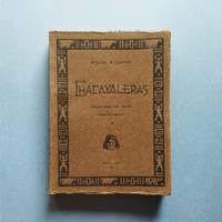
192125.0468Buenos Aires : Talleres Gráficos de Alfredo de Martino 1921. 2ª ed. Rústica. 13.5x18. Talleres Gráficos de Alfredo de Martino paperback
2024x-3031504690Springer Nature 2024. Hardcover. New. 109 pages. 10.98x8.27x0.47 inches. Springer Nature hardcover
6207028449.Gpaperback. Good. Access codes and supplements are not guaranteed with used items. May be an ex-library book. paperback
20072080502106409616Yuzankaku 2007. Soft Cover. Fine. Number of pages: 278p Yuzankaku paperback
20072091502135307432Yuzankaku 2007. Soft Cover. Fine. Volume: 1 Yuzankaku paperback
19732090502113717862Not Available 1973. Soft Cover. Fine. The book is in fine condition. Not Available paperback
192625.0469Buenos Aires : Sociedad de Publicaciones El Inca 1926. 1ª ed. Rústica. 14x18.5. Sociedad de Publicaciones El Inca paperback
2001Q-0738508632Arcadia Publishing 2001-08-20. Paperback. New. New. In shrink wrap. Looks like an interesting title! Arcadia Publishing paperback
1531605338.Ghardcover. Good. Access codes and supplements are not guaranteed with used items. May be an ex-library book. hardcover
0907073727.Gpaperback. Good. Access codes and supplements are not guaranteed with used items. May be an ex-library book. paperback
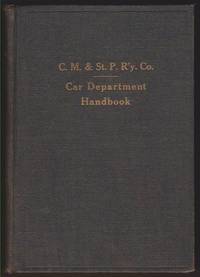
192258906Chicago Milwaukee & St. Paul Railway Co. VG. 1922. Hardcover. Hardback in Very Good condition without dust jacket. 8vo 8" - 9" tall. 384 pages. Ownership signature on front endpaper; hinges intact; light edge rubbing. Quick Shipping All Books Mailed in Boxes Free Tracking Provided . Chicago, Milwaukee & St. Paul Railway Co. hardcover
19832111902156201703Mokuba-sho-kan 1983. Soft Cover. Fine. Number of pages: 270 pages Size: B6 size Mokuba-sho-kan paperback
180476812X.Gpaperback. Good. Access codes and supplements are not guaranteed with used items. May be an ex-library book. paperback
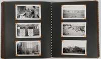
177650154 black and white snapshots held in place with photograph corners in a patterned fabric covered photograph album. Sizes of the photographs vary from 5 x7.5cm to 8.5 x 12.5cm. Black and white folding map of Burma 34.7 x 24cm loosely inserted two insets on the map show an elephant carrying teak a mahout on his back and a small map showing Burma's location within the region. Although the photographs are not individually captioned the album is divided into sections titled in white ink. Some blank leaves towards the rear of the album a separate section of 10 photographs titled "Burma & China" fills the last leaves. Six photographs are evenly browned all others are in excellent condition. A very interesting photograph album in excellent condition. A fascinating photographic record of events on the crucial Burma Road in southwestern China during and immediately after the Pacific War. An inscription on the final leaf gives the name John Barry Williams and the date 6/23/42 to 1/15/46. <br> <br>The Burma Road was constructed in 1936-1937 mainly to enable the allies to send material to China which was then at war with Japan. After the occupation of Burma by Japan in 1942 the flow of goods was cut until 1945 when in the last months of the war allied troops reconnected the transport corridor from Burma to China. Meanwhile war materiel continued to be transported by plane between Yunnan in China and India over the section of eastern Himalayas known as 'The Hump'. <br> <br>The owner of this album appears to have been a US serviceman stationed at Tsuyung Airfield in the Chinese province of Yunnan - the main transport hub at the Chinese end of the Hump route. The first photos in the album show scenes of the Burma Road and the Salween River on the border of Yunnan and Burma. There are a number of fine black-and-white photos of everyday life in the area including a village street a local salt mine a farmer ploughing with water buffaloes a street scene in Tsyuyung town women and children repairing the road and a train of pack ponies taking goods to market along the Burma Road in China. There are also images of a serviceman named Washburn holding up a captured Japanese flag. <br> <br>The following series of photos is labelled '780 Engineer Petroleum Distribution Co. Pipeline India-Burma-China 1944 and 1945' and shows scenes of the contruction of this vital fuel link with photos shot in India in the jungles of Burma and in southwestern China. The photos give a vivid image of the magnitude of the construction task showing teams camping out in rugged terrain and crossing rivers on makeshift bridges. A final group of photos labelled 'Burma and China' includes shots of a parachute drop from a plane and an image of allied soldiers with local villagers. A small map of Burma and Tibet published in 1948 has been loosely inserted in the front of the volume. . unknown
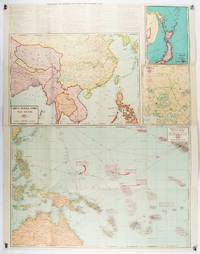
1943206908Chicago.: Geographical Publishing Company. 1943. 10 printed colour maps on a large single sheet 91 x 71 cms small inset map of the European theatre chronology of events original folds a few short fold splits archivally sealed; in very good condition. A suite of numbered U.S. war maps with Allied action overstamped in red by the publisher that for Germany and France with pictorial stamps for strategic targets including "Chemical Factories" and "Airplane Factories". The maps numbered 1 to 10: English Channel; Italy; Southern Greece; Western Mediterranean Sea; Germany and France; Baltic Sea and Scandinavia; China Burma India; Japan; Tokyo; and Greater Pacific Battle Zone: a large half sheet map noting the placement of US and Japanese bases. The "Chronology of Important War Events" lists action from the bombing of Pearl Harbour: "Japan's day of Infamy: Japanese air attack cripples American Fleet at Pearl Harbour" to March 21 1944 "Germans take over key political posts in Bulgaria and Romania". <br> <br>Issued by the Geographical Publishing Company of Chicago this educational sheet includes an advertisement for WLS Chicago "The prairie farmer station" with a list of their war broadcasts and a world clock. . Geographical Publishing Company. unknown
1953161304Edinburgh.: John Bartholomew & Son Ltd. 1953. Colour folding map laid down on linen. Scale 1:450000. 97 x 72 cm. Small holes and tears at some folds a little light browning. Cloth tape repair at fold adjoining upper card cover. Frederick Warne label upper cover a little creased and torn key includes glossary of Chinese geographical terms translated into English. Contour-coloured world map series. Published in the period immediately following the Korean War this map shows the 38th Parallel. . John Bartholomew & Son Ltd. hardcover
2091502133538545Soshisha N.A. Soft Cover. Fine. Number of books: 1 Soshisha paperback
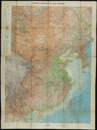
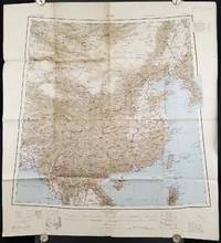
1945206545Calcutta: Compiled and drawn by the Survey of India. Second Edition. 1945. Large folding colour map 77.5 x 80cm; 95.5 x 86.2cm sheet including legend and small inset showing adjoining maps light toning and wear to upper margins and at corners and folds; but in very good condition. Very large clear map of China printed in 1945. The projection is noted as the "Lambert Conical Orthomorphic" a polyconic projection employed by the exhaustive Survey of India and the map includes surrounding countries: Taiwan Korea French Indo-China with a small inset key to Korean place-name abbreviations. As is typical of maps of this period Arunachal Pradesh is shown as Tibetan territory.The legend lists borders and provinces railways roads and canals with topography indicated with colouration. . Compiled and drawn by the Survey of India. unknown
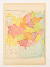
1900174904circa1900. Map printed in colour text in English provinces shaded in colour 28.3 x 23.2 cm central fold paper toned a small edge tear confined to the outer margin but in good condition. . unknown